City of Kamloops Thompson-Nicola Regional District, British Columbia
City - A populated place with legally defined boundaries, incorporated as a city municipality under the provincial Municipal Act. At junction of North and South Thompson Rivers, Kamloops Division Yale Land District
Mapped Location
City of Kamloops: The mapped location is an approximation and should not be used for navigation or wayfinding.
Information
General information on City of Kamloops
- Feature Type: Incorporated
Official, historical, colloquial and alternative toponyms for City of Kamloops
A brief list of names that this geographic feature has been named
| Name | Description |
|---|---|
| City of Kamloops | Official |
Origin Notes and History of City of Kamloops
References to City of Kamloops that document the origin of its place name
Incorporated as the City of Kamloops 1 July 1893. Kamloops (City) confirmed 7 June 1927 on 92I/NE.
Kamloops celebrated its centenary in 1912 because a century earlier, in May 1812, Alexander Ross established a post at "Cumcloups" --the meeting of the waters-- at the junction of the North Thompson and South Thompson rivers. He was representing the Pacific Fur Company; his trade during the ten days of his visit was extensive, and he found himself in the midst of a good beaver country. The previous summer the Pacific Fur Company had sent David Stuart from Astoria to explore the territory lying between the Columbia and Fraser Rivers; ascending the Okanagan to the height of land he reached the South Thompson river, and was compelled to spend the winter with the Shuswap and other Indian tribes in the neighbourhood. His report led to the visit of Alexander Ross. In 1812 the Nor'Westers built a post close to that of the Astorians, whose whole undertaking was acquired in 1813. Eight years later the amalgamation of the Hudson's Bay Company with their rivals led to the establishment of the Company in Kamloops. Kamloops Post Office was opened 1872. (17th Report of the Geographic Board of Canada, 1922). See also the municipality's own website.
Kam-a-loo'-la-pa: point between the rivers. (George M. Dawson, Notes on the Shuswap People...., published in Transactions, Royal Society of Canada, vol IX, 1891, and in Geological Survey of Canada Annual Report Vol VII, 1894, p.404B). compare with: "Beautiful point where waters meet" (information from Isaac Harris, published in Vernon News, 18 July 1918)
The meaning of this name is preserved for us by John Tod, the veteran HBC man, who in 1841 took over the fort here which had been abandoned after the murder of Chief Factor Black. In his memoirs Tod notes: "The [Indigenous people] called the place 'Kahm-o-loops,' meaning 'the meeting of the waters'.
(T)kim-loops: any confluence, meeting of waters (or people); (T)kim-lool-pa: any tributary. (Art Kuipers, The Shuswap Language, 1974, pp 61 & 213)
Rev. J, Goodfellow of Princeton, who is considered an authority in historical research of sections of southern BC, informated Miss Wolfenden [Provincial Library] in 1939 that Dr. Robie L. Reid of Vancouver, noted historian, had informed him that the name of Kamloops was associated with the early fur traders in the name Campe de Loup, which became in turn Kamloops (November 1944 advice from Provincial Archives).
Kamloops....'field of wolves' (Les Nomes Indiens de Mon Payes, by Fr. Joseph Guinard, OMI, p.54)
Parks Canada has installed a National Historic site monument at Riverside Park in Kamloops, "...to mark the site of Fort Kamloops, and in memory of the pioneer fur traders, who, by establishing themselves in that locality, aided in securing the country for Great Britain..."
A Selected Bibliography of City of Kamloops, Thompson-Nicola Regional District, British Columbia
A compilation of essential readings detailing the history, geography, and culture of the region.
Kamloops one hundred years of community, 1893-1993 by Wilf Schmidt, Wayne R. Norton

In this unique collection of writing and photography, nineteen skilled individuals have explored various facets of Kamloops' colorful past, present and future. Through their eyes, we see the landscapes, the city scenes and the people who made life in this southwestern B.C. community interesting and exciting. Kamloops: One Hundred Years of Community has an historic hand-tinted 1937 photograph as a four-color wrap-around cover. It also contains 87 black and white photographs, many previously unpublished. Soft cover, 8 1/2" x 11" horizontal format.
148 p. : ill. ; 22 x 28 cm.
Non-circulating [ 1 ]
Kamloops meeting of the waters : an illustrated history by Ken Favrholdt, Lynne Schuyler Bracewell, Greater Kamloops Chamber of Commerce
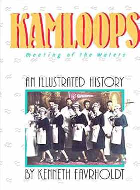
Ken Favrholdt and Lynne Schuyler Bracewell’s Kamloops meeting of the waters: an illustrated history chronicles the rich civic and commercial evolution at the strategic confluence of the North and South Thompson rivers in the arid interior plateau of British Columbia. Set against the sprawling sagebrush hills and vital river corridors traditionally stewarded by the Secwepemc people, the narrative details how early fur traders, gold prospectors, and overland ranching families navigated profound geographic isolation by establishing cooperative agrarian and mercantile networks. By tracing the collaborative labor required to transition from a transient Hudson's Bay Company trading post into a major Canadian Pacific Railway and agricultural hub, the text reveals how these dispersed inland residents forged tight-knit civic alliances to survive the extreme seasonal demands of the high desert environment. Ultimately, this illustrated history documents how the shared utilization of the region's defining waterways successfully transformed a remote frontier crossroads into a resilient, highly connected urban community that continues to anchor the British Columbia interior.
111 p. : ill. (some col.) ; 29 cm.
Non-circulating [ 1 ]
Kamloops a history of the district up to 1914 by Ruth Balf
Why that name? place names of Kamloops district by Mary Balf
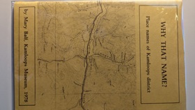
Why that name? place names of Kamloops district explores the linguistic footprint and settlement patterns etched into the semi-arid, rugged expanse of British Columbia's southern Interior Plateau. Balf details how the region's defining topographical feature—the strategic confluence of the North and South Thompson rivers—created a vital inland nexus that channeled centuries of human movement, from early Secwepemc (Shuswap) settlements to the sprawling overland routes of the fur trade and subsequent gold rushes. By decoding the origins behind local toponyms, the narrative reveals how the formidable physical barriers of steep, arid river canyons and the immense, open bunchgrass prairies strictly dictated where pioneers could establish vital ferry crossings, vast cattle ranches, and critical railway alignments. Ultimately, the book serves as a deeply localized spatial history, demonstrating how the complex riverine geography and stark environmental extremes of this inland Pacific Northwest frontier fundamentally anchored the enduring identity and physical footprint of the Kamloops district.
48 pages ; 22 cm
Non-circulating [ 2 ]
Kamloops cattlemen one hundred years of trail dust by T. Alex Bulman

Kamloops cattlemen one hundred years of trail dust examines the extensive livestock-ranching economy and grueling overland cattle drives situated across the vast, semi-arid interior plateau of south-central British Columbia. Bulman details how the region's formidable interior topography—specifically the sprawling, sun-baked bunchgrass steppes of the Thompson River valley, the rugged, heavily timbered alpine summer ranges, and the vital, isolated riparian watering corridors—strictly dictated the margins of massive cattle operations and seasonal transhumance routes. By mapping the grueling establishment of expansive pioneer ranches and the arduous transit of herds across unforgiving, arid distances to distant railheads and markets, the narrative highlights how this specific high-desert geography anchored a deeply resilient, livestock-dependent frontier economy. Ultimately, this agricultural record serves as a localized spatial history, demonstrating how the immense overland distances, harsh semi-arid climate, and vital bunchgrass forage of this Pacific Northwest interior fundamentally shaped the highly rugged, ranching-driven character of the early Kamloops region.
183 pages illustrations, map (on lining papers), portraits 24 cm
Non-circulating [ 1 ]
Thompson-Nicola Regional District
- 70 Mile House
- Aberdeen
- Adams Lake
- Agate
- Village of Ashcroft
- Aspen Grove
- Avola
- Barnhartvale
- District of Barriere
- Batchelor Hills
- Beresford
- Bestwick
- Big Bar Creek
- Birch Island
- Black Pines
- Blackloam
- Blackpool
- Blucher Hall
- Blue River
- Boston Flats
- Brigade Lake
- Brocklehurst
- Brookmere
- Village of Cache Creek
- Cahilty
- Campbell Creek
- Canford
- Village of Chase
- Chasm
- Cherry Creek
- Chinook Cove
- Chu Chua
- Clapperton
- District of Clearwater
- Village of Clinton
- Collettville
- Copper Creek
- Coutlee
- Coyle
- Criss Creek
- Dallas
- Darfield
- Douglas Lake
- Duck Range
- Dufferin
- Exlou
- Heffley Creek
- Holmwood
- Jesmond
- Juniper Ridge
- City of Kamloops
- Kanaka Bar
- Kelly Lake
- Knutsford
- Lac Le Jeune
- Little Fort
- District of Logan Lake
- Loon Lake
- Louis Creek
- Lower Nicola
- Village of Lytton
- Martin Prairie
- McLure
- City of Merritt
- Monte Creek
- Monte Lake
- Nicola
- North Bonaparte
- North Kamloops
- Oak Hills
- Pinantan Lake
- Powers Addition
- Pritchard
- Quilchena
- Rayleigh
- Sahali
- Savona
- Shulus
- Shuswap
- Six Mile Ranch
- Spatsum
- Spences Bridge
- Stillwater
- Stump Lake
- Sun Peaks Mountain Resort Municipality
- Tobiano
- Tranquille
- Turtle Valley
- Valleyview
- Vavenby
- Vidette
- Vinsulla
- Walhachin
- Westsyde
- Westwold
Political Boundaries
Last updated: 2023-10-02