Catalog of British Columbiana and Pacific Northwest Americana
The Encyclopedia Cascadia Catalog indexes mostly non-fiction literature covering the Pacific Northwest coast of North America, with an emphasis on British Columbia, Idaho, Oregon, and Washington State.
| Catalog Title | Published |
|---|---|
|
Oregon a bicentennial history by Gordon B. Dodds , American Association for State and Local History 
Oregon: a bicentennial history examines the sweeping territorial expansion and complex pioneer settlement across a vast landscape fundamentally fractured by extreme climatic and topographical divides. Dodds details how the region's formidable physical barriers—specifically the towering, volcanic spine of the Cascade Range—strictly dictated the bifurcation of human survival, permanently separating the dense, rain-drenched coastal rainforests and the fertile alluvial trough of the Willamette Valley from the sweeping, arid sagebrush steppes of the eastern high desert. By mapping the arduous overland migration that funneled thousands of exhausted pioneers into the lush western basins, the narrative highlights the immense physical labor required to carve an agricultural and timber-based empire from this demanding environment. The profound geographic disparities forced early homesteaders to adapt their lifeways to vastly different ecological realities, ranging from intensive valley farming and deepwater maritime extraction on the coast to precarious dryland ranching and mining on the unforgiving inland plains. Ultimately, this comprehensive historical record serves as a deeply localized spatial history, demonstrating how the immense physical scale and severe environmental dualities of the Pacific Northwest fundamentally shaped the fiercely resilient, multifaceted character of the Oregon frontier. xiv, 240 pages, 8 unnumbered leaves of plates : illustrations ; 22 cm. Non-circulating [ 1 ]
|
1977 |
|
Postmarked Washington Okanogan County by Guy Reed Ramsey, Okanogan County Historical Society 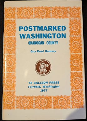
Postmarked Washington: Okanogan County by Guy Reed Ramsey is a 1966 local history, famously the first book ever published by the Okanogan County Historical Society, that details the region's early pioneer communication networks. The work meticulously chronicles the establishment, operation, and eventual closure of every frontier post office that existed within the county's borders. Ultimately, it serves as an essential genealogical and historical reference for understanding the rural development and the pioneer postmasters who connected this rugged area of North Central Washington. 60 pages : illustrations, map ; 23 cm Non-circulating [ 1 ]
|
1977 |
|
Early Indian village churches wooden frontier architecture in British Columbia by John Veillette , Gary White 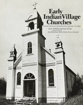
Early Indian village churches: wooden frontier architecture in British Columbia examines the unique architectural convergence of missionary expansion and Indigenous craftsmanship across the remote, rain-soaked coastal inlets and rugged river valleys of the provincial frontier. Veillette and White detail how the region's profound physical isolation and dense old-growth rainforests strictly dictated the construction of these spiritual outposts, precluding the use of traditional European building materials like stone or brick. By mapping the distribution of these wooden sanctuaries from the storm-battered shores of Vancouver Island to the deep interior canyons of the Skeena and Nass rivers, the narrative highlights how the sheer logistical constraints of the landscape forced a complete reliance on abundant local timber reserves and Native woodworking expertise. Ultimately, this heavily photographic inventory serves as a deeply localized spatial history, demonstrating how the formidable maritime and mountainous topography of the Pacific Northwest inherently shaped a distinct, hybrid frontier architecture perfectly adapted to its unforgiving forest environment. xx, 195 pages : illustrations (black and white) ; 29 cm Non-circulating [ 1 ]
|
1977 |
|
The H.W. McCurdy marine history of the Pacific Northwest, 1966-1976 by H. W. McCurdy, Gordon R. Newell, Seattle Historical Society 
The H.W. McCurdy Marine History of the Pacific Northwest, 1966-1976 chronicles the late-twentieth-century industrial evolution of maritime commerce and shipping across the sprawling, interconnected inland waterways and treacherous coastal corridors of the Pacific seaboard. Newell and McCurdy detail how the region’s formidable aquatic topography—spanning the deep, protected anchorages of Puget Sound to the storm-battered, shifting sandbars of the Columbia River and the perilous tidal narrows of the Inside Passage—strictly dictated the engineering of specialized tugs, expansive ferry networks, and massive commercial vessels designed to conquer the sheer scale of the North Pacific. By mapping the rapid modernization of regional port infrastructure and the absolute reliance of remote island communities on marine transit to bridge vast expanses of open water, the narrative highlights the relentless logistical efforts required to navigate and extract wealth from this unforgiving marine environment safely. Ultimately, this encyclopedic record serves as a deeply localized spatial history, demonstrating how the complex, demanding hydrography of the Pacific Northwest inherently shaped the enduring resilience of its maritime industries and maintained the physical lifeline of its coastal frontier. lvii, 36-255 pages : illustrations ; 34 cm Non-circulating [ 1 ]
|
1977 |
|
Navigating the coast a history of the Union Steamship Company by Peter Chapman, John Haskell Kemble (Donor), Provincial Archives of British Columbia
Navigating the Coast: A History of the Union Steamship Company chronicles the vital maritime lifeline that sustained isolated industrial and pioneer communities scattered along the rugged, deeply indented seaboard of British Columbia. Chapman details how the region's formidable physical barriers—specifically the towering, impenetrable slopes of the Coast Mountains that plunge directly into the sea—rendered overland transportation virtually impossible, forcing early canneries, logging camps, and Native villages to rely absolutely on the ocean for survival and commerce. By mapping the intricate, dangerous routes of the Union fleet through the treacherous tidal narrows, fog-bound fjords, and storm-battered straits of the Inside Passage, the narrative highlights the immense navigational skill required to maintain this precarious coastal network. The complete dependence on these coastal steamers for freight, mail, and human movement underscores the profound geographic isolation of these remote water-bound outposts. Ultimately, this historical record serves as a deeply localized spatial history, demonstrating how the unforgiving marine topography and sheer vertical extremes of the Pacific Northwest coast inherently dictated the absolute necessity of a specialized maritime infrastructure to conquer the rugged coastal frontier. 77 pages : illustrations, color map ; 27 cm. Non-circulating [ 1 ]
|
1977 |
|
Pioneers of the Olympic Peninsula by LeRoy Smith
Pioneers of the Olympic Peninsula chronicles the grueling homesteading and early industrial efforts across the massive, profoundly isolated landmass that forms the extreme northwestern corner of Washington State. Smith details how the region's formidable physical barriers—an impenetrable core of rugged, glaciated mountains ringed by some of the densest, rain-drenched temperate old-growth forests on the continent—strictly dictated the placement of early settlements. By mapping the immense physical labor required to carve permanent agricultural tracts and viable logging camps from this towering coastal wilderness, the narrative highlights how the utter lack of overland routes initially forced pioneers to cling to the narrow river valleys and the storm-battered coastline, relying completely on precarious maritime supply chains via the Strait of Juan de Fuca, the open Pacific Ocean, and Hood Canal. Ultimately, this historical record serves as a deeply localized spatial history, demonstrating how the extreme precipitation, massive timber, and unforgiving topography of the Pacific Northwest's most remote peninsula severely tested human endurance and fundamentally shaped its fiercely independent frontier culture. 109 pages : illustrations (some color) ; 23 cm Non-circulating [ 1 ]
|
1977 |
|
Millican memories by Jo Smith Southworth
Millican Memories chronicles the arduous pioneer settlement and subsequent decline of a remote homesteading community situated in the vast, arid expanse of Central Oregon's high desert. Southworth details how the region's formidable environmental constraints—specifically the profound lack of surface water, the sweeping sagebrush steppes, and the severe rain shadow cast by the towering Cascade Range—strictly dictated the margins of human survival. By mapping the daily struggles of precarious dryland farming and isolated cattle ranching, the narrative highlights the immense physical endurance required to carve out a living in this sparse, unforgiving landscape. The absolute isolation from larger population centers forced these early homesteaders into deep self-sufficiency, often resulting in transient settlements that ultimately faded into ghost towns when the harsh geography proved too marginal to sustain a permanent agricultural hub. Ultimately, this biographical record serves as a deeply localized spatial history, demonstrating how the severe climatic extremes and vast, open topography of the Pacific Northwest's inland desert frontier inherently shaped the fleeting existence and fiercely resilient character of its isolated pioneers. 176 pages : illustrations, portraits ; 21 cm Non-circulating [ 1 ]
|
1977 |
|
Sawtooth tales by Dick D'Easum, John Collias, Ernest Day 
Dick d'Easum fist glimpsed Idaho's Sawtooth Mountains when he was a boy, and it was love at first sight. D'Easum spent his life getting better acquainted with the mountains. He collected stories of the people, history, and legends of the region for more than fifty years. xii, 281 pages, [1] folded leaf of plates : illustrations, color map, portraits ; 23 cm Non-circulating [ 1 ]
|
1977 |
|
Idaho's place in the sun by H. M. Newell 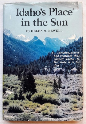
Published in 1975, Helen M. Newell's Idaho's Place in the Sun provides a comprehensive overview of the Gem State's historical development, moving from its early indigenous populations and fur trappers through the territorial days to modern statehood. The book combines detailed historical narratives with rich anecdotal accounts, capturing the rugged spirit of the miners, ranchers, and pioneers who settled the challenging landscape. Illustrated with archival photographs, it serves as both an accessible introduction for general readers and a valuable reference for those interested in Pacific Northwest history. Keen Insight: Newell’s narrative excels by treating Idaho not as a unified whole, but as a patchwork of isolated, geographically distinct micro-regions whose unique local struggles ultimately forged the state's broader cultural identity. vi, 180 pages : illustrations, portraits ; 24 cm Non-circulating [ 1 ]
|
1977 |
|
My, how time flies by George Hunsby
My, how time flies captures the intimate, grassroots transformation of Whatcom County, tracing its evolution from a rugged, heavily timbered frontier into a consolidated maritime and industrial center along Washington’s northernmost seaboard. Hunsby details how the region's formidable geography—characterized by the dense old-growth forests of the Nooksack River valley, the deepwater anchorages of Bellingham Bay, and the towering, glaciated foothills of Mount Baker—strictly dictated early pioneer lifeways and economic expansion. By chronicling firsthand experiences in isolated logging camps and the arduous engineering efforts required to carve the Mount Baker Highway through impenetrable alpine terrain, the narrative highlights the immense physical labor required to navigate and extract resources from this unforgiving landscape. Furthermore, the compilation of these historical accounts illustrates how the isolated coastal and mountainous topography of Fairhaven and Bellingham fostered a fiercely independent, self-reliant community deeply tied to its natural surroundings. Ultimately, this collection serves as a deeply personal spatial history, demonstrating how the dramatic environmental extremes of the Pacific Northwest’s extreme northwestern corner inherently shaped the enduring pioneer character and physical footprint of Whatcom County. 126 pages : illustrations ; 22 cm Non-circulating [ 1 ]
|
1977 |
|
Under eleven governors by Howard C. Belton
Under eleven governors examines the political and agricultural evolution of Oregon through the autobiographical lens of Howard C. Belton, a long-serving state legislator whose public life was deeply rooted in the fertile, alluvial soils of the northern Willamette Valley. Belton details how the region’s specific geography—particularly the rich plains of Canby where he anchored his farming operations for over four decades—strictly dictated a rural, agrarian economy that frequently collided with the state's rapid mid-century industrialization. By mapping his legislative tenure in Salem, the central political nexus situated within this massive agricultural trough, the narrative highlights the immense logistical and economic challenges of governing a territory defined by extreme topographical divides, from the dense timber of the Coast Range to the vast, arid expanses of the eastern high desert. The book illustrates how statewide infrastructure, rural banking networks, and complex tax frameworks had to be deliberately engineered to bridge these profound geographical and environmental disparities. Ultimately, this political memoir serves as a localized spatial history, demonstrating how the immense physical scale and diverse microclimates of the Pacific Northwest inherently shaped the legislative strategies and enduring agrarian character of Oregon's statesmen. xii, 90 pages : illustrations ; 23 cm Non-circulating [ 1 ]
|
1977 |
|
Reflections on early Cannon Beach by John Delbert Griffin 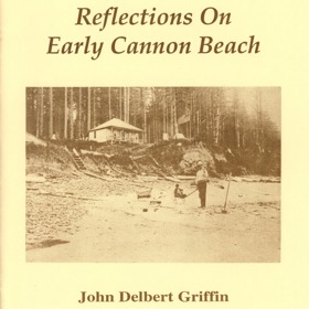
Reflections on early Cannon Beach captures the profound geographic isolation and subsequent environmental transformation of a small, rugged coastal enclave situated on the northern Oregon seaboard. Griffin details how the area's imposing physical barriers—specifically the towering, densely timbered prominence of Tillamook Head and the steep slopes of the Coast Range—rendered early overland travel exceptionally arduous, completely severing the community from inland population centers. By mapping the grueling pioneer journey that required boat transit from Astoria, rail to Seaside, and a precarious wagon ride over rough toll trails to Elk Creek, the narrative illustrates how the physical beach itself often served as the only viable highway. This intense spatial isolation initially preserved a primitive, resource-rich ecosystem where early residents relied entirely on the abundant marine life of the tidal zones. Ultimately, this localized memoir serves as a vital spatial history, demonstrating how the eventual penetration of these coastal barriers by large-scale logging and modern highways shattered the region's isolation, fundamentally transforming a resilient, self-sufficient frontier outpost into a heavily trafficked tourist landscape. 14 pages : illustrations ; 22 cm Non-circulating [ 1 ]
|
1977 |
|
The Indians of western Oregon this land was theirs by Stephen Dow Beckham, Christina Romano
The Indians of western Oregon: this land was theirs examines the deep ecological integration and subsequent tragic dispossession of Indigenous populations across the diverse, resource-rich landscapes situated between the Pacific Ocean and the towering Cascade Range. Beckham details how the region’s complex topography—ranging from the storm-battered, deeply indented estuaries of the Pacific coastline to the fertile, sweeping oak savannas of the Willamette, Umpqua, and Rogue river valleys—strictly dictated Native settlement patterns and intricate seasonal subsistence cycles. By mapping the sophisticated use of controlled inland burns to manage camas prairies and the absolute reliance on dense cedar forests and turbulent aquatic networks for plank-house architecture and maritime travel, the narrative highlights how these communities masterfully engineered their lifeways to fit the specific contours of the environment. Furthermore, the book illustrates how the sudden influx of overland pioneers systematically shattered this ancient spatial relationship, forcibly stripping tribes of these critical geographic hubs and confining them to isolated, marginal reservations. Ultimately, this vital ethnohistorical record serves as a deeply localized spatial history, demonstrating how the rich hydrography and profound natural abundance of the Pacific Northwest inherently shaped the enduring cultures of Western Oregon's first peoples prior to their severe geographic displacement. vii, 236 pages : illustrations ; 27 cm Non-circulating [ 1 ]
|
1977 |
|
Kitsap County history a story of Kitsap County and its pioneers by Kitsap County Historical Society Book Committee
Kitsap County history: a story of Kitsap County and its pioneers chronicles the intensive maritime settlement and rapid industrial timber extraction across the deeply indented, water-bound geography of the Kitsap Peninsula. The Historical Society Book Committee details how the region’s defining physical barriers—a highly fractured shoreline surrounded almost entirely by the complex tidal currents of Puget Sound and Hood Canal, coupled with completely impenetrable old-growth forests—strictly dictated the placement and survival of early frontier communities. By mapping the strategic establishment of massive, highly capitalized lumber mills at the edge of protected deepwater anchorages like Port Gamble and Port Blakely, the narrative highlights how the utter lack of overland wagon routes forced pioneers to rely absolutely on the "Mosquito Fleet" of coastal steamers for daily existence and regional commerce. This complete dependence on the marine highway allowed settlers to harvest immense coastal timber reserves and load them directly onto global shipping networks without ever penetrating the interior. Ultimately, this exhaustive compilation serves as a deeply localized spatial history, demonstrating how the complex, deeply carved aquatic topography and heavily forested environment of this Pacific Northwest peninsula inherently forged its enduring identity as a resilient, strictly maritime-dependent frontier. 1 volume (various pagings) illustrations Non-circulating [ 1 ]
|
1977 |
|
Stehekin a wilderness journey into the Northern Cascades by William A. Bake, United States National Park Service
Stehekin: a wilderness journey into the Northern Cascades captures the profound geographic isolation and environmental majesty of a remote frontier enclave situated deep within the rugged, glaciated core of Washington’s North Cascades. Bake details how the region's formidable physical barriers—specifically the towering, impenetrable alpine peaks and the sheer, precipitous walls of the fifty-mile-long, glacially carved trench of Lake Chelan—strictly dictated the margins of human access and pioneer settlement. By mapping the arduous logistical realities of a community completely severed from the modern highway system, the narrative highlights how this steep, fjord-like valley forced residents to rely entirely on waterborne transit up the deep inland lake or grueling overland travel via high mountain passes for their sheer survival. This intense spatial isolation preserved a pristine, unforgiving wilderness environment where early homesteaders and miners had to continuously adapt their lifeways to the extreme vertical topography and severe winter precipitation of the inland mountains. Ultimately, this narrative and photographic record serves as a deeply localized spatial history, demonstrating how the dramatic geologic extremes and absolute topographic inaccessibility of this Pacific Northwest valley fundamentally shaped its enduring identity as a resilient, water-bound sanctuary at the edge of the alpine frontier. 43 pages : illustrations (some color) ; 18 cm Non-circulating [ 1 ]
|
1977 |
|
Polk County, Oregon, place names by Gordon W. Clarke 
Polk County, Oregon, place names explores the linguistic footprint and settlement patterns etched into the fertile western margins of the Willamette Valley. Clarke details how the region's specific topography—spanning from the broad, flood-prone meanders of the Willamette River westward into the densely timbered, rugged slopes of the Coast Range—strictly dictated the establishment of early pioneer homesteads and remote logging camps. By decoding the historical origins behind local toponyms, the narrative reveals how the absolute physical necessity of securing vital river ferry crossings, bridging deep tributary creeks like the Luckiamute and Rickreall, and navigating the vast oak savannas permanently anchored the precise locations of early agrarian communities. Ultimately, this toponymic record serves as a deeply localized spatial history, demonstrating how the complex riverine geography and rich alluvial soils of this Pacific Northwest basin fundamentally shaped the enduring identity and physical footprint of the Oregon frontier. 157 pages ; 28 cm Non-circulating [ 1 ]
|
1977 |
|
The management of small history museums by Carl E. Guthe, American Association for State and Local History
The management of small history museums outlines the critical curatorial framework required to systematically preserve the localized material culture of pioneer settlement and environmental adaptation across geographically isolated frontiers like the Pacific Northwest. Guthe details how the profound physical isolation of remote communities—whether situated in heavily timbered coastal valleys, deepwater maritime ports, or arid inland deserts—necessitates the rigorous, localized archiving of regional history before it is lost to time and decay. By mapping the precise administrative and cataloging standards needed to curate the heavy tools of resource extraction, maritime navigation, and grueling overland travel, the manual highlights how these small, independent repositories function as the primary guardians of spatial history. The book illustrates that effectively managing these local collections is essential to anchoring a community's identity to its specific, often unforgiving landscape. Ultimately, this foundational museological text serves as a vital methodological guide, demonstrating how the disciplined preservation of physical artifacts is absolutely necessary to document the immense human labor required to conquer the formidable topography and severe environmental extremes of the regional frontier. 78 pages ; 23 cm Non-circulating [ 1 ]
|
1977 |
|
Voyages of enlightenment Malaspina on the Northwest coast, 1791-1792 by Thomas Vaughan, E. A. P. Crownhart-Vaughan , Mercedes Palau Baquero 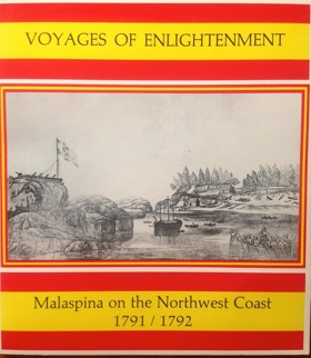
Voyages of Enlightenment: Malaspina on the Northwest Coast, 1791-1792 chronicles the ambitious Spanish maritime expedition tasked with charting the complex, glaciated shorelines and intricate archipelagos of the extreme Pacific seaboard. Vaughan, Crownhart-Vaughan, and Palau Baquero detail how the region's formidable hydrographic barriers—specifically the labyrinthine fjords, treacherous tidal narrows, and towering coastal mountains stretching from Alaska's Yakutat Bay to Vancouver Island's Nootka Sound—severely tested the navigational limits of eighteenth-century explorers searching for a mythical transcontinental waterway. By mapping the expedition's rigorous scientific, botanical, and ethnographic surveys, the narrative highlights the immense logistical effort required to visually and scientifically document a rugged marine environment dominated by impenetrable coastal rainforests and massive alpine ice fields. Furthermore, the account underscores the deep spatial relationship between the Indigenous Tlingit and Nuu-chah-nulth peoples and their water-bound world, illustrating how Native communities had long mastered the precarious coastal topography that European empires were merely struggling to chart. Ultimately, this detailed historical and visual record serves as a vital spatial history, demonstrating how the unforgiving, deeply carved maritime geography of the Pacific Northwest fundamentally shaped the limits of European imperial expansion and Enlightenment-era scientific inquiry on the remote frontier. viii, 61 pages : illustrations ; 23 cm. Non-circulating [ 1 ]
|
1977 |
|
Westward to Alki the story of David and Louisa Denny by Gordon R. Newell
Westward to Alki: the story of David and Louisa Denny chronicles the grueling overland migration and foundational pioneer settlement of the dense, rain-drenched coastal basin of Puget Sound. Newell details how the region's formidable physical barriers—an unbroken, towering expanse of old-growth timber extending to the very edge of the tidal flats—strictly dictated the precarious survival of Seattle's earliest founders. By mapping the Denny party's initial, desperate winter encampment on the storm-battered, exposed shores of Alki Point and their subsequent, strategic relocation to the deeper, protected anchorages of Elliott Bay, the narrative highlights the immense physical labor required to carve a permanent foothold in this unforgiving maritime environment. The utter lack of viable overland routes forced these early homesteaders into a complete reliance on the deepwater highway of the Sound, immediately anchoring their economic survival to the arduous extraction of coastal timber for marine export. Ultimately, this biographical record serves as a deeply localized spatial history, demonstrating how the severe winter climate and heavily forested, deeply indented aquatic topography of the Pacific Northwest inherently forged the resilient, strictly maritime-dependent origins of Washington's central metropolis. [6], 122 pages : illustrations, coat of arms, maps, portraits ; 26 cm Non-circulating [ 1 ]
|
1977 |
|
Golden days and pioneer ways by Ruth Pfefferle 
Published in 1934 by Ruth Pfefferle, Golden Days and Pioneer Ways is a localized chronicle of early settlement and domestic life in the Pacific Northwest, heavily focused on the intimate, day-to-day realities of homesteading. Drawing from family lore, pioneer letters, and community reminiscences, the text shifts away from grand geopolitical maneuvering to spotlight the domestic labor, social bonds, and domestic resilience of early families. Through a collection of homespun anecdotes and localized histories, the book paints an idyllic portrait of frontier community-building, celebrating the endurance and adaptability required to establish permanent roots in an isolated and demanding environment. vi, 128 pages : illustrations, portraits ; 28 cm Non-circulating [ 1 ]
|
1977 |
|
Capitol names individuals woven into Oregon's history by Philip Cogswell
Along the walls of the House and Senate chambers in the Oregon state legislature are the names of 158 men and women who helped shape Oregon's history. This compilation of biographies uses information taken from a number of existing published sources 133 pages : illustrations ; 21 cm Non-circulating [ 1 ]
|
1977 |
|
Of man, time, and a river the Skagit River, how should it be used? : proceedings of a series of meetings held in the Skagit River Valley, September-October 1976 by Roland L. DeLorme 
Of man, time, and a river the Skagit River, how should it be used? captures the intense late-twentieth-century environmental and industrial conflicts over one of the most powerful and ecologically vital watersheds in western Washington. DeLorme details how the region's complex topography—spanning from the sheer, glaciated alpine canyons of the North Cascades down to the broad, fertile alluvial floodplains emptying into Puget Sound—strictly dictated competing models of resource extraction and human settlement. By documenting a series of pivotal community meetings, the narrative highlights the immense spatial tension between exploiting the steep, narrow upper river corridors for massive hydroelectric dam projects to power distant urban centers, and preserving the delicate hydrography required to sustain the lower valley's rich agricultural grid and ancient, fragile salmon runs. The proceedings underscore how the sheer scale, velocity, and seasonal flooding of the river forced residents, engineers, and conservationists into a fierce debate over the ultimate physical control of the landscape. Ultimately, this documentary record serves as a deeply localized spatial history, demonstrating how the immense hydrological force and extreme topographic diversity of this Pacific Northwest river basin fundamentally shaped the modern political and environmental battlelines over the region's natural resources. x, 67 pages : map ; 28 cm Desiderata
|
1977 |
|
The Pacific Princesses an illustrated history of Canadian Pacific Railway's Princess fleet on the northwest coast by Robert D. Turner 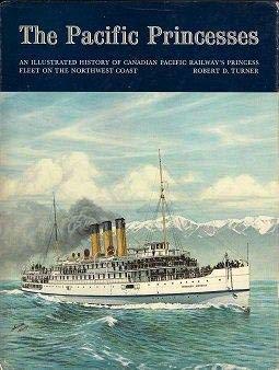
The Pacific Princesses: an illustrated history of Canadian Pacific Railway's Princess fleet on the northwest coast examines the vital maritime extension of a transcontinental transportation network across the deeply indented, water-bound geography of the British Columbia coastline and the Inside Passage. Turner details how the region's formidable physical barriers—specifically the towering, impenetrable slopes of the Coast Mountains that plunge directly into the sea—rendered continuous overland rail construction geographically impossible, forcing the Canadian Pacific to engineer a massive "marine railway" fleet to bridge the vast aquatic voids. By mapping the intricate, heavily trafficked routes of these specialized steamships through treacherous tidal narrows, fog-bound fjords, and storm-battered straits, the narrative highlights the immense navigational and logistical efforts required to connect remote island enclaves and northern outposts to the global economic grid. This absolute reliance on the maritime highway allowed the elegant Princess fleet to serve as the critical lifeline for passenger travel, mail, and industrial freight, effectively shattering the profound geographic isolation of these remote water-bound communities. Ultimately, this comprehensive historical record serves as a deeply localized spatial history, demonstrating how the unforgiving marine topography and sheer vertical extremes of the Pacific Northwest inherently forced a land-based railroad to evolve into a specialized maritime empire to conquer the rugged coastal frontier. xiii, 252 pages : illustrations ; 29 cm Non-circulating [ 1 ]
|
1977 |
|
Last trail to Bear Paw flight of the Nez Perces, 1877 by Rowena L. Alcorn 
Last trail to Bear Paw: flight of the Nez Perces, 1877 chronicles the grueling, thousand-mile fighting retreat of the Nez Perce people across the vast, unforgiving interior landscapes of the Pacific Northwest and the Northern Rockies. Alcorn details how the region's formidable physical barriers—spanning the deep, precipitous river canyons of the Snake and Salmon drainages to the towering, heavily timbered passes of the Bitterroot Range and the sweeping, exposed high plains of Montana—strictly dictated the tactical maneuvers of this tragic exodus. By mapping the desperate overland journey of families, warriors, and massive horse herds, the narrative highlights the immense physical endurance and deep ancestral geographic knowledge required to navigate this severe, shifting topography while evading relentless military pursuit. The tribe's strategic utilization of extreme terrain—leveraging narrow mountain defiles and rugged, rapid-choked river crossings to stall their pursuers—underscores a profound, pre-existing mastery of the inland environment. Ultimately, this historical record serves as a deeply localized spatial history, demonstrating how the immense physical scale and severe geological extremes of the inland frontier fundamentally shaped the trajectory of the Nez Perce and their resilient, heartbreaking struggle for geographic sanctuary. 80 pages : illustrations ; 28 cm Desiderata
|
1977 |
|
The Siletz Indian Reservation, 1855-1900 by William Eugene Kent, Lincoln County Historical Society (Lincoln County, Or) 
The Siletz Indian Reservation, 1855-1900 examines the forced geographic consolidation and subsequent survival of diverse Indigenous populations relocated to the rugged, heavily timbered coastal mountains of central Oregon. Kent details how the region's formidable physical barriers—specifically the steep, densely forested slopes of the Coast Range and the isolated, storm-battered Pacific shoreline—were intentionally utilized by the federal government to strictly dictate the confinement and marginalization of these displaced tribes. By mapping the arduous logistical realities of confining multiple distinct coastal and inland cultures within the remote, rain-drenched Siletz River basin, the narrative highlights the immense physical and cultural endurance required to adapt traditional subsistence practices to this highly restricted environment. The absolute geographic isolation of the Siletz Valley served to physically sever Native communities from their ancestral homelands across Western Oregon and Northern California, while the difficult, mountainous terrain severely limited the viability of the agrarian lifeways forced upon them by federal agents. Ultimately, this institutional and ethnohistorical record serves as a deeply localized spatial history, demonstrating how the severe topographical constraints and dense coastal forests of the Pacific Northwest inherently shaped the traumatic dislocation and enduring resilience of the confederated Siletz peoples. 54 pages : illustrations, maps ; 28 cm. Desiderata
|
1977 |