Catalog of British Columbiana and Pacific Northwest Americana
The Encyclopedia Cascadia Catalog indexes mostly non-fiction literature covering the Pacific Northwest coast of North America, with an emphasis on British Columbia, Idaho, Oregon, and Washington State.
| Catalog Title | Published |
|---|---|
|
Brookfield the Joe Megler story (Wahkiakum County) Washington by Carlton E. Appelo 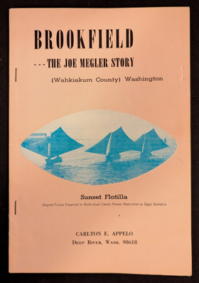
Carlton E. Appelo’s Brookfield: The Joe Megler Story chronicles the rise and fall of a pioneering salmon cannery town situated along the remote, timbered shores of the lower Columbia River in Wahkiakum County, Washington. The narrative maps the rugged estuarine geography where J.G. Megler established his bustling fishing enterprise, nestled between dense coastal rainforests and the sweeping tidal waters near the river's treacherous mouth. By detailing the daily operations of this isolated riverfront community, the book illustrates how the region's immense salmon runs and strategic aquatic access directly fueled the Pacific Northwest's early maritime economy. Ultimately, the text captures the distinct historical footprint of southwestern Washington’s coastal inlets, preserving the memory of a vibrant industrial settlement that was eventually reclaimed by the surrounding wilderness. 40 pages illustrations, maps, portraits 24 cm Non-circulating [ 1 ]
|
1966 |
|
Coast country a history of southwest Washington by Lucile Saunders McDonald 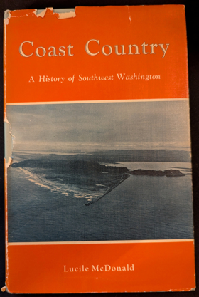
Lucile Saunders McDonald’s Coast Country: A History of Southwest Washington chronicles the maritime and pioneer history of the rugged, windswept coastline stretching north of the Columbia River's treacherous mouth. The narrative meticulously maps the challenging topography of this distinct Pacific environment, focusing on the shallow, tidal expanses of Willapa Bay, the dense temperate rainforests surrounding Grays Harbor, and the shifting sands of the Long Beach Peninsula. By detailing the booming nineteenth-century oyster industry that thrived within these sheltered estuarine mudflats, alongside perilous coastal shipping operations and early timber harvesting, the book illustrates how early settlers exploited the region's rich aquatic and arboreal resources despite severe navigational hazards. Ultimately, the text captures the formidable geographical realities of southwestern Washington, highlighting how its unique marine inlets and punishing oceanic weather dictated the economic survival of its most isolated pioneer communities. v, 184 pages, 24 unnumbered pages of plates : illustrations, map (on lining paper) ; 23 cm Non-circulating [ 1 ]
|
1966 |
|
Oregon's historical markers by W. M. Scofield, Oregon State Highway Commission, Oregon Historical Society, Souvenir Publishing Co 
W. M. Scofield’s Oregon’s Historical Markers serves as a comprehensive roadside geographical guide to the pioneer migrations, indigenous heritage, and pivotal events physically commemorated across the state. The directory maps the extensive landscape of the region's past, guiding readers from the treacherous maritime inlets and early navigational aids of the rugged Pacific coast, eastward through the dramatic, wind-swept chokepoint of the Columbia River Gorge. Scofield traces the final, arduous overland descents of the Oregon Trail into the fertile, sheltered basin of the Willamette Valley, while also documenting the isolated ranching outposts and mining camps scattered across the vast, arid plateaus of eastern Oregon's high desert. By chronicling the exact physical locations of these widespread plaques and monuments, the book provides a tangible, site-by-site historical geography, illustrating how early populations navigated, settled, and ultimately transformed the formidable and highly varied topography of Oregon. 103 pages : illustrations, map ; 21 cm Non-circulating [ 1 ]
|
1966 |
|
Idaho's bonanza years ghost towns, their history and how to find them by Rex Painter, Dorothy Povey 
Rex Painter and Dorothy Povey’s Idaho's Bonanza Years: Ghost Towns, Their History and How to Find Them serves as both a pioneer chronicle and a physical navigational guide to the abandoned mining settlements scattered across the Gem State. The narrative maps the rugged, isolated topography that dictated Idaho's late-nineteenth-century mineral rushes, tracing routes through the steep, timbered gulches of the central Salmon River Mountains southward to the arid, high-elevation basins of the Owyhee range. By detailing the rapid rise and inevitable collapse of these remote boomtowns—often built precariously along narrow canyon walls and deep within unforgiving alpine valleys—the authors illustrate the extreme environmental challenges prospectors faced in extracting wealth from the state's formidable interior. Ultimately, the text captures the transient geographical footprint of resource extraction in the inland Pacific Northwest, demonstrating how the harsh physical realities of these isolated mountainous enclaves eventually reclaimed the ambitious pioneer architecture of Idaho's gold and silver rushes. 46 pages illustrations, map 25 cm Non-circulating [ 1 ]
|
1966 |
|
Yankee steamboats on the Fraser River, British Columbia by Frank Raymond Coutant
|
1966 |
|
Umpqua Valley, Oregon, and its pioneers by Harold Avery Minter
Harold Avery Minter’s Umpqua Valley, Oregon, and its Pioneers chronicles the nineteenth-century settlement of this distinct and rugged river basin nestled in southwestern Oregon. The narrative maps the challenging overland routes into a geographically isolated region bounded by the towering Cascade Range to the east and the densely forested Coast Range to the west. Minter details how early homesteaders adapted to this enclosed topography, establishing foundational communities like Roseburg and Oakland along the vital arterial waters of the North and South Umpqua rivers. By documenting the transformation of these wild inland waterways and valleys into a thriving agricultural enclave, the book vividly captures the frontier geography of southern Oregon. 290 pages illustrations, map (on lining papers), portraits 23 cm Non-circulating [ 1 ]
|
1967 |
|
The Rosario story, Orcas Island by Glenn Carlson, Mildred Carlson 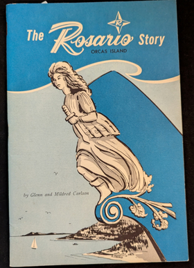
Glenn and Mildred Carlson’s The Rosario Story, Orcas Island chronicles the history of the iconic Moran Mansion and its surrounding estate, situated on the forested shores of Cascade Bay in Washington’s San Juan archipelago. The narrative focuses deeply on the rugged geography of Orcas Island, detailing how shipbuilding magnate Robert Moran selected this isolated, deep-water inlet along the East Sound to build his sprawling early twentieth-century retreat. By documenting the estate's transformation from a private wilderness sanctuary beneath the towering peak of Mount Constitution into a renowned regional resort, the text maps the historical development of this pristine maritime landscape. Ultimately, the book captures the rugged coastal topography of the San Juan Islands, showcasing a vital piece of the broader Salish Sea's historical geography. 23 pages : illustrations ; 23 cm Non-circulating [ 1 ]
|
1967 |
|
The Oregon territory by C. G. Nicolay, Robert Hitchman (Writer of introduction)
C.G. Nicolay's The Oregon Territory provides a sweeping nineteenth-century geographical survey of the vast, contested frontier stretching from the towering Rocky Mountains to the Pacific Ocean. Written during the height of the international boundary dispute, the narrative maps the sprawling region that encompasses the entirety of modern-day British Columbia, Washington, Oregon, and Idaho. The text details the vital inland river networks, such as the Columbia and Fraser, as well as the strategic coastal harbors of Puget Sound and Vancouver Island that were highly coveted by competing British and American empires. By documenting this rugged, undivided topography alongside established fur-trading outposts like Fort Vancouver, the book captures the immense geographic scale of the Pacific Northwest just before its political partition. 226 pages : illustrations ; 21 cm Non-circulating [ 1 ]
|
1967 |
|
Home port Victoria a collection of true stories of men and ships that sailed from this port, told by seamen at meetings of the Thermopylae Club, Victoria, B.C., including short sketches of their narrators, articles on relevant history of the Port of Victoria, and two maps by Ursula Jupp, Thermopylae Club 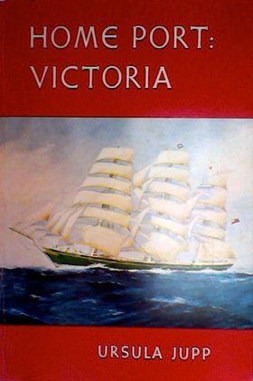
Home Port Victoria, compiled by Ursula Jupp in collaboration with Victoria's maritime-focused Thermopylae Club in 1967, is a rich anthology of authentic nautical history and personal seafaring narratives. The book preserves the firsthand accounts of veteran seamen, detailing the rugged voyages of the men and ships that sailed out of British Columbia's capital city. Alongside these captivating true stories, the volume features biographical sketches of the narrators, historical essays on the port's development, and detailed maps that anchor the region's proud maritime legacy. 168 pages illustrations, maps, portraits 24 cm Non-circulating [ 1 ]
|
1967 |
|
The Idaho story by Idaho Poets and Writers Guild
The Idaho Story, compiled by the Idaho Poets and Writers Guild, is a rich anthology that chronicles the localized history, folklore, and pioneer experiences across the diverse landscapes of the Gem State. The collection's narratives span the rugged topography of this inland Pacific Northwest territory, moving from the deep, forested canyons of the Salmon River down to the sweeping, arid expanses of the southern Snake River Plain. By detailing daily life in the isolated mining camps of the Owyhee Mountains and the remote agricultural settlements of the northern panhandle, the book heavily maps the challenging terrain early inhabitants had to navigate. Ultimately, this collaborative work provides a vivid geographical portrait of how diverse communities adapted to and shaped the formidable interior environments of Idaho. 352 pages : illustrations, portraits Non-circulating [ 1 ]
|
1967 |
|
Astoria by Washington Irving
Washington Irving’s Astoria chronicles the ambitious early nineteenth-century enterprise of John Jacob Astor to establish a global fur-trading empire at the treacherous mouth of the Columbia River in present-day Oregon. The sweeping narrative maps the grueling overland journey of the Astorians as they navigated the unforgiving topography of the inland Pacific Northwest, struggling through the deep gorges and rapids of the Snake River across what is now southern Idaho and eastern Oregon. Simultaneously, the book traces the maritime arm of the expedition, detailing the perilous coastal navigation from the Columbia's notoriously violent sandbar north to the rugged, forested shores of Vancouver Island, British Columbia. By documenting the brutal environmental realities of these coastal inlets and arid interior plateaus, Irving vividly captures the severe geographic challenges that defined the earliest commercial settlement of the Pacific Northwest. 467 pages illustrations Non-circulating [ 1 ]
|
1967 |
|
The Oregon question essays in Anglo-American diplomacy and politics by Frederick Merk
Frederick Merk’s The Oregon Question: Essays in Anglo-American Diplomacy and Politics examines the fierce nineteenth-century international dispute over the vast, undivided wilderness encompassing modern-day British Columbia, Washington, Oregon, and Idaho. The historical analysis maps the contested geographic lines that dominated the negotiations, particularly the British push to establish the mighty Columbia River as a natural southern border. The narrative heavily emphasizes the strategic geopolitical value of the region's coastal topography, focusing on the highly coveted deep-water harbors of Washington's Puget Sound and the vital maritime position of Vancouver Island. By detailing the diplomatic battles over these rugged shorelines and expansive inland watersheds, the book illustrates how the eventual drawing of the 49th parallel forever fractured the historic, interconnected geography of the Pacific Northwest. xiv, 427 pages : map ; 25 cm Non-circulating [ 1 ]
|
1967 |
|
Clackamas County historical, 1966-1967 history of Willamette Falls by Clackamas County Historical Society
The Clackamas County Historical Society's Clackamas County Historical, 1966-1967: History of Willamette Falls provides a detailed chronicle of the monumental waterfall situated along the Willamette River in northwestern Oregon. The narrative centers on the dramatic basalt horseshoe of the falls, mapping how this vital geographical chokepoint spurred the development of pioneer settlements like Oregon City and West Linn on opposing riverbanks. By documenting early industrial power generation, indigenous fishing encampments, and the construction of navigational locks, the text highlights the falls as a crucial artery connecting the fertile Willamette Valley to the broader Columbia River basin. Ultimately, this historical account vividly captures the profound physical and economic impact of this specific aquatic landmark on the early expansion of the Oregon Territory. 60 pages : illustrations ; 22 cm Non-circulating [ 1 ]
|
1967 |
|
Washington's historical markers by W. M. Scofield
W. M. Scofield’s Washington’s Historical Markers serves as a comprehensive roadside geographical guide to the pioneer history, indigenous heritage, and pivotal events commemorated across the Evergreen State. The directory maps the physical landscape of the region's past, guiding readers from the historic maritime outposts of the San Juan Islands down through the bustling timber and shipping ports of Puget Sound. Scofield also traces overland pioneer trails and early agricultural settlements stretching eastward across the imposing Cascade Mountains into the arid expanse of the Inland Empire. By chronicling the exact physical locations of these widespread plaques and monuments, the book provides a tangible, site-by-site historical geography of Washington's transformation from a rugged frontier into a modern state. 79 pages : illustrations, map ; 21 cm Non-circulating [ 1 ]
|
1967 |
|
So this is Klickitat by Selma M. Neils, Klickitat Woman's Club
Selma M. Neils's So this is Klickitat provides a localized history of the bustling timber communities nestled deep within the rugged Klickitat River canyon of south-central Washington State. The narrative maps the geographical footprint of the town of Klickitat, detailing how its strategic position just north of the expansive Columbia River Gorge transformed it into a vital hub for massive milling operations. By chronicling the development of logging camps and railroad networks stretching northward into the densely forested foothills of Mount Adams, the book captures the challenging topography navigated by early residents and laborers. Ultimately, this detailed historical account illustrates how the isolated, narrow river valleys of this specific inland Washington landscape were fundamentally shaped by the Pacific Northwest's booming timber industry. 176 pages illustrations, map (on lining papers), portraits 23 cm Non-circulating [ 1 ]
|
1967 |
|
You're at liberty here mines and miners of the Swauk by Josee Jordan
Josee Jordan’s You're at liberty here: Mines and miners of the Swauk chronicles the rugged pioneer history of the historic gold-mining town of Liberty, nestled deep within the eastern slopes of Washington's Cascade Mountains. The narrative maps the challenging topography of the Swauk Creek basin, detailing the extensive placer mining operations that transformed this remote, forested enclave in northern Kittitas County. By documenting the daily lives and arduous labor of prospectors navigating the steep, timbered gulches just south of Blewett Pass, the book illustrates the severe environmental realities of the region's late-nineteenth-century gold rush. Ultimately, the text captures the distinct geographical footprint of this inland Washington landscape, preserving the legacy of one of the Pacific Northwest's most enduring historic mining districts. v, 103 pages : illustrations, map, portrait ; 22 cm Non-circulating [ 1 ]
|
1967 |
|
Island in the sound by Hazel Heckman 
Anderson Island in Puget Sound exists as a kind of tiny, autonomous world. Sharply defined by bitterly cold water, deep enough to float a destroyer; by dense fog; and by dangerous tide rips caused by the narrow channels, it is a community without an officer of the law, a minister of the gospel, or a doctor of medicine. Nevertheless, it is a tightly knit and well-organized microcosm in its wilderness environment. Hailed as a ‘local classic’ by Murray Morgan and Wallace Stegner, Hazel Heckman’s story of this Northwest island will have strong appeal for devotees of island life anywhere. The Pacific Northwesterner will learn much about his native soil, but this book will find an audience far beyond the shadows of Mount Rainier and the wild Olympics. It will be especially treasured by those who feel deep nostalgia for the leisurely pace of life in a small community. Wit, depth of perception, engaging literary style -- all are warmly present in this saga of a Midwestern woman’s experience with a new homeland, an environment strange and very different from the dusty Oklahoma country where she had lived for the previous twenty years. Feeling at first that the perpetual rain and gray skies were a high price to pay for a relatively comfortable year-round climate, Mrs. Heckman came to like, and eventually to love, the Northwest only after she discovered Anderson Island. Located near McNeil Island in upper Puget Sound, Anderson has approximately ninety permanent residents. Most of them are descendants of the original Scandinavian settlers of the Island, and they seem to have inherited the individualism and self-reliance necessary to survive in a hostile environment. Thus, ‘modern’ innovations, such as regular ferry service and electricity, are comparatively recent developments. This book is the lively chronicle of Anderson Island -- its history, its residents, its idiosyncrasies, its commonplaces. Mrs. Heckman’s lyrical evocations of the natural life have captured the essence of Anderson Island. xii, 284 pages illustrations, map 23 cm Non-circulating [ 1 ]
|
1967 |
|
Bridge River gold by Emma Ritchie De Hullu, Evelyn E. Cunningham
Emma Ritchie De Hullu and Evelyn E. Cunningham’s Bridge River Gold chronicles the arduous pioneer history and booming industry of British Columbia's most prolific gold-producing region. The narrative meticulously maps the treacherous topography of the Bridge River Valley, located deep within the rugged Coast Mountains northwest of the historic inland hub of Lillooet. By detailing the establishment of remote, large-scale hard-rock mining camps like Bralorne and Pioneer Mine, the authors illustrate how prospectors navigated steep canyons and punishing alpine environments to extract vast mineral wealth. Ultimately, the book captures the extreme physical isolation of this remote Canadian landscape, highlighting how human endurance and industrial ambition temporarily transformed the unforgiving mountainous wilderness of the Pacific Northwest. viii, 88 pages : illustrations, maps ; 23 cm Desiderata
|
1967 |
|
One man's gold rush a Klondike album by Murray Morgan, Eric A. Hegg (Illustrator, Photographer)
"When Eric A. Hegg rushed north to Alaska in 1897, he as a journeyman photographer, largely self-trained. He forced a sled load of photographic equipment across the coastal mountains in the dead of winter. He hiked out to the claims on Bonanza and Eldorado, and he poked his camera into the banks and bars and bordellos in Dawson. He rode a paddle-wheel steamer down the Yukon to the Bering and was on the dark sands of the beach at Home when the prospectors swirled gravel in their pans and worked their mechanical rockers. Most important, he was there, high on the Chilkoot Pass in the winter of 1897-98, as the dark-clad men climbed antlike up the frozen steps of The Scales under the burden of a year's supplies." -- amazon.com 213 pages : illustrations, maps, portraits ; 22 x 27 cm Non-circulating [ 1 ]
|
1967 |
|
The big blow the story of the Pacific Northwest's Columbus Day storm by Ellis Lucia 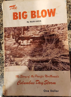
Ellis Lucia’s The Big Blow: The Story of the Pacific Northwest's Columbus Day Storm chronicles the catastrophic 1962 extratropical cyclone that violently reshaped the region's physical and cultural landscape. The gripping narrative maps the storm's devastating trajectory as it roared northward from the coast, tearing through the fertile Willamette Valley of Oregon and battering the densely populated Puget Sound corridor of Washington. Lucia details the unprecedented destruction inflicted upon coastal timberlands and inland agricultural basins, extending its fury all the way into the coastal communities of southern British Columbia to leave billions of board feet of shattered forests in its wake. By documenting the widespread infrastructural collapse across these interconnected states and provinces, the book captures the terrifying vulnerability of the broader Pacific Northwest geography to extreme oceanic weather systems. 80 pages illustrations, map 23 cm. Desiderata
|
1967 |
E. W. Wright’s Lewis & Dryden’s Marine History of the Pacific Northwest serves as an exhaustive chronicle of the maritime exploration, shipbuilding, and navigational enterprises that physically connected the region's vast coastlines and interior waterways. The extensive narrative maps the early nautical expansion from the treacherous coastal approaches of the Columbia River bar and the rugged shores of British Columbia's Vancouver Island, deep into the sheltered, bustling harbors of Washington's Puget Sound. By documenting the golden age of steamboat navigation, Wright traces the vital aquatic highways that penetrated the inland frontier, stretching up the turbulent Willamette, Columbia, and Fraser rivers, and pushing as far east as the perilous rapids of Idaho’s Snake River. Ultimately, this foundational text illustrates how the interconnected marine geography of Oregon, Washington, British Columbia, and Idaho dictated the economic and cultural settlement of the entire Pacific Northwest. xxiii, 494 pages : illustrations, portraits ; 35 cm Desiderata
|
1967 |
|
Steens Mountain in Oregon's high desert country by Charles Conkling, E. R. Jackman , John Scharff 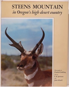
Charles Conkling, E. R. Jackman, and John Scharff’s Steens Mountain in Oregon's High Desert Country provides a sweeping visual and historical portrait of the massive fault-block mountain that dominates the remote southeastern corner of the state. The narrative deeply maps the stark, dramatic topography of this isolated inland geography, contrasting the sheer, glacier-carved drops of Kiger Gorge with the expansive, arid alkali flats of the Alvord Desert lying directly in its eastern rain shadow. By chronicling the region's sprawling cattle ranches, rugged Basque sheepherders, and resilient wildlife, the authors illustrate how early inhabitants and ecosystems adapted to the severe climate of Harney County. Ultimately, the book captures the unyielding beauty of the Great Basin environment, showcasing a drastically different geographic facet of the Pacific Northwest far removed from its famously wet coastal timberlands. xiv, [2], 203 pages : color illustrations ; 38 cm Desiderata
|
1967 |
|
Indians of the North Pacific Coast by Tom McFeat (Editor, Writer of introduction) 
This book offers a many-faceted examination of the cultures of the Tlingit, the Haida, the Tsimshian, the Bella Coola, the Kwakiutl, the Nootka, and the Salish--Indian peoples of the coast running from the Canadian border area of Juan de Fuca Strait to Yakutat Bay in southeastern Alaska. Professor McFeat has brought together key writings by seventeen authorities including Franz Boas, Helen Codere, Viola E. Garfield, and Wayne Suttles. General readers as well as scholars have an opportunity to examine a wide range of literature and thereby to increase their understanding of one of the most interesting groups among the Indian peoples of North America. xv, 268 pages 21 cm Desiderata
|
1967 |
|
Indian relics of the Pacific Northwest by N. G. Seaman 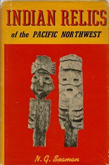
N. G. Seaman’s Indian Relics of the Pacific Northwest provides a detailed archaeological survey of the indigenous artifacts scattered across the diverse physical landscapes of Oregon, Washington, and the broader Columbia basin. The narrative meticulously maps the vital riverine geography that sustained early Native American communities, with a particular focus on the ancient, bustling fishing encampments and campsites once situated along the Columbia River Gorge near The Dalles and Celilo Falls. By documenting the unearthing of stone tools, petroglyphs, and bone implements from rugged coastal shorelines eastward into the arid inland plateaus of Idaho, Seaman illustrates the deep historical connection between indigenous populations and the region's varied terrain. Ultimately, the book captures the rich cultural geography of the Pacific Northwest, preserving the physical legacy of its first inhabitants before modern hydroelectric dams permanently flooded these foundational aquatic networks. 255 pages illustrations 22 cm Desiderata
|
1967 |
|
Once upon an island by David Conover 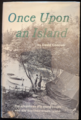
Once Upon an Island by David Conover is a classic 1967 memoir chronicling the true story of a young couple who purchased Wallace Island in the Canadian Gulf Islands during the late 1940s. The book details David and Jeanne Conover's adventures, struggles, and eventual triumphs as they worked to transform the rugged, undeveloped land into a functioning summer vacation resort. Ultimately, it serves as an inspiring and humorous narrative for boaters and dreamers drawn to the trials and joys of escaping city life for a self-sufficient island existence. 242 pages illustrations, portraits 22 cm Non-circulating [ 1 ]
|
1967 |