Catalog of British Columbiana and Pacific Northwest Americana
The Encyclopedia Cascadia Catalog indexes mostly non-fiction literature covering the Pacific Northwest coast of North America, with an emphasis on British Columbia, Idaho, Oregon, and Washington State.
| Catalog Title | Published |
|---|---|
|
Friday Harbor, then and now by F. H. Van Cleve 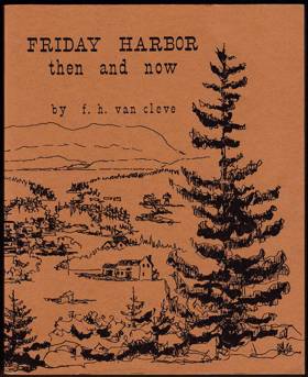
Friday Harbor, then and now examines the insular maritime settlement and commercial port development situated within the protected anchorages and agricultural heartland of San Juan Island. Van Cleve details how the region's distinct archipelagic topography—specifically the deep, naturally sheltered basin of Friday Harbor, the rocky, current-swept coastal margins of the Salish Sea, and the fertile, glaciated interior valleys—strictly dictated the margins of early pioneer homesteading, marine-based resource extraction, and inter-island commerce. By mapping the transformation of this strategic deep-water refuge from a vital agricultural shipping point and bustling salmon cannery hub into a highly connected, modern ferry-dependent commercial center, the narrative highlights how this specific sheltered geography anchored the island's profound reliance on sustained maritime connectivity. Ultimately, this community record serves as a localized spatial history, demonstrating how the immense marine isolation, sheltered deep-water access, and productive coastal ecology of this Pacific Northwest island fundamentally shaped the highly resilient, maritime-driven character of Friday Harbor. 97 [2] pages : chiefly illustrations ; 23 cm Non-circulating [ 1 ]
|
1972 |
|
Pioneering the Snake River fork country by Louis J. Clements, Harold S. Forbush 
Pioneering the Snake River fork country examines the agrarian settlement and early pioneer expansion situated within the critical riverine convergence and sprawling volcanic plains of eastern Idaho. Clements and Forbush detail how the region's formidable interior topography—specifically the powerful, flood-prone channels of the Snake River forks, the vast, arid sagebrush steppes of the upper river plain, and the vital, fertile riparian bottomlands—strictly dictated the margins of early homesteading, complex irrigation development, and agricultural reclamation. By mapping the grueling transformation of these arid volcanic flatlands through massive, community-driven canal networks that diverted the converging rivers, the narrative highlights how this specific high-desert geography anchored the pioneers' profound reliance on engineered water systems to survive the arid climate. Ultimately, this pioneer record serves as a localized spatial history, demonstrating how the immense hydrological forces, severe arid constraints, and rich volcanic soils of this interior Pacific Northwest landscape fundamentally shaped the highly engineered, agriculturally driven character of the Snake River fork country. xxii, 312 pages : illustrations ; 24 cm Non-circulating [ 1 ]
|
1972 |
|
The hidden Northwest by Robert Cantwell
The hidden Northwest examines the early exploration, cultural perception, and literary rendering situated across the vast, heavily obscured coastal and interior landscapes of the Pacific Northwest. Cantwell details how the region's formidable and often deceptive macro-geography—specifically the impenetrable, perpetually damp temperate rainforests, the chronic, low-hanging coastal marine layers, and the immense, isolating mountain barriers—strictly dictated the margins of early Euro-American exploration, pioneer settlement, and the resulting sense of profound regional isolation. By mapping how early maritime navigators and overland pioneers repeatedly bypassed or were overwhelmed by these shrouded coastlines and deeply shadowed river valleys, the narrative highlights how this specific obscuring geography anchored a profound psychological and cultural detachment from the rest of the expanding nation. Ultimately, this literary and historical study serves as a macro-level spatial history, demonstrating how the immense botanical scale, chronic atmospheric obscurity, and severe overland isolation of this Pacific Northwest landscape fundamentally shaped the deeply introspective, historically overlooked character of the region. 335 pages : maps ; 24 cm Non-circulating [ 1 ]
|
1972 |
|
They named it Deer Harbor covering the period of 1852 to 1912 by Edith McLachlan, Washington State Library Rare Publications Collection 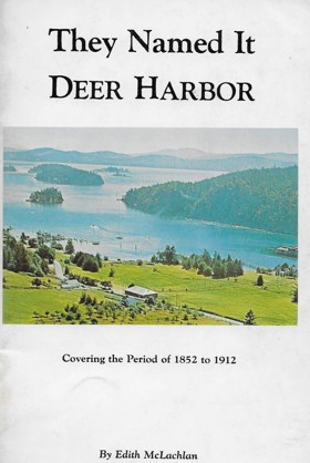
They named it Deer Harbor covering the period of 1852 to 1912 examines the insular pioneer settlement and nascent agrarian-maritime economy situated within the deep, sheltered inlets of western Orcas Island. McLachlan details how the region's distinct archipelagic topography—specifically the deeply incised, naturally protected marine basin of Deer Harbor, the steep, heavily timbered slopes of the island's interior, and the complex tidal currents of the surrounding Salish Sea—strictly dictated the margins of early homesteading, localized logging operations, and extensive fruit orchard cultivation. By mapping the transformation of this secluded marine refuge from a remote frontier anchorage into a thriving, self-reliant community entirely dependent on the regional steamboat "mosquito fleet" for external commerce and transport, the narrative highlights how this specific sheltered geography anchored a profound reliance on sustained maritime connectivity. Ultimately, this historical record serves as a deeply localized spatial history, demonstrating how the severe overland isolation, protective deep-water access, and fertile island microclimates of this Pacific Northwest archipelago fundamentally shaped the highly resilient, water-bound character of early Deer Harbor. 48 pages : illustrations, maps ; 21 cm Non-circulating [ 1 ]
|
1972 |
|
The railroad that ran by the tide Ilwaco Railroad & Navigation Co. of the State of Washington by Raymond J. Feagans
The railroad that ran by the tide Ilwaco Railroad & Navigation Co. of the State of Washington examines the highly idiosyncratic transportation network and coastal resort expansion situated along the shifting, narrow sandspit of southwestern Washington's Long Beach Peninsula. Feagans details how the region's dynamic estuarine and coastal topography—specifically the shallow, treacherous mudflats of Baker Bay, the extreme tidal fluctuations of the lower Columbia River, and the unbroken, surf-pounded expanse of the Pacific shoreline—strictly dictated the margins of regional transit, maritime docking, and early tourism. By mapping the operation of a precarious narrow-gauge rail line whose daily schedule was entirely governed by the rhythm of the ocean tides rather than a clock—a physical necessity to align with deep-water steamboat arrivals at the shallow Ilwaco terminus—the narrative highlights how this specific tidal geography anchored the peninsula's profound reliance on synchronized marine-overland connectivity. Ultimately, this transportation record serves as a highly localized spatial history, demonstrating how the immense estuarine shoals, severe tidal variations, and isolating coastal geography of this Pacific Northwest landscape fundamentally shaped the uniquely synchronized, tide-bound character of the Ilwaco Railroad and the early Long Beach Peninsula. 146 pages illustrations 29 cm Non-circulating [ 1 ]
|
1972 |
|
The Chilcotin uprising a study of Indian-white relations in nineteenth-century British Columbia by Edward S. Hewlett
Edward S. Hewlett’s academic thesis, The Chilcotin Uprising: A Study of Indian-White Relations in Nineteenth-Century British Columbia, provides an authoritative historical examination of the 1864 Chilcotin War (Tsilhqot'in War). Hewlett investigates the root causes of the conflict, demonstrating how Alfred Waddington’s attempt to construct an overland toll road from Bute Inlet to the Cariboo goldfields proceeded across sovereign Tsilhqot'in territory without tribal consent, threatening traditional food networks and spreading devastating smallpox epidemics. The text details the organized military defense led by Head War Chief Lhats'as?in, examining the engagements along the Homathko River and the central plateau near Tatlayoko Lake, Nemaiah Valley, Anahim Lake, and Alexis Creek. Hewlett analyzes the deceptive capture of the chiefs under a flag of truce, their subsequent trials and executions at Quesnelmouth, and the profound enduring implications of the conflict on provincial Indigenous policy. ix, 230 leaves : maps ; 28 cm Desiderata
|
1972 |
|
Potlatch by George Clutesi
Potlatch examines the intricate ceremonial gatherings and deep cultural consolidation situated within the sheltered coastal inlets and towering cedar forests of Vancouver Island's rugged western shoreline. Clutesi details how the region's dramatic maritime topography—specifically the rich tidal estuaries, the dense temperate rainforests, and the intricate network of deep-water fjords—strictly dictated the margins of inter-tribal connectivity and seasonal habitation. By mapping the staging of massive winter ceremonies within monumental cedar longhouses anchored securely to the Pacific edge, the narrative highlights how the profound abundance of the local marine and forest ecosystems directly sustained complex societal structures. Ultimately, this cultural record serves as a deeply localized spatial history, demonstrating how the rich estuarine geography and immense botanical scale of this Pacific Northwest coastline fundamentally shaped the deeply rooted, geographically tethered character of Nuu-chah-nulth ceremonial life. 188 pages : illustrations ; 21 cm Non-circulating [ 1 ]
|
1973 |
|
Longview, the first fifty years 1923-1973 by Longview Golden Jubilee Committee
Longview, the first fifty years 1923-1973 examines the rapid, master-planned urban development situated on the low-lying, flood-prone alluvial plains at the confluence of the Cowlitz and Columbia rivers in southwestern Washington. The Jubilee Committee details how the region's distinct riverine topography—specifically the sprawling riparian marshlands, the shifting estuarine silt, and the vital deep-water access of the Columbia—strictly dictated the massive scale of hydrological engineering required to establish the city. By mapping the aggressive transformation of this swampy delta through extensive dredging, diking, and the imposition of a rigid, radial street grid, the narrative highlights how the specific riparian geography was forcibly molded to anchor a massive timber processing hub. Ultimately, this civic record serves as a localized spatial history, demonstrating how the dynamic hydrological forces and strategic waterway position of this Pacific Northwest landscape fundamentally shaped the highly engineered, industrially defined character of early Longview. 112 pages : illustrations ; 28 cm Non-circulating [ 1 ]
|
1973 |
|
This isle of Guemes by Helen Troy Elmore, Community Club of Guemes Island
This isle of Guemes examines the isolated insular settlement and tight-knit community development situated within the narrow marine channels and heavily wooded shorelines of the eastern Salish Sea. Elmore and the Community Club detail how the region's distinct archipelagic topography—specifically the steep coastal bluffs, the protected, gravel-strewn coves, and the swift tidal currents of Guemes Channel separating it from Fidalgo Island—strictly dictated the margins of early homesteading, transportation, and civic organization. By mapping the evolution of scattered pioneer farms and early mosquito fleet transit into a resilient, ferry-dependent enclave, the narrative highlights how this specific insular geography anchored the islanders' profound reliance on localized cooperation and marine connectivity. Ultimately, this community record serves as a deeply localized spatial history, demonstrating how the pervasive marine isolation and defining tidal boundaries of this Pacific Northwest island fundamentally shaped the highly cohesive, geography-dependent character of Guemes Island. 139 pages 23 cm Non-circulating [ 1 ]
|
1973 |
|
Northwest disaster avalanche and fire by Ruby El Hult
Gives a narrative history of 2 separate disasters that happened in the northwest US in 1910. One was an avalanche that killed 96 people at Wellington, Washington. The other was the huge forest fires of 1910 in Montana and Idaho. The emphasis on the fire portion of this book is on the fires in Idaho 228 S., Taf. Ill. Non-circulating [ 1 ]
|
1973 |
|
Vancouver Island railroads by Robert D. Turner 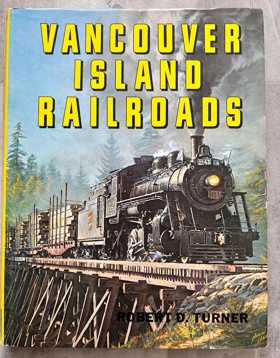
The history of railroads on Vancouver Island begins in 1863. Turner presents the stories of the lines, the men who built them, and the locomotives and cars that gave them a unique character. Included is the saga of the Dunsmuirs, the coal barons and railroad builders who influenced the entire history of the Island 170 pages illustrations 29 cm Non-circulating [ 1 ]
|
1973 |
|
The struggle for survival Indian cultures and the Protestant ethic in British Columbia [by] Forrest E. LaViolette by Forrest Emmanuel LaViolette
The struggle for survival Indian cultures and the Protestant ethic in British Columbia examines the intense cultural collision and colonial administrative expansion situated across the deeply indented fjords and heavily forested coastal margins of the Canadian Pacific edge. LaViolette details how the region's formidable macro-geography—specifically the labyrinthine marine waterways, the dense, resource-rich temperate rainforests, and the steep, isolating mountainous topography—strictly dictated the margins of indigenous socio-economic networks and the subsequent imposition of European institutional control. By mapping the Canadian government's aggressive efforts to overlay a rigid, agrarian-based Protestant spatial order onto a terrain that had long supported complex, marine-harvesting indigenous societies, the narrative highlights how this specific coastal geography anchored the profound resistance to cultural and territorial displacement. Ultimately, this sociological record serves as a macro-level spatial history, demonstrating how the immense geographic isolation and rich marine abundance of this northern Pacific frontier fundamentally shaped the highly contested, terrain-dependent character of British Columbia's indigenous cultural survival. xii, 201 pages : illustrations Non-circulating [ 1 ]
|
1973 |
|
Owyhee trails the West's forgotten corner by Mike Hanley, Ellis Lucia 
History and folklore of the little known and sparsely populated high desert region of the Owyhee Mountains. The Owyhees are sharp and ragged peaks rising from the high desert of Oregon and Idaho. Mike Hanley and Ellis Lucia recount the boisterous past and present of this wild and rugged corner of the West. xxii, 314 pages : illustrations ; 24 cm Non-circulating [ 1 ]
|
1973 |
|
John McLoughlin's business correspondence, 1847-48 by John McLoughlin, William R. Sampson , Washington State Historical Society
John McLoughlin held the role as chief factor in the Columbia Department of the Hudson's Bay Company. His career following his retirement from the company in 1846 is less well known. In 1962, the United States National Park Service acquired the McLoughlin letter book. These letters provide insights into the wide range of his interests and affairs in Oregon City, and they show his continuing relations, both economic and personal, with the Hudson's Bay Company and its officers. The letters also provide an increased understanding of the problems and frustrations that a frontier community had in struggling to diversify and expand its economy.--adapted from the preface li, 179 pages illustrations 24 cm Non-circulating [ 1 ]
|
1973 |
|
Washington a history of the Evergreen State by Mary W. Avery
Washington a history of the Evergreen State examines the macro-scale settlement and economic evolution situated across the starkly divided physical environments of the Pacific Northwest. Avery details how the region's formidable physical divide—specifically the towering volcanic barrier of the Cascade Range separating the maritime-moderated, heavily timbered Puget Sound basin from the vast, semi-arid Columbia River Plateau—strictly dictated the diverging patterns of regional resource extraction, transit corridors, and agrarian expansion. By mapping the historical layering of indigenous routes, pioneer migrations, and burgeoning industrial hubs against this dualistic terrain, the narrative highlights how the state’s contrasting microclimates and sharp elevation gradients determined where commerce could take root. Ultimately, this foundational text serves as a macro-level spatial history, demonstrating how the stark topographical bifurcation and profound environmental diversity of this Pacific Northwest landscape fundamentally shaped the multifaceted, geography-driven identity of Washington State. 362 pages : illustrations, maps, portraits ; 24 cm Non-circulating [ 1 ]
|
1973 |
|
Chechacos all the pioneering of Skagit by Skagit County Historical Society, Margaret Willis
Chechacos all the pioneering of Skagit examines the agrarian settlement and intense resource extraction situated within the fertile alluvial delta and densely forested foothills of northwestern Washington's Skagit River basin. Willis and the Skagit County Historical Society detail how the region's dynamic riparian and coastal topography—specifically the sprawling, flood-prone tidal flats of Skagit Bay, the immense, meandering channels of the Skagit River, and the heavily timbered slopes of the Cascade Range—strictly dictated the margins of pioneer homesteading, massive logging operations, and agricultural reclamation. By mapping the grueling transformation of these estuarine marshlands through extensive community diking networks and the establishment of river-dependent timber camps, the narrative highlights how this specific delta geography anchored the early settlers' profound reliance on rich floodplain soils and navigable waterways. Ultimately, this pioneer record serves as a localized spatial history, demonstrating how the powerful hydrological forces and immense botanical scale of this Pacific Northwest river valley fundamentally shaped the highly engineered, agriculturally rich character of early Skagit County. ix, 212 pages illustrations 29 cm. Non-circulating [ 1 ]
|
1973 |
|
Flood tide of empire Spain and the Pacific Northwest, 1543-1819 by Warren L. Cook 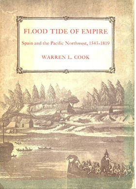
Flood tide of empire Spain and the Pacific Northwest, 1543-1819 examines the ambitious maritime exploration and fragile imperial claims projected across the immense, storm-battered coastlines of the northern Pacific edge. Cook details how the region's formidable marine macro-geography—specifically the treacherous, fog-shrouded headlands, the relentless northern ocean currents, and the extreme linear distance from established naval bases in New Spain—strictly dictated the limits of Spanish colonial reach and coastal fortification. By mapping the tenuous establishment of isolated garrisons, such as Nootka Sound, clinging precariously to the rocky, rainforest-backed shorelines, the narrative highlights how this severe maritime environment thwarted sustained occupation despite massive geopolitical efforts. Ultimately, this geopolitical record serves as a macro-level spatial history, demonstrating how the sheer oceanic distance and rugged, inhospitable coastal geography of this Pacific Northwest frontier fundamentally shaped the overextended, environmentally constrained character of the Spanish imperial project. 620 s. 12 tvl. [2 i lomme] Non-circulating [ 1 ]
|
1973 |
|
"A particular friend, Penn's Cove" a history of the settlers, claims, and buildings of central Whidbey Island by Jimmie Jean Cook 
"A particular friend, Penn's Cove" a history of the settlers, claims, and buildings of central Whidbey Island examines the pioneer agrarian settlement and maritime architectural development situated within the sheltered inland waters and rare natural prairies of central Whidbey Island. Cook details how the region's distinct insular topography—specifically the deep, protected anchorage of Penn's Cove, the fertile, glacially cleared expanses of Ebey's Prairie, and the commanding coastal bluffs overlooking the Puget Sound—strictly dictated the margins of territorial land claims and early commercial port development. By mapping the establishment of expansive Donation Land Claims and the construction of prominent sea captains' homes directly along this vital marine corridor, the narrative highlights how this specific sheltered geography anchored a thriving, dual agricultural and seafaring economy. Ultimately, this pioneer record serves as a localized spatial history, demonstrating how the unique glacial prairies and strategic maritime topography of this Pacific Northwest island fundamentally shaped the deeply rooted, maritime-agrarian character of early Penn's Cove. 148 pages illustrations 28 cm Non-circulating [ 1 ]
|
1973 |
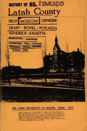
From the forward by Simon K. Benson: “This new addition of Early History of North Idaho, but more particular the history of Latah County, Moscow (Paradise City) 1871, Troy (Huff Gulch) our first home after World War II. Some of the history first came out in a limited edition in 1903. I have republished with permission and the desire of many of the families, and chiefly as a tribute to my father-in-law Guy Senter (now deceased). “The book is a valuable reference work on early Northern Idaho and Latah County history from the explorations into the old Oregon territory, of which the counties of Northern Idaho were once a part. “This book can bring knowledge, enjoyment and memories for anyone who reads it. Books can have a wide distribution and bring joy as an ideal gift. “Perhaps everyone who ever lived in Latah County or had a parent or grandparent who did, can once again relive the nostalgic, exciting pages of the past. ‘Let’s live to give, learn, love, and remember.’” (276 pages) 276 pages : illustrations, portraits ; 21 cm Desiderata
|
1973 |
|
The Construction of the Northern Pacific Railroad main line the years 1870-1888 by Louis T. Renz 
Excellent short history of the construction of the Northern Pacific Railroad between 1870-1888, describing the building of the Eastern Section, the Western Section and the Cascade Line. The author provides a well-written look at the people involved, the geography, financial difficulties and the engineering triumphs. With map. 64 pages with index. 64 pages ; 24 cm. Non-circulating [ 1 ]
|
1973 |
|
Pig-tail days in old Seattle by Sophie Frye Bass 
ONLY SOME TWELVE DECADES have passed since the first small band of settlers dug clams along the beach and built their cabins at Alki Point where Seattle, Washington, had its beginning. When the men came from Alki, after sounding the harbor and finding good anchorage for ships, they staked their claims on February 15, 1852, built their cabins on tiny patches of land they had cleared in the forest, and then began the survey through the heavy timber for the future great city. Seattle's streets still carry many of the names of those first settlers-or names bestowed by them-and in the following pages are the historically true, and often amusing, stories of the early days of these streets-how they looked, who walked along them; all the friendly, gossipy beginnings, recalled by the granddaughter of Arthur Armstrong Denny, founder and surveyor of the city. [4], 191, [1] pages : illustrations, maps (on lining papers) ; 23 cm Non-circulating [ 1 ]
|
1973 |
|
British Columbia, one hundred years of geographical change by J. Lewis Robinson, Walter G. Hardwick
British Columbia, one hundred years of geographical change examines the sweeping macro-scale settlement patterns and shifting resource economies situated across the vast, heavily glaciated cordillera and rugged coastal margins of Canada's westernmost province. Robinson and Hardwick detail how the region's formidable physical geography—specifically the immense, isolating barriers of parallel mountain ranges, the fertile but narrow interior river valleys, and the highly constrained coastal lowlands of the Lower Mainland—strictly dictated the margins of urbanization, industrial timber extraction, and transcontinental transportation routing. By mapping the historical evolution from scattered, isolated frontier outposts into a highly centralized core-and-hinterland spatial structure tethered by precarious alpine transit corridors, the narrative highlights how this specific mountainous terrain anchored the province's starkly uneven demographic footprint. Ultimately, this geographical record serves as a macro-level spatial history, demonstrating how the immense topographic hostility, concentrated coastal access, and vast resource hinterlands of this Pacific Northwest landscape fundamentally shaped the highly centralized, terrain-constrained character of modern British Columbia. 63 pages : maps ; 21 x 28 cm Non-circulating [ 1 ]
|
1973 |
|
Marcus and Narcissa Whitman, and the opening of old Oregon by Clifford Merrill Drury 
Marcus and Narcissa Whitman, and the opening of old Oregon examines the early Protestant missionary settlement and the grueling transcontinental pioneer migration situated within the arid interior steppes and vital river valleys of the Columbia Plateau. Drury details how the region's formidable interior topography—specifically the imposing overland barrier of the Blue Mountains, the sprawling, sun-baked expanses of the bunchgrass plateau, and the critical, sheltered riparian oasis of the Walla Walla River—strictly dictated the margins of early Euro-American agricultural outposts and established indigenous Cayuse transit. By mapping the strategic placement of the Waiilatpu mission as an isolated agrarian waystation at the exhausted terminus of a massive overland trail, the narrative highlights how this specific riverine geography anchored the volatile collision between surging pioneer overland transit and indigenous seasonal reliance. Ultimately, this biographical and historical record serves as a macro-level spatial history, demonstrating how the immense overland distances, harsh arid plateau constraints, and vital hydrological chokepoints of this Pacific Northwest interior fundamentally shaped the highly contested, pioneer-driven character of the early Oregon territory's opening. 2 volumes : illustrations ; 25 cm Desiderata
|
1973 |
|
Ethnobotany of western Washington the knowledge and use of indigenous plants by Native Americans by Erna Gunther, Jeanne R. Janish (Illustrator) 
Since its original publication in 1945, this small classic has acquired a new audience concerned with living in harmony with the environment and interested in the particularly intimate relationship of Native Americans to the land. This survey of the use of plants by Native Americans in western Washington describes the ways in which more than 150 species served as food and medicine, and were used for the manufacture of clothes and other objects. Since its original publication in 1945, this small classic has acquired a new audience concerned with living in harmony with the environment and interested in the particularly intimate relationship of Native Americans to the land. This survey of the use of plants by Native Americans in western Washington describes the ways in which more than 150 species served as food and medicine, and were used for the manufacture of clothes and other objects. 71 pages : illustrations, map ; 27 cm Desiderata
|
1973 |
|
Flora of the Pacific Northwest an illustrated manual by C. Leo Hitchcock , Arthur Cronquist , Jeanne R. Janish (Illustrator) 
Flora of the Pacific Northwest an illustrated manual examines the immense botanical diversity and complex ecological zoning situated across the drastically varied macro-geography of the region. Hitchcock and Cronquist detail how the region's formidable environmental gradients—specifically the moisture-laden temperate rainforests of the coastal margins, the extreme altitudinal bands of the volcanic Cascade and Olympic ranges, and the sprawling, arid sagebrush steppes of the interior plateau—strictly dictate the margins of plant speciation, survival, and terrestrial distribution. By cataloging the precise biological adaptation of thousands of plant species across these highly fragmented microclimates, the manual highlights how this specific topographic and climatic diversity anchored the evolution of deeply localized, terrain-bound ecological communities. Ultimately, this definitive botanical record serves as a macro-level ecological and spatial history, demonstrating how the dramatic elevation changes, stark rain-shadow divides, and complex glacial soils of this Pacific Northwest landscape fundamentally shaped the highly specialized, geographically constrained character of the region's natural flora. xix, 730 pages : illustrations ; 27 cm Desiderata
|
1973 |