Catalog of British Columbiana and Pacific Northwest Americana
The Encyclopedia Cascadia Catalog indexes mostly non-fiction literature covering the Pacific Northwest coast of North America, with an emphasis on British Columbia, Idaho, Oregon, and Washington State.
| Catalog Title | Published |
|---|---|
|
Early Portland stump-town triumphant; rival towns on the Willamette, 1831-1854 by Eugene E. Snyder 
Early Portland stump-town triumphant; rival towns on the Willamette, 1831-1854 examines the fierce urban competition and rapid mercantile expansion situated along the deep-water, heavily timbered corridors of the lower Willamette River. Snyder details how the region's formidable riparian macro-geography—specifically the deep-water navigational limits for ocean-going sailing vessels, the steep, densely forested barricade of the Tualatin Mountains, and the muddy, flood-prone alluvial terraces of the riverbank—strictly dictated the margins of strategic townsite placement, aggressive old-growth timber clearing, and the intense rivalry to control agricultural trade routes. By mapping Portland's ultimate triumph over neighboring settlements like Oregon City and Milwaukie—achieved by strategically leveraging its position as the furthest inland deep-water anchorage and physically carving a precarious plank road through the western hills to siphon the Tualatin Valley's lucrative agrarian wealth—the narrative highlights how this specific riverine and topographical geography anchored a profoundly competitive, mercantile-driven urban hub. Ultimately, this urban and civic record serves as a localized spatial history, demonstrating how the severe riparian constraints, immense botanical density, and critical deep-water access of this Pacific Northwest landscape fundamentally shaped the highly strategic, commercially aggressive character of early Portland's founding. vii, 182 pages illustrations, maps, portraits 23 cm Non-circulating [ 1 ]
|
1970 |
|
Whatcom seascapes the influence of the sea on Whatcom County. An exhibition of the Whatcom Museum of History and Art, Bellingham, Washington, October 9, 1970--April 30, 1971 by Whatcom Museum of History and Art, Susan H. L. Barrow
Whatcom seascapes the influence of the sea on Whatcom County examines the deep maritime commerce, coastal resource extraction, and early aquatic infrastructure situated along the deeply indented, island-studded littoral margin of northwestern Washington. Barrow details how the region's formidable coastal topography—specifically the sheltered deep-water harbors of Bellingham Bay, the labyrinthine, tide-swept channels of the San Juan archipelago, and the towering, impassable alpine barrier of the Cascade Range that restricted overland access—strictly dictated the margins of early native canoe trade, commercial salmon fishing, and aggressive maritime shipping. By mapping the development of these isolated coastal communities that relied entirely on the sea as their primary highway to connect remote timber camps and coal mines with regional markets, the narrative highlights how this specific maritime geography anchored a profoundly water-bound, industrially driven frontier society. Ultimately, this exhibition and historical record serves as a localized spatial history, demonstrating how the severe overland barricades, rich estuarine fisheries, and vital deep-water access of this Pacific Northwest landscape fundamentally shaped the highly maritime-dependent, commercial character of early Whatcom County. 78 pages illustrations, map (on inside covers) 24 cm Non-circulating [ 1 ]
|
1970 |
|
Place names of the Pacific Northwest Coast origins, histories and anecdotes in bibliographic form about the coast of British Columbia, Washington and Oregon by Lynn Middleton
Place names of the Pacific Northwest Coast examines the intricate layers of indigenous nomenclature, maritime exploration, and colonial cartography situated along the sprawling, fjord-indented littoral margin of British Columbia, Washington, and Oregon. Middleton details how the region's formidable coastal macro-geography—specifically the labyrinthine, tide-ripped channels of the Inside Passage, the hazardous, shifting sandbars of the Columbia and coastal river mouths, and the towering, densely forested mountain ranges that strictly isolated the coast from the interior—strictly dictated the margins of native habitation, dangerous maritime navigation, and the historic naming practices of explorers, traders, and settlers. By cataloging the diverse etymologies of coastal bays, capes, islands, and settlements, mapping how native place names rooted in deep ecological familiarity were systematically overlaid or adapted by Spanish, British, and American maritime surveyors responding to the complex hazards of the coastal topography, the narrative highlights how this specific maritime geography anchored a profoundly layered, culturally contested littoral landscape. Ultimately, this bibliographic and historical record serves as a macro-level spatial history, demonstrating how the immense linear scale, treacherous navigation hazards, and vital sheltered waterways of this Pacific Northwest coastline fundamentally shaped the highly descriptive, historically rich nomenclature of the western seaboard. [10], 226 pages : illustrations, maps (on lin ing papers) ; 27 cm Non-circulating [ 1 ]
|
1969 |
|
Pillar Rock, Wahkiakum County, Washington by Carlton E. Appelo 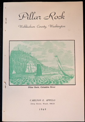
Pillar Rock, Wahkiakum County, Washington examines the rich indigenous folklore, early maritime exploration milestones, and nineteenth-century industrial salmon canning situated along the isolated, tide-swept northern shore of the lower Columbia River. Appelo details how the region's formidable riverine macro-geography—specifically the towering basalt monolith rising directly out of the deep-water channel, the shifting, treacherous currents of the lower estuary, and the densely forested, steep Wahkiakum County hills that strictly isolated the area from overland transit—strictly dictated the margins of native Chinookan settlement, early fur-trade salteries, and precarious water-bound industrialization. By mapping the transformation of this remote promontory—from a sacred landmark and summer village site noted by Lewis and Clark to a bustling late-nineteenth-century cannery enclave reliant entirely on gillnet fleets and river steamers to bridge its severe geographic isolation—the narrative highlights how this specific localized river geography anchored a profoundly resilient, maritime-dependent frontier community. Ultimately, this local historical and pictorial record serves as a localized spatial history, demonstrating how the severe topographic barriers, vital aquatic highways, and prominent natural landmarks of this Pacific Northwest landscape fundamentally shaped the highly specific, river-centric character of the lower Columbia. 40 pages : illustrations ; 23 cm Non-circulating [ 1 ]
|
1969 |
|
Salt Spring Island by Bea Hamilton 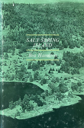
Salt Spring Island by Bea Hamilton is a 1969 local history that chronicles the early settlement and community development of the prominent British Columbia Gulf Island. Written by a lifelong resident from a pioneering family, the book offers an affectionate, firsthand perspective on the island's diverse founders—including English, American, Hawaiian, and Black settlers—and its enduring tradition of rural self-sufficiency. Ultimately, it serves as both a nostalgic personal account and a valuable historical record of the region's pioneering era before modern development transformed the landscape. Officially spelled Saltspring Island. xi, 180 pages illustrations, maps, portraits 24 cm Non-circulating [ 1 ]
|
1969 |
|
Reminiscences of Washington Territory by Charles Prosch
Reminiscences of Washington Territory examines the pioneering journalism, foundational civic organizing, and early urban development situated across the rapidly evolving, heavily timbered maritime macro-geography of the Puget Sound basin. Prosch details how the region's formidable topography—specifically the dense, old-growth forests that choked the shoreline, the vast, intricate network of deep-water marine highways, and the profound physical isolation from eastern commercial centers—strictly dictated the margins of early press operations, political institution-building, and localized community survival. By mapping the establishment of territorial newspapers and the arduous efforts to link scattered frontier settlements through primitive trails and coastal steam navigation, the narrative highlights how this specific challenging, water-bound geography anchored a profoundly communicative, politically ambitious pioneer society. Ultimately, this historical and autobiographical record serves as a localized spatial history, demonstrating how the severe overland barriers, vital marine waterways, and immense botanical scale of this Pacific Northwest landscape fundamentally shaped the highly connected, civic-minded character of early Washington Territory. 128 pages, 26 unnumbered pages of plates : illustrations ; 25 cm Non-circulating [ 1 ]
|
1969 |
|
Frontiers of Vancouver Island by E. Blanche Norcross, Doris Farmer Tonkin 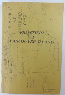
Frontiers of Vancouver Island by E. Blanche Norcross and Doris Farmer Tonkin offers a detailed historical account of British Columbia's Vancouver Island from the late eighteenth century onward. The narrative explores the rugged coastal geography and interior valleys of the island, focusing heavily on the growth of early settlements and resource-based communities like Zeballos, Ladysmith, Campbell River, and Tofino. By chronicling the transformation of these isolated outposts and the ancestral lands of the Cowichan tribes into established coastal villages, the book vividly captures the frontier spirit of Canada's westernmost Pacific Northwest territory. 128 pages, [1] leaf of plates : illustrations, folded map ; 22 cm Non-circulating [ 1 ]
|
1969 |
|
Idaho a descriptive tour by C. Aubrey Angelo
C. Aubrey Angelo's 1865 account, Idaho: A Descriptive Tour, chronicles the rugged landscapes and burgeoning mining districts of the Idaho Territory during the height of the inland gold rush. The narrative guides readers through early boomtowns and perilous pioneer trails across the Boise Basin, the Owyhee Mountains, and the remote Salmon River country. By detailing the challenging overland transportation routes from neighboring Pacific Northwest hubs—such as Portland, Oregon and Walla Walla, Washington—into Idaho's interior valleys, Angelo maps the commercial arteries of the frontier era. Ultimately, the text provides a vivid geographic snapshot of Idaho's river systems and mineral-rich mountain ranges just as they were opening to widespread settlement. [6], 52, [6] pages ; 23 cm Non-circulating [ 1 ]
|
1969 |
|
Tendoy, chief of the Lemhis by David L. Crowder
David L. Crowder's Tendoy, Chief of the Lemhis traces the life of the prominent Shoshone leader against the dramatic backdrop of Idaho's Lemhi Valley and the rugged Salmon River country. The biographical narrative is deeply anchored in this specific Pacific Northwest geography, detailing the tribe's ancestral homelands nestled beneath the towering Bitterroot Mountains. Crowder chronicles Tendoy's diplomatic efforts to maintain peace as waves of miners and settlers encroached upon these vital eastern Idaho waterways and valleys during the late nineteenth century. Ultimately, the book describes the heartbreaking forced relocation of Tendoy's people from their beloved northern territories to the arid plains of the Fort Hall Indian Reservation in southeastern Idaho. 139 pages : illustrations, 3 maps, portraits ; 23 cm Non-circulating [ 1 ]
|
1969 |
|
Steamboat days on the rivers by Frederick Wallace Wilson, Earle K. Stewart, Oregon Historical Society
Steamboat Days on the Rivers by Frederick Wallace Wilson and Earle K. Stewart details the transformative era of sternwheelers navigating the vital waterways of the Pacific Northwest. The historical account centers heavily on the Columbia and Willamette rivers, tracing the perilous maritime routes from the bustling docks of Portland, Oregon, up through the treacherous Cascade Rapids and Celilo Falls. The narrative explores how these riverboats served as the economic lifeblood connecting coastal settlements in Washington and Oregon to the distant, rugged interior as far inland as Lewiston, Idaho, via the Snake River. Through vivid descriptions of these arterial waterways, the book captures the geography of a region unified by its reliance on riverborne commerce and transportation. iii, 118 pages : illustrations ; 22 cm Non-circulating [ 1 ]
|
1969 |
|
Report upon the Pacific wagon roads by Albert H. Campbell, United States Department of the Interior
Albert H. Campbell’s 1859 government document, Report upon the Pacific Wagon Roads, details the arduous federal engineering projects undertaken to carve overland migration routes into the expanding Pacific Northwest. A major geographic focus of the text is the monumental Fort Benton to Walla Walla route—later known as the Mullan Road—which required clearing paths through the rugged Bitterroot Mountains of northern Idaho and extending across the vast plains of eastern Washington. The report also surveys critical transportation corridors in southern Oregon, mapping the challenging topography and mountain passes necessary to connect established Willamette Valley settlements to frontier territories further south. By documenting the exhaustive surveying across these formidable river crossings, high deserts, and dense forests, Campbell's report highlights the severe physical landscapes that defined early pioneer travel into Washington, Oregon, and Idaho. 125 pages : 3 maps (folded in pocket) ; 27 cm Non-circulating [ 1 ]
|
1969 |
|
Voyages of the Columbia to the northwest coast, 1787-1790 and 1790-1793 Columbia Rediviva (Ship) by F. W. Howay, Robert Haswell, John Box Hoskins, John Boit, Massachusetts Historical Society
Voyages of the Columbia to the Northwest Coast chronicles the pioneering maritime fur trade expeditions of the Columbia Rediviva along the rugged and unmapped coastlines of present-day Oregon, Washington, and British Columbia. The firsthand journals extensively document the crew's anchorages and interactions with Indigenous peoples at key Vancouver Island harbors, particularly Nootka Sound and Clayoquot Sound, where they established winter encampments. The narrative also details the ship's historic explorations further south, capturing the treacherous discovery of Grays Harbor in Washington and Captain Robert Gray's monumental crossing of the Columbia River bar along the Oregon-Washington border. By mapping these perilous inlets and river mouths, the book provides a foundational geographic portrait of the Pacific Northwest's coastal frontier before widespread land settlement. xxvii, 518 pages 12 illustrations, facsimile, 3 maps, 4 portraits 25 cm. Non-circulating [ 1 ]
|
1969 |
|
The Green years the development of transportation, trade and finance in the Puget Sound region from 1886 to 1969 as recalled by Joshua Green by Gordon Newell, Joshua Green
The Green Years chronicles the rapid maritime and economic expansion of Washington State's Puget Sound region through the lifelong experiences of pioneer steamboat captain and banker Joshua Green. The narrative centers heavily on Seattle's bustling Elliott Bay, tracing how early "Mosquito Fleet" vessels and Green's famous Black Ball ferry line connected isolated coastal timber towns, the San Juan Islands, and ports as far north as Victoria, British Columbia. As Green transitions from steering steamboats to shaping regional finance, the book maps the commercial transformation of western Washington's deep-water harbors into a major metropolitan hub. Ultimately, the biography provides a vivid geographic snapshot of how vital maritime arteries built the foundational infrastructure of the modern Pacific Northwest coast. 220 p. : ill. ; 24 cm. Non-circulating [ 1 ]
|
1969 |
|
The Bohemia story by Wally Hunter
Wally Hunter's The Bohemia Story chronicles the rise and operations of the Bohemia Lumber Company, deeply rooting its narrative in the heavily forested landscapes of western Oregon. The historical account centers on Lane County, specifically detailing the bustling mill operations and logging camps that thrived in Cottage Grove and along the banks of the Row River in Culp Creek. Through the lens of this pioneering timber venture, the book maps the rugged foothills of the Oregon Cascades where the extraction of timber fueled the region's mid-century economy. Ultimately, the text provides a vivid geographic snapshot of how these specific inland Oregon valleys were transformed into vital, bustling hubs of the Pacific Northwest's logging industry. 61 pages map Non-circulating [ 1 ]
|
1969 |
|
Post offices of Oregon, Washington, and Idaho by Robert L. Landis 
Robert L. Landis's historical directory, Post Offices of Oregon, Washington, and Idaho, provides a comprehensive geographic record of how postal communication networks expanded across the diverse landscapes of the Pacific Northwest. The book acts as a detailed gazetteer, tracing the establishment of early mail routes from the bustling maritime hubs of Puget Sound and the Columbia River to the most isolated mining camps deep in the Idaho panhandle. By documenting the life cycles of hundreds of rural, urban, and island post offices—many of which are now forgotten ghost towns—the text maps the shifting demographics and settlement patterns of the region. Ultimately, this extensive catalog illustrates how the challenging topography of coastal rainforests, high deserts, and rugged mountain passes dictated the vital flow of communication and commerce throughout these three frontier states. [8], 89, 98, 55, 9 pages illustrations 24 cm Non-circulating [ 1 ]
|
1969 |
|
Pioneers and progress Armstrong and Spallumcheen, B.C. by Okanagan Historical Society. Armstrong-Spallumcheen Branch
The Armstrong-Spallumcheen Branch of the Okanagan Historical Society’s Pioneers and Progress: Armstrong and Spallumcheen, B.C. chronicles the agricultural and civic transformation of the fertile valley corridor connecting Okanagan Lake to the Shuswap watershed. The volume details how early cattle pre-emptions, extensive grain farming, and flour milling enterprises were established directly across the ancestral lands and seasonal gathering domains of the Splatsin Secwépemc and Syilx peoples. The narrative examines the incorporation of the Township of Spallumcheen in 1892 as the interior’s first rural district municipality, tracing the arrival of the Shuswap and Okanagan Railway and the subsequent commercial rise of Armstrong as a major celery, grain, and dairy shipping depot. Featuring local family records and historical photographs, the work documents early cooperative creameries, rural school districts, and community hubs established throughout Hullcar and Grandview Bench. 152 pages : illustrations, portraits ; 23 cm Desiderata
|
1969 |
|
Victoria the fort by Derek Pethick 
Victoria: The Fort by Derek Pethick is a 1968 historical account detailing the early, formative years of British Columbia's capital city. The book chronicles Victoria's rapid transformation from its origins as a remote Hudson's Bay Company fur-trading post in 1843 through the frantic expansion of the regional gold rushes. Pethick offers a well-researched exploration of the pivotal figures and economic shifts that defined the colonial era and laid the foundation for the modern urban center. 287 pages illustrations, portraits 24 cm Non-circulating [ 1 ]
|
1968 |
|
Ranch under the rimrock by Dorothy Lawson McCall
Dorothy Lawson McCall’s memoir, Ranch Under the Rimrock, chronicles her dramatic transition from high-society Boston to the rugged high desert of Central Oregon in 1911. The narrative is deeply rooted in the dramatic geography of the Crooked River canyon, where imposing basalt cliffs and arid sagebrush flats defined her unforgiving new environment. Centered on her family's sprawling agricultural estate near Prineville, the book vividly details the physical challenges of adapting to this remote, inland Pacific Northwest landscape. Through her pioneering experiences, McCall maps the harsh but beautiful terrain of Oregon's rimrock country during the early twentieth century. xiii, 166 pages : illustrations, portraits ; 23 cm Non-circulating [ 1 ]
|
1968 |
|
Island County a world beater by E.M. Hawes and Lou Clark
E.M. Hawes and Lou Clark’s Island County: A World Beater serves as a vivid promotional and historical portrait of this unique geography nestled in the heart of Washington State's Puget Sound. The narrative focuses extensively on the prominent landmasses of Whidbey Island and Camano Island, detailing their extensive shorelines and vital maritime waterways. By highlighting the region's exceptionally fertile agricultural valleys and historic coastal settlements, the text underscores the economic potential drawn directly from the local terrain. Ultimately, the book captures the distinct, isolated beauty and natural abundance of this vital marine enclave within the Pacific Northwest. First published and written by E.M. Hawees and Lou Clark, 1911 iii, 55 pages illustrations, map, portraits 17 x 25 cm Non-circulating [ 1 ]
|
1968 |
|
Dryden's history of Washington by Cecil P. Dryden
Cecil P. Dryden’s Dryden's History of Washington provides a comprehensive geographic and historical overview of the state's development from early exploration to modern industrialization. The narrative sweeps across the diverse landscapes of the region, tracing maritime discoveries along the jagged coastlines of Puget Sound and mapping the vital fur trade routes established at Fort Vancouver along the lower Columbia River. Dryden also details the arduous overland pioneer migrations and subsequent agricultural booms that transformed the arid plains and fertile valleys of eastern Washington, particularly around Walla Walla and the Inland Empire. By chronicling the transition of these untamed coastal rainforests and eastern high deserts into a unified political entity, the book captures the expansive environmental diversity that shaped this cornerstone of the Pacific Northwest. 412 pages illustrations, map 23 cm Non-circulating [ 1 ]
|
1968 |
|
Of yesterday and the river by June Crithfield
June Crithfield's Of Yesterday and the River provides a localized history of the early agricultural communities and transportation networks nestled along the dramatic gorges of the Snake River in eastern Washington. The narrative focuses extensively on Whitman and Garfield counties, capturing the daily life and commerce of bustling, yet remote, pioneer river ports such as Wawawai and Almota. By chronicling the construction of the ingenious bucket tramways and grain chutes—most notably the Mayview and Interior tramways—that moved harvested wheat from the steep Palouse bluffs down to waiting steamboats, the book vividly maps how settlers adapted to the severe topography of this vital inland Pacific Northwest waterway. 1 online resource (iv, 116 pages) illustrations, facsimiles, portraits Non-circulating [ 1 ]
|
1968 |
|
A bibliography of British Columbia laying the foundations, 1849-1899 by Barbara J. Lowther (Compiler), Muriel Laing (Compiler), University of Victoria (B.C.). Social Sciences Research Centre
Compiled by Barbara J. Lowther and Muriel Laing, A Bibliography of British Columbia: Laying the Foundations, 1849-1899 serves as a comprehensive guide to the historical texts documenting the province's formative half-century. The catalogued works extensively map the colonial expansion across this rugged Pacific Northwest terrain, from the early maritime hub of Victoria on Vancouver Island to the burgeoning mainland ports of the Burrard Inlet. Furthermore, the bibliography highlights literature detailing the arduous inland routes forged by prospectors navigating the treacherous Fraser River canyon and the remote Cariboo goldfields. Through its exhaustive collection of early regional literature, the book offers a foundational literary geography of how British Columbia transitioned from isolated coastal fur-trading outposts into a unified Canadian province. Every effort has been made to include the government publications of the two colonies of Vancouver Island and British Columbia and, after their union in 1866, of the united colony of British Columbia to 1871. xii, 328 pages ; 29 cm ONLINE Circulation [ 1 ] Non-circulating [ 1 ]
|
1968 |
|
Oregon imprints 1845-1870 by George N. Belknap
An expansion of McMurtrie's 1950 bibliography of early Oregon printing. 305 pages 1,521 entries of books, pamphlets, and broadsides printed in Oregon through 1870, and index, plus 16 pages of facsimile broadsides and title pages 305 pages : facsimiles ; 26 cm Desiderata
|
1968 |
|
Names of Idaho Counties by Lalla Phipps Boone
Article from Names publication in 1968 where author discusses the origin of Idaho County names. pp 19-26 Non-circulating [ 1 ]
|
1968 |
|
Steamboats in the timber by Ruby El Hult 
In the heyday of its water commerce, Lake Coeur d'Alene in northern Idaho was the scene of more steamboating than any other lake, salt or fresh, west of the Great Lakes. The old steamers brought gold, silver, and lead from the mines; lumber from the forests; mail to lonely homesteaders; and romance down the shadowy St. Joe River, whose silken waters flow into the Coeur d'Alene. The old steamboats are gone now from the lake-but here is their story, exciting, nostalgic and complete. Across Lake Coeur d'Alene, in the early days, the big mining boom in the Coeur d'Alene Mountains was carried out, and the ore-hauling steamers came and went. Across the lake later went the timber seekers in their rush to grab the white pine riches of the St. Joe country; and a new fleet of steamers carried timber barons, homesteaders and lumberjacks up the twisting, cottonwood-shaded St. Joe. Here you will visit the bustling waterfront boom towns of Coeur d'Alene, Harrison, St. Maries, Ferrell, and St. Joe, just as they were in the glory days of steamboating, and as they are today. Romantic and factual history skill-fully merge as the old towns, the rivermen, and the boats glide by in easy, informed narrative. 209 pages, [7] leaves of plates : illustrations, map (on lining paper) ; 23 cm Desiderata
|
1968 |