Catalog of British Columbiana and Pacific Northwest Americana
The Encyclopedia Cascadia Catalog indexes mostly non-fiction literature covering the Pacific Northwest coast of North America, with an emphasis on British Columbia, Idaho, Oregon, and Washington State.
| Catalog Title | Published |
|---|---|
|
Beyond Garibaldi by Irene Ronayne, Georgina Keddell 
Beyond Garibaldi examines the isolated pioneer agricultural settlements and remote gold rush supply corridors situated across the precipitous, mountainous interior north of British Columbia's Howe Sound. Ronayne and Keddell detail how the region's formidable alpine macro-geography—specifically the towering, glaciated volcanic barrier of Mount Garibaldi, the dense, impassable chasms of the Coast Mountains, and the narrow, fertile alluvial bottomlands of the Pemberton Valley—strictly dictated the margins of early homesteading, precarious overland transit, and localized high-valley farming. By mapping the arduous establishment of scattered frontier farms and mining enclaves that carved a highly resilient existence out of the alpine wilderness stretching from Britannia Beach to Lillooet, relying entirely on treacherous mountain passes to navigate the severely restricted inland basin, the narrative highlights how this specific mountainous geography anchored a profoundly rugged, valley-bound pioneer society. Ultimately, this historical record serves as a localized spatial history, demonstrating how the immense alpine barricades, severe winter isolation, and vital riparian flatlands of this Pacific Northwest interior fundamentally shaped the highly self-reliant, geographically constrained character of the early Pemberton and Lillooet corridors. 167 pages illustrations 22 cm. Non-circulating [ 1 ]
|
1971 |
|
Pioneer trails of the Oregon coast by Samuel N. Dicken 
This study deals with the historical geography of coastal pioneer trails during the period of settlement, for the most part before 1860. The Oregon Coast is presented as it was seen trough he eyes of early travelers, and against the background of coastal features, climate, terrain, drainage and vegetation. Though this is a geography of a past period, it also includes relevant firsthand descriptions of coastal features, in the present tense, based on many years of field study by the writer. viii, 77 pages illustrations 28 cm Non-circulating [ 1 ]
|
1971 |
|
The Evergreen Fleet a pictorial history of Washington State Ferries by Harre W. Demoro
This book has more than 270 illustrations including maps and timetables. The complete history of the Washington State Ferry system with each route outlined and descriptions of each vessel 136 pages illustrations, maps 29 cm Non-circulating [ 1 ]
|
1971 |
|
The Royal Navy and the northwest coast of North America, 1810-1914 a study of British maritime ascendancy by Barry M. Gough 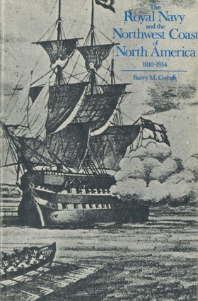
Examination of contest for the Columbia Country, the Oregon Crisis, the gold rush crises, the dispute over the San Juan Islands, and the defense of the Pacific colonies in a decade of Anglo-Americanism (1861-1871) from the perspective of the Royal Navy's involvement. Esquimalt Naval base's evolution as the Pacific headquarters of the Royal Navy to meet the changing strategic requirements of the whole Pacific area is considered in detail. The repercussions of the Crimean War and the rise of German and United States naval power on the alignment of British forces in the Pacific are also considered. xvi, 294 pages : illustrations, maps, portraits ; 25 cm Non-circulating [ 1 ]
|
1971 |
|
Centennial history of Salmon Arm by Ernest Doe 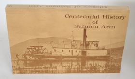
Ernest Doe’s Centennial History of Salmon Arm serves as the foundational civic chronicle documenting the transition of the Salmon River valley and Shuswap Lake shorelines from rural pre-emption tracts into an incorporated municipal district and city. Doe traces how late nineteenth-century homesteading corridors, early wagon roads, and agricultural clearings were established directly across the ancestral lands and seasonal gathering domains of the Secwépemc (Shuswap) people. The narrative details the crucial logistics of frontier community building, illustrating how the arrival of the Canadian Pacific Railway in 1885 catalyzed land settlement, commercial fruit orchard development, and civic governance, leading to the district municipality's formal incorporation in 1905 and subsequent municipal evolution. Drawing extensively upon municipal ledgers, early council minutes, and pioneer oral accounts, the work records the civic institutions, church bodies, and school districts that structured settler society in the interior lake country. 298 pages : illustrations, portraits, maps ; 23 cm Desiderata
|
1971 |
|
Bridge River gold by Emma de Hullu, Bralorne Pioneer Museum Society
Emma de Hullu and the Bralorne Pioneer Museum Society’s Bridge River Gold provides a firsthand social and industrial chronicle of the prolific lode gold mining camps situated along the Cadwallader Creek and Bridge River canyons. The narrative traces the discovery of high-grade quartz veins in the 1890s, detailing how remote mountain wilderness was transformed into the bustling, modern company mining communities of Bralorne, Pioneer Mine, Gold Bridge, and Brexton. De Hullu documents the physical hardships of packing heavy mill equipment over the treacherous Hurley River pass, the installation of high-pressure Pelton wheels, and the construction of underground mine shafts descending thousands of feet below sea level. Through personal memoirs, company records, and historic photographs, the work captures daily family life, union organization, and the rapid civic transformation of the Bridge River Valley during the 1930s mining boom. 160 pages : illustrations, maps, portraits ; 23 cm Desiderata
|
1971 |
|
Gold rush a pictorial history of the Southern Lakes and the Atlin gold rush by James Blower
James Blower’s Gold Rush: A Pictorial History of the Southern Lakes and the Atlin Gold Rush documents the logistical corridors connecting the Chilkoot and White Pass trails to the subarctic goldfields of northern British Columbia. Blower details the rapid rise of tent cities and boatyards along the shores of Lake Bennett and Lake Lindeman, where thousands of stampeders built improvised wooden flotillas to navigate the upper Yukon and Southern Lakes waterways. The narrative captures the construction of the White Pass and Yukon Route railway and the unique portage railroad at Taku that moved freight between Graham Inlet and Scotia Bay on Atlin Lake. Through archival photographs, the volume illustrates the grueling labor, sternwheeler operations, and spatial evolution of these subarctic transit hubs. 236 pages : illustrations, maps, portraits ; 28 cm Desiderata
|
1971 |
|
S.S. Beaver the ship that saved the West by Derek Pethick
S.S. Beaver the ship that saved the West examines the aggressive corporate expansion and strategic maritime fur trade situated along the profoundly fractured, fjord-indented coastline of the Pacific Northwest and British Columbia. Pethick details how the region's formidable coastal macro-geography—specifically the labyrinthine, deep-water channels of the Inside Passage, the treacherous, tide-ripped narrows of the Salish Sea, and the unpredictable, wind-shadowed corridors of the mountainous coastal fjords—strictly dictated the margins of early indigenous trade networks, precarious maritime navigation, and the projection of Hudson's Bay Company authority. By mapping the introduction of the coast's first steamship, a technological necessity deployed specifically to overcome the severe wind-calms and perilous tidal currents that routinely paralyzed traditional sailing vessels, the narrative highlights how this specific complex coastal geography anchored a deeply mobile, highly efficient corporate monopoly that secured the vast maritime frontier against Russian and American encroachment. Ultimately, this maritime and commercial record serves as a macro-level spatial history, demonstrating how the severe navigational hazards, immense linear scale, and vital sheltered waterways of this Pacific Northwest landscape fundamentally shaped the highly strategic, steam-powered character of early British dominance on the coast. xi, 160 pages : illustrations, map (on lining paper), portraits ; 24 cm Non-circulating [ 1 ]
|
1970 |
|
The sound and the mountain by Roland Carey
The sound and the mountain examines the vital "mosquito fleet" steamboat network and early coastal community survival situated across the sprawling, deeply carved macro-geography of Washington's Puget Sound. Carey details how the region's formidable maritime topography—specifically the labyrinthine, deep-water fjords of the inland sea, the towering, impenetrable volcanic backdrop of the Cascade Range, and the dense, heavily timbered shorelines that precluded overland travel—strictly dictated the margins of pioneer mobility, isolated homesteading, and intense regional commerce. By mapping the daily operation of these scattered coastal enclaves, which relied entirely on a complex web of steam-powered vessels traversing the sound's sheltered corridors to function as the region's only viable highway system, the narrative highlights how this specific archipelagic geography anchored a profoundly interconnected, water-bound society. Ultimately, this maritime and historical record serves as a macro-level spatial history, demonstrating how the severe overland barricades, critical navigable deep-water channels, and isolating coastal shorelines of this Pacific Northwest landscape fundamentally shaped the highly mobile, maritime-dependent character of the early Puget Sound frontier. 110, [13] pages : illustrations ; 28 cm Non-circulating [ 1 ]
|
1970 |
|
Mapping the frontier Charles Wilson's diary of the survey of the 49th parallel, 1858-1862, while secretary of the British Boundary Commission by Charles William Wilson 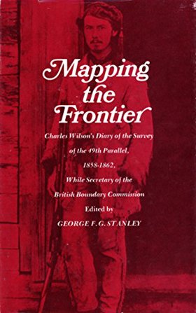
Mapping the frontier Charles Wilson's diary of the survey of the 49th parallel, 1858-1862 examines the grueling imperial cartography and immense logistical struggle situated across the profoundly rugged, trans-mountain macro-geography of the US-British Columbia borderlands. Wilson details how the region's formidable topography—specifically the impenetrable, old-growth temperate rainforests of the coastal slope, the sheer, glaciated alpine barricades of the Cascade and Rocky Mountains, and the deep, turbulent river chasms cutting perpendicular to the border—strictly dictated the margins of early scientific reconnaissance, precarious overland supply chains, and the immense physical labor required to physically mark the wilderness. By mapping the Boundary Commission's arduous effort to impose a rigid, abstract political line across violently fractured terrain—requiring the literal chopping of massive forest swaths, precarious high-altitude ascents, and constant battles with severe winter isolation—the narrative highlights how this specific unforgiving, mountainous geography anchored a profoundly grueling, highly isolated feat of imperial engineering. Ultimately, this diaristic and cartographic record serves as a macro-level spatial history, demonstrating how the immense alpine barricades, severe botanical density, and unrelenting climatic extremes of this Pacific Northwest landscape fundamentally shaped the highly arduous, geographically defiant character of the 49th parallel boundary survey. 182 pages : maps, portrait ; 22 cm Non-circulating [ 1 ]
|
1970 |
|
The Kwakiutl Indians of British Columbia by Ronald Preston Rohner , Evelyn C. Rohner
The Kwakiutl Indians of British Columbia examines the complex indigenous social structures, intensive maritime subsistence, and rich material culture situated along the deeply indented, fjord-riven coastline of northern Vancouver Island and the adjacent British Columbia mainland. Rohner and Rohner detail how the region's formidable coastal macro-geography—specifically the labyrinthine, tide-ripped channels of the Queen Charlotte and Johnstone straits, the towering, impenetrable temperate cedar rainforests that strictly precluded inland migration, and the highly productive, localized marine estuaries—strictly dictated the margins of indigenous winter village placement, specialized maritime foraging, and extensive inter-tribal canoe networks. By mapping the Kwakiutl's profound adaptation to this littoral edge—where the dense old-growth forests provided the massive timber essential for monumental plank houses and ocean-going dugouts, and the immense seasonal marine surpluses of salmon and eulachon fueled the complex, wealth-redistributing potlatch economy—the narrative highlights how this specific resource-rich coastal geography anchored a profoundly stratified, socially dynamic maritime society. Ultimately, this ethnographic record serves as a localized spatial history, demonstrating how the severe overland isolation, immense botanical scale, and incredibly abundant marine ecology of this Pacific Northwest coastline fundamentally shaped the highly resilient, ocean-bound character of the Kwakiutl people. xv, 111 pages : illustrations, maps ; 24 cm. Non-circulating [ 1 ]
|
1970 |
|
A history of Victoria, 1842-1970 by Harry Gregson 
"Victoria as a trading post, gold rush town, despondent backwater, thriving industrial center, pleasant residential resort and busy university city... these are some of the developments entertainingly described..." Dust jacket ix, 246 pages illustrations, maps 24 cm Non-circulating [ 1 ]
|
1970 |
|
Idaho Chinese lore by M. Alfreda Elsensohn, Idaho Corporation of Benedictine Sisters
Idaho Chinese lore examines the isolated immigrant mining enclaves and intensive, terraced agrarian adaptations situated within the deeply incised river canyons and rugged high-altitude basins of the Idaho interior. Elsensohn details how the region's formidable macro-geography—specifically the labyrinthine, whitewater chasms of the Salmon River, the steep, mineral-rich slopes of the Clearwater Mountains and Boise Basin, and the severe winter isolation of the high-country camps—strictly dictated the margins of marginalized Chinese placer mining, precarious overland supply networks, and specialized subsistence agriculture. By mapping the arduous establishment of remote Chinatowns and the intricate engineering of hillside water flumes and terraced canyon gardens by a highly resilient immigrant workforce—who systematically extracted residual gold from extreme terrain abandoned by Euro-American miners—the narrative highlights how this specific rugged, mountainous geography anchored a profoundly adaptable, physically demanding frontier existence. Ultimately, this historical and cultural record serves as a localized spatial history, demonstrating how the severe topographic barricades, harsh climatic extremes, and isolated riparian corridors of this inland Pacific Northwest landscape fundamentally shaped the highly engineered, geographically entrenched character of Idaho's early Chinese pioneer communities. 121 pages, xvi pages of plates : illustrations, portraits ; 23 cm Non-circulating [ 1 ]
|
1970 |
|
A touch of Oregon by Ralph Friedman
A touch of Oregon examines the scattered pioneer settlements, isolated ghost towns, and localized folklore situated across the profoundly diverse, highly fractured macro-geography of the Oregon interior and coastline. Friedman details how the region's formidable macro-topography—specifically the sprawling, sun-baked expanses of the eastern high desert, the towering, impenetrable volcanic barrier of the Cascade Range, and the rugged, tempestuous littoral edge of the Pacific coast—strictly dictated the margins of early homesteading, precarious overland transit, and isolated resource extraction. By mapping the establishment of these tenacious, widely dispersed frontier enclaves that carved a tenuous existence out of hidden river valleys and arid bunchgrass steppes, often weathering severe isolation or fading into ghost towns as vital transportation corridors bypassed their difficult terrain, the narrative highlights how this specific immensely varied geography anchored a profoundly resilient, hyper-localized pioneer society. Ultimately, this folkloric and historical record serves as a macro-level spatial history, demonstrating how the immense overland distances, severe topographic extremes, and highly localized microclimates of this Pacific Northwest landscape fundamentally shaped the highly fragmented, enduring character of Oregon's backroads communities. 234 pages : illustrations, portraits ; 22 cm Non-circulating [ 1 ]
|
1970 |
|
Chinook a history and dictionary by Edward Harper Thomas
Chinook a history and dictionary examines the rapid linguistic synthesis and sprawling intercultural trade networks situated across the profoundly fractured, multi-linguistic macro-geography of the Pacific Northwest coast and interior. Thomas details how the region's formidable topography—specifically the deeply isolated river valleys that historically fostered immense indigenous linguistic diversity, the vast maritime trading corridors of the coastal waterways, and the sprawling trans-mountain fur routes—strictly dictated the margins of intercultural diplomacy, commercial bartering, and the absolute necessity of a highly adaptable frontier pidgin. By mapping the rapid dissemination of Chinook Jargon—a utilitarian trade language that bridged the severe communicative divides between diverse Native populations, European maritime explorers, and overland fur trappers navigating this immense, compartmentalized terrain—the narrative highlights how this specific highly fragmented geography anchored a profoundly interconnected, linguistically pragmatic commercial network. Ultimately, this linguistic and historical record serves as a macro-level spatial history, demonstrating how the immense topographic barriers, vital commercial riverine routes, and intense cultural convergences of this Pacific Northwest landscape fundamentally shaped the highly practical, cross-cultural character of early frontier communication. xi, [1], 171 pages : portraits ; 23 cm Non-circulating [ 1 ]
|
1970 |
|
Booming and panicking on Puget Sound by George H. Bacon
Booming and panicking on Puget Sound examines the frenetic real estate speculation, rapid civic expansion, and devastating economic collapses situated along the deep-water, heavily timbered littoral margins of Washington's inland sea. Bacon details how the region's formidable macro-geography—specifically the labyrinthine maritime corridors of Puget Sound, the vast, highly lucrative old-growth coastal forests, and the imposing, nearly impassable volcanic barrier of the Cascade Range—strictly dictated the margins of intense terminus rivalry, precarious capital investment, and aggressive resource extraction. By mapping the explosive, speculative growth of these isolated coastal enclaves, which feverishly leveraged their localized deep-water anchorages in a desperate competition to secure vital trans-mountain railroad lines and bridge the severe geographical divide between continental markets and Pacific maritime trade, the narrative highlights how this specific archipelagic geography anchored a profoundly volatile, boom-and-bust frontier economy. Ultimately, this economic and civic record serves as a localized spatial history, demonstrating how the immense topographic barricades, critical navigable waterways, and rich botanical wealth of this Pacific Northwest landscape fundamentally shaped the highly speculative, fiercely competitive character of early Puget Sound urbanization. [78] pages (pages [61-78] advertisements) illustrations, portrait 22 cm Non-circulating [ 1 ]
|
1970 |
|
A history of the Snoqualmie Valley by Ada Snyder Hill
A history of the Snoqualmie Valley examines the intense old-growth logging, early infrastructural engineering, and isolated agrarian homesteading situated within the deeply incised, riverine macro-geography of Washington's western Cascade foothills. Hill details how the region's formidable riparian topography—specifically the immense, impassable hydrological barrier of Snoqualmie Falls, the dense, heavily timbered slopes of the surrounding mountain barricade, and the fertile, flood-prone alluvial bottomlands—strictly dictated the margins of pioneer mobility, aggressive timber extraction, and specialized agricultural settlement. By mapping the arduous transformation of this dense river valley from an impenetrable temperate rainforest into a productive agrarian and industrial corridor, requiring precarious railroad lines to breach the isolating foothills and bypass the massive falls to link interior timber wealth with coastal markets, the narrative highlights how this specific constrained geography anchored a profoundly industrious, resource-dependent pioneer society. Ultimately, this historical and civic record serves as a localized spatial history, demonstrating how the severe hydrological barricades, immense botanical scale, and vital riparian flatlands of this Pacific Northwest landscape fundamentally shaped the highly resilient, valley-bound character of the early Snoqualmie settlements. 163, [4] pages : illustrations ; 28 cm Non-circulating [ 1 ]
|
1970 |
|
The Spokane Indians children of the sun by Robert H. Ruby , John A. Brown , Robert L. Bennett
The Spokane Indians children of the sun examines the complex indigenous seasonal subsistence, shifting tribal diplomacy, and subsequent forced reservation confinement situated across the sprawling, semi-arid macro-geography of eastern Washington's Columbia Plateau. Ruby, Brown, and Bennett detail how the region's formidable interior topography—specifically the deeply incised, fast-flowing chasms of the Spokane River, the vast, sun-baked expanses of the bunchgrass steppe, and the vital, immense salmon fisheries at Spokane Falls—strictly dictated the margins of indigenous seasonal migrations, centralized trade networks, and later, aggressive Euro-American agricultural encroachment. By mapping the Spokane people's profound adaptation to this riverine and plateau environment—where the vital aquatic resources of the falls and the rich root-gathering grounds of the plains sustained a highly mobile, equestrian culture that was ultimately fractured by arbitrary colonial boundaries and the destruction of the river ecology—the narrative highlights how this specific riparian and arid geography anchored a profoundly resilient, river-centric indigenous society. Ultimately, this ethnohistorical record serves as a localized spatial history, demonstrating how the vital hydrological focal points, expansive arid plateau, and severe ecological transformations of this inland Pacific Northwest landscape fundamentally shaped the highly adaptable, culturally enduring character of the Spokane people. xx, 346 pages : illustrations, maps, portraits ; 24 cm Non-circulating [ 1 ]
|
1970 |
|
Mill town a social history of Everett, Washington, from its earliest beginnings on the shores of Puget Sound to the tragic and infamous event known as the Everett Massacre by Norman H. Clark 
A social history of Everett, Washington, from its earliest beginnings to the tragic and infamous event on November 5, 1916, which came to be known as the Everett Massacre viii, 267 pages, 12 unnumbered pages of plates : illustrations ; 21 cm Non-circulating [ 1 ]
|
1970 |
|
The history of the Portland District Corps of Engineers, 1871-1969 by Henry R. Richmond , Robert Bangert, Pacific Northwest History Collection
The history of the Portland District Corps of Engineers, 1871-1969 examines the massive federal infrastructure projects, river channel engineering, and large-scale hydro-electric transformation situated across the sprawling, dramatically varied macro-geography of the Columbia River basin and the Oregon coast. Richmond and Bangert detail how the region's formidable hydrologic topography—specifically the treacherous, shifting sandbars of the Columbia River mouth, the violent, whitewater rapids of the Columbia River Gorge cutting through the Cascade Range, and the sprawling drainage networks of the Willamette and Snake river systems—strictly dictated the margins of hazardous maritime commerce, devastating seasonal floods, and centralized federal intervention. By mapping the Corps' decades-long campaign to tame these volatile waterways through the construction of monumental jetties, deep-water dredging networks, and colossal multipurpose dams like Bonneville and The Dalles, the narrative highlights how this specific immense riverine geography anchored a profoundly engineered, federally managed regional economy. Ultimately, this institutional and engineering record serves as a macro-level spatial history, demonstrating how the severe hydrological hazards, immense topographic barriers, and vital commercial water corridors of this Pacific Northwest landscape fundamentally shaped the highly controlled, hydro-industrial character of the modern Columbia basin. [4], i, [2], 274, A1-16 pages : illustrations, maps, portraits ; 27 cm ONLINE Circulation [ 1 ]
|
1970 |
|
Cariboo gold the story of the British Columbia gold rush by Marian T. Place, Deane Cate (Illustrator)
Cariboo gold the story of the British Columbia gold rush examines the frantic inland mineral stampede and monumental transportation engineering situated within the deeply fractured, mountainous macro-geography of British Columbia's interior plateau. Place details how the region's formidable topography—specifically the precipitous, whitewater canyons of the Fraser and Quesnel rivers, the dense, impassable alpine forests, and the extreme winter isolation of the high-altitude plateau—strictly dictated the margins of frantic prospecting, perilous pack-train logistics, and desperate colonial state-building. By mapping the explosive influx of thousands of miners racing north to the remote creeks of Barkerville and Lightning Creek, relying entirely on the heroic, cliff-hugging construction of the Cariboo Wagon Road to breach the insurmountable mountain barriers, the narrative highlights how this specific unforgiving, alpine geography anchored a profoundly transient, highly isolated frontier society. Ultimately, this historical and narrative record serves as a localized spatial history, demonstrating how the severe topographic barricades, immense overland distances, and vital mineral-bearing river basins of this Pacific Northwest interior fundamentally shaped the highly adventurous, infrastructure-dependent character of the Cariboo gold rush. 180 pages : illustrations, map ; 24 cm Non-circulating [ 1 ]
|
1970 |
|
|
1970 |
|
Continental waterboy the Columbia River controversy by Donald Waterfield
Donald Waterfield’s Continental Waterboy: The Columbia River Controversy provides a critical firsthand analysis of the political, economic, and environmental disputes surrounding the implementation of the 1964 Columbia River Treaty. Waterfield documents the massive hydrological re-engineering of southeastern British Columbia, focusing on the construction of the colossal Mica Dam north of Revelstoke and the establishment of the remote construction townsite of Mica Creek. The text examines how the resulting impoundment of the Columbia River into the massive reservoir of Kinbasket Lake permanently submerged over a hundred miles of the historic Big Bend route, flooding ancient Indigenous river crossings, historic gold-mining workings, and ecological habitats. The work remains an essential historical and political record detailing the sacrifice of upper Columbia communities to international hydroelectric planning. xiv, 250 pages : illustrations, maps ; 24 cm Desiderata
|
1970 |
|
Montpelier the central city of Bear Lake Valley by A. McKay Rich
A. McKay Rich’s Montpelier: The Central City of Bear Lake Valley chronicles the commercial, railroad, and industrial transformation of eastern Bear Lake County. The text documents the 1864 settlement of "Clover Creek" by pioneer homesteaders and its rapid economic reorientation following the 1882 arrival of the Oregon Short Line Railroad. Rich examines Montpelier’s development into a major divisional railway terminal, tracing how engine roundhouses, freight yards, and commercial business blocks reshaped the valley's pastoral economy. The volume details the 1896 Butch Cassidy bank robbery, phosphate mining ventures along the mountain benches, and the civic expansion that established Montpelier as the primary trade and transportation hub connecting Georgetown, Bennington, and Dingle. 188 pages : illustrations, maps, portraits ; 23 cm Desiderata
|
1970 |
|
A history of the Columbia County courthouse by Pearl M. Becker
Pearl M. Becker’s A History of the Columbia County Courthouse chronicles the contentious political and civic struggles that determined the seat of government on the lower Columbia River. Becker traces the early administrative formation of the county, detailing the heated nineteenth-century county seat rivalry between the riverfront rivals of Saint Helens, Columbia City, and Rainier. The text documents the construction of the landmark 1893 stone and Italianate courthouse overlooking the Saint Helens waterfront, analyzing how municipal governance, road surveying, and tax administration were orchestrated from the building. Becker incorporates early commissioners' journals and court records, preserving the administrative histories of surrounding rural precincts including Scappoose, Warren, McNulty, Trenholm, and Bachelor Flat. 44 pages : illustrations, portraits ; 23 cm Desiderata
|
1970 |