Catalog of British Columbiana and Pacific Northwest Americana
The Encyclopedia Cascadia Catalog indexes mostly non-fiction literature covering the Pacific Northwest coast of North America, with an emphasis on British Columbia, Idaho, Oregon, and Washington State.
| Catalog Title | Published |
|---|---|
|
A Bibliography of The Pacific Northwest by Washington State School Library Association 
The Washington State School Library Association’s A Bibliography of The Pacific Northwest serves as a comprehensive reference guide that catalogs the extensive written record of the region's diverse physical and cultural landscapes. While fundamentally an educational directory, the volume effectively maps the intellectual topography of the Pacific Northwest, directing researchers through the vast array of texts that document the rugged maritime inlets of the coastal rainforests, the towering, glaciated barrier of the Cascade Mountains, and the expansive, arid basins of the inland empire. By meticulously curating pioneer chronicles, indigenous histories, and industrial records of early timber, mining, and salmon harvesting operations, the compilation illustrates how educators systematically organized the region's collective memory. Ultimately, the text captures the profound geographical identity of the western frontier, demonstrating how the structured preservation of these foundational narratives is essential for understanding how human populations historically navigated, exploited, and adapted to the formidable environments of Washington, Oregon, Idaho, and British Columbia. 88 pages Non-circulating [ 1 ]
|
1964 |
|
Cattle country of Peter French by Giles French
Into the valley of Donner and Blitzen, almost a century ago, rode Peter French with 1,200 head of California cattle. John Devine of White Horse Ranch was already in the Harney country of Southeast Oregon, but the Blitzen was left for Peter. This is the story of how the great stockmen of the late 1800s set a pattern for modern cow ranches, improving the land and cattle by the best scientific methods available. Peter French himself irrigated thousands of acres of sageland with his canals and ditches. Hard-driving and ambitious, French, in a few years, won control of 200,000 acres of range land, and thousands of head of cattle 167 pages : illustrations ; 23 cm Non-circulating [ 1 ]
|
1964 |
|
East of the Cascades by Phil F. Brogan
Phil F. Brogan’s East of the Cascades provides a comprehensive historical and geological chronicle of the vast, arid plateaus and volcanic landscapes that define Central Oregon. The narrative meticulously maps the stark topography lying in the massive rain shadow of the Cascade Mountains, stretching across jagged lava fields, expansive pumice plains, and the deeply entrenched rimrock canyons of the Deschutes River basin. By detailing the profound challenges faced by early indigenous populations, sprawling pioneer cattle ranches, and transient Basque sheepmen, the book illustrates how the severe, dry climate and rugged geological barriers forced early inhabitants to rely entirely on isolated springs and the vital riparian lifeline of the Deschutes. Furthermore, the text chronicles the region's industrial transition from open-range livestock grazing to the immense ponderosa pine logging operations that eventually capitalized on the area's unique high-elevation forests. Ultimately, the book captures the formidable environmental realities of Oregon's inland empire, demonstrating how the imposing volcanic topography and arid conditions fundamentally shaped the resilient cultural and economic development of the state's high desert frontier. 304 pages illustrations, portraits, map (on lining paper) 23 cm Non-circulating [ 1 ]
|
1964 |
|
Washington names a pronunciation guide of Washington State place names by Hugh Augustus Rundell (Compiler)
Hugh Augustus Rundell’s compiled Washington Names: A Pronunciation Guide of Washington State Place Names serves as a vital linguistic map of the state's diverse physical and cultural geography. While fundamentally an auditory reference manual, the guide charts the complex topographical features of the region, stretching from the dense, rain-soaked estuarine inlets of Puget Sound and the rugged Pacific coast, eastward across the towering, glacier-clad Cascade Mountains, and into the arid, basalt coulees of the expansive Columbia Plateau. By documenting the exact oral legacy of these specific locations, the text illustrates how the state's nomenclature is deeply rooted in the indigenous populations who first named and navigated its vital river networks, alongside the maritime explorers and pioneer resource extractors who later claimed its remote harbors and inland valleys. Ultimately, the book captures the rich historical footprint embedded in Washington's cartography, demonstrating how mastering the often challenging pronunciations of these geographic markers is essential to fully grasping the varied human settlement and formidable terrain of the Pacific Northwest. [2], 113 pages ; 28 cm ONLINE Circulation [ 1 ]
|
1964 |
|
Naming, opening, and dedication of Stanley Park, Vancouver, Canada, 1888-1889 by Archives of Vancouver Society 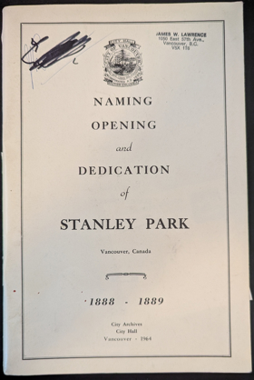
The Archives of Vancouver Society’s documentary record of the Naming, opening, and dedication of Stanley Park, Vancouver, Canada, 1888-1889 chronicles the civic preservation of a massive, densely forested peninsula situated at the strategic maritime gateway to British Columbia’s booming railway terminus. The historical narrative maps the rugged estuarine topography separating English Bay from Burrard Inlet, detailing how this imposing promontory of ancient western red cedar and Douglas fir historically functioned as a vital military reserve and indigenous settlement overlooking the treacherous tidal rips of the First Narrows. By documenting the transformation of this unlogged coastal rainforest into a sprawling municipal sanctuary amidst the rapid late-nineteenth-century industrialization of the adjacent Vancouver townsite, the text illustrates a deliberate civic effort to protect the region's formidable natural scale. Ultimately, the account captures a defining moment in the urban geography of the Pacific Northwest, demonstrating how the conscious preservation of this impenetrable, deep-water coastal wilderness permanently anchored the cultural and spatial identity of Canada’s primary Pacific metropolis. With the compliments of the Commissioners of the Park Board, past and present. On the seventy-fifth anniversary of the dedication of Stanley Park, 1889. 60 pages illustrations 23 cm Non-circulating [ 1 ]
|
1964 |
|
Debaters and dynamiters the story of the Haywood trial by David H. Grover 
In December of 1905, ex-Governor Frank Steunenberg of Idaho was killed when a dynamite bomb shattered his home in Caldwell, Idaho. The dynamiter s confession implicated four officials of the powerful Western Federation of Miners, a militant union that had figured prominently in the labor wars of the day. The trial of the union men became a subject of national interest. A trial in a small town in Idaho with national implications regarding unions, Socialism and labor riots. viii, 310 pages, 8 unnumbered pages of plates : illustrations ; 24 cm Desiderata
|
1964 |
|
Indians of the Northwest Coast by Philip Drucker, American Museum of Natural History
Philip Drucker’s Indians of the Northwest Coast provides a comprehensive anthropological chronicle of the complex indigenous nations that inhabited the rugged maritime frontier stretching from southeast Alaska to northern California. The narrative meticulously maps the formidable coastal topography—characterized by deep, glaciated fjords, treacherous tidal rips, and dense, nearly impenetrable temperate rainforests—that physically confined these societies to a narrow aquatic margin backed by impassable mountain barriers. By detailing their sophisticated marine technology, specifically the massive western red cedar dugout canoes used to harvest immense seasonal salmon runs and navigate unforgiving oceanic swells for whaling, the book illustrates how these communities entirely bypassed overland transit in favor of a profoundly aquatic existence. Furthermore, Drucker demonstrates how the extreme natural abundance of this specific marine and arboreal environment allowed for the construction of permanent, monumental cedar-plank villages and highly stratified economies long before European contact. Ultimately, the text captures the defining physical realities of the Pacific shore, highlighting how mastering this severe, resource-rich coastal geography dictated the unique cultural, artistic, and societal evolution of the region's First Nations. xiii, 224 pages, 32 unnumbered pages of plates : illustrations, map ; 18 cm. Non-circulating [ 1 ]
|
1963 |
|
Vancouver Island's west coast 1762-1962. With illustrations, map and list of shipwrecks by George Salier Willis Nicholson 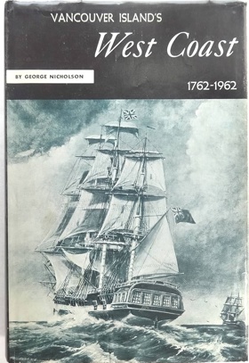
George Salier Willis Nicholson’s Vancouver Island's West Coast 1762-1962 chronicles two centuries of maritime exploration, indigenous encounter, and pioneer resource extraction along one of the Pacific Northwest’s most unforgiving shorelines. The narrative meticulously maps the treacherous, storm-battered topography that defines the seaward edge of the island, stretching across deep, glaciated fjords like Nootka and Clayoquot Sounds, which are walled in by dense temperate rainforests and the rugged Insular Mountains. By detailing the area’s notorious reputation as the "Graveyard of the Pacific"—evidenced by the book’s extensive catalog of maritime disasters—Nicholson illustrates how the perilous combination of dense fogs, violent winter gales, and jagged offshore reefs constantly threatened early marine transit and commercial shipping. The text traces how subsequent pioneer enterprises, including isolated coastal logging camps, commercial salmon canneries, and whaling stations, were forced to operate entirely dependent on these dangerous aquatic highways due to the impassable nature of the island’s interior. Ultimately, the book captures the extreme physical isolation of Vancouver Island's outer coast, demonstrating how the constant battle against this formidable, wave-swept geography fundamentally shaped the cultural and industrial survival of its remote coastal enclaves. Index of shipwrecks. History from the time of the landing of the Spaniards and Captain Cook 356 pages : illustrations, portraits, maps (on lining papers) ; 25 cm Non-circulating [ 1 ]
|
1963 |
|
I will fight no more forever Chief Joseph and the Nez Perce War by Merrill D. Beal
Merrill D. Beal’s I Will Fight No More Forever chronicles the tragic 1877 flight of Chief Joseph and the Nez Perce, detailing a masterful but desperate tactical retreat across the most unforgiving topography of the inland Pacific Northwest. The narrative meticulously maps the arduous 1,170-mile route, beginning with the tribe's forced expulsion from the fertile, mountain-ringed Wallowa Valley of northeastern Oregon, continuing through the precipitous depths of the Snake River canyon, and ascending over the steep, densely timbered divide of the Bitterroot Mountains via Lolo Pass. By detailing how the fleeing bands—burdened with elders, children, and horse herds—utilized this formidable alpine terrain and the volcanic plateaus of Yellowstone to repeatedly stall and outmaneuver pursuing United States cavalry columns, the book illustrates the profound strategic role of the region's physical environment. The text captures the devastating final siege on the freezing, windswept foothills of Montana's Bear Paw Mountains, just short of the Canadian sanctuary. Ultimately, this account demonstrates how the pioneer seizure of traditional agricultural basins forced an epic, agonizing migration, proving that the harsh geographical realities of the western frontier were as much an adversary as the military forces enforcing the region's brutal geopolitical displacement. xvii, 366 pages, 8 unnumbered pages of plates : illustrations, 1 map, portraits ; 21 cm Non-circulating [ 1 ]
|
1963 |
|
Steamer to Tacoma by Wilbur Thompson, Allen Beach
Wilbur Thompson and Allen Beach’s Steamer to Tacoma chronicles the vital maritime history and fierce civic rivalry that defined the "Mosquito Fleet" era on the sheltered inland waters of Washington's Puget Sound. The narrative maps the complex estuarine geography of the region, detailing the deep, glaciated channels and unpredictable tidal currents that separate the bustling maritime hub of Seattle’s Elliott Bay from the massive timber and railway terminals of Tacoma’s Commencement Bay. By illustrating how dense, impenetrable coastal rainforests and deeply entrenched river valleys historically choked off viable overland transit, the book demonstrates how pioneer populations were forced to rely entirely on this bustling aquatic highway for daily survival and economic expansion. The text details the technological evolution of the shallow-draft steamers that conquered these restrictive marine corridors, hauling lumber, agricultural yields, and passengers between rapidly industrializing port cities. Ultimately, the account captures the defining marine geography of the Pacific Northwest, highlighting how mastering this current-swept coastal basin through mechanized steam power was the absolute prerequisite for unifying the region long before the advent of modern highway infrastructure. 76 pages : illustrations, portrait ; 23 cm Non-circulating [ 1 ]
|
1963 |
|
Water over the wheel by W. H. Olsen
W. H. Olsen’s Water Over the Wheel chronicles the pioneer settlement and rapid industrial timber expansion within the Chemainus Valley on the rugged eastern coast of Vancouver Island. The narrative meticulously maps the heavily forested, riverine topography of the region, detailing how the fast-flowing Chemainus River descends from the island’s mountainous interior to meet the sheltered, deep-water anchorages of the Strait of Georgia. By illustrating how early nineteenth-century settlers first harnessed the kinetic energy of the river to power crude waterwheels—the mechanical catalyst for what would become one of the world's largest coastal sawmills—the book highlights the profound pioneer reliance on the region's dynamic hydrology. Olsen traces the grueling physical transition from isolated agricultural clearings carved out of the dense, seemingly impenetrable Douglas fir rainforest to a sprawling maritime lumber export hub. Ultimately, the text captures the defining geography of Vancouver Island's eastern seaboard, demonstrating how mastering volatile river currents for inland log drives and exploiting protected estuarine harbors for oceanic shipping fundamentally dictated the economic and cultural trajectory of this remote coastal enclave. 169 pages, 10 unnumbered pages of plates : illustrations (some color) ; 23 cm Non-circulating [ 1 ]
|
1963 |
|
Captain Bonneville's county by Edith Haroldsen Lovell 
Edith Haroldsen Lovell’s Captain Bonneville's County provides a comprehensive historical and geographical chronicle of southeastern Idaho, focusing on the expansive, arid basin of the upper Snake River Plain. The narrative maps the stark topographical transition from the rugged, timbered slopes of the Caribou Mountains along the Wyoming border down to the vast, unforgiving sagebrush steppe bisected by the powerful, life-sustaining currents of the Snake River. By detailing the region's evolution from the early, transient fur-trapping expeditions of its namesake explorer to the grueling pioneer transit along the overland trails, the book illustrates how early populations were initially repelled by the severe, water-starved volcanic landscape, relying strictly on the river's vital riparian corridor for survival. The text then chronicles the transformative arrival of the railroad at the basalt chokepoint of Eagle Rock (modern-day Idaho Falls) and the subsequent massive hydrological engineering projects. It demonstrates how settlers ultimately conquered the arid geography by carving extensive irrigation canal networks out of the dusty plateau, harnessing the river to cultivate the fertile but deeply desiccated soils. Ultimately, the account captures the defining environmental realities of Idaho's inland empire, highlighting how mastering the region's dynamic hydrology and overcoming its formidable high-desert topography dictated the transformation of an isolated frontier transit route into a thriving agricultural hub. 275, [9] pages : illustrations, maps ; 24 cm Non-circulating [ 1 ]
|
1963 |
|
Oregon historic landmarks Willamette Valley by Daughters of the American Revolution Oregon Society
The Daughters of the American Revolution Oregon Society’s Oregon Historic Landmarks: Willamette Valley provides a structured architectural and pioneer history of the state’s foundational agricultural heartland. The text meticulously maps the fertile, sheltered topography of this massive alluvial basin, which is securely walled in by the rugged Coast Range to the west and the towering, volcanic peaks of the Cascades to the east. By detailing the specific geographic placement of early territorial government buildings, pioneer gristmills, and the original Methodist missions, the book illustrates how the valley's rich soils and the vital, navigable artery of the north-flowing Willamette River dictated the exact patterns of early homesteading. As the celebrated terminus of the grueling Oregon Trail, the valley offered a profound geographic contrast to the arid high deserts and treacherous mountain passes the pioneers had just endured. Ultimately, the account captures the defining physical realities of this inland sanctuary, demonstrating how its mild climate and highly favorable riparian network allowed for the rapid transition from exhausted frontier survival to a prosperous, deeply rooted agrarian society. 63 pages : illustrations ; 22 cm Non-circulating [ 1 ]
|
1963 |
|
A history of Wenatchee the apple capital of the world by John Arthur Gellatly
John Arthur Gellatly’s A History of Wenatchee, the Apple Capital of the World chronicles the profound pioneer and agricultural transformation of a harsh, semi-arid basin in central Washington. The narrative maps the formidable topography of the region, situated at the strategic confluence of the Columbia and Wenatchee rivers, yet deeply isolated within the massive rain shadow of the towering Cascade Mountains. By detailing the area's transition from a rugged, sagebrush-covered trading outpost into a globally dominant horticultural hub, the book illustrates how early settlers were forced to conquer the desiccated environment through ambitious hydrological engineering. The text highlights the construction of extensive irrigation canal networks—vital infrastructure that siphoned mountain snowmelt from the turbulent rivers to hydrate the fertile but severely water-starved volcanic soils of the valley floor. Furthermore, Gellatly demonstrates how overcoming the sheer geographic isolation of the basin, achieved only when the Great Northern Railway finally pierced the imposing alpine barrier of the Cascades, was essential for exporting the valley's vast fruit harvests to coastal and eastern markets. Ultimately, the account captures the defining environmental realities of Washington’s inland empire, demonstrating how mastering regional hydrology and conquering severe topographical barriers engineered a thriving agrarian economy out of a forbidding desert landscape. vi, 399 pages : illustrations ; 23 cm Non-circulating [ 1 ]
|
1963 |
|
Passes to the North history of Wenatchee Mountains by Edson Dow
Edson Dow’s Passes to the North provides a detailed pioneer and transit history of the Wenatchee Mountains, a rugged, eastward-reaching spur of the Cascade Range in central Washington. The narrative meticulously maps this formidable alpine topography, which historically formed a massive physical barrier isolating the Kittitas Valley to the south from the fertile Columbia River basin to the north. By detailing the grueling efforts to carve viable overland routes through steep, heavily timbered defiles and treacherous, snow-choked saddles like Colockum and Blewett passes, the book illustrates how early miners, freighters, and cattlemen battled extreme elevations and volatile weather to access the region's remote gold strikes along Swauk Creek. The text highlights how these precarious mountain corridors slowly transitioned from ancient indigenous pathways to crude pioneer toll roads, serving as the essential, if highly dangerous, economic arteries for isolated mining camps and early logging operations. Ultimately, the account captures the defining geographic severity of Washington’s high-elevation interior, demonstrating how mastering these restrictive topographical chokepoints was the absolute prerequisite for resource extraction and the cultural integration of the state's divided inland valleys. 255 pages illustrations 22 cm Non-circulating [ 1 ]
|
1963 |
|
Old forts of the Northwest by Herbert M. Hart
Herbert M. Hart’s Old Forts of the Northwest serves as a comprehensive architectural and military chronicle of the strategic frontier outposts established to secure the vast, violently contested territories of the inland and coastal Pacific Northwest. The narrative meticulously maps the formidable geography that dictated the precise placement of these isolated garrisons, ranging from the rugged, storm-battered coastal defenses guarding the estuarine entrances of the Columbia River and Puget Sound, to the arid, wind-swept plateaus and steep alpine passes of the interior empire. By detailing the construction of these timber, stone, and adobe fortresses at critical topographical chokepoints—such as major river confluences, treacherous overland trail crossings, and deep-water maritime harbors—the book illustrates how the United States military sought to systematically control the region's vital transit corridors. Hart highlights the profound logistical nightmares of supplying these remote outposts, demonstrating how the sheer physical isolation, challenging terrain, and brutal winter climates often proved as formidable an adversary to the enlisted men as the indigenous nations fiercely resisting pioneer land seizures. Ultimately, the text captures the severe environmental realities of nineteenth-century military expansion, demonstrating how the unforgiving topography and sprawling distances of the western frontier fundamentally shaped the strategic architecture and geopolitical consolidation of the region. 192 pages : illustrations, portraits, map (on lining papers) plans ; 28 cm Non-circulating [ 1 ]
|
1963 |
|
The Olympic seashore by Ruth Kirk, Olympic Natural History Association, United States National Park Service 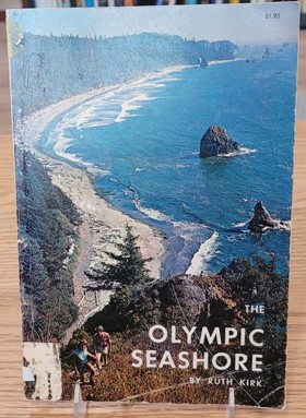
Ruth Kirk’s The Olympic Seashore provides a comprehensive ecological and cultural chronicle of the rugged, storm-battered Pacific coastline that defines the extreme western edge of Washington’s Olympic Peninsula. The narrative meticulously maps the formidable marine topography of this isolated frontier, where dense, nearly impenetrable temperate rainforests collide directly with violent oceanic swells, creating a treacherous shoreline characterized by towering sea stacks, jagged coastal reefs, and extreme tidal zones. By detailing the deep historical presence of indigenous maritime nations—who entirely bypassed the forbidding inland timber in favor of harvesting the rich marine ecosystem and hunting whales from massive cedar dugout canoes—the book illustrates how survival here strictly demanded mastering the volatile ocean. The text further highlights the perilous reality for later pioneer navigators attempting to transit this unforgiving stretch, whose frequent catastrophic shipwrecks underscored the hostility of the environment. Ultimately, the account captures the sheer physical severity of the coastal edge, demonstrating how the profound isolation and unyielding nature of this landscape successfully resisted dense industrial settlement, leading to its federal preservation as a pristine testament to the region's raw, primeval geography. vi, 79 pages : illustrations, maps ; 24 cm Non-circulating [ 1 ]
|
1962 |
|
The steamboat landing on Elliott Bay by Roland Carey
Roland Carey’s The Steamboat Landing on Elliott Bay chronicles the rapid maritime and commercial evolution of Seattle's waterfront during the bustling era of the Puget Sound mosquito fleet. The narrative maps the strategic, deep-water topography of Elliott Bay, detailing how early pioneer infrastructure was precariously wedged between expansive, tide-swept mudflats and the steep, heavily forested bluffs of the coastal mainland. By illustrating how the dense, impenetrable inland rainforests effectively strangled early attempts at overland transit, the book demonstrates that the region's scattered resource camps and agricultural settlements were forced to rely entirely on this centralized marine nexus for survival and economic integration. The text highlights the chaotic, dynamic environment of the sprawling wooden wharves extending over the tidal zones, where shallow-draft steamers systematically conquered the restrictive, current-swept corridors of the inland sea to deliver vital freight and passengers. Ultimately, the account captures the defining physical constraints of early Seattle, demonstrating how capitalizing on its protected oceanic anchorage and mastering the surrounding aquatic highways transformed an isolated, mud-bound timber outpost into the dominant maritime terminus of the Pacific Northwest. 66 pages : illustrations ; 29 cm Non-circulating [ 1 ]
|
1962 |
|
Intermountain railroads, standard and narrow gauge by Merrill D. Beal
Merrill D. Beal’s Intermountain Railroads, Standard and Narrow Gauge chronicles the grueling industrial conquest of the rugged interior Northwest, detailing the mechanized integration of an isolated, landlocked frontier. The narrative meticulously maps the formidable, high-elevation topography of the intermountain region, stretching across the arid volcanic expanses of the Snake River Plain, through deep, treacherous river canyons, and over the precipitous, snow-choked passes of the northern Rocky Mountains. By detailing the strategic engineering decisions underlying track construction, the book illustrates how the sheer severity of the alpine terrain often forced early rail barons to utilize the tighter turning radii of narrow-gauge lines simply to carve viable transit corridors through restrictive, steeply pitched mountain defiles. The text highlights how these fragile ribbons of steel conquered the profound physical isolation of remote pioneer mining camps and agricultural basins, overcoming punishing winter climates to replace arduous wagon trails with vital, year-round commercial arteries. Ultimately, the account captures the defining environmental realities of the inland empire, demonstrating how mastering this massive, unforgiving topographical barrier through ambitious rail infrastructure was the absolute prerequisite for unlocking the economic potential of the intermountain West. 252 pages illustrations 22 cm Non-circulating [ 1 ]
|
1962 |
|
Atlas of the Pacific Northwest resources and development by Richard M. Highsmith , Jon M. Leverenz (Cartographer), Oregon State University
Richard M. Highsmith and cartographer Jon M. Leverenz’s Atlas of the Pacific Northwest: Resources and Development provides a comprehensive spatial and economic baseline for understanding the region's complex, resource-driven geography. The volume meticulously maps the formidable, defining topography of the area, charting the stark transitions from the dense, rain-soaked temperate rainforests and deep-water estuarine networks of the maritime coast, across the towering, glaciated barrier of the Cascade Range, and out onto the expansive, arid volcanic plateaus of the inland empire. By translating these severe environmental realities into detailed cartographic data, the text illustrates how the region's restrictive mountain chokepoints, volatile riverine systems, and highly localized microclimates strictly dictated both pioneer settlement patterns and subsequent industrial expansion. The atlas highlights how early agricultural colonization, sprawling timber harvesting operations, and massive hydrological engineering projects along the Columbia River were fundamentally constrained and directed by the physical landscape. Ultimately, the work captures the profound geographical determinism of the Pacific Northwest, demonstrating how the systematic mapping and scientific evaluation of this unforgiving, sprawling terrain was the absolute prerequisite for transforming a remote, isolated frontier into an integrated, mechanized regional economy. viii, 168 pages : illustrations, 97 maps (some color) ; 32 cm Non-circulating [ 1 ]
|
1962 |
|
An introduction to Quinault Valley rain forest by Irene O'Connor
Irene O’Connor’s An Introduction to Quinault Valley Rain Forest provides an intimate ecological and pioneer chronicle of one of the most heavily vegetated and hydro-intense environments in the Pacific Northwest. The narrative meticulously maps the formidable topography of the Olympic Peninsula’s western slope, where relentless Pacific storm systems collide with the rugged Olympic Mountains to deluge the deeply entrenched Quinault River basin. By detailing the arduous survival of the indigenous Quinault people and subsequent pioneer homesteaders, the book illustrates how human settlement was physically constrained and perpetually overshadowed by the sheer biological mass of the ancient temperate rainforest. The text highlights how the dense, virtually impenetrable understory and towering canopy of Sitka spruce and western red cedar rendered overland transit nearly impossible, forcing early inhabitants to rely entirely on the glacier-fed lifeline of the Quinault River and its expansive lake for transportation and sustenance. Ultimately, the account captures the profound environmental severity of this isolated maritime valley, demonstrating how yielding to the overwhelming forces of extreme rainfall and immense timber was the absolute prerequisite for enduring in this remote coastal sanctuary. 39 pages : illustrations ; 22 cm Non-circulating [ 1 ]
|
1962 |
|
The Oregon country under the Union Jack a reference book of historical documents for scholars and historians by B. C. Payette, Alexander Henry
B. C. Payette’s The Oregon Country under the Union Jack, anchored by the meticulous journals of North West Company trader Alexander Henry, provides a primary-source chronicle of early British commercial hegemony in the Pacific Northwest. The compiled documents map the sprawling, treacherous geography of the Columbia River basin, detailing the rain-drenched, heavily timbered estuarine environment surrounding the coastal headquarters of Fort George (formerly Astoria) and the violent, rapid-choked inland waterways. By documenting the grueling logistical realities of the fur trade era, the book illustrates how the dense, impenetrable coastal rainforests and formidable alpine barriers entirely precluded standard overland travel, forcing European traders and indigenous populations to rely strictly on the region's volatile aquatic highways. The narrative highlights the lethal reality of this dependence—tragically underscored by Henry’s own drowning in the unpredictable tidal currents of the Columbia—revealing the extreme vulnerability of isolated frontier outposts tethered to dangerous maritime supply chains. Ultimately, the collection captures the defining physical severity of the early Oregon Country, demonstrating how navigating this massive, unforgiving riverine topography was the absolute prerequisite for monopolizing the region's ecological wealth and securing a fragile geopolitical foothold on the remote Pacific shore. xxii, 682 pages : illustrations, maps, portraits ; 24 cm Non-circulating [ 1 ]
|
1962 |
|
Beacon for mountain and plain story of the University of Idaho by Rafe Gibbs 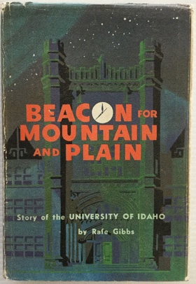
Rafe Gibbs’s Beacon for Mountain and Plain: Story of the University of Idaho chronicles the pioneer and institutional history of a land-grant university established amidst the profoundly fractured geography of the Idaho Panhandle. The narrative meticulously maps the rolling, fertile loess topography of the Palouse basin, detailing how this remote agricultural enclave was historically severed from the state's southern population centers by the massive, impassable alpine barrier of the Salmon River Mountains and the precipitous canyons of the Snake River. By detailing the immense logistical hurdles of building a centralized academic hub in such profound physical isolation, the book illustrates how the institution’s foundational mission was strictly dictated by the severe environmental realities of the inland empire. Gibbs highlights how the university was forced to prioritize vital, place-based sciences—specifically pioneering advanced dryland farming techniques to exploit the region's deep, wind-blown prairie soils, and developing rigorous forestry programs to manage the sprawling, heavily timbered slopes of the northern Rockies. Ultimately, the account captures the defining topographical divide of the state, demonstrating how establishing this isolated educational outpost was the absolute prerequisite for both culturally unifying a pioneer populace partitioned by extreme mountain geography and driving the modern, scientific management of its immense natural resources. x, 420 pages illustrations, portraits, facsimiles 24 cm Desiderata
|
1962 |
|
Lewis and Clark at Fort Clatsop by Lancaster Pollard
Lancaster Pollard’s Lewis and Clark at Fort Clatsop provides a focused historical chronicle of the Corps of Discovery’s grueling winter encampment at the terminus of their transcontinental expedition. The narrative meticulously maps the saturated, heavily timbered estuarine topography at the mouth of the Columbia River, detailing a formidable coastal environment characterized by relentless Pacific winter squalls, dense, nearly impenetrable temperate rainforests, and expansive, unpredictable tidal marshes. By detailing the expedition's daily struggle against near-constant rainfall, rotting supplies, and the immense difficulty of hunting elk within the thick, boggy understory, the book illustrates how the oppressive climate and sheer biological mass of the coastal edge fundamentally dictated the mechanics of their survival. The text highlights how the explorers were forced to adapt to this severe marine geography, necessitating the establishment of a remote ocean-side camp to boil seawater for vital salt preservation, while relying heavily on the indigenous Clatsop nation to navigate the treacherous aquatic network. Ultimately, the account captures the profound physical misery and environmental severity of the Pacific maritime winter, demonstrating how enduring the unrelenting dampness and isolation of this remote coastal outpost was the agonizing final geographic toll exacted upon the explorers to secure a fragile American foothold on the western shore. 32 pages : illustrations ; 23 cm Non-circulating [ 1 ]
|
1962 |
|
Shipwrecks of the Pacific Coast by Jim Gibbs
Jim Gibbs’s Shipwrecks of the Pacific Coast provides a comprehensive maritime chronicle of the catastrophic nautical disasters that defined early navigation along the unforgiving western seaboard of North America. The narrative meticulously maps the treacherous, storm-battered marine topography stretching from the jagged sea stacks of the Olympic Peninsula down to the rocky promontories of California, emphasizing the perilous reality of a shoreline notoriously devoid of safe, deep-water anchorages. By detailing the lethal combination of violent winter gales, dense coastal fogs, and submerged offshore reefs—most notably the shifting sandbars and violent tidal collisions of the Columbia River Bar, famously known as the "Graveyard of the Pacific"—the book illustrates how severe atmospheric and oceanographic forces perpetually threatened pioneer commerce. The text highlights how early industrial populations, physically constrained by impassable inland mountain ranges and impenetrable temperate rainforests, were forced to rely entirely on this volatile oceanic highway for basic survival and economic integration. Ultimately, the account captures the extreme physical severity of the Pacific edge, demonstrating how the devastating toll exacted by this unforgiving marine geography directly compelled the systematic development of coastal lighthouses and life-saving infrastructure, an absolute prerequisite for securing the most vital, yet dangerous, aquatic transit corridor on the western frontier. 316 pages illustrations, map (on lining papers) 23 cm Non-circulating [ 1 ]
|
1962 |