Catalog of British Columbiana and Pacific Northwest Americana
The Encyclopedia Cascadia Catalog indexes mostly non-fiction literature covering the Pacific Northwest coast of North America, with an emphasis on British Columbia, Idaho, Oregon, and Washington State.
| Catalog Title | Published |
|---|---|
|
The salmon people the story of Canada's West Coast salmon fishing industry by Hugh W. McKervill 
Hugh W. McKervill’s The Salmon People provides a comprehensive historical account of the commercial fishing industry that fundamentally shaped the coastal geography of British Columbia. The narrative maps the perilous maritime routes and remote, isolated inlets, stretching from the massive, teeming salmon runs of the Fraser River delta northward through the jagged, forested archipelagos of the Pacific coast. By chronicling the establishment of pioneer canneries and the arduous daily lives of the diverse fleets navigating the tempestuous waters of the open ocean, the text illustrates the profound human reliance on the region's marine ecosystems. Ultimately, the book vividly captures how the intricate aquatic topography of Canada's western shoreline served as the vital cultural and industrial lifeblood of this Pacific Northwest province. 198 pages illustrations, maps 23 cm Non-circulating [ 1 ]
|
1967 |
|
Clackamas County historical, 1966-1967 history of Willamette Falls by Clackamas County Historical Society
The Clackamas County Historical Society's Clackamas County Historical, 1966-1967: History of Willamette Falls provides a detailed chronicle of the monumental waterfall situated along the Willamette River in northwestern Oregon. The narrative centers on the dramatic basalt horseshoe of the falls, mapping how this vital geographical chokepoint spurred the development of pioneer settlements like Oregon City and West Linn on opposing riverbanks. By documenting early industrial power generation, indigenous fishing encampments, and the construction of navigational locks, the text highlights the falls as a crucial artery connecting the fertile Willamette Valley to the broader Columbia River basin. Ultimately, this historical account vividly captures the profound physical and economic impact of this specific aquatic landmark on the early expansion of the Oregon Territory. 60 pages : illustrations ; 22 cm Non-circulating [ 1 ]
|
1967 |
|
Champoeg place of transition; a disputed history by John A. Hussey, Oregon State Highway Commission, United States National Park Service
John A. Hussey’s Champoeg: Place of Transition chronicles the pivotal historical events centered at this vital riverside settlement nestled within Oregon’s fertile Willamette Valley. The narrative maps the strategic geography of the French Prairie region along the banks of the Willamette River, which served as a crucial gathering point for early French-Canadian trappers and American pioneers. By detailing the legendary 1843 meetings where settlers voted to establish the Pacific Northwest's first provisional government, the text highlights the townsite's role as an early political and economic hub. Ultimately, the book vividly captures the transformation of this specific Oregon landscape from an isolated trading outpost into the foundational cornerstone of the larger Oregon Territory. xvi, 404 pages illustrations, maps, portraits 24 cm Non-circulating [ 1 ]
|
1967 |
|
You're at liberty here mines and miners of the Swauk by Josee Jordan
Josee Jordan’s You're at liberty here: Mines and miners of the Swauk chronicles the rugged pioneer history of the historic gold-mining town of Liberty, nestled deep within the eastern slopes of Washington's Cascade Mountains. The narrative maps the challenging topography of the Swauk Creek basin, detailing the extensive placer mining operations that transformed this remote, forested enclave in northern Kittitas County. By documenting the daily lives and arduous labor of prospectors navigating the steep, timbered gulches just south of Blewett Pass, the book illustrates the severe environmental realities of the region's late-nineteenth-century gold rush. Ultimately, the text captures the distinct geographical footprint of this inland Washington landscape, preserving the legacy of one of the Pacific Northwest's most enduring historic mining districts. v, 103 pages : illustrations, map, portrait ; 22 cm Non-circulating [ 1 ]
|
1967 |
|
Empire of the Columbia a history of the Pacific Northwest by Dorothy O. Johansen, Charles M. Gates
Dorothy O. Johansen and Charles M. Gates's Empire of the Columbia serves as a foundational historical text that frames the sprawling Pacific Northwest through the unifying geographic force of the Columbia River basin. The comprehensive narrative maps the region's physical development, tracing early exploration from the rugged maritime outposts of the British Columbia coast and Washington's Puget Sound, eastward across the towering Cascade Mountains into the vast, arid interior plateaus of Oregon and Idaho. By detailing the arduous overland pioneer migrations and the modern industrialization of the mighty Columbia and Snake river watersheds via railroads and massive hydroelectric dams, the authors illustrate how human settlement adapted to and ultimately reshaped this diverse topography. Ultimately, the book captures the immense geographic scale of the region, demonstrating how interconnected aquatic networks and formidable mountain ranges dictated the political and economic destiny of these western territories. xiii, 654 pages : illustrations, maps ; 24 cm Non-circulating [ 2 ]
|
1967 |
|
Britannia the story of a Canadian mine by Bruce Ramsey
Bruce Ramsey’s Britannia: The Story of a Canadian Mine provides an industrial and social history of the Britannia copper empire, which operated on the eastern shoreline of Howe Sound from 1904 to 1974. Ramsey chronicles how mineral deposits discovered on Britannia Mountain were developed into one of the largest copper producers in the British Commonwealth, mapping deep underground workings, aerial tramways, and gravity mills directly into the coastal mountains. The text examines the isolated coastal logistics of the community, detailing how mine workers and their families depended exclusively on Union Steamship vessels running between Vancouver, Porteau, Minaty Bay, Furry Creek, and Britannia Beach prior to the completion of the railway and highway. Ramsey documents the devastating 1915 Jane Mine avalanche and the catastrophic 1921 flood and fire, highlighting the corporate resilience, multi-ethnic labor forces, and technological adaptations that sustained operations across seven decades. viii, 177 pages : illustrations, maps ; 24 cm Desiderata
|
1967 |
|
Brookfield the Joe Megler story (Wahkiakum County) Washington by Carlton E. Appelo 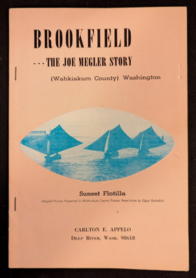
Carlton E. Appelo’s Brookfield: The Joe Megler Story chronicles the rise and fall of a pioneering salmon cannery town situated along the remote, timbered shores of the lower Columbia River in Wahkiakum County, Washington. The narrative maps the rugged estuarine geography where J.G. Megler established his bustling fishing enterprise, nestled between dense coastal rainforests and the sweeping tidal waters near the river's treacherous mouth. By detailing the daily operations of this isolated riverfront community, the book illustrates how the region's immense salmon runs and strategic aquatic access directly fueled the Pacific Northwest's early maritime economy. Ultimately, the text captures the distinct historical footprint of southwestern Washington’s coastal inlets, preserving the memory of a vibrant industrial settlement that was eventually reclaimed by the surrounding wilderness. 40 pages illustrations, maps, portraits 24 cm Non-circulating [ 1 ]
|
1966 |
|
The letters and journals of Simon Fraser, 1806-1808 by W. Kaye Lamb
W. Kaye Lamb’s edited volume of The Letters and Journals of Simon Fraser, 1806-1808 chronicles the grueling North West Company expeditions that first charted the unforgiving interior wilderness of present-day British Columbia. The firsthand accounts meticulously map Fraser’s treacherous descent through the sheer, violent rock gorges of the Fraser River canyon—most notably the punishing rapids of Hell's Gate—as he mistakenly sought a navigable route to the Columbia River. By documenting the extreme physical tolls of navigating from the rugged central plateaus down to the coastal tidal waters of the Strait of Georgia, the journals capture the formidable topography of the northern Pacific Northwest. Ultimately, this foundational text vividly illustrates the severe geographical barriers that challenged the earliest overland explorers attempting to conquer Canada's westernmost province. 292 pages ; 22 cm Non-circulating [ 1 ]
|
1966 |
|
110 years with Josephine the history of Josephine County, Oregon, 1856-1966 by Jack Sutton, Josephine County Historical Society
Jack Sutton’s 110 Years with Josephine provides a comprehensive pioneer history of Josephine County, a rugged and resource-rich enclave nestled among the Klamath and Siskiyou mountain ranges of southwestern Oregon. The narrative meticulously maps the region's defining topography, stretching from the deep, forested canyons carved by the wild Rogue and Illinois rivers to the fertile agricultural expanses of the Applegate Valley. By detailing the mid-nineteenth-century gold rush camps that sprouted in remote gulches and the subsequent rise of the local timber industry, the book illustrates how early settlers navigated and harvested this formidable inland wilderness. Ultimately, this account captures the physical and economic evolution of this specific southern Oregon landscape, tracing its transformation from isolated mining claims into a thriving network of logging and agricultural communities. 205 pages : illustrations ; 23 cm Non-circulating [ 1 ]
|
1966 |
|
Coast country a history of southwest Washington by Lucile Saunders McDonald 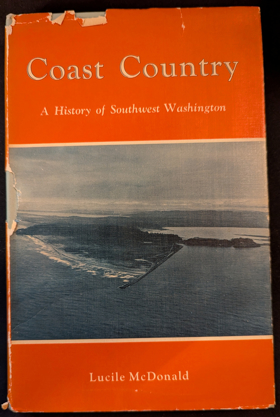
Lucile Saunders McDonald’s Coast Country: A History of Southwest Washington chronicles the maritime and pioneer history of the rugged, windswept coastline stretching north of the Columbia River's treacherous mouth. The narrative meticulously maps the challenging topography of this distinct Pacific environment, focusing on the shallow, tidal expanses of Willapa Bay, the dense temperate rainforests surrounding Grays Harbor, and the shifting sands of the Long Beach Peninsula. By detailing the booming nineteenth-century oyster industry that thrived within these sheltered estuarine mudflats, alongside perilous coastal shipping operations and early timber harvesting, the book illustrates how early settlers exploited the region's rich aquatic and arboreal resources despite severe navigational hazards. Ultimately, the text captures the formidable geographical realities of southwestern Washington, highlighting how its unique marine inlets and punishing oceanic weather dictated the economic survival of its most isolated pioneer communities. v, 184 pages, 24 unnumbered pages of plates : illustrations, map (on lining paper) ; 23 cm Non-circulating [ 1 ]
|
1966 |
|
With pride in heritage history of Jefferson County, a symposium by Jefferson County (Wash) Historical Society 
The Jefferson County Historical Society's With Pride in Heritage provides a collaborative pioneer and maritime chronicle of one of Washington State’s most geographically extreme regions. The narrative heavily maps the dramatic cross-peninsular topography of the Olympic Peninsula, stretching from the sheltered, deep-water maritime hub of Port Townsend on Puget Sound, westward across the towering, glacier-capped barrier of the Olympic Mountains, to the remote, storm-battered river valleys of the Pacific coast. By detailing the booming nineteenth-century shipping and military defense networks anchored in the eastern bays, alongside the arduous timber and homesteading operations isolated within the dense western temperate rainforests, the book illustrates how early development was dictated by this polarized environment. Ultimately, the text captures the profound physical divide of Jefferson County, demonstrating how its formidable mountain ranges and vital marine inlets shaped the distinct cultural and industrial histories of its eastern and western shores. xii, 422, [18] pages illustrations, maps, portraits 24 cm Non-circulating [ 1 ]
|
1966 |
|
The Library of Oregon State University its origins, management, and growth : a centennial history by William Hugh Carlson, Oregon State University
William Hugh Carlson’s The Library of Oregon State University chronicles the institutional evolution of the academic repository at the heart of Oregon’s pioneer land-grant university in Corvallis. While fundamentally an administrative history, the narrative maps the intellectual and economic maturation of the fertile Willamette Valley and the broader state. By detailing the library's mandate to amass and organize research materials supporting forestry, marine biology, and agricultural sciences, the book illustrates how the sheer physical diversity of Oregon’s landscapes—from its dense coastal timberlands to its expansive inland farming basins—demanded a rigorous scientific infrastructure. Ultimately, the text captures a distinct facet of regional development, demonstrating how the structured curation of knowledge became essential for late-nineteenth and twentieth-century residents to systematically harness and cultivate the formidable natural resources of the Pacific Northwest. 94 pages ; 28 cm ONLINE Circulation [ 1 ]
|
1966 |
|
Oregon's historical markers by W. M. Scofield, Oregon State Highway Commission, Oregon Historical Society, Souvenir Publishing Co
W. M. Scofield’s Oregon’s Historical Markers serves as a comprehensive roadside geographical guide to the pioneer migrations, indigenous heritage, and pivotal events physically commemorated across the state. The directory maps the extensive landscape of the region's past, guiding readers from the treacherous maritime inlets and early navigational aids of the rugged Pacific coast, eastward through the dramatic, wind-swept chokepoint of the Columbia River Gorge. Scofield traces the final, arduous overland descents of the Oregon Trail into the fertile, sheltered basin of the Willamette Valley, while also documenting the isolated ranching outposts and mining camps scattered across the vast, arid plateaus of eastern Oregon's high desert. By chronicling the exact physical locations of these widespread plaques and monuments, the book provides a tangible, site-by-site historical geography, illustrating how early populations navigated, settled, and ultimately transformed the formidable and highly varied topography of Oregon. 103 pages : illustrations, map ; 21 cm Non-circulating [ 1 ]
|
1966 |
|
Early and present history of Fix Ridge, Latah County, Idaho, 1877-1964 by Maris T. Dennler, Fix Ridge Club (Issuing body) 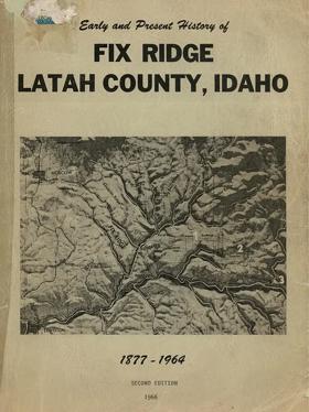
From the preface: This book "represents merely an attempt to pay a tribute to the 'old days' and the 'old Pioneers' and to record as accurately as possible the events and happenings of this area, both past and present." xvi, 128 leaves, 39 unnumbered leaves of plates : illustrations, map (on cover) portraits ; 28 cm Desiderata
|
1966 |
|
Idaho's bonanza years ghost towns, their history and how to find them by Rex Painter, Dorothy Povey 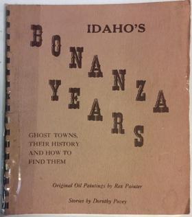
Rex Painter and Dorothy Povey’s Idaho's Bonanza Years: Ghost Towns, Their History and How to Find Them serves as both a pioneer chronicle and a physical navigational guide to the abandoned mining settlements scattered across the Gem State. The narrative maps the rugged, isolated topography that dictated Idaho's late-nineteenth-century mineral rushes, tracing routes through the steep, timbered gulches of the central Salmon River Mountains southward to the arid, high-elevation basins of the Owyhee range. By detailing the rapid rise and inevitable collapse of these remote boomtowns—often built precariously along narrow canyon walls and deep within unforgiving alpine valleys—the authors illustrate the extreme environmental challenges prospectors faced in extracting wealth from the state's formidable interior. Ultimately, the text captures the transient geographical footprint of resource extraction in the inland Pacific Northwest, demonstrating how the harsh physical realities of these isolated mountainous enclaves eventually reclaimed the ambitious pioneer architecture of Idaho's gold and silver rushes. 46 pages illustrations, map 25 cm Non-circulating [ 1 ]
|
1966 |
|
Yankee steamboats on the Fraser River, British Columbia by Frank Raymond Coutant
|
1966 |
|
The name was Olney by Roscoe Sheller
Roscoe Sheller’s The Name Was Olney chronicles the arduous pioneer journey and settlement of Nathan Olney, who established the first permanent non-indigenous trading post at The Dalles in the mid-nineteenth century. The narrative maps the treacherous aquatic geography of the Columbia River Gorge, detailing Olney's perilous descent past the roaring cascades of Celilo Falls on a crude log raft. By focusing on this strategic inland chokepoint—originally the indigenous village of Winquat, meaning "a-place-encircled-by-a-rock"—the book illustrates how the area's formidable basalt topography functioned as the ultimate geographical crossroads for early Pacific Northwest commerce. Ultimately, the text captures the severe physical realities of the Columbia basin, demonstrating how the transition from grueling overland wagon trails to the turbulent, unforgiving currents of the lower Columbia River shaped the region's earliest frontier outposts and indigenous relations. viii, 171 pages : illustrations, portraits ; 23 cm Non-circulating [ 1 ]
|
1965 |
|
Coos River echoes a story of the Coos River Valley by Charlotte L. Mahaffy
Charlotte L. Mahaffy’s Coos River Echoes provides a detailed pioneer history of the isolated, resource-rich Coos River Valley on the rugged southwestern Oregon coast. The narrative meticulously maps the intricate estuarine and riverine geography that dictated early settlement, illustrating how the dense, nearly impenetrable timber of the Coast Range forced early inhabitants to rely entirely on the river network as their primary transportation and commercial highway. By detailing the establishment of early dairy farms along the fertile, tidal bottomlands and the grueling logging operations that utilized splash dams to violently flush timber down steep, narrow tributaries toward the coastal mills of Coos Bay, the book highlights the profound pioneer reliance on the region's hydrology. Ultimately, the text captures the severe physical isolation of this coastal environment, demonstrating how the challenging topography and dynamic waterways shaped the distinct cultural and industrial development of the valley. 253, [2] pages illustrations, map (on lining papers) portraits 23 cm Non-circulating [ 1 ]
|
1965 |
|
The sound of steamers by Roland Carey
Roland Carey’s The Sound of Steamers chronicles the transformative nineteenth-century maritime evolution that physically interconnected the sprawling, fragmented waterways of Washington's Puget Sound. The narrative maps the region's complex estuarine geography, demonstrating how deep, current-swept channels, unpredictable tidal rips, and dense, impassable coastal rainforests initially isolated early pioneer settlements from one another. By detailing the introduction of robust side-wheelers and shallow-draft steamboats, Carey illustrates how this mechanized technology allowed early mariners to finally conquer the restrictive ocean winds and severe tides that had historically crippled sailing vessels. The book traces the resulting aquatic highways that reliably linked sheltered lumber ports like Seattle and Tacoma to remote island homesteads and northern gold rush outposts along the Fraser River. Ultimately, the text captures the vital marine geography of the inland Pacific Northwest, highlighting how mastering this formidable aquatic basin through steam power was the absolute prerequisite for the region's economic and cultural unification. 109 pages : illustrations, facsimile, portraits ; 29 cm Non-circulating [ 1 ]
|
1965 |
|
Bainbridge landings by Allen Beach 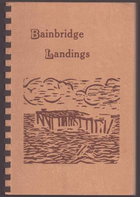
Allen Beach’s Bainbridge Landings chronicles the intimate maritime and pioneer history of Bainbridge Island, an isolated, heavily forested landmass strategically situated in the heart of Washington's Puget Sound. The narrative meticulously maps the island's convoluted, deeply indented shoreline, illustrating how the dense, impassable interior timber forced early settlement to cluster entirely around sheltered estuarine inlets like Eagle Harbor and the deep-water anchorage of Port Blakely. By detailing the massive coastal lumber mills, sprawling shipyards, and the vital daily operations of the "Mosquito Fleet" steamboats that serviced dozens of scattered wooden piers, the book demonstrates how the surrounding tidal waters served as the absolute economic and social lifeline for these disconnected enclaves. Ultimately, the text captures the defining marine geography of this inland island community, highlighting how its physical isolation from the mainland and total reliance on aquatic transit dictated the industrial development and cultural rhythm of the region long before the advent of the modern automobile ferry system. unpaged. Non-circulating [ 1 ]
|
1965 |
|
Leschi of the Nisquallies by Della Gould Emmons
Della Gould Emmons’s Leschi of the Nisquallies chronicles the tragic life of the prominent Nisqually chief and the violent Puget Sound War ignited by the pioneer seizure of indigenous homelands. The narrative maps the vital riverine and prairie geography of the south Puget Sound, focusing heavily on the rich delta and salmon-bearing waters of the Nisqually River basin extending eastward toward the rugged foothills of Mount Rainier. By detailing the disastrous 1854 Medicine Creek Treaty—which attempted to force the tribe onto barren, elevated bluffs entirely severed from their foundational aquatic lifelines—the book illustrates how the sudden, forced restriction of traditional geographic access directly sparked armed resistance. The text captures the strategic military use of the region's dense, impassable lowland forests and tangled river crossings by indigenous fighters attempting to repel territorial militias. Ultimately, this account demonstrates how a fundamental clash over land use and riparian access within this specific Washington landscape dictated the devastating geopolitical realities of the 1850s frontier. 416 pages : map ; 23 cm Non-circulating [ 1 ]
|
1965 |
|
I remember Portland by Laurence Pratt
Laurence Pratt’s I Remember Portland chronicles the rapid urban and industrial maturation of Oregon's primary metropolis at the dawn of the twentieth century. The narrative maps the strategic riverine geography of the lower Willamette River, positioned just before its confluence with the Columbia, which served as the vital deep-water maritime port anchoring the Willamette Valley's expansive agricultural and timber hinterlands. By detailing the city's physical expansion from the dense, muddy commercial hub clustered beneath the steep, forested slopes of the West Hills, outward across the newly bridged river to the sprawling, flatter residential grids of the Eastside, the book illustrates how early mechanized infrastructure—such as steel bridges and electric streetcars—allowed residents to conquer the formidable aquatic barrier that had historically divided the settlement. Ultimately, the text captures the evolving urban geography of the Pacific Northwest, demonstrating how Portland leveraged its essential riverine highway and adapted to its constraining topography to transition from a rugged pioneer river town into a modernized, interconnected metropolitan hub. 91 pages ; 21 cm Non-circulating [ 1 ]
|
1965 |
|
Early voyages in the North Pacific, 1813-1818 by Peter Corney
Peter Corney’s Early Voyages in the North Pacific, 1813-1818 chronicles the perilous maritime fur trade and the expansive commercial networks established by the North West Company in the early nineteenth century. The firsthand narrative maps the vast and unforgiving oceanic geography connecting the rugged, storm-battered coastlines of the Pacific Northwest—stretching from the treacherous, shifting sandbars at the mouth of the Columbia River northward to the isolated Russian outposts in Alaska—with the vital provisioning harbors of the Hawaiian Islands. By detailing the arduous navigation of deep coastal inlets, the logistical operations at Fort George (Astoria) within the dense estuarine environment of the lower Columbia, and the complex barter with indigenous coastal nations for valuable sea otter pelts, the book illustrates how early commercial fleets exploited the region's rich marine resources. Ultimately, the text captures the extreme navigational hazards and sprawling geographical scale of the early Pacific Northwest economy, demonstrating how mastering this harsh coastal topography was essential for integrating the remote maritime frontier into a lucrative global trading empire. 238 pages : illustrations, facsimile, portraits ; 23 cm Non-circulating [ 1 ]
|
1965 |
|
For love of some islands memoirs of some years spent in the San Juan Islands of Puget Sound by F. W. Schmoe 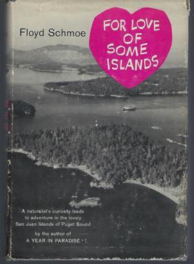
F. W. Schmoe’s For Love of Some Islands provides an intimate pioneer and naturalist memoir chronicling life amidst the complex, heavily forested archipelago of Washington’s San Juan Islands. The narrative meticulously maps the intricate marine geography of this glaciated inland sea, detailing the formidable tidal rips, rocky straits, and sheltered estuarine bays that dictate the crucial aquatic pathways between the scattered landmasses. By documenting the region's evolution from rugged, isolated homesteads and early maritime harvesting camps to established agricultural enclaves, the book illustrates how the archipelago's deep-water channels and rugged island topography mandated a strictly boat-reliant existence. Ultimately, the text captures the profound physical isolation of the island chain, demonstrating how mastering the dynamic, current-swept environment of the northern inland waters was absolutely essential for early inhabitants to sustain daily survival and commercial connectivity. vii, 226 pages : illustrations ; 22 cm Non-circulating [ 1 ]
|
1964 |
|
The Oregon desert by E. R. Jackman, R. A. Long 
E. R. Jackman and R. A. Long’s The Oregon Desert provides a deeply personal and comprehensive chronicle of the vast, arid sagebrush steppe that dominates the southeastern quadrant of the state. The narrative meticulously maps the formidable, high-elevation topography lying in the massive rain shadow of the Cascade Mountains, stretching across ancient dried lake beds, jagged volcanic fault blocks, and the expansive alkali flats of the Great Basin. By detailing the arduous survival of early homesteaders, resilient cattlemen, and nomadic sheepherders who navigated this severe, water-starved environment, the authors illustrate how the extreme climate and sheer physical isolation forced a unique, self-reliant culture to develop in remote outposts like the Fort Rock valley. Ultimately, the text captures the stark geographic reality of Oregon’s inland empire, demonstrating how adapting to this unforgiving, sprawling desert landscape was the absolute prerequisite for any enduring human settlement east of the Cascades. xiii, 407 pages : illustrations (some color) facsimile, map (on lining papers), portraits ; 24 cm Desiderata
|
1964 |