Catalog of British Columbiana and Pacific Northwest Americana
The Encyclopedia Cascadia Catalog indexes mostly non-fiction literature covering the Pacific Northwest coast of North America, with an emphasis on British Columbia, Idaho, Oregon, and Washington State.
| Catalog Title | Published |
|---|---|
|
Shortline to Lillooet a history of the Pacific Great Eastern Railway by Bruce Ramsey 
Bruce Ramsey’s Shortline to Lillooet: A History of the Pacific Great Eastern Railway chronicles the heroic engineering and turbulent financing of the railway constructed through the precipitous mountain canyons of the Pacific Coast and southern Interior. Ramsey details the physical challenges of blasting track beds along the vertical granite bluffs of Cheakamus Canyon, crossing the alpine summits of Alta Lake, and skirting the sheer cliffs flanking Anderson Lake and Seton Lake. The text documents the operation of lakeside transfer docks and rail communities—including D'Arcy, Seton Portage, Shalalth, and South Shalalth—where passenger and freight traffic connected to inland branch routes. Ramsey illustrates how the railway line served as an indispensable physical and economic artery linking isolated ranching and mining settlements across the Squamish-Lillooet region directly to coastal tidewater. 189 pages : illustrations, maps ; 28 cm Desiderata
|
1962 |
|
Pronunciation guide of Oregon place names by Robert Monaghan 
Robert Monaghan’s Pronunciation Guide of Oregon Place Names provides a unique linguistic and cultural chronicle of the state's diverse indigenous and pioneer heritage, serving as a phonetic map of human settlement across a profoundly fragmented landscape. The compilation implicitly maps the sprawling, varied topography of Oregon, tracing a vast geographic vocabulary that spans from the storm-battered, rain-swept coastal estuaries and the towering, densely timbered barrier of the Cascade Range, out to the arid, sprawling sagebrush steppes of the inland high desert. By detailing the precise, often counterintuitive local pronunciations of remote towns, volatile rivers, and precipitous mountain passes, the book illustrates how early human adaptation was intimately tied to specific, physically isolated geographic pockets. The text highlights how the region’s formidable topographical barriers effectively preserved distinct linguistic microclimates, where the complex vocabularies of indigenous nations—whose languages were deeply adapted to local ecological realities—collided and inextricably merged with the dialects of transient French-Canadian fur trappers and weary overland pioneers. Ultimately, the guide captures the enduring cultural imprint of Oregon’s severe environmental realities, demonstrating how mastering the authentic spoken nomenclature of this rugged, varied terrain serves as an oral record of surviving, claiming, and integrating into the diverse physical landscapes of the Pacific Northwest. 81 pages ; 23 cm Non-circulating [ 1 ]
|
1961 |
|
A Gulf Islands patchwork some early events on the islands of Galiano, Mayne, Saturma, North and South Pender by British Columbia Historical Association Gulf Islands Branch 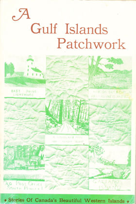
The British Columbia Historical Association’s A Gulf Islands Patchwork provides a fragmented but intimate pioneer chronicle of the sprawling Southern Gulf Islands archipelago, specifically detailing early settlement on Galiano, Mayne, Saturna, and the Penders. The narrative maps the defining, water-bound topography of these rugged landmasses, scattered across the treacherous tidal currents of the Strait of Georgia. By detailing the early establishment of remote lighthouses, coastal homesteads, and vital ferry landings, the book illustrates how the sheer physical isolation of this marine environment dictated every aspect of daily survival and community integration. The text highlights how early indigenous populations and subsequent pioneer settlers were forced to rely entirely on volatile aquatic highways—most notably navigating the violent, rip-tide currents of Active Pass—as dense, rocky interiors severely restricted overland transit and large-scale agriculture. Ultimately, the collection captures the profound environmental constraints of this coastal frontier, demonstrating how mastering complex maritime navigation and adapting to the unyielding isolation of a fractured island geography were the absolute prerequisites for establishing a viable, interconnected pioneer society along the remote Pacific seaboard. 192 pages : illustrations ; 23 cm Non-circulating [ 1 ]
|
1961 |
|
Indians in Washington by Washington Secretary of State Office
The Washington Secretary of State Office’s Indians in Washington provides a comprehensive anthropological and geographic chronicle of the diverse indigenous nations that populated the extreme, fragmented landscapes of the territory prior to pioneer displacement. The narrative meticulously maps the state's defining topographical divide—the massive, glaciated barrier of the Cascade Range—which fundamentally partitioned early human adaptation into two drastically different cultural and economic spheres. By detailing the maritime societies of the western seaboard, the book illustrates how the dense, nearly impenetrable temperate rainforests forced coastal and Puget Sound tribes to bypass overland transit entirely. Instead, these populations were deeply tethered to the volatile Pacific currents and sheltered estuarine networks, relying on monumental cedar dugout canoes to master a heavily resource-dependent oceanic economy. Conversely, the text highlights how the stark, arid volcanic plateaus of the inland empire east of the mountains demanded a highly mobile, semi-nomadic existence. Here, survival was strictly dictated by the region's dynamic hydrology, anchoring inland populations to the massive seasonal salmon runs at the strategic, turbulent chokepoints of the Columbia and Snake rivers, while requiring the rapid adoption of equestrian transit to navigate the sprawling, exposed sagebrush steppes. Ultimately, the account captures the profound environmental determinism of the Pacific Northwest, demonstrating how successfully adapting to these polarized geographic realities—whether conquering the wet, timber-choked maritime edge or mastering the sprawling distances of the unforgiving high desert—was the absolute prerequisite for the cultural endurance of the region's first peoples. 48 pages illustrations Non-circulating [ 2 ]
|
1961 |
|
Vancouver from milltown to metropolis by Alan Morley 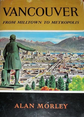
Alan Morley’s Vancouver from Milltown to Metropolis chronicles the explosive industrial and urban evolution of Canada’s premier Pacific port city, detailing its rapid transition from a remote, heavily forested logging outpost to a vital hub of global commerce. The narrative meticulously maps the strategic but formidable coastal geography of the Burrard Inlet peninsula, securely wedged between the volatile alluvial delta of the Fraser River and the towering, precipitous barrier of the Coast Mountains. By detailing the settlement’s crude origins at early lumber camps like Hastings Mill, the book illustrates how the sheer biological mass of the climax temperate rainforest initially pinned early pioneers against the shoreline, forcing a complete reliance on sheltered aquatic highways for survival and initial resource extraction. The text highlights the profound geographic turning point when this protected, deep-water oceanic anchorage was selected as the western terminus of the Canadian Pacific Railway. Morley demonstrates how piercing the massive, unyielding alpine ranges of the interior with transcontinental rail finally shattered the region's profound physical isolation, seamlessly linking the landlocked resource wealth of the vast Canadian expanse with lucrative Pacific shipping lanes. Ultimately, the account captures the defining environmental realities of British Columbia's coastal nexus, demonstrating how clearing an impenetrable forest, maximizing a natural deep-water harbor, and conquering a massive continental divide were the absolute prerequisites for transforming a rugged pioneer milltown into a mechanized, integrated maritime metropolis. xiii, 227 pages illustrations 4.17 Non-circulating [ 1 ]
|
1961 |
|
The king's pines of Idaho a story of the Browns of McCall by Grace Edgington Jordan
Grace Edgington Jordan’s The King's Pines of Idaho: A Story of the Browns of McCall chronicles the grueling pioneer expansion and the establishment of an enduring timber empire in the rugged, high-elevation wilderness of west-central Idaho. The narrative meticulously maps the formidable alpine topography of the Payette River basin, detailing a deeply isolated geographic bowl dominated by vast, ancient stands of ponderosa pine surrounding the deep, glacial waters of Payette Lake. By detailing the industrial ascent of the Brown family's logging operations, the book illustrates how early resource extraction was strictly dictated by the severe environmental realities of the inland mountains. The text highlights how the dense, impenetrable timber and punishing, snow-choked winters initially strangled standard overland transit, forcing early lumbermen to leverage the region's dynamic hydrology—utilizing the frozen lake and volatile spring river swells to execute massive, highly dangerous log drives. Ultimately, the account captures the defining physical severity of Idaho’s mountainous interior, demonstrating how mastering this volatile aquatic network and conquering the extreme geographic isolation of the Payette watershed were the absolute prerequisites for transforming a forbidding alpine frontier into a highly mechanized and prosperous timber economy. 295 pages illustrations 23 cm Non-circulating [ 1 ]
|
1961 |
|
Port Angeles, U.S.A. by John D. McCallum, Lorraine Wilcox Ross , James Warner Bellah (Writer of introduction)
John D. McCallum and Lorraine Wilcox Ross’s Port Angeles, U.S.A. chronicles the pioneer and industrial evolution of a remote maritime settlement strategically sheltered behind the protective, miles-long sand spit of Ediz Hook on the northern coast of the Olympic Peninsula. The narrative maps how the towering, heavily glaciated barrier of the Olympic Mountains and the impenetrable density of the surrounding temperate rainforest initially strangled overland transit, forcing early settlers and massive logging operations to rely entirely on the deep-water harbor and the volatile aquatic highway of the Strait of Juan de Fuca for economic survival. By detailing the transition from an isolated pioneer outpost to a booming, mill-driven seaport, the book illustrates how mastering this unique marine topography and leveraging a natural oceanic breakwater were the absolute prerequisites for establishing a thriving timber metropolis on an otherwise unforgiving coastal frontier. 197 pages, 32 unnumbered pages of plates : illustrations, map (on lining papers), portraits ; 24 cm Non-circulating [ 1 ]
|
1961 |
|
Oregon argonauts merchant adventurers on the western frontier by Arthur Loreston Throckmorton
Arthur Loreston Throckmorton’s Oregon Argonauts chronicles the economic transformation of the Willamette Valley, detailing how pioneer merchants built a localized capitalist empire despite the profound geographic isolation of the early Pacific Northwest. Cut off from eastern manufacturing by the impassable Rocky Mountains and vast inland steppes, early agrarian settlers were forced to rely on the treacherous aquatic highway of the Columbia River and volatile coastal shipping routes to export their agricultural surplus. The narrative illustrates how the sudden explosion of the California Gold Rush provided a ravenous market for this fertile topography, allowing savvy frontier merchants to monetize the region's agricultural wealth by mastering these unforgiving maritime supply chains. Ultimately, the account captures how overcoming severe continental detachment and navigating dangerous oceanic barriers was the absolute prerequisite for transitioning the territory from a primitive bartering outpost into an integrated, market-driven commercial economy. xvii, 372 pages : illustrations, portraits, tables ; 24 cm Non-circulating [ 1 ]
|
1961 |
|
Lone Cone a journal of life on the west coast of Vancouver Island, B.C. by Dorothy Abraham 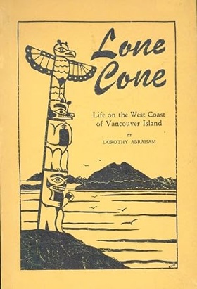
Dorothy Abraham’s Lone Cone: A Journal of Life on the West Coast of Vancouver Island, B.C. provides an intimate pioneer chronicle of daily survival and domestic adaptation in one of the Pacific Northwest's most geographically isolated and storm-battered environments. The narrative meticulously maps the formidable marine topography of Clayoquot Sound, dominated by the imposing alpine presence of its titular peak, where dense, nearly impenetrable temperate rainforests plunge directly into the volatile, deep-water fjords of the Pacific edge. By detailing the grueling realities of twentieth-century homesteading, the book illustrates how the complete absence of viable overland transit through the steep, rain-soaked interior forced settlers to rely entirely on precarious aquatic highways for basic communication, medical access, and supply delivery. The text highlights how the unrelenting oceanic climate and sheer physical isolation demanded absolute self-sufficiency, dictating that every aspect of domestic life be tethered to the unpredictable schedules of coastal steamers navigating treacherous offshore reefs. Ultimately, the account captures the profound geographical determinism of Vancouver Island’s western seaboard, demonstrating how yielding to the overwhelming forces of extreme maritime weather and mastering a fractured, water-bound landscape were the absolute prerequisites for enduring at the very edge of the continental frontier. 103 pages : illustrations ; 22 cm Non-circulating [ 1 ]
|
1961 |
|
An Oregon idyl a tale of a transcontinental journey, and life in Oregon in 1883-1884, based on the diary of Janette Lewis Young by Nellie May Young, Janette Lewis Young 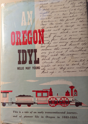
Nellie May Young’s An Oregon Idyl, drawn from the 1883 diary of Janette Lewis Young, chronicles the profound geographic transition from a grueling transcontinental rail journey across the massive, arid interior to daily pioneer life in the rain-fed valleys of the Pacific Northwest. The narrative maps the formidable topography that historically isolated the western frontier, detailing how the newly completed mechanical infrastructure of the railroad finally conquered the towering alpine barriers of the Rockies and Cascades to safely deposit settlers into the fertile but heavily timbered Oregon landscape. By chronicling the domestic realities of homesteading within this damp, densely vegetated environment, the book illustrates how adapting to local climatic constraints and relying on these vital new overland transit arteries were the absolute prerequisites for enduring on the remote western seaboard. 111 pages illustrations 22 cm Non-circulating [ 1 ]
|
1961 |
|
The curve of time by M. Wylie Blanchet 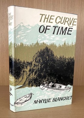
Widowed at the age of thirty-five, Muriel Wylie Blanchet packed up her five children in the summers that followed and set out aboard the twenty-five-foot Caprice. For fifteen summers, in the 1920s and 1930s, the family explored the coves and islands of the West Coast, encountering settlers and hermits, hungry bears and dangerous tides, and falling under the spell of the region’s natural beauty. Driven by curiosity, the family followed the quiet coastline, and Blanchet—known as Capi, after her boat—recorded their wonder as they threaded their way between the snowfields, slept under the bright stars and wandered through Indigenous winter villages left empty in the summer months. The Curve of Time weaves the story of these years into a memoir that has inspired generations to seek out their own adventures on the wild West Coast. First published in 1961, less than a year before the author died, Blanchet’s captivating work has become a bestselling classic of travel writing. 202 pages 22 cm Desiderata
|
1961 |
|
A water tour of Seattle by Stan Styner, Merrill Grant (Illustrator) 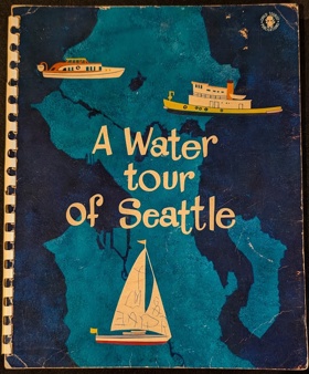
Bright lithograph full color printing with text depicting the Seattle waterfront, Pioneer Square, Alki Point, the Locks, Portage Bay, the Ship Canal, Lake Washington, the Floating Bridge, etc. Color map at back with route the book follows. Keywords: 1960's, Children's Book, Seattle, Waterfront, Pioneer Square, Alki Point, Locks, Portage Bay, Ship Canal. 1 volume (unpaged) illustrations Non-circulating [ 1 ]
|
1961 |
|
Histories of the Seattle public schools, 1961 by Seattle Public Schools
|
1961 |
|
History of Columbia County by Columbia County Historical Society
Published annually between 1961 and 1973 by the Columbia County Historical Society, this twelve-volume series serves as the primary compendium of micro-histories, pioneer memoirs, and spatial records for the region. The compiled monographs systematically document early settler claims, logging skid roads, and riverboat landings that superseded ancient Chinookan seasonal villages along the lower Columbia. The serial contains dedicated historical studies on the timber camps and rural hamlets of Beaver Homes, Canaan, Trenholm, Yankton, Deer Island, and Goble, while detailing the early riverfront industries of Columbia City, Saint Helens, and Rainier. Featuring extensive family diaries, cemetery inscriptions, and cadastral maps, the collection preserves the foundational human geography of Columbia County. Annual serial (Vols. I-XII) : illustrations, maps, portraits ; 23 cm Desiderata
|
1961 |
|
Fort Victoria from fur trading post to capital city of British Columbia, Canada by Herbert P. Plasterer 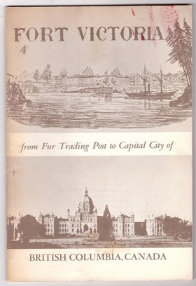
Fort Victoria: From Fur Trading Post to Capital City of British Columbia, Canada by Herbert P. Plasterer is a concise 1967 historical booklet that traces the foundational years of British Columbia's capital. The work provides a focused overview of Victoria's evolution, detailing its origins as a strategic 19th-century Hudson's Bay Company fort and its rapid expansion during the colonial era. Ultimately, it serves as an accessible, localized snapshot of the pioneer history and key milestones that transformed a remote settlement into a modern political center. 38 pages : illustrations ; 23 cm Non-circulating [ 1 ]
|
1960 |
|
Prince Rupert, a gateway to Alaska by R. Geddes Large
R. Geddes Large’s Prince Rupert, a Gateway to Alaska chronicles the ambitious, heavily mechanized struggle to carve a transcontinental railway terminus out of the punishing, muskeg-shrouded topography of British Columbia’s remote northern coast. The narrative maps how the sheer physical severity of Kaien Island—characterized by relentless maritime downpours, impenetrable temperate rainforests, and unyielding bedrock—required massive explosive engineering simply to secure a structural foothold for the Grand Trunk Pacific Railway. Despite the agonizing overland construction through the rugged Coast Mountains, the settlement's precise location was strictly dictated by the immense strategic value of its deep-water, ice-free harbor, which offered an unparalleled maritime shortcut to Asian markets and northern frontier resources. Ultimately, the book illustrates how conquering this profoundly isolated and inhospitable coastal geography was the absolute prerequisite for establishing a vital, industrialized marine gateway to Alaska and the broader Pacific seaboard. 210 pages illustrations 29 cm Non-circulating [ 1 ]
|
1960 |
|
Historic Silver City the story of the Owyhees by Mildretta Adams
Mildretta Adams’s Historic Silver City: The Story of the Owyhees chronicles the brutal pioneer extraction of immense mineral wealth from the stark, unforgiving high-desert topography of southwestern Idaho. The narrative maps how the severe geographic isolation, punishing alpine winters, and precipitous volcanic canyons of the Owyhee Mountains demanded massive logistical feats simply to construct the precarious toll roads and stamp mills necessary to sustain a booming silver metropolis. By detailing the explosive rise and inevitable collapse of this remote mining enclave, the book illustrates how temporarily conquering the extreme environmental realities of the arid inland empire was the absolute prerequisite for exploiting its geological riches, just as those same harsh geographic constraints ultimately dictated its abandonment. 60 pages : illustrations ; 23 cm Non-circulating [ 1 ]
|
1960 |
|
A brief history of Franklin, first permanent settlement in the state of Idaho by Idaho Pioneer Association, Boise Public Library Idaho Collection 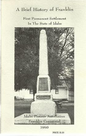
The Idaho Pioneer Association’s A brief history of Franklin chronicles the grueling agrarian colonization of Cache Valley, where Mormon pioneers established Idaho’s first permanent settlement in an isolated, high-altitude basin just north of the Utah border. The narrative maps how the formidable geography of the surrounding Bear River Range and the region's punishing alpine winters forced these early colonizers to immediately undertake massive, cooperative hydrological engineering projects to divert mountain streams for vital crop irrigation. By detailing the communal construction of protective forts and localized agricultural infrastructure, the text illustrates how an absolute reliance on the fertile but climatically severe valley floor dictated early survival strategies in a deeply isolated frontier environment. Ultimately, the account captures how mastering this localized geography and conquering the harsh climatic realities of the inland empire were the absolute prerequisites for establishing a lasting, agriculturally independent pioneer foothold in the rugged topography of southeastern Idaho. 41 pages illustrations with photographs 23 cm Non-circulating [ 1 ]
|
1960 |
|
Echoes of Puget Sound fifty years of logging and steamboating by Torger Birkeland
Torger Birkeland’s Echoes of Puget Sound chronicles the symbiotic pioneer industries of maritime transit and timber extraction that defined early settlement within the deep glacial fjords of western Washington. The narrative maps how the impenetrable biological mass of the ancient temperate rainforest completely precluded early overland road construction, forcing isolated coastal logging camps to rely entirely on a sprawling network of shallow-draft steamers for basic survival. By detailing the grueling, daily navigation of this vital Mosquito Fleet, the text illustrates how the physical constraints of the rugged shoreline required the mastery of dynamic tidal currents to tow massive log booms to centralized regional mills. Ultimately, the account captures the profound geographical determinism of the inland sea, demonstrating that conquering these volatile aquatic highways was the absolute prerequisite for unifying a fragmented, wilderness-bound frontier into an integrated timber empire. 251 pages illustrations 22 cm Non-circulating [ 1 ]
|
1960 |
|
Yakima, Washington Jubilee, 1885-1960 by Click Relander, George M. Martin , Yakima Diamond Jubilee, Inc (Issuing body), Yakima Diamond Jubilee 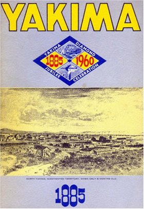
Click Relander and George M. Martin’s Yakima, Washington Jubilee, 1885-1960 chronicles the dramatic agricultural transformation of an arid, sun-baked basin trapped within the profound rain shadow of the towering Cascade Range. The narrative maps how the severe climatic realities of this sprawling sagebrush steppe forced early pioneers to execute massive hydrological projects, systematically diverting the glacier-fed Yakima River into extensive, life-sustaining irrigation networks. By detailing the physical relocation of the entire pioneer settlement to intercept the newly constructed Northern Pacific Railway, the text illustrates how a total reliance on engineered waterways and mechanized overland transit strictly dictated the region's economic viability. Ultimately, the account demonstrates that artificially mastering this localized hydrology to conquer a punishing high-desert climate was the absolute prerequisite for transitioning a barren inland expanse into a lucrative, globally recognized agricultural epicenter. iv, 25, [12], 26-50, [2] pages : illustrations, portraits ; 25 cm Non-circulating [ 1 ]
|
1960 |
|
Land of the Royal Kwantlen. A history of North Surrey, B.C by John Pearson, John M. Reitz 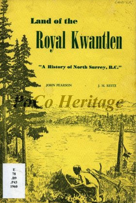
John Pearson and John M. Reitz’s Land of the Royal Kwantlen chronicles the complex historical evolution of North Surrey from an indigenous riverine stronghold to an engineered agricultural extension of metropolitan Vancouver. The narrative maps how the massive, volatile hydrology of the lower Fraser River initially dictated all human activity, forcing both the Kwantlen First Nation and early European pioneers to rely entirely on this dominant aquatic highway for transit and sustenance amidst the dense, impenetrable coastal rainforest. By detailing the arduous pioneer efforts to clear immense timber stands and construct drainage infrastructure across the low-lying alluvial floodplains, the text illustrates how early agrarian colonization was strictly governed by the severe physical realities of the tidal delta. Ultimately, the account demonstrates that artificially stabilizing this dynamic, flood-prone topography and bridging the formidable Fraser watercourse were the absolute prerequisites for integrating this isolated riparian settlement into the broader Pacific seaboard economy. 27 pages 24 cm Desiderata
|
1960 |
|
A brief historical sketch of Port Townsend, Washington by William D. Welsh, Port Townsend Chamber of Commerce, Crown Zellerbach Corporation
William D. Welsh’s A brief historical sketch of Port Townsend, Washington chronicles the dramatic economic arc of a Victorian seaport whose destiny was absolutely dictated by its strategic but isolated marine geography. The narrative maps how the settlement's commanding position on the precipitous northeastern tip of the Olympic Peninsula initially guaranteed immense prosperity, allowing it to monopolize early pioneer commerce as the vital deep-water customs gateway bridging the Strait of Juan de Fuca and the inland sea. However, the text illustrates that the very same rugged, heavily timbered topography that framed the harbor ultimately proved fatal to its metropolitan ambitions, as the impenetrable coastal mountains effectively blocked any viable overland connection to the transcontinental railroad. Ultimately, the account demonstrates how this inescapable geographic isolation forced the bypassed maritime hub to adapt to severe continental detachment, permanently tethering its survival to localized timber and paper extraction industries that could leverage the remaining oceanic highway. 24 pages : illustrations (some color), map ; 21 cm Non-circulating [ 1 ]
|
1959 |
|
A brief history of Waldron Island by Charles H. Ludwig 
HISTORY OF A SEASONAL CAMPING SITE OF THE LUMMI INDIANS. The second edition was published in 1972 in response to requests for copies of the original mimeographed first edition. The preface to the second edition contains some comments on the more recent history of the island and Frederick Marks, one of the very early settlers on Waldron. 44 pages map, table Desiderata
|
1959 |
|
Early Vancouver narratives of pioneers of Vancouver, B.C. by James Skitt Matthews 
James Skitt Matthews’s Early Vancouver chronicles the grueling pioneer efforts to carve a viable metropolitan footprint out of the massive, unyielding temperate rainforests dominating the Burrard Inlet peninsula. The collected narratives map how the sheer biological density of ancient timber stands and the rugged, marshy topography of the coastal shoreline initially strangled overland movement, forcing early settlers to rely exclusively on the sheltered aquatic highway of the deep-water harbor. By detailing the arduous transition from primitive waterfront logging camps to the western terminus of the transcontinental railway, the text illustrates how clear-cutting this imposing vegetation and constructing robust maritime infrastructure were strictly dictated by the region's severe environmental constraints. Ultimately, the account demonstrates that systematically conquering the imposing physical realities of this rain-soaked, heavily forested marine frontier was the absolute prerequisite for anchoring Canada's vital gateway to the Pacific seaboard. 8 volumes : illustrations, maps, plans, portraits ; 24 cm Desiderata
|
1959 |
|
Robert Newell's Memoranda travles in the teritory of Missourie : travle to the Kayuse War : together with A report on the Indians south of the Columbia River by Robert Newell , Dorothy Johansen , Lawton Kennedy (Book designer, Printer), Champoeg Press (Publisher) 
Robert Newell (1807-1868) was an American Mountain Man and 'Doctor' who settled in Oregon and was involved in Indian Affairs of the Oregon Territory. He served as a peace commissioner in the Cayuse War keeping the Nez Perce neutral during the conflict. He settled in Oregon after 1840 and had 3 wives with 16 children and served in the Territorial Government and later the State Government. 159 pages, 2 unnumbered leaves of plates (1 folded) : illustrations, maps ; 27 cm Desiderata
|
1959 |