District of Saanich Capital Regional District, British Columbia
District Municipality (1) - A populated place with legally defined boundaries, incorporated as a district municipality under the provincial Municipal Act. Just N of City of Victoria, Victoria Land District
Mapped Location
District of Saanich: The mapped location is an approximation and should not be used for navigation or wayfinding.
Information
General information on District of Saanich
- Feature Type: Incorporated
Official, historical, colloquial and alternative toponyms for District of Saanich
A brief list of names that this geographic feature has been named
| Name | Description |
|---|---|
| District of Saanich | Official |
Origin Notes and History of District of Saanich
References to District of Saanich that document the origin of its place name
Incorporated 1 March 1906 as The Corporation of the District of Saanich. "Saanich (Municipal District)" adopted in the 18th Report of the Geographic Board of Canada, 31 March 1924, as labelled on BC map 2A, 1914. Re-approved 6 November 1934 on National Defence sheet 1449, Saanich.
"Our word Wsanec in Saanich means 'raised up'. If you go offshore to the east and look [back] you will see why. You'll see what it looks like in the distance compared to the surrounding land. It is 'raised up'." (Saltwater People, as told by David Elliott Sr., ed. Janet Poth; a resource book for the Saanich Native Studies program, School District 63, 1990). Elsewhere in the publication, Wsanec is identified as the name for Saanich Peninsula, meaning 'emerging people', where the name Wsanec comes from the name of the Saanich people (ibid, p.26).
From the Saanich (Straits Salish) word meaning 'elevated' or 'upraised'. The word describes what Mount Newton looked like to [people] approaching by sea from the east - someone lying down with his rump up. Another explanation is that Saanich refers to the appearance of the peninsula when seen through a mirage on a warm summer day. Under such conditions, it indeed looks 'elevated' or 'upraised.'
"I have had repeated requests during the past few years and although we have made every endeavor to trace the meaning, we have not been successful. All we know is that the word designates a local tribe." (John Hosie, Provincial Librarian, 19 March 1934, file 1008386/34275s). "[Indigenous people] I have talked with say that "Fair-land" as used by Victoria Publicity Bureau is not right, yet they do not know the meaning themselves." (H.J. McIntyre, Saanich Peninsula & Gulf Islands Review (file 1007898/34275a).
Related Catalog Titles
A Bibliography for District of Saanich, Capital Regional District, British Columbia
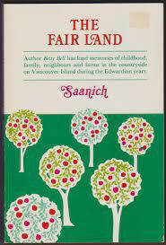
The fair land, Saanich by Betty Bell
Capital Regional District
- Albert Head
- Ardmore
- Bear Mountain
- Beaver Lake
- Beaver Point
- Bedwell Harbour
- Belmont Park
- Braemar Heights
- Brentwood Bay
- Cadboro Bay
- District of Central Saanich
- Colquitz
- City of Colwood
- Cordova Bay
- Deep Cove
- East Sooke
- Township of Esquimalt
- Fairfield
- Fernwood
- Fulford Harbour
- Galiano
- Ganges
- Glen Lake
- Goldstream
- Gordon Head
- Happy Valley
- District of Highlands
- Hope Bay
- James Bay
- Keating
- Lake Hill
- City of Langford
- Leechtown
- Lighthouse Point
- Long Harbour
- Luxton
- Marigold
- Mayne Island
- District of Metchosin
- Millstream
- Milnes Landing
- Montague Harbour
- Musgrave Landing
- North Galiano
- District of North Saanich
- District of Oak Bay
- Otter Bay
- Pender Island
- Port Renfrew
- Port Washington
- Prospect Lake
- River Jordan
- Royal Oak
- District of Saanich
- Saanichton
- Saseenos
- Saturna
- Sevenoaks
- Shirley
- Town of Sidney
- District of Sooke
- Strawberry Vale
- Sturdies Bay
- Swartz Bay
- Tillicum
- Vesuvius
- City of Victoria
- Town of View Royal
- Village Bay
Political Boundaries
Last updated: 2025-09-23