Catalog of British Columbiana and Pacific Northwest Americana
The Encyclopedia Cascadia Catalog indexes mostly non-fiction literature covering the Pacific Northwest coast of North America, with an emphasis on British Columbia, Idaho, Oregon, and Washington State.
| Catalog Title | Published |
|---|---|
|
Moscow at the turn of the century by Homer David 
Moscow at the Turn of the Century offers a detailed local history of a rapidly growing pioneer community nestled within the distinctive, rolling loess hills of the Palouse region in northern Idaho. The narrative anchors the town's early civic and economic development directly to this fertile inland landscape near the Washington border, where rich soils fueled a booming dryland wheat economy. By documenting the physical expansion of the town grid, early local rail connections, and the foundational establishment of the University of Idaho, David traces the transformation of an isolated agricultural outpost into a permanent regional hub. Ultimately, the book provides a grounded geographic portrait of how early settlers adapted to and capitalized on the sweeping, wind-blown topography of this vital inland Pacific Northwest corridor. vii, 86 pages : illustrations ; 22 cm. Non-circulating [ 1 ]
|
1979 |
|
Looking at Indian art of the Northwest Coast by Hilary Stewart 
Bold, inventive and highly graphic, the indigenous art of the Northwest Coast is distinguished by its sophistication and complexity. It is also composed of basically simple elements, which, guided by a rich mythology, create images of striking power. This indispensable and beautifully illustrated book is the first to introduce everyone, from the casual observer to the serious collector of Northwest Coast prints, to the forms, cultural background and structures of this highly imaginative art. The elements of style are introduced; the myths and legends which shape the motifs are interpreted; the stylistic differences between the major cultural groupings are defined and illustrated. Raven, Thunderbird, Killer Whale, Bear: all the traditional forms are here, deftly analyzed by a professional writer and artist who has a deep understanding of this powerful culture. 111 pages : illustrations ; 23 cm Non-circulating [ 1 ]
|
1979 |
|
The colonial postal systems and postage stamps of Vancouver Island and British Columbia, 1849-1871 by Alfred Stanley Deaville 
The colonial postal systems and postage stamps of Vancouver Island and British Columbia, 1849-1871 examines the immense logistical challenges of establishing reliable communication networks across the vast, unforgiving terrains of Canada's westernmost colonial frontiers. Deaville details how early postal routes struggled to penetrate the region's extreme physical barriers, tracking the movement of mail from the isolated maritime hub of Victoria on Vancouver Island through the treacherous, steep-walled canyons of the Fraser River. By mapping the perilous overland express trails that supplied remote gold rush encampments deep within the rugged Cariboo interior, the narrative highlights the profound physical isolation of these early mainland settlements. Ultimately, the book illustrates how the development of early postal infrastructure was a direct, necessary response to the sprawling and mountainous topography that separated this rugged Pacific Northwest outpost from the rest of the world. 210 pages, 8 unnumbered leaves of plates : illustrations ; 24 cm Non-circulating [ 1 ]
|
1979 |
|
Ralph Edwards of Lonesome Lake by Ralph A. Edwards, Ed Gould 
Often called The Crusoe of Lonesome Lake, because of a best-selling book written by the American journalist Leland Stowe, Edwards has gone on to live at least one more life and reveals himself to be a pioneer of a breed that no longer exists. Best known for his almost single-handed rescue of the trumpeter swans from extinction in North America, Edwards now related in his own words other aspects of his long, varied life, including experience with his missionary parents in India, as a telegraph operator under fire in World War I and his eventual return to Lonesome Lake. 293 pages, 20 unnumbered leaves of plates : illustrations (some color) ; 23 cm Non-circulating [ 1 ]
|
1979 |
|
Tales of Richland, White Bluffs & Hanford, 1805-1943, before the atomic reserve by Martha Berry Parker 
From back This book, Tales of Richland, White Bluffs and Hanford, tells the story of these three towns before there was an atomic project. They were farming communities, rich in a wide variety of early bearing fruit, and with a long growing season for vegetables, feed grains and alfalfa hay. The author lived in Richland from 1932 to 1941. Her mother's family, the Charles Sawyers, came to the Fruitvale District in 1909. The Sawyers had a 19-acre farm just upriver from where the Graduate Center is at present (1986), north of Richland's Hanford School. Mrs Parker has a deep interest in Northwest history and has written two other books, Kin-i-wak, Kenewick, Tehe, Kennewick, and Washington, Oregon; a Map History of the Oregon Country. She is also an amateur archaeologist and is actively interested in Geology and Genealogy. 407 pages : illustrations ; 29 cm Non-circulating [ 1 ]
|
1979 |
|
Port Townsend--years that are gone an illustrated history by Peter Simpson, James Hermanson 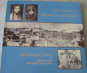
Port Townsend—Years That Are Gone provides a visual and historical chronicle of a maritime boomtown strategically situated at the extreme northeastern tip of Washington’s Olympic Peninsula. The authors detail how the city's exposed location at the turbulent junction of the Strait of Juan de Fuca and Admiralty Inlet dictated its early development, physically dividing the settlement between a bustling deepwater commercial waterfront and a residential district built atop steep coastal bluffs. By examining the ornate Victorian architecture constructed during its prosperous peak, the narrative demonstrates how the town's ultimate geographic isolation—surrounded by marine waterways and backed by rugged mountains—thwarted vital railroad connections and abruptly halted its expansion. Ultimately, the book captures the physical legacy of this unique seaport, mapping its rapid late-nineteenth-century boom and sudden bust directly onto the dramatic coastal topography of the Pacific Northwest. iii, 192 pages : illustrations ; 21 x 22 cm Non-circulating [ 1 ]
|
1979 |
|
Indian tribes of Washington, Oregon & Idaho by John Reed Swanton
Indian tribes of Washington, Oregon & Idaho provides a comprehensive ethnographic and geographic catalog of the Indigenous peoples who inhabited the vastly diverse environments of the inland and coastal Pacific Northwest. Swanton meticulously maps the historical territories of these tribes against the region's formidable topography, contrasting the marine-oriented cultures sustained by the resource-rich estuaries and temperate rainforests of the Pacific seaboard with the riverine societies dependent upon the massive Columbia and Snake River watersheds. The narrative further details how the severe geographic divides of the Cascade Range and the rugged Bitterroot Mountains dictated distinct seasonal migration routes and trade networks across the semi-arid inland plateaus. By anchoring specific tribal lineages and linguistic groups to precise river confluences, coastal bays, and mountain valleys, the book vividly illustrates how the deep physical contours of the region inherently shaped the cultural borders and survival strategies of its earliest inhabitants. 81 pages ; 23 cm Non-circulating [ 1 ]
|
1979 |
|
Salmon fishers of the Columbia by Courtland L. Smith 
Salmon Fishers of the Columbia provides a comprehensive historical study of the commercial fishing industry that dominated the massive, fast-flowing waterway forming the border between Washington and Oregon. The author details how the river's diverse physical environments—from the treacherous, storm-battered estuary at the Pacific Ocean to the steep, rocky rapids of the inland gorge—dictated highly specialized harvesting methods like gillnetting, seining, and the use of massive fish wheels. By anchoring the narrative to specific shifting sandbars and turbulent river channels, Smith illustrates how intense industrial competition ultimately clashed with the physical transformation of the basin through sweeping hydroelectric dam projects. Ultimately, the book serves as an environmental and geographic history, documenting how the relentless power and rich aquatic ecosystems of the Pacific Northwest’s largest river shaped generations of maritime livelihood before the natural waterway was permanently altered. ix, 117 pages : illustrations, charts, maps, portraits ; 29 cm Non-circulating [ 1 ]
|
1979 |
|
The making of Oregon a study in historical geography by Samuel Newton Dicken, Emily F. Dicken
|
1979 |
|
Grassroots a history of Lumby and district by Lumby Historians
The Lumby Historians’ Grassroots: A History of Lumby and District provides a comprehensive local and spatial record of the eastern valleys situated between Vernon and the Monashee foothills. The volume documents the early settlement of "White Valley" (later renamed Lumby after pioneer Moses Lumby), detailing how early French-Canadian and European pre-emptors cleared dense cedar and hemlock bottomlands to establish dairy farms and cattle spreads across Creighton Valley, Trinity Valley, and Blue Springs. The text traces the development of independent sawmill camps, regional rail links via the Canadian National Railway, and the construction of the early twentieth-century hydroelectric generating station at Shuswap Falls. Richly supported by property cadastrals, one-room schoolhouse records, and pioneer recollections, the chronicle captures the everyday realities of rural community formation. 312 pages : illustrations, maps, portraits ; 29 cm Desiderata
|
1979 |
|
Overlanders the Cassiar gold rush by Richard Thomas Wright
Richard Thomas Wright’s Overlanders: The Cassiar Gold Rush examines the 1870s placer gold rush that opened the remote plateau between the Stikine River and Dease Lake. Wright chronicles how prospectors ascended the Stikine River to Telegraph Creek before traversing the rugged overland pack trail to Dease Lake, establishing boomtown settlements along Thibert, Dease, and McDame creeks. The narrative details the boom years of Laketon, Centreville, Defot, and Porter Landing, exploring the significant presence of Chinese miners and merchants who reworked claims and sustained local commerce. Wright also outlines the subsequent establishment of Hudson's Bay Company trading posts and early government administration in the subarctic interior. 64 pages : illustrations, maps, portraits ; 28 cm Desiderata
|
1979 |
|
Summer of promise Victoria 1864-1914 by Derek Pethick 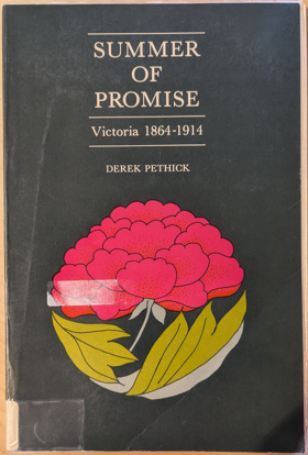
In 1864 Governor James Douglas handed over his office to Arthur Edward Kennedy, closing an era in Vancouver Island's history and ushering in a period of growth and development. The optimism felt by its people was to a large extent justified; the ensuing years were to bring stability, prosperity and many changes. In Summer of Promise, a sequel to Victoria: The Fort, the author chronicles the years from 1864 to the outbreak of World War One in 1914, seeing them through the eyes of the inhabitants of the city which was the capital of the colony and later of the province. Despite its geographical isolation, its population remained well aware of world events: the Boer War, the death of Queen Victoria, the ascension of Edward VII to the throne and the rising threat of the German navy were as much talked about as the waning of many traditional religious beliefs and the enfranchisement of women. Nearer home, these were important years for Victoria as the colony voted to join the Dominion of Canada, the railroad connected the new province with the rest of the country, and the "All Red Route" linked it by steamship to Australia and the Orient. Motorcars, aeroplanes, telephones, the telegraph and electricity brought British Columbia into the twentieth century. From the momentous to the mundane, and sometimes even to the ridiculous, Derek Pethick documents an era in Victoria's history. Summer of Promise is enlightening, fascinating and enjoyable reading. 191 pages, 8 unnumbered leaves of plates : illustrations ; 23 cm Non-circulating [ 1 ]
|
1980 |
|
Heritage of the Wallowas life as it was by Ethel Halsey Scott 
Ethel Halsey, daughter of Bill Halsey (born 1873) and Vergie Bell Pinkley (born 1886), was born in the early 1900s. She tells of her life with her husband, Noel Scott, and her children and extended family and friends and neighbors, weaving these with the history of the Wallowa, Oregon area iii, 153 pages : illustrations ; 23 cm Non-circulating [ 1 ]
|
1980 |
|
Oregon Coast Range wilderness by Sherry Wellborn
|
1980 |
|
Early churches of Washington State by Arnold Pearson, Esther Pearson 
Author is an alumnus of Evanston Township High School, class of 1932 ix, 182 pages : illustrations, map ; 27 cm Non-circulating [ 1 ]
|
1980 |
|
The Nootka connection Europe and the Northwest coast, 1790-1795 by Derek Pethick 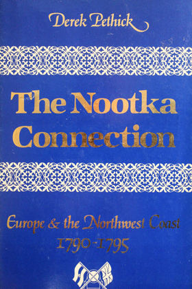
Derek Pethick’s The Nootka Connection: Europe and the Northwest Coast, 1790–1795 chronicles the intense diplomatic, naval, and commercial maneuvers between Great Britain and Spain following the Nootka Crisis, which transformed the Pacific Northwest coastline into an arena of competing imperial claims. Centered on the pivotal diplomatic anchorage of Yuquot (Friendly Cove) and radiating through the Strait of Juan de Fuca, the Strait of Georgia, and Haida Gwaii, the volume documents how British and Spanish naval expeditions systematically superimposed European toponymy and sovereign boundary lines over the maritime territories of the Nuu-chah-nulth, Coast Salish, and Haida nations. Pethick details the delicate frontier logistics of this naval presence, demonstrating that sustained reconnaissance by commanders like George Vancouver and Juan Francisco de la Bodega y Quadra remained profoundly reliant on negotiated trade alliances and navigational intelligence provided by hereditary leaders such as Chief Maquinna and Wickaninnish. Ultimately, the work captures the transitional era when multilateral imperial treaties and maritime fur trade corridors laid the foundational cartographic framework that paved the way for Euro-American colonial settlement across the Pacific slope. 281 pages : illustrations, maps ; 24 cm Non-circulating [ 1 ]
|
1980 |
|
Pioneers of North Central Washington by Eva Greenslit Anderson
|
1980 |
|
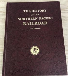
The history of the Northern Pacific Railroad by Louis T. Renz
|
1980 |
|
Seattle's black Victorians, 1852-1901 by Esther Hall Mumford 
"...looks at black life in 19th century Seattle from many angles. The combination of newspaper files, county records, and oral history gives a density to the historical picture." John Berry, Seattle Sun -- Back cover 235 pages : illustrations, facsimiles, map, portraits ; 22 cm Desiderata
|
1980 |
|
Strangers in blood fur trade company families in Indian country by Jennifer S. H. Brown 
Describes the social world of the traders in the 18th and 19th centuries. Examines differences between the North West Company and the Hudson's Bay Company and their effects on Indian-white relations xxiii, 255 pages, 6 unnumbered leaves of plates : illustrations (some color) ; 24 cm Desiderata
|
1980 |
|
The Northern Shoshoni by Brigham D. Madsen 
Brigham D. Madsen examines four distinct groups which comprise the Northern Shoshoni, focusing on the tribe since the arrival of the first white settlers. He describes the early days on the reservation and the tribe’s struggle to adapt to massive cultural changes. 259 pages : illustrations ; 29 cm Desiderata
|
1980 |
|
Point Roberts, U.S.A. the history of a Canadian enclave by Richard Eugene Clark , Runa Thordarson (Photographer), Robert B. Lindquist (Contributor) 
When the June 15, 1846 Treaty of Washington was signed by representatives of the United States and Great Britain, it established the forty-ninth parallel of north latitude as the boundary to the middle of the channel which separates the North American continent from Vancouver Island. That decision, probably unknowingly, left a small piece of real estate below the line but isolated by marine waters from the rest of United States / Washington land. That promontory subsequently became known as Point Roberts, a unique and interesting community, greatly influenced by Canada but fiercely American. Point Roberts is a story of political and geographic accident; it is also a story of the people who settled there, who fished and farmed, who lived under difficult circumstances and isolation. It is a chronicle of good times and bad, rising expectations and tragic events. It includes the efforts of people to create social and cultural institutions to solve their problems and to pass their culture on from one generation to the next — governmental units, churches, schools, water districts, even a cemetery. Point Roberts is also a study of two nations and their people facing off, sharing, trying to learn how to live together. That chapter still is not complete, nor is the history of Point Roberts. But its history has begun, and we are indebted to Richard Clark for gathering the existing bits and pieces to date together in this book. It teaches some valuable lessons — that human perseverance can overcome adversity, that human institutions and social inventions do advance a people, and that Point Roberts is an extremely interesting and valuable part of Washington State and the United States of America. viii, 137 pages : illustrations ; 23 cm Desiderata
|
1980 |
|
Fort Walla Walla Museum the story of how a determined and dedicated community built their museum to tell their region's history by Vance Orchard, Walla Walla Valley Pioneer and Historical Society 
Vance Orchard’s Fort Walla Walla Museum: the story of how a determined and dedicated community built their museum to tell their region's history chronicles the grassroots civic effort to preserve the agricultural, military, and pioneer heritage of the Inland Northwest. Set in a fertile valley that served as a vital crossroads for the Walla Walla, Cayuse, and Umatilla peoples long before Euro-American settlement, the text details how local historians and volunteers relied on strong community bonds and interdependent alliances to construct a massive repository of frontier artifacts. Orchard documents the cooperative labor required to physically relocate and restore nineteenth-century pioneer cabins, early agricultural equipment, and military structures, implicitly revealing how these early settler footprints were originally mapped directly onto the region's ancient indigenous trade networks and overland trails. Ultimately, this institutional history serves as a testament to collective civic dedication, demonstrating how a modern rural community actively curated and memorialized the complex, overlapping geographic legacy of the Walla Walla Valley. 47 pages : illustrations, portraits ; 22 cm Desiderata
|
1980 |
|
The Court years, 1939-1975 the autobiography of William O. Douglas by William O. Douglas 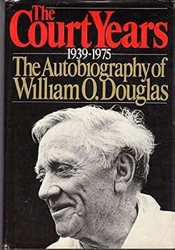
William O. Douglas served on the Supreme Court of the United States for over 36 years, from 1939 to 1975, the longest term of any Justice. His tenure was marked by an unyielding and brilliantly executed determination to- as he frequently put it- "keep the government off the backs of the people." Together with Hugo Black, Justice Douglas was responsible for many of the Supreme Court decisions which extended the protection of the Due Process Clause of the Constitution; limited the power of the large corporations; protected the maverick and the dissident from government harassment; extended and guarded the civil rights of blacks, of women and of other minorities; safeguarded American public lands and resources from those who would plunder them ... and on ... and on. He wrote more dissenting opinions (and wrote them faster) than any other Justice, and yet many of those dissents were later reflected in legislation or else in the majority opinions of the Court itself. Timely, newsworthy, historically important, This book is the personal record of that great lifelong struggle. It continues the memoirs Justice Douglas began so eloquently in his best-selling 'Go East, Young Man.' For the first time in the history of the Supreme Court, one of the Justices- himself- has set about to give the judicial history of the great issues of American life and to show how these issues were dealt with in the Conference Room and "among the Brethren." With a deep understanding of the Court process, with a pungent wit and an intimate knowledge both of the law and of those who interpreted it, Douglas reveals the Supreme Court as it has never been seen before. -- from Book Jacket xi, 434 pages, 8 unnumbered leaves of plates : illustrations ; 24 cm Desiderata
|
1980 |
|
Bloomington, Idaho a history of the town and its people by Bloomington Historical Committee
The Bloomington Historical Committee’s Bloomington, Idaho: A History of the Town and Its People records the founding, spatial arrangement, and family histories of one of the earliest Mormon settlements in the Bear Lake Valley. Settled in the spring of 1864 along Bloomington Creek, the text documents the communal surveying of farm plots, the construction of log meetinghouses, and the establishment of water rights that supported grain cultivation and cattle husbandry. The narrative chronicles the operation of early shingle mills and limestone quarries in Bloomington Canyon, recording community cultural activities, brass bands, and cooperative livestock herds. Comprehensive genealogical sections and property registers preserve the social and economic fabric linking Bloomington to its neighboring settlements in Paris and St. Charles. vi, 242 pages : illustrations, maps, portraits ; 28 cm Desiderata
|
1980 |