Catalog of British Columbiana and Pacific Northwest Americana
The Encyclopedia Cascadia Catalog indexes mostly non-fiction literature covering the Pacific Northwest coast of North America, with an emphasis on British Columbia, Idaho, Oregon, and Washington State.
| Catalog Title | Published |
|---|---|
|
Cottardi Station, Wahkiakum County, Washington by Carlton E. Appelo 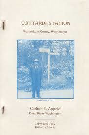
By Carlton Appelo: Whenever the local phone book was printed there was always a wonderful historical book in the back. This one is about Cottardi Station, Washington located on the north side of the Columbia River near Altoona. Now just a memory not even a Ghost Town. 80 pages : illustrations ; 24 cm Non-circulating [ 1 ]
|
1980 |
|
The Magnificent distances early aviation in British Columbia, 1910-1940 by Dennis Duffy, Carol Crane, David N. Parker, Paul Stoddart 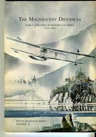
The Magnificent Distances: Early Aviation in British Columbia, 1910-1940 chronicles the pioneering era of flight across the vast, challenging terrains of Canada's westernmost province. The narrative heavily focuses on how early bush pilots and commercial aviators navigated the formidable Coast Mountains, the remote northern wilderness, and the jagged Pacific coastline to connect isolated frontier communities. By documenting historical flights out of early coastal hubs like Vancouver and Victoria into the resource-rich but deeply inaccessible coastal inlets and interior valleys, the authors highlight the critical role aircraft played in overcoming the region's immense geographic barriers. Ultimately, the book illustrates how these daring aviation efforts transformed the widely scattered settlements of British Columbia, effectively bridging the "magnificent distances" of the province's incredibly rugged topography. ii, 78 pages : illustrations, maps ; 26 cm. Non-circulating [ 1 ]
|
1980 |
|
Follow the pathfinders through the Okanogan and Ogopogoland to the Shuswap by George Bechtold
|
1980 |
|
Exploring the southern Selkirks including the Valhallas and Kokanee Glacier Provincial Park by John Carter, Douglas Leighton 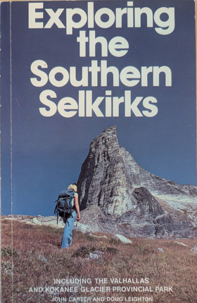
Exploring the Southern Selkirks serves as a comprehensive visual and geographic guide to the rugged, glaciated landscapes of the West Kootenay region in southeastern British Columbia. The authors focus extensively on the steep granite peaks of Valhalla Provincial Park and the pristine alpine environments found within Kokanee Glacier Provincial Park. Through detailed descriptions, the book captures the remote, mountainous terrain that defines the southern Selkirk range, an area characterized by dramatic elevation changes and deep river valleys. By highlighting these specific wilderness areas, the work illustrates the profound natural beauty and challenging topography that draw backcountry explorers to this distinct inland mountain corridor. 119 pages : illustrations, maps ; 22 cm Non-circulating [ 1 ]
|
1980 |
|
So they called the town "Concrete" a story of life and times in unique Concrete, Washington by Charles M. Dwelley 
Concrete, as a town, had a colorful and interesting history and those who took part even briefly never forgot "those old days in Concrete." Some of the itinerant workers who arrived with the building of the railroad in 1900 - Italians, Swedes, Norwegians, Greeks from the old country; plus Northerners, Southerners, Easterners of all nationalities remained to become accorded an unusual acceptance and welcome that made them feel at home. Many who came for a short employment stayed on to marry and settle in, and lived to be buried here as old-timers. It was that kind of town. If you want to know the rest of the story, read on. 134 pages : illustrations ; 21 cm Non-circulating [ 1 ]
|
1980 |
|
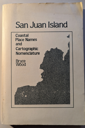
San Juan Island coastal place names and cartographic nomenclature by Bryce Wood, Washington State Historical Society
|
1980 |
|
Coyote was going there Indian literature of the Oregon country by Jarold Ramsey (Compiler, Editor) 
The vivid imagination, robust humor, and profound sense of place of the Indians of Oregon are revealed in this anthology, which gathers together hitherto scattered and often inaccessible legends originally transcribed and translated by scholars such as Archie Phinney, Melville Jacobs, and Franz Boas. xxxvii, 295 pages : illustrations ; 24 cm Desiderata
|
1980 |
|
William H. Gray, journal of his journey East, 1836-1837 by W. H. Gray, Donald R. Johnson
|
1980 |
|
Barkerville by Richard Thomas Wright 
Richard Thomas Wright’s Barkerville provides a comprehensive historical and spatial account of the urban and commercial capital of the Cariboo Gold Rush along Williams Creek. Wright traces how the discovery of rich placer gold deposits by Billy Barker in 1862 catalyzed the rapid construction of an extensive wooden mining town directly within the mountain watershed long navigated by Indigenous peoples. The work examines the engineering of massive wooden flumes, water wheels, and drift shafts, detailing the catastrophic fire of 1868 and the town’s swift Victorian reconstruction. Wright highlights the vital role of Chinese merchants, laundry operators, and miners who formed an enduring Chinatown community along Williams Creek, tracing how this remote gold metropolis weathered eventual resource depletion to become an internationally recognized provincial historic site. 124 pages : illustrations (some color), maps ; 28 cm Desiderata
|
1980 |
|
Cherryville a history of the community by Laura Langstaff
Laura Langstaff’s Cherryville: A History of the Community documents the historical geography of Cherryville and the rugged Monashee mining corridor along the upper Shuswap River drainage. Originally established as "Cherry Creek" following the 1860s discovery of placer gold, the chronicle traces how prospectors and pack trains carved precarious trails through dense mountain forests to reach the high-elevation Monashee Pass. Langstaff examines the transition from speculative placer workings to hard-rock quartz mining operations, detailing how depleted claims gave way to family dairy homesteads, cedar pole camps, and independent sawmilling outfits. The narrative highlights the resilient community networks that sustained isolated settlement pockets across Blue Springs, Creighton Valley, and the river reaches surrounding Shuswap Falls. 88 pages : illustrations, maps, portraits ; 23 cm Desiderata
|
1980 |
|
The Atlin gold rush by Ronald Johnson
Ronald Johnson’s The Atlin Gold Rush chronicles the sudden northward diversion of stampeders to extreme northwestern British Columbia during the 1898 Klondike stampede. Johnson documents how initial placer discoveries by Fritz Miller and Kenneth McLaren on Pine Creek triggered the immediate platting of the Atlin townsite directly along ancestral Taku River Tlingit lands. The text traces the establishment of early commercial avenues, recording the installation of massive hydraulic flumes, ditch networks, and floating dredge infrastructure that re-engineered the drainage systems of Pine, Spruce, and McKee creeks. Johnson details the social development of the frontier community through boom and decline, documenting the growth of satellite mining camps at Surprise and Boulder City and the lake transport docks at Scotia Bay that sustained the district’s industrial extraction. 88 pages : illustrations, maps, portraits ; 23 cm Desiderata
|
1980 |
|
Southern Idaho ghost towns by Wayne C. Sparling 
When mineral riches were found in Idaho an explosion of development erupted and quickly died away. Here is a guide to eighty-four of Idaho s most interesting ghost towns, describing the history of Idaho s mining boomtowns and their eventual demise. Descriptions are organized by region and provide the current state of preservation. Both wilderness explorers and armchair travelers will be delighted with the treasures to be found. 135 pages : illustrations ; 23 cm Non-circulating [ 1 ]
|
1981 |
|
Mark the wind's power a novel by George R. Cerveny
|
1981 |
|
Captains, curates, and cockneys the English in the Pacific Northwest by Frank L. Green, Bruce Le Roy (Writer of introduction)
|
1981 |
|
Historical atlas map of Marion & Linn Counties, Oregon by Edgar Williams & Co
|
1981 |
|
Ashland the first 130 years by Marjorie O'Harra
|
1981 |
|
Log of the Union John Boit's remarkable voyage to the Northwest Coast and around the world, 1794-1796 by John Boit, Edmund Hayes, Hewitt R. Jackson 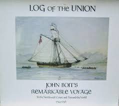
xxxvii, 136 pages, 1 unnumbered leaf of plates : illustrations (some color) ; 26 x 29 cm. Non-circulating [ 1 ]
|
1981 |
|
Colfax 100 plus by Edith E. Erickson
|
1981 |
|
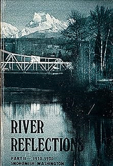
River reflections Part II - 1910 - 1980 by Snohomish Historical Society
|
1981 |
|
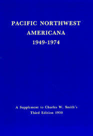
Pacific Northwest Americana, 1949-1974 a supplement to Charles W. Smith's third edition 1950 by Richard E. Moore, Nadine H. Purcell, Charles W. Smith, Pacific Northwest Library Association Committee on the Smith Bibliography Supplement
|
1981 |
|
The life of a cranberry grower by Ethel Kranick Reichenbach 
Ethel Kranick Reichenbach’s memoir, The life of a cranberry grower, documents the twentieth-century agricultural development and family-scale enterprise that established Bandon, Oregon, as the cranberry capital of the southern Oregon coast. The narrative traces the physical engineering of the coastal terrace—specifically the diking, ditching, and sanding of acidic peat bogs—which superimposed intensive commercial berry agriculture directly onto the wetland ecosystems, estuaries, and seasonal gathering grounds stewarded by the Coquille and Miluk Coos peoples. Reichenbach details the exacting logistics of coastal wetland farming, illuminating how isolated growers managed frost mitigation, intricate water-fluming systems, and labor-intensive seasonal harvesting while building cooperative marketing networks to access distant urban distribution channels. Ultimately, the work illustrates how specialized hydrological manipulation and community resourcefulness transformed an ecologically delicate coastal dune landscape into an enduring commercial monoculture on the Pacific slope. 70 pages : illustrations ; 21 cm Non-circulating [ 1 ]
|
1981 |
|
|
1981 |
|
Oceanography of the British Columbia coast by Richard E. Thomson 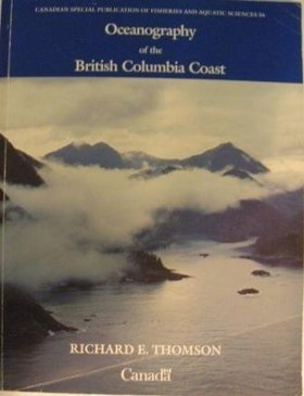
This book deals with the physical aspects of the sea as exemplified by the Pacific Ocean and the contiguous waters of the British Columbia coast. Although principally devoted to waves, currents and tides, the book spans a broad spectrum of topics ranging from meteorology and marine biology to past and present marine geology. It attempts to elucidate the nature of oceanic motions and to relate them to everyday experience for the general interest of the casual reader and for the practical benefit of the professional mariner, scientist, or engineer xii, 291 pages : illustrations ; 28 cm Non-circulating [ 1 ]
|
1981 |
|
San Juan Papers by John N. Rupp
|
1981 |
|
The Kerry line the Columbia & Nehalem River Railroad by Donald A. Davis
Donald A. Davis’s The Kerry Line: The Columbia & Nehalem River Railroad documents the engineering and operation of one of the Pacific Northwest’s most famous heavy-tonnage logging common carriers. Davis chronicles how lumberman A.S. Kerry constructed a 27-mile standard-gauge railroad beginning in 1913, driving track from the deep-water log dumps at Kerry on the Columbia River, over the Coast Range summit via a timber tunnel, and down into the Nehalem Valley. The text details the transportation of billions of board feet of virgin old-growth fir logs hauled by massive Mallet and geared locomotives from remote logging spurs at Keasey, Neverstill, Treharne, and Kyser. Davis illustrates the hazardous engineering challenges of maintaining steep trestles, managing runaway log trains, and sustaining isolated worker camps that operated until the timber was cut out in the late 1930s. 120 pages : illustrations, maps ; 28 cm Desiderata
|
1981 |