Catalog of British Columbiana and Pacific Northwest Americana
The Encyclopedia Cascadia Catalog indexes mostly non-fiction literature covering the Pacific Northwest coast of North America, with an emphasis on British Columbia, Idaho, Oregon, and Washington State.
| Catalog Title | Published |
|---|---|
|
The H.W. McCurdy marine history of the Pacific Northwest, 1966-1976 by H. W. McCurdy, Gordon R. Newell, Seattle Historical Society 
The H.W. McCurdy Marine History of the Pacific Northwest, 1966-1976 chronicles the late-twentieth-century industrial evolution of maritime commerce and shipping across the sprawling, interconnected inland waterways and treacherous coastal corridors of the Pacific seaboard. Newell and McCurdy detail how the region’s formidable aquatic topography—spanning the deep, protected anchorages of Puget Sound to the storm-battered, shifting sandbars of the Columbia River and the perilous tidal narrows of the Inside Passage—strictly dictated the engineering of specialized tugs, expansive ferry networks, and massive commercial vessels designed to conquer the sheer scale of the North Pacific. By mapping the rapid modernization of regional port infrastructure and the absolute reliance of remote island communities on marine transit to bridge vast expanses of open water, the narrative highlights the relentless logistical efforts required to navigate and extract wealth from this unforgiving marine environment safely. Ultimately, this encyclopedic record serves as a deeply localized spatial history, demonstrating how the complex, demanding hydrography of the Pacific Northwest inherently shaped the enduring resilience of its maritime industries and maintained the physical lifeline of its coastal frontier. lvii, 36-255 pages : illustrations ; 34 cm Non-circulating [ 1 ]
|
1977 |
|
Navigating the coast a history of the Union Steamship Company by Peter Chapman, John Haskell Kemble (Donor), Provincial Archives of British Columbia 
Navigating the Coast: A History of the Union Steamship Company chronicles the vital maritime lifeline that sustained isolated industrial and pioneer communities scattered along the rugged, deeply indented seaboard of British Columbia. Chapman details how the region's formidable physical barriers—specifically the towering, impenetrable slopes of the Coast Mountains that plunge directly into the sea—rendered overland transportation virtually impossible, forcing early canneries, logging camps, and Native villages to rely absolutely on the ocean for survival and commerce. By mapping the intricate, dangerous routes of the Union fleet through the treacherous tidal narrows, fog-bound fjords, and storm-battered straits of the Inside Passage, the narrative highlights the immense navigational skill required to maintain this precarious coastal network. The complete dependence on these coastal steamers for freight, mail, and human movement underscores the profound geographic isolation of these remote water-bound outposts. Ultimately, this historical record serves as a deeply localized spatial history, demonstrating how the unforgiving marine topography and sheer vertical extremes of the Pacific Northwest coast inherently dictated the absolute necessity of a specialized maritime infrastructure to conquer the rugged coastal frontier. 77 pages : illustrations, color map ; 27 cm. Non-circulating [ 1 ]
|
1977 |
|
Sawtooth tales by Dick D'Easum, John Collias, Ernest Day 
Dick d'Easum fist glimpsed Idaho's Sawtooth Mountains when he was a boy, and it was love at first sight. D'Easum spent his life getting better acquainted with the mountains. He collected stories of the people, history, and legends of the region for more than fifty years. xii, 281 pages, [1] folded leaf of plates : illustrations, color map, portraits ; 23 cm Non-circulating [ 1 ]
|
1977 |
|
The Indians of western Oregon this land was theirs by Stephen Dow Beckham, Christina Romano
The Indians of western Oregon: this land was theirs examines the deep ecological integration and subsequent tragic dispossession of Indigenous populations across the diverse, resource-rich landscapes situated between the Pacific Ocean and the towering Cascade Range. Beckham details how the region’s complex topography—ranging from the storm-battered, deeply indented estuaries of the Pacific coastline to the fertile, sweeping oak savannas of the Willamette, Umpqua, and Rogue river valleys—strictly dictated Native settlement patterns and intricate seasonal subsistence cycles. By mapping the sophisticated use of controlled inland burns to manage camas prairies and the absolute reliance on dense cedar forests and turbulent aquatic networks for plank-house architecture and maritime travel, the narrative highlights how these communities masterfully engineered their lifeways to fit the specific contours of the environment. Furthermore, the book illustrates how the sudden influx of overland pioneers systematically shattered this ancient spatial relationship, forcibly stripping tribes of these critical geographic hubs and confining them to isolated, marginal reservations. Ultimately, this vital ethnohistorical record serves as a deeply localized spatial history, demonstrating how the rich hydrography and profound natural abundance of the Pacific Northwest inherently shaped the enduring cultures of Western Oregon's first peoples prior to their severe geographic displacement. vii, 236 pages : illustrations ; 27 cm Non-circulating [ 1 ]
|
1977 |
|
Bugles in the valley Garnett's Fort Simcoe by Heister Dean Guie
Through such rolling hills and prairies, over rocks and across valleys with views of cascade peaks, army troops and indians evaded and confrtoned each other during the Yakima War that brought Fort Simcoe's begining viii, 196 pages : illustrations ; 23 cm Non-circulating [ 1 ]
|
1977 |
|
Years plowed under by Leo F. Vogel
Years plowed under chronicles the grueling agricultural transformation and precarious pioneer settlement across the arid, sweeping expanse of the Columbia Basin in eastern Washington. Vogel details how the region's formidable environmental constraints—specifically the profound lack of surface water, sweeping sagebrush steppes, and the severe rain shadow of the Cascade Range that defined the Connell area—strictly dictated the margins of early dryland farming and human survival. By mapping the decades-long struggle of these isolated communities and their eventual salvation through the massive hydrological engineering of the Columbia Basin Project, the narrative highlights the immense physical labor required to carve a permanent agrarian economy from this unforgiving inland desert. The utter lack of natural precipitation initially forced homesteaders into a fragile existence of seasonal boom and bust, eventually requiring an absolute dependence on massive federal irrigation networks to forcibly convert the arid landscape into a controlled, highly productive agricultural grid. Ultimately, this compilation of pioneer experiences serves as a deeply localized spatial history, demonstrating how the severe climatic extremes and vast, open topography of the Pacific Northwest's inland frontier inherently shaped the fiercely resilient character of its farming communities. 167 pages : illustrations ; 24 cm Non-circulating [ 1 ]
|
1977 |
|
Horse Heaven Hills their lengthening shadows by Harry Stanley Ganders
Horse Heaven Hills: their lengthening shadows chronicles the grueling agricultural settlement and precarious pioneer existence atop the vast, rolling ridge system that dominates the arid landscape of south-central Washington. Ganders details how the region's formidable environmental constraints—specifically the profound lack of surface water, the relentless winds, and the sweeping, semi-arid bunchgrass steppes situated deep within the rain shadow of the Cascade Range—strictly dictated the margins of human survival. By mapping the immense physical labor required to carve expansive dryland wheat farms from this massive topographical divide, the narrative highlights how the utter lack of natural hydrography initially forced homesteaders into the punishing daily routine of hauling water over steep, rugged terrain from distant rivers or deep canyons. The profound geographic isolation of these high plains from the more easily irrigated valleys below mandated an absolute, uncompromising self-sufficiency among its earliest inhabitants. Ultimately, this historical record serves as a deeply localized spatial history, demonstrating how the severe climatic extremes and vast, waterless topography of this inland Pacific Northwest frontier fundamentally shaped the fiercely resilient, agrarian character of the Horse Heaven communities. v, 268 pages : illustrations, maps ; 23 cm Non-circulating [ 1 ]
|
1977 |
|
The management of small history museums by Carl E. Guthe, American Association for State and Local History
The management of small history museums outlines the critical curatorial framework required to systematically preserve the localized material culture of pioneer settlement and environmental adaptation across geographically isolated frontiers like the Pacific Northwest. Guthe details how the profound physical isolation of remote communities—whether situated in heavily timbered coastal valleys, deepwater maritime ports, or arid inland deserts—necessitates the rigorous, localized archiving of regional history before it is lost to time and decay. By mapping the precise administrative and cataloging standards needed to curate the heavy tools of resource extraction, maritime navigation, and grueling overland travel, the manual highlights how these small, independent repositories function as the primary guardians of spatial history. The book illustrates that effectively managing these local collections is essential to anchoring a community's identity to its specific, often unforgiving landscape. Ultimately, this foundational museological text serves as a vital methodological guide, demonstrating how the disciplined preservation of physical artifacts is absolutely necessary to document the immense human labor required to conquer the formidable topography and severe environmental extremes of the regional frontier. 78 pages ; 23 cm Non-circulating [ 1 ]
|
1977 |
|
Voyages of enlightenment Malaspina on the Northwest coast, 1791-1792 by Thomas Vaughan, E. A. P. Crownhart-Vaughan , Mercedes Palau Baquero 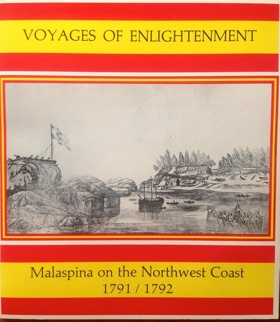
Voyages of Enlightenment: Malaspina on the Northwest Coast, 1791-1792 chronicles the ambitious Spanish maritime expedition tasked with charting the complex, glaciated shorelines and intricate archipelagos of the extreme Pacific seaboard. Vaughan, Crownhart-Vaughan, and Palau Baquero detail how the region's formidable hydrographic barriers—specifically the labyrinthine fjords, treacherous tidal narrows, and towering coastal mountains stretching from Alaska's Yakutat Bay to Vancouver Island's Nootka Sound—severely tested the navigational limits of eighteenth-century explorers searching for a mythical transcontinental waterway. By mapping the expedition's rigorous scientific, botanical, and ethnographic surveys, the narrative highlights the immense logistical effort required to visually and scientifically document a rugged marine environment dominated by impenetrable coastal rainforests and massive alpine ice fields. Furthermore, the account underscores the deep spatial relationship between the Indigenous Tlingit and Nuu-chah-nulth peoples and their water-bound world, illustrating how Native communities had long mastered the precarious coastal topography that European empires were merely struggling to chart. Ultimately, this detailed historical and visual record serves as a vital spatial history, demonstrating how the unforgiving, deeply carved maritime geography of the Pacific Northwest fundamentally shaped the limits of European imperial expansion and Enlightenment-era scientific inquiry on the remote frontier. viii, 61 pages : illustrations ; 23 cm. Non-circulating [ 1 ]
|
1977 |
|
Westward to Alki the story of David and Louisa Denny by Gordon R. Newell
Westward to Alki: the story of David and Louisa Denny chronicles the grueling overland migration and foundational pioneer settlement of the dense, rain-drenched coastal basin of Puget Sound. Newell details how the region's formidable physical barriers—an unbroken, towering expanse of old-growth timber extending to the very edge of the tidal flats—strictly dictated the precarious survival of Seattle's earliest founders. By mapping the Denny party's initial, desperate winter encampment on the storm-battered, exposed shores of Alki Point and their subsequent, strategic relocation to the deeper, protected anchorages of Elliott Bay, the narrative highlights the immense physical labor required to carve a permanent foothold in this unforgiving maritime environment. The utter lack of viable overland routes forced these early homesteaders into a complete reliance on the deepwater highway of the Sound, immediately anchoring their economic survival to the arduous extraction of coastal timber for marine export. Ultimately, this biographical record serves as a deeply localized spatial history, demonstrating how the severe winter climate and heavily forested, deeply indented aquatic topography of the Pacific Northwest inherently forged the resilient, strictly maritime-dependent origins of Washington's central metropolis. [6], 122 pages : illustrations, coat of arms, maps, portraits ; 26 cm Non-circulating [ 1 ]
|
1977 |
|
The Siletz Indian Reservation, 1855-1900 by William Eugene Kent, Lincoln County Historical Society (Lincoln County, Or) 
The Siletz Indian Reservation, 1855-1900 examines the forced geographic consolidation and subsequent survival of diverse Indigenous populations relocated to the rugged, heavily timbered coastal mountains of central Oregon. Kent details how the region's formidable physical barriers—specifically the steep, densely forested slopes of the Coast Range and the isolated, storm-battered Pacific shoreline—were intentionally utilized by the federal government to strictly dictate the confinement and marginalization of these displaced tribes. By mapping the arduous logistical realities of confining multiple distinct coastal and inland cultures within the remote, rain-drenched Siletz River basin, the narrative highlights the immense physical and cultural endurance required to adapt traditional subsistence practices to this highly restricted environment. The absolute geographic isolation of the Siletz Valley served to physically sever Native communities from their ancestral homelands across Western Oregon and Northern California, while the difficult, mountainous terrain severely limited the viability of the agrarian lifeways forced upon them by federal agents. Ultimately, this institutional and ethnohistorical record serves as a deeply localized spatial history, demonstrating how the severe topographical constraints and dense coastal forests of the Pacific Northwest inherently shaped the traumatic dislocation and enduring resilience of the confederated Siletz peoples. 54 pages : illustrations, maps ; 28 cm. Desiderata
|
1977 |
|
Keepers at the gates by Vladimir J. Gregory 
Polk's cry of 54-40 hastened the survey of military forts. The Olympic Peninsula was recognized as a key point in the national structure. Three forts were established within Admiralty Inlet. Fifty years of armed insurance by the Coast Artillery guns held the peace ... Book jacket 367, [1]pages : illustrations, maps, portraits ; 23 cm Non-circulating [ 1 ]
|
1976 |
|
The hub of Eastern Idaho a history of Rigby, Idaho, 1885-1976 by Patricia Lyn Scott
|
1976 |
|
Stanley-Sawtooth country the colorful story of a rugged, scenic part of Idaho now included in the Sawtooth National Recreation Area, its people, and a way of life dictated by their surroundings by Esther Yarber (Composer), Edna McGown 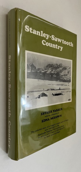
Snug within the realms of Central Idaho, the Stanley Sawtooth country comprises one of the most scenic regions in the West. This is the story of the people who settled this land and their struggle to survive its hostile winters, and about an unhurried way of life. Subjects included mining, first settlements, schools, homesteading, cattle and sheep ranching, forest service. viii, 404 pages : illustrations, maps, portraits Non-circulating [ 1 ]
|
1976 |
|
Know your town Pocatello, Idaho gate city to the great Northwest by League of Women Voters of Pocatello
Know your town Pocatello, Idaho: gate city to the great Northwest examines the strategic urban development and critical transportation role of a settlement positioned at a crucial geographic chokepoint of southeastern Idaho. The League of Women Voters of Pocatello details how the region's formidable physical barriers—specifically the narrowing, rugged corridor of the Portneuf River Valley flanked by the imposing peaks of the Bannock Range—strictly dictated the flow of overland migration and the subsequent expansion of transcontinental rail networks onto the vast Snake River Plain. By mapping the deliberate establishment of massive railroad infrastructure designed to funnel freight and pioneer traffic through this narrow topographic gateway, the narrative highlights the immense logistical effort required to anchor a modern industrial hub in a demanding, semi-arid inland environment. The absolute geographic necessity of traversing this specific mountain pass forced both early overland pioneers and the Oregon Short Line Railroad into a strict reliance on the valley's contours, permanently concentrating human settlement and economic survival around this vital transportation nexus. Ultimately, this civic and historical record serves as a deeply localized spatial history, demonstrating how the specific topographical funnels and severe environmental realities of the inland Pacific Northwest fundamentally shaped the enduring, transit-dependent character of the Pocatello gateway. 47 pages : illustrations, maps ; 22 x 14 cm Non-circulating [ 1 ]
|
1976 |
|
The Trail blazer history of the development of southeastern Idaho by Daughters of the Pioneers
The Trail blazer history of the development of southeastern Idaho chronicles the grueling overland migration and precarious pioneer settlement across the sweeping, semi-arid high plains and rugged intermountain valleys of the Upper Snake River basin. The Daughters of the Pioneers detail how the region's formidable environmental constraints—specifically the profound lack of natural precipitation across the sagebrush steppes, the severe winter climatic extremes of the inland high desert, and the challenging topographic corridors funneled between imposing mountain ranges—strictly dictated the margins of early homesteading and agricultural expansion. By mapping the immense physical labor required to carve permanent agrarian communities from this unforgiving landscape and the strategic establishment of complex irrigation networks to divert the lifeblood of regional rivers, the narrative highlights the monumental cooperative effort necessary to forcibly convert the arid terrain into a highly productive agricultural grid. The absolute necessity of securing reliable water sources and navigating the precise geographic chokepoints of the overland trails forced these isolated pioneer settlements into a strict reliance on the severe hydrology and topography of the inland routes. Ultimately, this compiled historical record serves as a deeply localized spatial history, demonstrating how the vast, open terrain and harsh climatic realities of the inland Pacific Northwest frontier fundamentally shaped the fiercely resilient, agriculturally dependent character of southeastern Idaho's foundational communities. iii, 215 pages : illustrations, maps ; 22 cm Non-circulating [ 1 ]
|
1976 |
|
Waitsburg "one of a kind." by Vance Orchard 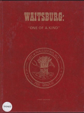
Waitsburg "one of a kind." chronicles the strategic agricultural settlement and early industrial milling development along the vital riparian corridors of the inland Columbia Basin. Orchard details how the region's formidable environmental constraints—specifically the sweeping, semi-arid rolling hills of the Walla Walla Valley and the profound reliance on the narrow, life-sustaining flow of the Touchet River—strictly dictated the margins of early pioneer survival and economic expansion. By mapping the immense physical labor required to harness the river's hydrological force for foundational gristmills and to carve expansive dryland wheat farms from the surrounding bunchgrass steppes, the narrative highlights the monumental effort necessary to anchor a permanent community in this demanding inland terrain. The absolute geographic necessity of securing this reliable water source amidst the vast, dry interior forced early homesteaders into a strict reliance on the valley's precise riparian geography, transforming a remote overland trail crossing into a critical agricultural processing chokepoint for the broader regional frontier. Ultimately, this local historical record serves as a deeply localized spatial history, demonstrating how the specific riverine topography and severe climatic realities of the inland Pacific Northwest fundamentally shaped the fiercely resilient, agriculturally dependent character of the Waitsburg settlement. 134 pages : illustrations, map, portraits ; 29 cm Non-circulating [ 1 ]
|
1976 |
|
Renton from coal to jets by Morda C. Slauson , Ethel Telban , Clark Petersen (Designer), Joann Morgan (Contributor), Renton Historical Society (Publisher, Contributor) 
Renton from coal to jets examines the dramatic industrial evolution and severe geographic manipulation of a critical aquatic chokepoint situated at the southern tip of Lake Washington. Slauson and her co-contributors detail how the region's formidable physical barriers—specifically the rugged, resource-heavy foothills of the Cascade Range that abruptly meet the flood-prone alluvial fan of the Cedar River—strictly dictated the initial margins of pioneer resource extraction. By mapping the immense physical labor required to excavate deep coal seams from the precipitous inland slopes and transport that heavy freight via precarious riparian corridors to urban markets, the narrative highlights the grueling early reliance on the region's raw geological topography. The absolute geographic necessity of expanding this frontier economy eventually forced a monumental reengineering of the landscape itself, as residents aggressively rerouted the volatile river and capitalized on the artificial lowering of the lake's shoreline to forge the massive, flat industrial grid required for modern aerospace manufacturing. Ultimately, this civic and historical record serves as a deeply localized spatial history, demonstrating how the complex hydrological force and steep topographical gradients of the Puget Sound lowlands inherently shaped the fiercely resilient, highly engineered transition of the Renton settlement from a rugged frontier mining camp into a global aviation hub. [6], 183, [4] pages, 31 unnumbered pages of plates : illustrations, maps, portraits ; 23 cm Non-circulating [ 1 ]
|
1976 |
|
Idaho an illustrated history by Idaho State Historical Society 
Idaho: an illustrated history examines the complex territorial expansion and arduous pioneer settlement across a vast, fractured landscape defined by extreme topographical and climatic divides. The Idaho State Historical Society details how the region's formidable physical barriers—specifically the massive, impenetrable spine of the Salmon River Mountains that effectively severs the state's northern panhandle from its southern expanse, alongside the sheer volcanic gorges and sweeping, arid high-desert plains of the Snake River basin—strictly dictated the margins of overland migration, resource extraction, and human survival. By mapping the immense physical labor required to blast precarious mining camps into the deep, isolated northern river canyons and to engineer massive irrigation grids across the unforgiving southern sagebrush steppes, the narrative highlights the monumental effort necessary to anchor permanent communities within this demanding inland environment. The profound geographic disparity and utter lack of viable north-south overland routes initially forced these remote outposts into isolated enclaves, completely anchoring their economic existence to either grueling alpine mineral extraction or the strict hydrological control of the southern rivers. Ultimately, this comprehensive visual and textual record serves as a deeply localized spatial history, demonstrating how the severe geological extremes, immense physical scale, and rugged intermountain topography of this Pacific Northwest frontier fundamentally shaped the fiercely resilient, geographically partitioned character of Idaho. 250 pages : illustrations ; 23 x 31 cm Non-circulating [ 1 ]
|
1976 |
|
Dungeness, the lure of a river a Bicentennial history of the east end of Clallam County by Sequim Bicentennial Committee, Virginia Keeting
Dungeness, the lure of a river: a Bicentennial history of the east end of Clallam County chronicles the grueling agricultural transformation and isolated pioneer settlement situated within a unique, paradoxical microclimate on the northern Olympic Peninsula. Keeting and the Sequim Bicentennial Committee detail how the region's formidable environmental constraints—specifically the profound rain shadow cast by the towering Olympic Mountains, the unpredictable, glacier-fed hydrology of the Dungeness River, and the impenetrable barrier of surrounding coastal rainforests—strictly dictated the margins of human survival and early farming. By mapping the immense physical labor required to engineer the first complex irrigation networks in western Washington across an otherwise rain-drenched maritime peninsula, the narrative highlights the monumental cooperative effort necessary to forcibly convert this localized dry prairie into a highly productive agricultural grid. The absolute geographic isolation from viable overland routes initially forced these remote homesteaders into a strict reliance on the deepwater maritime highway of the Strait of Juan de Fuca for commercial export, while permanently anchoring their daily existence to the erratic, powerful flow of the river itself. Ultimately, this civic and historical record serves as a deeply localized spatial history, demonstrating how the severe climatic anomalies and complex riverine topography of this Pacific Northwest frontier fundamentally shaped the fiercely resilient, hydrologically dependent character of the Dungeness and Sequim communities. 190 pages : illustrations ; 28 cm Non-circulating [ 1 ]
|
1976 |
|
The last wilderness by Murray Morgan 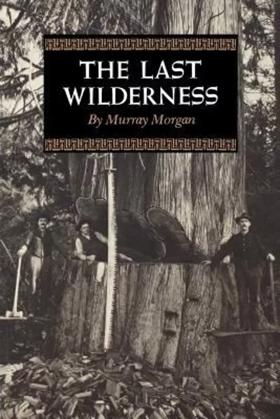
First published in 1955, this book tells the lively and entertaining story of the Olympic Peninsula, "the fist of land thrust north between Puget Sound and the Pacific Ocean, a wilderness area of six thousand square miles, as large as the state of Massachusetts, more rugged than the Rockies, its lowlands blanketed by a cool jungle of fir and pine and cedar, its peaks bearing hundreds of miles of living ice that gave rise to swift rivers alive with giant salmon; the first land in the Pacific Northwest to be reported by explorers, the last to be mapped--the last wilderness." Murray Morgan has recorded the epic adventures of the pioneers of this remote region in this rousing and humor-filled saga, one that should capture the imagination of Americans everywhere.--Publisher's description xi, 275 pages ; 20 cm. Non-circulating [ 1 ]
|
1976 |
|
The land that kept its promise a history of South Lincoln County by Marjorie H. Hays
The land that kept its promise: a history of South Lincoln County chronicles the grueling pioneer settlement and precarious resource extraction along the rugged, storm-battered coastline and dense temperate rainforests of central Oregon. Hays details how the region's formidable physical barriers—specifically the steep, impenetrable western slopes of the Coast Range and the treacherous, unforgiving surf of the Pacific Ocean—strictly dictated the margins of human survival, overland travel, and economic expansion. By mapping the arduous daily labor of isolated homesteaders carving narrow agricultural footholds within the deeply incised valleys of the Alsea River and the dangerous extraction of massive old-growth timber, the narrative highlights the immense physical endurance required to anchor permanent communities in this demanding maritime environment. The utter lack of viable overland routes to the fertile Willamette Valley initially forced these remote coastal enclaves into an absolute reliance on the perilous marine highway and treacherous tidal bay entrances, completely anchoring their commercial existence to the severe coastal climate and the rugged marine topography. Ultimately, this historical record serves as a deeply localized spatial history, demonstrating how the extreme physical isolation, dense coastal forests, and relentless maritime environment of this Pacific Northwest frontier fundamentally shaped the fiercely resilient, strictly resource-dependent character of South Lincoln County. 157 pages : illustrations ; 28 cm. Non-circulating [ 1 ]
|
1976 |
|
Magic Valley the story of St. Joseph Academy and the blossoming of Yakima by Ellis Lucia, Sisters of Charity of Providence 
Published in 1976, Ellis Lucia’s Magic Valley chronicles the founding of St. Joseph Academy by the Sisters of Providence and its profound influence on the early development of Yakima, Washington. The narrative intertwines the institutional history of this pioneer Catholic school with the broader agricultural and civic expansion of the region. The book offers the keen insight that these frontier nuns functioned as critical civic architects, establishing the essential educational and social infrastructure that allowed a rugged agrarian settlement to successfully "blossom" into a cohesive, enduring community. 48 pages : illustrations, facsimiles ; 21 x 23 cm Desiderata
|
1976 |
|
Postmarked Washington Island County, San Juan County by Guy Reed Ramsey 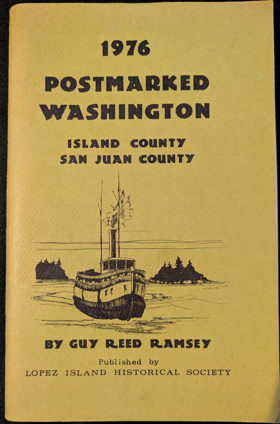
Postmarked Washington: Island County, San Juan County examines the grueling establishment of early communication networks and isolated pioneer settlement across the deeply indented, tide-swept archipelagos of the Salish Sea. Ramsey details how the region's formidable physical barriers—specifically the treacherous marine currents of the Strait of Juan de Fuca, the steep, heavily timbered shorelines of islands like Orcas and Whidbey, and the vast, fog-bound expanses of water separating these enclaves from the mainland—strictly dictated the margins of human survival and postal connectivity. By mapping the arduous logistical realities of establishing remote island post offices and the dangerous navigation required by early mosquito fleet steamers to deliver vital correspondence across these fractured aquatic topographies, the narrative highlights the immense physical endurance required to anchor permanent communities in this demanding maritime environment. The absolute geographic isolation of these remote homesteads and resource camps forced them into a strict reliance on the deepwater marine highway, completely anchoring their civic and commercial existence to the unpredictable weather patterns and the precarious arrival of maritime mail routes. Ultimately, this philatelic and historical record serves as a deeply localized spatial history, demonstrating how the severe aquatic isolation and complex island topography of this Pacific Northwest frontier fundamentally shaped the fiercely resilient, strictly maritime-dependent character of the San Juan and Island County communities. 62 pages : illustrations, facsimiles, maps ; 23 cm Non-circulating [ 1 ]
|
1976 |
|
Homesteading in the Bear Lake Valley pioneer life in Georgetown and Bear Lake County, Idaho by Ezra S. Stucki
Ezra S. Stucki’s Homesteading in the Bear Lake Valley offers an intimate social and agricultural record of pioneer settlement across the northern margins of Bear Lake County. Stucki traces the arduous physical labor required to clear sagebrush benchlands, construct hand-hewn log cabins, and engineer cooperative gravity-flow water ditches diverted from Georgetown Creek. The narrative captures the daily realities of dry-farming, livestock wintering, and cheese production, illuminating the strong communal alliances that sustained isolated families through harsh subalpine winters. Stucki preserves pioneer genealogies, early school records, and municipal developments spanning Georgetown, Bennington, and Nounan, documenting the agrarian perseverance that forged the valley’s rural heritage. 146 pages : illustrations, portraits ; 22 cm Desiderata
|
1976 |