Catalog of British Columbiana and Pacific Northwest Americana
The Encyclopedia Cascadia Catalog indexes mostly non-fiction literature covering the Pacific Northwest coast of North America, with an emphasis on British Columbia, Idaho, Oregon, and Washington State.
| Catalog Title | Published |
|---|---|
|
Balancing Bountiful what I learned about feminism from my polygamist grandmothers by Mary Jayne Blackmore 
"As the daughter of Mormon leader Winston Blackmore, Mary Jayne Blackmore grew up within the closed-off polygamist community of Bountiful, BC. She spent her younger years riding ponies, raising pet lambs and playing in the hay in the Old Barn, under the constant shadow of religious fanaticism, doomsday preparation and an instilled fear of the world outside of Mormonism. In 2017 her father was charged and convicted of practicing polygamy, splitting the community in two and further inciting the media sensationalism and worldwide criticism that had always surrounded Bountiful. As the world she had always known imploded, Mary Jayne was forced to redefine her faith, family and womanhood for herself. Today, through her work and her personal exploration of feminism, Mary Jayne is helping to heal a broken community, one that she watched turn from safe and loving to angry, arrogant and resentful. She is also building her own place in the world--as a teacher, mother, writer and educated woman--and she has managed to retain loving bonds with her family, including her father. From a childhood in an idyllic but sheltered community to early adulthood in an arranged marriage, ensuing divorce, and eventual return to Bountiful, Bridging Bountiful is Mary Jayne's journey of coming of age and coming to terms with her background as she strives to answer the question: What is the right kind of family, the right kind of woman and the right kind of feminist?"-- Provided by publisher 319 pages : back and white illustration ; 23 cm Desiderata
|
2020 |
|
Baker County sketch book by Gordon Stewart, Patricia Stewart 
Gordon Stewart and Patricia Stewart’s Baker County Sketch Book chronicles the arduous pioneer colonization and explosive industrial extraction of a rugged inland expanse defined by the formidable alpine barricades of the Blue Mountains and the arid high-desert valleys of northeastern Oregon. The narrative maps how the severe environmental realities of this remote topography—characterized by steep, ore-choked canyons, vast sagebrush steppes, and plunging winter climates—initially challenged early overland migration, forcing prospectors and settlers to endure a punishing existence profoundly isolated from the fertile coastal plains. By detailing the frenetic regional transition from an unforgiving pioneer transit corridor to a booming epicenter of deep-vein gold mining, heavy timber harvesting, and expansive cattle ranching, the text illustrates how the aggressive exploitation of the county's immense natural wealth was strictly governed by the necessity of engineering robust localized rail networks to finally breach the mountain passes. Ultimately, the account demonstrates that violently extracting its subterranean riches and deploying heavy transit infrastructure to conquer the profound geographical detachment of the inland plateau were the absolute prerequisites for transforming a forbidding alpine frontier into a lucrative, permanent commercial anchor of the eastern Oregon empire. 40 pages : illustrations ; 28 cm Non-circulating [ 1 ]
|
1956 |
|
Bainbridge landings by Allen Beach 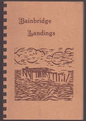
Allen Beach’s Bainbridge Landings chronicles the intimate maritime and pioneer history of Bainbridge Island, an isolated, heavily forested landmass strategically situated in the heart of Washington's Puget Sound. The narrative meticulously maps the island's convoluted, deeply indented shoreline, illustrating how the dense, impassable interior timber forced early settlement to cluster entirely around sheltered estuarine inlets like Eagle Harbor and the deep-water anchorage of Port Blakely. By detailing the massive coastal lumber mills, sprawling shipyards, and the vital daily operations of the "Mosquito Fleet" steamboats that serviced dozens of scattered wooden piers, the book demonstrates how the surrounding tidal waters served as the absolute economic and social lifeline for these disconnected enclaves. Ultimately, the text captures the defining marine geography of this inland island community, highlighting how its physical isolation from the mainland and total reliance on aquatic transit dictated the industrial development and cultural rhythm of the region long before the advent of the modern automobile ferry system. unpaged. Non-circulating [ 1 ]
|
1965 |
|
Badger and Coyote were neighbors Melville Jacobs on Northwest Indian myths and tales by William R. Seaburg, Pamela Amoss 
For the Clackamas Chinook Indians, these words signaled the end of a myth recital. Melville Jacobs spent a lifetime recording traditional stories and studying the life ways of those who told them. An anthropologist and folklorist, Jacobs (1902-1971) made it his life's work to preserve and interpret the fast-disappearing languages and traditions of the Indian peoples of Oregon and Washington. This volume presents an introduction to Jacobs's seminal research and provides an engaging selection of the myths and tales that he painstakingly collected. In their introduction, the editors provide an overview of Jacobs's remarkable life and career. A professor at the University of Washington, Jacobs, like his mentor Franz Boas, spent months in the field, seeking out and interviewing Native people. A selection of Jacobs's articles and essays on Northwest Indian oral traditions introduce his theory and method of folklore research. In addition to his own original writings, this volume gathers eighteen stories collected and translated by Jacobs. Eight of the stories include his extensive interpretations, several of which are published here for the first time. The stories represent the range of genres that Jacobs collected and are drawn from many of the Native groups with which he worked, including Chinook, Kalapuya, Sahaptin, and Coos. All the stories were originally collected in the Native languages and translated into English with help from Jacobs's Indian consultants. Making possible the scholarly understanding and appreciation of Native folk literature was Melville Jacobs's greatest challenge. This volume in the Northwest Readers series is evidence of his success. It offers a valuable introduction to Jacobs's work for anyone interested in the rich folklore of Northwest Indians, as well as for students and scholars of American Indian oral traditions and their interpretation. x, 310 pages : illustrations ; 23 cm. Desiderata
|
2000 |
|
Backroad adventures through interior British Columbia by Donovan Clemson 
BACKROAD ADVENTURE takes us through the great stretch of country lying between the Coast range and the Rockies, south of Prince George. It is about the quiet remote places and the people one finds sheepherders in alpine pastures, ranchers in secluded valleys, fire watchers on isolated mountain tops, and the lonely ferrymen. The byways straggle and wander through the interior, leading to dry valleys where fantastic rock formations surprise the stranger; or to remote jack pine plateaux where back woods ranchers count many miles between neighbors. Threading the timbered Kootenay valleys, quiet and friendly roads trail past the fast fading relics of ghostly mining towns and rustic settlements which time has passed by. 192 pages : illustrations ; 21 cm Non-circulating [ 1 ]
|
1981 |
|
Backcountry roads--Idaho by Lynna Howard, Leland Howard 
Backcountry Roads- Idaho is a beautiful, informative and practical guide to the Gem State's hidden treasure of roadways. Enhanced by 140 photos from award-winning photographer Leland Howard, Backcountry Roads-Idaho is a rarity, a guidebook that is also a work of art. Award-winning outdoor writer Lynna Howard provides GPS coordinates, expedition maps, and detailed descriptions for would be explorers. Her creative flair brings backcountry travel to life with an immediacy that engages all the senses. This is an indispensable tool for anyone who wishes to experience firsthand the rugged beauty of scenic Idaho 240 pages : color illustrations, color maps ; 22 x 28 cm Desiderata
|
2009 |
|
Back roads of Washington 74 trips on Washington's scenic byways by Earl Thollander 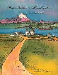
Wander off the beaten path with artist Earl Thollander and discover some of the most picturesque areas of the state. In hand-written text and vivid illustrations, Back Roads of Washington guides readers through 6,000 miles of scenic beauty. This regional classic captures the memorable details of back roads that can be enjoyed on the way to a destination, on a Sunday drive, or sitting in a comfortable armchair. -- Amazon 200 pages : illustrations, maps ; 28 cm Non-circulating [ 1 ]
|
1992 |
|
Autobiography of Rear Admiral Charles Wilkes, U.S. Navy, 1798-1877 by Charles Wilkes, William James Morgan, United States Naval History Division 
Autobiography of Rear Admiral Charles Wilkes, U.S. Navy, 1798-1877 chronicles the unprecedented maritime surveying efforts of the United States Exploring Expedition as it navigated the complex and treacherous coastal geography of the Pacific Northwest in 1841. Wilkes details the immense logistical challenges of charting this unforgiving maritime frontier, famously underscored by the violent wreck of the USS Peacock upon the shifting, notoriously dangerous sandbars of the Columbia River's mouth. By meticulously mapping the deep, sheltered anchorages of Puget Sound and surveying the sprawling, fertile expanse of the inland Willamette Valley, the narrative illustrates how recognizing the region's specific topographic value—its immense timber reserves, navigable inland waterways, and strategic deepwater harbors—directly fueled American territorial ambitions. The expedition's reliance on Indigenous spatial knowledge to penetrate the dense coastal rainforests and complex riverine networks highlights the formidable physical barriers of the Pacific seaboard. Ultimately, this autobiographical account provides a vital spatial history, demonstrating how mastering and documenting the severe marine topography of the Pacific Northwest coast fundamentally laid the navigational groundwork for American imperial expansion. xxii, 944 pages : illustrations, facsimiles, portraits ; 25 cm ONLINE Circulation [ 1 ]
|
1978 |
|
Auburn--a look down Main Street by Josephine Emmons Vine 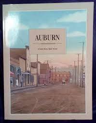
Josephine Emmons Vine’s Auburn—a look down Main Street chronicles the civic and commercial evolution of the fertile Green and White River valleys in southern King County, Washington. Centered around the strategic railway corridors and agricultural floodplains of early Auburn, the narrative details how foundational pioneer families and immigrant farmers cooperatively built a thriving agrarian hub out of the surrounding wilderness. By tracing the rapid structural and social development along the town's central commercial artery, the text reveals how scattered frontier homesteads transitioned into a highly interconnected civic center sustained by shared merchant networks and tight-knit kinship bonds. Ultimately, this local history documents how collaboratively navigating the seasonal rhythms of the river basin established the enduring community structures and deeply rooted family lineages that define the modern city. xi, 124 pages : illustrations (some color) ; 28 cm Non-circulating [ 1 ]
|
1990 |
|
Atomic frontier days Hanford and the American West by John M. Findlay, Bruce William Hevly 
On the banks of the Pacific Northwest’s greatest river lies the Hanford nuclear reservation, an industrial site that appears to be at odds with the surrounding vineyards and desert. The 586-square-mile compound on the Columbia River is known both for its origins as part of the Manhattan Project, which made the first atomic bombs, and for the monumental effort now under way to clean up forty-five years of waste from manufacturing plutonium for nuclear weapons. Hanford routinely makes the news, as scientists, litigants, administrators, and politicians argue over its past and its future. It is easy to think about Hanford as an expression of federal power, a place apart from humanity and nature, but that view distorts its history. Atomic Frontier Days looks through a wider lens, telling a complex story of production, community building, politics, and environmental sensibilities. In brilliantly structured parallel stories, the authors bridge the divisions that accompany Hanford’s headlines and offer perspective on today’s controversies. Influenced as much by regional culture, economics, and politics as by war, diplomacy, and environmentalism, Hanford and the Tri-Cities of Richland, Pasco, and Kennewick illuminate the history of the modern American West. xv, 368 pages : illustrations, maps ; 23 cm. Desiderata
|
2011 |
|
Atlas of the Pacific Northwest resources and development by Richard M. Highsmith , Jon M. Leverenz (Cartographer), Oregon State University
Richard M. Highsmith and cartographer Jon M. Leverenz’s Atlas of the Pacific Northwest: Resources and Development provides a comprehensive spatial and economic baseline for understanding the region's complex, resource-driven geography. The volume meticulously maps the formidable, defining topography of the area, charting the stark transitions from the dense, rain-soaked temperate rainforests and deep-water estuarine networks of the maritime coast, across the towering, glaciated barrier of the Cascade Range, and out onto the expansive, arid volcanic plateaus of the inland empire. By translating these severe environmental realities into detailed cartographic data, the text illustrates how the region's restrictive mountain chokepoints, volatile riverine systems, and highly localized microclimates strictly dictated both pioneer settlement patterns and subsequent industrial expansion. The atlas highlights how early agricultural colonization, sprawling timber harvesting operations, and massive hydrological engineering projects along the Columbia River were fundamentally constrained and directed by the physical landscape. Ultimately, the work captures the profound geographical determinism of the Pacific Northwest, demonstrating how the systematic mapping and scientific evaluation of this unforgiving, sprawling terrain was the absolute prerequisite for transforming a remote, isolated frontier into an integrated, mechanized regional economy. viii, 168 pages : illustrations, 97 maps (some color) ; 32 cm Non-circulating [ 1 ]
|
1962 |
|
Atlas of Oregon wilderness by William L. Sullivan 
With the addition of 200,000 more acres designated by Congress as Oregon wilderness in 2009, use this as a planning guide to explore new areas and old favorites from The Three Sisters and Mount Hood to Eagle Cap and Steens Mountain. This is a complete guide to Oregon's backcountry. This complete guide to Oregon's backcountry includes the new wilderness areas designated by Congress in March 2009 as well as old favorites from Mt. Hood and the Three Sisters to Steens Mountain and the Wallowas. The atlas features 70 pages of detailed, shaded-relief maps, 40 pages of color photographs, 146 recommended backpacking trips, 500 featured hikes, and tips for mountain climbers, whitewater rafters, kayakers, Nordic skiers, and snowshoers. 384 pages : illustrations (some color), maps, plates ; 23 cm Desiderata
|
2010 |
|
Atlas of Oregon by William G. Loy, Stuart Allan, Aileen R. Buckley, James E. Meacham 
This beautiful and authoritative volume offers a detailed look at the history, geography, and people of Oregon. Stunning full-color maps are complemented by informative text exploring everything from the earliest settlers to the growth of Oregon vineyards to Portland's traffic jams. The Atlas maps a world of information, from native cultures, exploration, politics, religion, and economic growth to landforms, volcanoes, lakes, place names, vegetation, and wildlife habitat. Created by an award-winning team of geographers and cartographers, it is both a work of art and a fascinating reference. 1 atlas (xvii, 301 pages) : color illustrations, color maps ; 34 cm Desiderata
|
2001 |
|
Atlas of Lane County, Oregon by James E. Meacham, Lane County (Or), University of Oregon, Lane Council of Governments (Or) 
James E. Meacham and the University of Oregon’s Atlas of Lane County, Oregon explores the profound spatial documentation and cooperative regional planning required to govern one of the state's most geographically diverse jurisdictions. The cartographic narrative illustrates how the contrasting environmental realities of this vast topography—spanning from the rugged, maritime extremes of the Pacific coastline, across the fertile agricultural expanse of the southern Willamette Valley, to the densely timbered slopes of the High Cascades—require immense ecological foresight and shared, structured adaptation from modern civic institutions. By detailing the gradual transition from an era of geographically isolated frontier resource extraction to the cooperative establishment of comprehensive land-use frameworks and urban boundary controls, the atlas highlights how the county’s economic and environmental health relies heavily on collaborative, data-driven governance. Ultimately, the comprehensive geographic catalog demonstrates that patiently mapping these complex ecological borders and collaboratively managing the intersection of booming urban centers like Eugene with fragile natural resources are essential steps in transforming a massive, environmentally varied territory into a cohesive, enduring model of modern civic stewardship in the Pacific Northwest. 1 atlas (iv, 73 pages) : color maps ; 19 x 44 cm Non-circulating [ 1 ]
|
1990 |
|
At the hearth of the crossed races a French-Indian community in nineteenth-century Oregon, 1812-1859 by Melinda Marie Jetté 
"Despite the force of Oregon's founding mythology, the Willamette Valley was not an empty Eden awaiting settlement by hardy American pioneers. Rather, it was, as Melinda Jette explores in At the Hearth of the Crossed Races, one of the earliest sites of extensive intercultural contact in the Pacific Northwest. Jette's study focuses on the 'hearth' of this contact: French Prairie, so named for the French-Indian families who resettled the homeland of the Ahantchuyuk Kalapuyans. Although these families sought a middle course in their relations with their various neighbors, their presence ultimately contributed to the Anglo-American colonization of the region. By establishing farming and husbandry operations in the valley, the French-Indian settlers enhanced the Willamette Valley's appeal as a destination of choice for the Anglo-Americans who later emigrated to the Pacific Northwest via the Oregon Trail. Upon these emigrants' arrival, the social space for the people of the 'crossed races' diminished considerably, as the Anglo-Americans instituted a system of settler colonialism based on racial exclusion. Like their Native kin, the French-Indian families pursued various strategies to navigate the changing times and Jette's study of French Prairie takes on the relationships among all three: the French-Indian families, the Indigenous peoples, and the Anglo-American settlers. With At the Hearth of the Crossed Races, Jette delivers a social history that deepens our understanding of the Oregon Country in the nineteenth century. This history of French Prairie provides a window into the multi-racial history of the Pacific Northwest and offers an alternative vision of early Oregon in the lives of the biracial French-Indian families whose community challenged notions of white supremacy, racial separation, and social exclusion"-- Provided by publisher xix, 337 pages : illustrations ; 23 cm. Non-circulating [ 1 ]
|
2015 |
|
At the end of the car line by Ben Hur Lampman 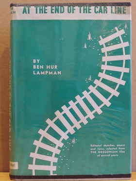
At the End of the Car Line, published in 1942 by Binfords & Mort in Portland, Oregon, is a collection of editorial sketches, essays, and verses originally written by Ben Hur Lampman for The Oregonian, where he was a longtime columnist and associate editor. Lampman, a celebrated Oregon writer and the state’s poet laureate from 1951 until his death in 1954, was known for his lyrical yet accessible style, capturing the everyday life and natural beauty of the Pacific Northwest. This book reflects his versatility as a writer—blending prose and poetry to explore themes close to his heart. 1 preliminary leaf, 191, [1] pages : frontispiece (illustration) ; 21 cm Desiderata
|
1942 |
|
At the bridge James Teit and an anthropology of belonging by Wendy C. Wickwire 
"Every once in a while, an important historical figure makes an appearance, makes a difference, and then disappears from the public record. James Teit (1864-1922) was such a figure. A prolific ethnographer and tireless Indian rights activist, Teit spent four decades helping British Columbia's Indigenous peoples in their challenge of the settler-colonial assault on their lives and territories. Yet his story is little known. At the Bridge chronicles Teit's fascinating story. From his base at Spences Bridge, British Columbia, Teit practised a participant- and place-based anthropology - an anthropology of belonging - that covered much of BC and northern Washington, Idaho, and Montana. Whereas his contemporaries, including famed anthropologist Franz Boas, studied Indigenous peoples as the last survivors of "dying cultures" in need of preservation in metropolitan museums, Teit worked with them as members of living cultures actively asserting jurisdiction over their lives and lands. Whether recording stories and songs, mapping place-names, or participating in the chiefs' fight for fair treatment, he made their objectives his own. With his allies, he produced copious, meticulous records; an army of anthropologists could not have achieved a fraction of what Teit achieved in his short life. Wendy Wickwire's beautifully crafted narrative accords Teit the status he deserves. At the Bridge serves as a long-overdue corrective, consolidating Teit's place as a leading and innovative anthropologist in his own right."-- Provided by publisher xviii, 374 pages : illustrations, maps ; 24 cm Non-circulating [ 1 ]
|
2019 |
|
Astorians, eccentric and extraordinary by Karen Kirtley 
In 1993, The New Yorker published Calvin Trillin’s memorable article on the eccentric Flavel family of Astoria, the descendants of Captain George Flavel, whose ornate Queen-Anne-style mansion is a tourist draw today. With Trillin’s gracious consent, “First Family of Astoria” is reprinted in Part One of Astorians, Eccentric and Extraordinary, making its first appearance in book form. Part Two carries on the theme with portraits of fifty-five other notable Astorians. Five Oregon writers have captured the essence and the flavor of vivid personalities that include the notorious shanghaier Bridget Grant; the charming scoundrel Mayor Francis Clay Harley; the elusive English “barmaid” Jane Barnes, the first white woman in the Pacific Northwest; and Rolf Klep, who believed he could create a major maritime museum in an economically depressed town—and made it happen. In biology, it is said that the richest life forms reside at the edge of the ecosystem. Astoria epitomizes edges—the edge of the country, the edge of a great river, the edge of the Pacific Ocean, and the edge of our American culture. This book celebrates the larger-than-life quality that has appeared with regularity in the town’s two-hundred-year history. As Steve Forrester, publisher of The Daily Astorian, notes in the book’s introduction: “Extraordinary people are not necessarily eccentric. But eccentrics are driven to do extraordinary things.” 224 pages : illustrations, maps ; 23 cm Desiderata
|
2010 |
|
Astoria & empire by James P. Ronda 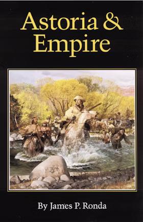
In late December 1788 a worried Spanish official in Mexico City set down his fears about a new and aggressive northern neighbor. Viceroy Manuel Antonio Florez offered a gloomy prediction about the future of Spanish-United States relations in the West. He already knew about the steady march of frontiersmen toward St. Louis and now came troubling word of Robert Gray's ship Columbia on the Northwest coast. All this seemed to fit a pattern, a design for Yankee expansion. "We ought not to be surprised," warned the viceroy, "that the English colonies of America, now being an independent Republic, should carry out the design of finding a safe port on the Pacific and of attempting to sustain it by crossing the immense country of the continent above our possessions of Texas, New Mexico, and California." Canadian fur merchants and Russian bureaucrats also viewed the young republic as a potential rival in the struggle for western dominion. The viceroy's vision of the future proved startlingly accurate. Within the next two decades an American president would authorize a federally funded expedition to find just the sort of transcontinental route Florez imagined. Equally important, a New York entrepreneur would propose and put into motion an ambitious plan to make the Northwest an American political and commercial empire. John Astor's Pacific Fur Company, with Astoria as its central post on the Columbia River, was Florez's nightmare come true. Astoria had long represented either a daring overland adventure or simply a failed trading venture. The Astorians surely had their share of adventure. And the Pacific Fur Company never brought its founder the profits he expected. But all those involved in the extensive enterprise knew it meant more. Thomas Jefferson once described Astoria as the "germ of a great, free and independent empire," believing that the entire American claim to the lands west of the Rockies rested on "Astor's settlement at the mouth of the Columbia." And John Quincy Adams, the expansionist-minded secretary of state, labeled then entire Northwest as "the empire of Astoria." This book seeks to explore Astoria as part of a large and complex struggle for national sovereignty in the Northwest. The Astorians and their rivals were always engaged in more than trading and trapping. They were advance agents of empire. -- from Preface xiv, 400 pages : illustrations, maps ; 23 cm Non-circulating [ 1 ]
|
1990 |
|
Astoria Enterprise beyond the Rocky mountains by Washington Irving
Washington Irving's 'Astoria' chronicles the story of John Jacob Astor's ambitious attempt to establish a trading post on the Columbia River in Oregon in 1810. Irving narrates the adventurous spirit of the pioneers, their encounters with native tribes, and the legacy they left behind. It is a gripping tale of exploration and enterprise, ideal for readers of adventure and history. xvi, 336 pages ; 22 cm ONLINE Circulation [ 1 ]
|
1836 |
|
Astoria an Oregon history by Karen L. Leedom 
The rest of the country is just beginning to discover Astoria, Oregon, that historic gem of a town at the mouth of the Columbia River west of Portland, and the oldest European-American settlement west of the Rockies. The author provides a chronological look dating back to the 1500s, including European exploration, Native American life, logging, fishing, Chinese laborers in the salmon industry, a giant cheese in the Civil War, Oregon’s first female surgeon, Victorian architecture, and valiant Coast Guard rescues. vi, 218 pages : illustrations, maps ; 23 cm Non-circulating [ 1 ]
|
2010 |
|
Astoria by Washington Irving
Washington Irving’s Astoria chronicles the ambitious early nineteenth-century enterprise of John Jacob Astor to establish a global fur-trading empire at the treacherous mouth of the Columbia River in present-day Oregon. The sweeping narrative maps the grueling overland journey of the Astorians as they navigated the unforgiving topography of the inland Pacific Northwest, struggling through the deep gorges and rapids of the Snake River across what is now southern Idaho and eastern Oregon. Simultaneously, the book traces the maritime arm of the expedition, detailing the perilous coastal navigation from the Columbia's notoriously violent sandbar north to the rugged, forested shores of Vancouver Island, British Columbia. By documenting the brutal environmental realities of these coastal inlets and arid interior plateaus, Irving vividly captures the severe geographic challenges that defined the earliest commercial settlement of the Pacific Northwest. 467 pages illustrations Non-circulating [ 1 ]
|
1967 |
|
Astoria by Chelsea K. Vaughn 
Established in 1811, Astoria, Oregon, holds claim to being the oldest US settlement west of the Rockies. After surviving devastating fires and severe economic downturns, modern Astoria--with its well-preserved historic homes and bustling downtown--is a beacon on the scenic Columbia River. Comparing our present to our past is how we understand our history. Books in this series offer a special view of American life by placing historical images side by side with contemporary photographs.--From back cover x, 95 pages : illustrations (some color) ; 24 cm. Desiderata
|
2023 |
|
Asserting native resilience Pacific rim indigenous nations face the climate crisis by Zoltán. Grossman, Alan Parker 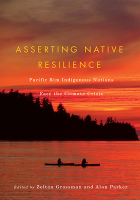
Indigenous nations are on the frontline of the current climate crisis. With cultures and economies among the most vulnerable to climate-related catastrophes, Native peoples are developing responses to climate change that serve as a model for Native and non-Native communities alike. Native American nations in the Pacific Northwest, First Nations in Canada, and Indigenous peoples around the Pacific Rim have already been deeply affected by droughts, flooding, reduced glaciers and snowmelts, seasonal shifts in winds and storms, and changes in species on the land and in the ocean. Having survived the historical and ecological wounds inflicted by colonization, industrialization, and urbanization, Indigenous peoples are using tools of resilience that have enabled them to respond to sudden environmental changes and protect the habitat of salmon and other culturally vital species. They are creating defenses to strengthen their communities, mitigate losses, and adapt where possible. Asserting Native Resilience presents a rich variety of perspectives on Indigenous responses to the climate crisis, reflecting the voices of more than twenty contributors, including Indigenous leaders and Native and non-Native scientists, scholars, and activists from the Pacific Northwest, British Columbia, Alaska, and Aotearoa/New Zealand. Also included is a resource directory of indigenous governments, non-governmental organizations, and communities that are researching and responding to climate change and a community organizing booklet for use by Northwest tribes. An invaluable addition to the literature on climate change, Asserting Native Resilience will be useful for students of environmental studies, Native studies, geography, and rural sociology, and will serve as an important reference for indigenous leaders, tribal members, rural planners, and environmental agency staff. 239 pages : illustrations, maps ; 26 cm Desiderata
|
2012 |
|
Ashland, an Oregon oasis an Oregon documentary by Janelle Davidson, Bert Webber 
Authored by Janelle Davidson and Bert Webber, Ashland, an Oregon Oasis: An Oregon Documentary chronicles the development of the southern Oregon town from a pioneer milling settlement into a vibrant cultural haven renowned for its natural mineral springs and the Oregon Shakespeare Festival. The book weaves together historical photographs, local archives, and narrative documents to trace how the community leveraged its unique natural geography and artistic ambitions to survive economic shifts. Through these collected records, the text captures the deliberate transformation of a remote Rogue Valley stopover into a thriving destination for travelers and intellectuals alike. A keen insight drawn from the work is how intentional cultural institutions can insulate a regional economy from resource dependency; by pivoting from local timber and agriculture toward world-class theater and holistic tourism, Ashland demonstrated that remote communities can engineer their own prosperity by transforming local geographic assets into an internationally recognized cultural brand. 160 pages : illustrations, maps ; 22 cm Non-circulating [ 1 ]
|
1995 |