Catalog of British Columbiana and Pacific Northwest Americana
The Encyclopedia Cascadia Catalog indexes mostly non-fiction literature covering the Pacific Northwest coast of North America, with an emphasis on British Columbia, Idaho, Oregon, and Washington State.
| Catalog Title | Published |
|---|---|
|
Mapping the frontier Charles Wilson's diary of the survey of the 49th parallel, 1858-1862, while secretary of the British Boundary Commission by Charles William Wilson 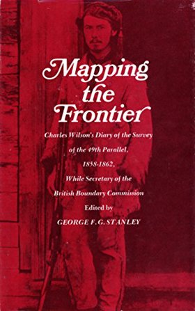
Mapping the frontier Charles Wilson's diary of the survey of the 49th parallel, 1858-1862 examines the grueling imperial cartography and immense logistical struggle situated across the profoundly rugged, trans-mountain macro-geography of the US-British Columbia borderlands. Wilson details how the region's formidable topography—specifically the impenetrable, old-growth temperate rainforests of the coastal slope, the sheer, glaciated alpine barricades of the Cascade and Rocky Mountains, and the deep, turbulent river chasms cutting perpendicular to the border—strictly dictated the margins of early scientific reconnaissance, precarious overland supply chains, and the immense physical labor required to physically mark the wilderness. By mapping the Boundary Commission's arduous effort to impose a rigid, abstract political line across violently fractured terrain—requiring the literal chopping of massive forest swaths, precarious high-altitude ascents, and constant battles with severe winter isolation—the narrative highlights how this specific unforgiving, mountainous geography anchored a profoundly grueling, highly isolated feat of imperial engineering. Ultimately, this diaristic and cartographic record serves as a macro-level spatial history, demonstrating how the immense alpine barricades, severe botanical density, and unrelenting climatic extremes of this Pacific Northwest landscape fundamentally shaped the highly arduous, geographically defiant character of the 49th parallel boundary survey. 182 pages : maps, portrait ; 22 cm Non-circulating [ 1 ]
|
1970 |
|
Early Portland stump-town triumphant; rival towns on the Willamette, 1831-1854 by Eugene E. Snyder 
Early Portland stump-town triumphant; rival towns on the Willamette, 1831-1854 examines the fierce urban competition and rapid mercantile expansion situated along the deep-water, heavily timbered corridors of the lower Willamette River. Snyder details how the region's formidable riparian macro-geography—specifically the deep-water navigational limits for ocean-going sailing vessels, the steep, densely forested barricade of the Tualatin Mountains, and the muddy, flood-prone alluvial terraces of the riverbank—strictly dictated the margins of strategic townsite placement, aggressive old-growth timber clearing, and the intense rivalry to control agricultural trade routes. By mapping Portland's ultimate triumph over neighboring settlements like Oregon City and Milwaukie—achieved by strategically leveraging its position as the furthest inland deep-water anchorage and physically carving a precarious plank road through the western hills to siphon the Tualatin Valley's lucrative agrarian wealth—the narrative highlights how this specific riverine and topographical geography anchored a profoundly competitive, mercantile-driven urban hub. Ultimately, this urban and civic record serves as a localized spatial history, demonstrating how the severe riparian constraints, immense botanical density, and critical deep-water access of this Pacific Northwest landscape fundamentally shaped the highly strategic, commercially aggressive character of early Portland's founding. vii, 182 pages illustrations, maps, portraits 23 cm Non-circulating [ 1 ]
|
1970 |
|
Whatcom seascapes the influence of the sea on Whatcom County. An exhibition of the Whatcom Museum of History and Art, Bellingham, Washington, October 9, 1970--April 30, 1971 by Whatcom Museum of History and Art, Susan H. L. Barrow
Whatcom seascapes the influence of the sea on Whatcom County examines the deep maritime commerce, coastal resource extraction, and early aquatic infrastructure situated along the deeply indented, island-studded littoral margin of northwestern Washington. Barrow details how the region's formidable coastal topography—specifically the sheltered deep-water harbors of Bellingham Bay, the labyrinthine, tide-swept channels of the San Juan archipelago, and the towering, impassable alpine barrier of the Cascade Range that restricted overland access—strictly dictated the margins of early native canoe trade, commercial salmon fishing, and aggressive maritime shipping. By mapping the development of these isolated coastal communities that relied entirely on the sea as their primary highway to connect remote timber camps and coal mines with regional markets, the narrative highlights how this specific maritime geography anchored a profoundly water-bound, industrially driven frontier society. Ultimately, this exhibition and historical record serves as a localized spatial history, demonstrating how the severe overland barricades, rich estuarine fisheries, and vital deep-water access of this Pacific Northwest landscape fundamentally shaped the highly maritime-dependent, commercial character of early Whatcom County. 78 pages illustrations, map (on inside covers) 24 cm Non-circulating [ 1 ]
|
1970 |
|
Continental waterboy the Columbia River controversy by Donald Waterfield
Donald Waterfield’s Continental Waterboy: The Columbia River Controversy provides a critical firsthand analysis of the political, economic, and environmental disputes surrounding the implementation of the 1964 Columbia River Treaty. Waterfield documents the massive hydrological re-engineering of southeastern British Columbia, focusing on the construction of the colossal Mica Dam north of Revelstoke and the establishment of the remote construction townsite of Mica Creek. The text examines how the resulting impoundment of the Columbia River into the massive reservoir of Kinbasket Lake permanently submerged over a hundred miles of the historic Big Bend route, flooding ancient Indigenous river crossings, historic gold-mining workings, and ecological habitats. The work remains an essential historical and political record detailing the sacrifice of upper Columbia communities to international hydroelectric planning. xiv, 250 pages : illustrations, maps ; 24 cm Desiderata
|
1970 |
|
Paddlewheels on the frontier the story of B.C.-Yukon sternwheel steamers, volume two by Art Downs
Paddlewheels on the frontier the story of B.C.-Yukon sternwheel steamers, volume two examines the precarious inland maritime transit and remote resource extraction situated across the vast, roadless river systems of northern British Columbia and the Yukon Territory. Downs details how the region's formidable hydro-geography—specifically the shallow, fast-flowing northern river arteries, the treacherous, whitewater rock canyons, and the sprawling, frozen subarctic wilderness—strictly dictated the margins of pioneer logistics, gold rush supply lines, and the highly specialized shallow-draft engineering of the sternwheelers. By mapping the grueling navigation of these formidable inland waterways to sustain deeply isolated mining camps during the brief, ice-free summer months, the narrative highlights how this specific riverine geography anchored the northern frontier's absolute reliance on seasonal steamboat connectivity. Ultimately, this maritime and transportation record serves as a macro-level spatial history, demonstrating how the immense overland isolation, extreme seasonal ice constraints, and vital navigable waterways of this Pacific Northwest and subarctic landscape fundamentally shaped the highly precarious, river-bound character of the B.C.-Yukon frontier. 80p illus Non-circulating [ 1 ]
|
1971 |
|
Manchester memories (1871-1971) by Edith Jones Hillstrom
Manchester memories (1871-1971) examines the insular pioneer settlement and maritime-dependent community development situated along the eastern shoreline of western Washington's Kitsap Peninsula. Hillstrom details how the region's formidable coastal topography—specifically the steep, heavily timbered marine bluffs, the dense, nearly impenetrable coniferous forests of the peninsula's interior, and the vital deep-water channels of Puget Sound—strictly dictated the margins of early homesteading, localized timber extraction, and inter-community transit. By mapping the transformation of this isolated coastal enclave from a remote frontier outpost into a thriving settlement entirely reliant on the regional steamboat "mosquito fleet" to bypass the rugged overland terrain, the narrative highlights how this specific coastal geography anchored the community's profound dependence on sustained maritime connectivity. Ultimately, this historical record serves as a localized spatial history, demonstrating how the severe overland isolation, vital deep-water access, and dense coastal timber of this Pacific Northwest landscape fundamentally shaped the highly resilient, water-bound character of early Manchester. 2 volumes illustrations 24 cm Non-circulating [ 1 ]
|
1971 |
|
Paul Kane, the Columbia wanderer, 1846-47 sketches and paintings of the Indians and his lecture, "The Chinooks." by Paul Kane, Thomas Vaughan, Francis Norbert Blanchet 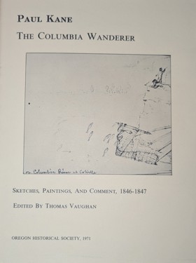
Paul Kane, the Columbia wanderer, 1846-47 sketches and paintings of the Indians and his lecture, "The Chinooks." examines the indigenous cultural practices and early artistic documentation situated along the vital riverine corridors and coastal estuaries of the lower Columbia River. Kane, alongside Vaughan and Blanchet, details how the region's formidable hydro-geography—specifically the sprawling, nutrient-rich estuarine tidelands of the river's mouth, the powerful, channeled currents of the Columbia Gorge, and the dense, rain-soaked temperate rainforests of the coastal margin—strictly dictated the margins of indigenous Chinookan settlement, intensive salmon harvesting, and the precarious transit of early fur trade brigades. By mapping Kane’s arduous riverborne expedition alongside Hudson's Bay Company flotillas to vividly document these complex indigenous river societies, the narrative highlights how this specific riparian and estuarine geography anchored a highly specialized, trade-oriented culture deeply interconnected with the river's immense hydrological forces. Ultimately, this artistic and ethnohistorical record serves as a macro-level spatial history, demonstrating how the immense riverine scale, rich estuarine ecology, and vital navigational corridors of this Pacific Northwest landscape fundamentally shaped the deeply integrated, water-bound character of the Chinook people and early European observation. viii, 54, 11 pages non numérotées : illustrations ; 28 cm. Non-circulating [ 1 ]
|
1971 |
|
Fred T. Dubois's The making of a state by Frederick T. Dubois , Louis J. Clements
Fred T. Dubois's The making of a state examines the tumultuous political consolidation and frontier settlement situated across the deeply fractured, mountainous macro-geography of the Idaho Territory. Dubois and Clements detail how the region's formidable interior topography—specifically the severe alpine barriers of the Bitterroot and Sawtooth ranges, the deep, impassable trench of the Salmon River gorge, and the vast, arid expanses of the Snake River Plain—strictly dictated the margins of early pioneer migration, isolated mining booms, and intense regional factionalism. By mapping the grueling political and physical efforts to unite these geographically severed mining enclaves and agrarian settlements into a cohesive political entity, overcoming the immense natural barricades that historically isolated the northern panhandle from the southern plains, the narrative highlights how this specific highly fragmented geography anchored a deeply divided territorial frontier. Ultimately, this political memoir serves as a macro-level spatial history, demonstrating how the immense mountain ranges, vast arid distances, and severe topographic divisions of this interior Pacific Northwest landscape fundamentally shaped the highly contested, geographically strained character of early Idaho statehood. 207 pages : illustrations ; 24 cm Non-circulating [ 1 ]
|
1971 |
|
Old Fort Boise by Annie Laurie Bird, Arthur E. Yensen (Illustrator)
Old Fort Boise examines the strategic fur-trade outpost and vital overland pioneer sanctuary situated at the critical riverine confluence of the arid western Snake River Plain. Bird details how the region's formidable interior topography—specifically the powerful, flood-prone currents of the converging Snake and Boise rivers, the vast, sun-scorched sagebrush steppes of the surrounding high desert, and the vital, narrow riparian corridors of sustaining forage—strictly dictated the margins of early Euro-American trapping operations and the precarious overland routing of the Oregon Trail. By mapping the establishment and tenuous survival of this adobe fortress, which leveraged the crucial hydrological convergence to provide a mandatory, life-saving oasis for exhausted pioneer wagon trains before they faced the grueling Blue Mountains, the narrative highlights how this specific riparian geography anchored a highly transient but deeply necessary desert waystation. Ultimately, this historical record serves as a localized spatial history, demonstrating how the severe arid isolation, dynamic riverine forces, and critical confluence of this interior Pacific Northwest landscape fundamentally shaped the highly resilient, transit-bound character of Old Fort Boise. 90 pages : maps ; 23 cm Non-circulating [ 1 ]
|
1971 |
|
Chuckanut chronicles by Robert B. Thomas
Chuckanut chronicles examines the precarious coastal settlement and intensive resource extraction situated along the steep, heavily timbered coastal mountains of northwestern Washington's Puget Sound. Thomas details how the region's formidable coastal topography—specifically the sheer sandstone cliffs plunging directly into the marine waters of Samish and Bellingham Bays, the dense, rain-soaked coniferous forests of the Chuckanut Range, and the narrow, treacherous littoral edge—strictly dictated the margins of early pioneer homesteading, precarious overland transit, and massive sandstone quarrying operations. By mapping the extraction of the region's highly valued structural sandstone—shipped almost entirely via waterborne transit prior to the arduous, cliff-side carving of Chuckanut Drive—and the tenuous clinging of early communities to the precipitous shoreline, the narrative highlights how this specific vertical geography anchored a profoundly rugged, resource-dependent maritime enclave. Ultimately, this regional record serves as a localized spatial history, demonstrating how the severe topographic constraints, vital deep-water access, and rich geological deposits of this Pacific Northwest landscape fundamentally shaped the highly resilient, extraction-driven character of the early Chuckanut coast. 64 pages illustrations Non-circulating [ 1 ]
|
1971 |
|
General history of Oregon through early statehood by Charles Henry Carey
General history of Oregon through early statehood examines the sweeping territorial consolidation, mass pioneer migration, and nascent political formation situated across the profoundly diverse, highly fractured macro-geography of the Oregon Territory. Carey details how the region's formidable macro-topography—specifically the treacherous, shifting sandbars of the Columbia River bar, the towering, heavily timbered volcanic barrier of the Cascade Range, and the sprawling, fertile alluvial expanse of the Willamette Valley—strictly dictated the margins of indigenous displacement, grueling overland wagon transit, and concentrated agrarian settlement. By mapping the arduous transformation of a fiercely contested fur-trade frontier into an organized American state, reliant on the Columbia River gorge to funnel exhausted pioneers through the impassable mountain barricades and into the protected western valleys, the narrative highlights how this specific immense geography anchored a deeply enduring, valley-bound pioneer society. Ultimately, this comprehensive historical record serves as a macro-level spatial history, demonstrating how the immense overland distances, severe topographic barricades, and vital fertile river basins of this Pacific Northwest landscape fundamentally shaped the highly resilient, agrarian-driven character of early Oregon statehood. xii, 916 pages : illustrations, maps ; 24 cm Non-circulating [ 1 ]
|
1971 |
|
Homesteads and heritages a history of Morrow County, Oregon by Giles French
Homesteads and heritages a history of Morrow County, Oregon examines the extensive agrarian settlement and vast livestock-ranching economy situated across the rolling, semi-arid plateau of north-central Oregon. French details how the region's formidable interior topography—specifically the sprawling, sun-baked bunchgrass steppes of the Columbia Basin, the deeply incised basalt canyons, and the rugged, timbered foothills of the Blue Mountains—strictly dictated the margins of early pioneer homesteading, dryland wheat cultivation, and massive sheep and cattle operations. By mapping the grueling transformation of these arid uplands from isolated pioneer sheep camps into highly resilient dry-farming communities entirely dependent on precarious seasonal rainfall and eventual rail access to the Columbia River gorge, the narrative highlights how this specific high-desert geography anchored a deeply enduring, agriculturally driven frontier economy. Ultimately, this regional record serves as a macro-level spatial history, demonstrating how the immense overland distances, severe arid constraints, and vital bunchgrass forage of this interior Pacific Northwest landscape fundamentally shaped the highly rugged, ranching and wheat-bound character of early Morrow County. 127 pages illustrations 29 cm Non-circulating [ 1 ]
|
1971 |
|
Almost out of the world scenes from Washington Territory: the Strait of Juan de Fuca, 1859-61 by James G. Swan, William A. Katz
Almost out of the world scenes from Washington Territory: the Strait of Juan de Fuca, 1859-61 examines the profoundly isolated frontier outposts and complex indigenous maritime cultures situated along the storm-battered northwestern edge of the Olympic Peninsula. Swan and Katz detail how the region's formidable coastal macro-geography—specifically the turbulent, wind-swept marine corridor of the Strait of Juan de Fuca, the treacherous rocky promontories of Cape Flattery, and the dense, impenetrable temperate rainforests that entirely precluded overland transit—strictly dictated the margins of early Euro-American settlement and the highly specialized marine subsistence of the indigenous Makah people. By mapping Swan’s immersive observations of a frontier enclave clinging to the very edge of the continent, functioning completely independent of the territorial mainland through a total reliance on precarious coastal schooners and indigenous canoe networks, the narrative highlights how this specific edge-of-the-world geography anchored a deeply entrenched, water-bound society. Ultimately, this ethnographic and historical record serves as a localized spatial history, demonstrating how the extreme overland isolation, immense oceanic exposure, and rich marine ecology of this Pacific Northwest coastline fundamentally shaped the highly resilient, fiercely independent character of the early Strait of Juan de Fuca settlements. xxiii, 126 pages, 3 unnumbered leaves of plates : map (on lining papers), portraits ; 24 cm Non-circulating [ 1 ]
|
1971 |
|
Jimmy come lately, history of Clallam County. A symposium by Jervis Russell
Jimmy come lately, history of Clallam County. A symposium examines the remote timber enclaves and isolated coastal homesteads situated across the rugged, heavily forested northern expanse of Washington's Olympic Peninsula. Russell details how the region's formidable macro-geography—specifically the impenetrable alpine barrier of the Olympic Mountains to the south, the sprawling, dense temperate rainforests of the coastal margins, and the vital, wind-swept maritime highway of the Strait of Juan de Fuca—strictly dictated the margins of early pioneer settlement, massive old-growth logging operations, and specialized agricultural development. By mapping the establishment of frontier communities that clung precariously to the narrow littoral edge and the unique, semi-arid microclimate of the Sequim rain shadow, relying almost entirely on the regional steamboat "mosquito fleet" and deep-water ports to bypass the impassable mountainous interior, the narrative highlights how this specific peninsular geography anchored a deeply resilient, water-bound and resource-dependent economy. Ultimately, this historical symposium serves as a macro-level spatial history, demonstrating how the severe overland isolation, immense botanical scale, and critical marine connectivity of this Pacific Northwest landscape fundamentally shaped the highly rugged, extraction-driven character of early Clallam County. xxvi, 631 pages illustrations 24 cm Non-circulating [ 1 ]
|
1971 |
|
The Alpine lakes by Ed Cooper, Bob Gunning, Brock Evans, David Brower, Harvey Manning
The Alpine lakes examines the fierce environmental conservation campaign and high-altitude wilderness advocacy situated within the deeply glaciated, granite-studded macro-geography of Washington's Central Cascade Range. Cooper, Evans, Manning, and their co-authors detail how the region's formidable alpine topography—specifically the razor-sharp, glaciated peaks of the high Cascades, the immense concentration of fragile, high-elevation tarns, and the dense, old-growth valleys heavily targeted by timber interests—strictly dictated the margins of aggressive industrial logging, early mining intrusions, and the subsequent mobilization of intense wilderness preservation. By mapping the visual and political effort to shield this rugged, immensely scenic high country from encroaching resource extraction, leveraging the region's severe topography and its critical proximity to the expanding Seattle metropolis to forge a massive citizen-led wilderness defense, the narrative highlights how this specific fragile, high-altitude geography anchored a profoundly fierce, modern environmental battleground. Ultimately, this visual and environmental record serves as a localized spatial history, demonstrating how the severe topographic extremes, pristine alpine hydrology, and vital urban proximity of this Pacific Northwest landscape fundamentally shaped the highly contested, preservation-driven character of the Alpine Lakes region. 128 pages : color illustrations ; 36 cm Non-circulating [ 1 ]
|
1971 |
|
Snake River country by Bill Gulick, Earl Roberge (Photographer) 
Born in incredible beauty, flowing through incredible desolation, nourishing incredible fertility, the Snake River is unlike any other in the lower 48 states. A winner of numerous awards for lithography and photography, this "coffee table" book is a classic xvi, 195 pages : color illustrations, map (on lining papers) ; 38 cm Non-circulating [ 1 ]
|
1971 |
|
Fishwheels of the Columbia by Ivan J. Donaldson, Frederick K. Cramer
Fishwheels of the Columbia examines the intensive industrial salmon harvest and specialized riparian engineering situated along the powerful, constricted channels of the Columbia River Gorge. Donaldson and Cramer detail how the region's formidable hydro-topography—specifically the narrow, bedrock-lined chokepoints of the Cascades and Celilo, the immense hydraulic force of the river's turbulent currents, and the steep, rugged banks of the gorge—strictly dictated the margins of early commercial fishery placement, riparian land monopolization, and the highly specialized mechanics of the river-driven harvest. By mapping the construction of massive, current-powered fishwheels securely anchored in strategic river narrows to intercept immense, upriver-migrating salmon runs, functioning entirely as mechanical extensions of the river's own kinetic energy, the narrative highlights how this specific riparian geography anchored a highly efficient, hyper-localized monopoly on marine resource extraction. Ultimately, this industrial and environmental record serves as a localized spatial history, demonstrating how the immense hydrological forces, severe topographical constrictions, and rich anadromous ecology of this Pacific Northwest waterway fundamentally shaped the highly engineered, extraction-driven character of the early Columbia River fisheries. 2 preliminary leaves, 124 pages illustrations, maps, portraits 29 cm Non-circulating [ 1 ]
|
1971 |
|
Fray Juan Crespi, missionary explorer on the Pacific coast, 1769-1774 by Juan Crespí, Herbert Eugene Bolton
Fray Juan Crespi, missionary explorer on the Pacific coast, 1769-1774 examines the arduous imperial reconnaissance and nascent mission expansion situated along the vast, uncharted littoral edge of Alta California and the rugged Pacific Northwest. Crespí and Bolton detail how the region's formidable coastal macro-geography—specifically the unrelenting, deeply incised coastal mountain ranges, the sprawling, hidden estuarine network of San Francisco Bay, and the treacherous, fog-shrouded maritime headlands extending into the northern latitudes—strictly dictated the margins of early Spanish overland marches, strategic presidio placement, and precarious seaborne exploration. By mapping Crespí’s grueling overland expeditions through dense coastal chaparral and his subsequent naval voyage into the impenetrable temperate rainforests and storm-battered indigenous waters of the far northern coast, the narrative highlights how this specific immense, linear geography anchored Spain's tenuous, hyper-extended imperial ambitions entirely to the continent's ocean-bound edge. Ultimately, this exploratory and ethnohistorical record serves as a macro-level spatial history, demonstrating how the immense overland distances, severe topographical barriers, and obscuring maritime climates of this Pacific coastal landscape fundamentally shaped the highly precarious, geographically strained character of early Spanish reconnaissance. lxiv, 402 pages illustrations, maps 23 cm Non-circulating [ 1 ]
|
1971 |
|
Washington State place names by James Wendell Phillips
Washington State place names examines the complex linguistic overlay and historical settlement patterns situated across the profoundly diverse, highly fractured macro-geography of the Pacific Northwest. Phillips details how the region's formidable topography—specifically the deeply glaciated marine waterways of the Salish Sea, the towering, impenetrable volcanic barrier of the Cascade Range, and the vast, arid sagebrush steppes of the Columbia Basin—strictly dictated the margins of indigenous habitation, early maritime exploration, and subsequent pioneer homesteading. By mapping the immense catalog of regional nomenclature—from indigenous descriptors of vital riparian resources and perilous coastal headlands to the imported naming conventions of competing European navies and resource-driven mining enclaves—the narrative highlights how this specific, highly varied geography anchored the cultural and historical identity of the state directly to its physical landscape. Ultimately, this toponymic record serves as a macro-level spatial history, demonstrating how the immense geographic diversity, severe topographical barriers, and rich localized resources of this Pacific Northwest landscape fundamentally shaped the highly layered, culturally complex character of Washington's exploration and settlement. xv, 167 pages : color maps (on lining papers) ; 23 cm Non-circulating [ 1 ]
|
1971 |
|
Pioneers and incidents of the Upper Coquille Valley, 1890-1940 by Alice H. Wooldridge (Compiler)
Pioneers and incidents of the Upper Coquille Valley, 1890-1940 examines the isolated agrarian homesteading and localized timber extraction situated within the deeply incised river valleys of southwestern Oregon's Coast Range. Wooldridge details how the region's formidable interior topography—specifically the steep, heavily timbered slopes of the surrounding mountain barrier, the winding, flood-prone riparian bottomlands of the Coquille River, and the dense, nearly impenetrable temperate rainforests—strictly dictated the margins of early pioneer settlement, precarious overland transit, and grueling land-clearing operations. By mapping the arduous establishment of scattered frontier farms and logging enclaves that carved a tenuous existence out of the old-growth timber, relying on the narrow riverine corridors to navigate the severely restricted inland basin, the narrative highlights how this specific valley geography anchored a profoundly rugged, self-reliant pioneer society. Ultimately, this pioneer record serves as a localized spatial history, demonstrating how the severe overland isolation, immense botanical scale, and dynamic riparian corridors of this Pacific Northwest landscape fundamentally shaped the highly resilient, valley-bound character of the early Upper Coquille. 384 pages illustrations, maps (on lining papers), group portraits 24 cm Non-circulating [ 1 ]
|
1971 |
|
Gastown's Gassy Jack the life and times of John Deighton of England, California and early British Columbia by Raymond Hull, Olga Ruskin 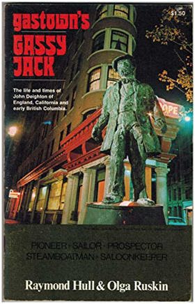
Gastown's Gassy Jack the life and times of John Deighton of England, California and early British Columbia examines the nascent frontier settlement and precarious maritime commerce situated along the sheltered southern shores of British Columbia's Burrard Inlet. Hull and Ruskin detail how the region's formidable coastal topography—specifically the deep, naturally protected marine basin of the inlet, the impenetrable, towering temperate rainforests of the surrounding mainland, and the tidal mudflats of the littoral margin—strictly dictated the margins of early pioneer homesteading, massive old-growth logging operations, and the establishment of opportunistic waterfront enterprise. By mapping the spontaneous growth of Deighton's improvised saloon enclave, which strategically leveraged the vital deep-water anchorage to intercept isolated Hastings Mill timber crews and coastal maritime traffic, the narrative highlights how this specific estuarine and coastal geography anchored the settlement's absolute reliance on marine connectivity. Ultimately, this biographical and civic record serves as a localized spatial history, demonstrating how the severe overland isolation, immense botanical scale, and critical deep-water access of this Pacific Northwest landscape fundamentally shaped the highly rugged, maritime-dependent character of early Gastown and the future city of Vancouver. 48 pages illustrations, maps, portraits 22 cm Desiderata
|
1971 |
|
Gem minerals of Idaho by John A. Beckwith, Jane Beckwith 
Gem Minerals of Idaho, designed for beginners and for those collectors visiting Idaho for the first time, it is a guide to some of the countless collecting areas of the state. It is not a textbook of mineralogy and, so far as possible, avoids technical terminology. However, it does contain information of general value on the physical and optical characteristics of minerals, as well as facts concerning history, lore, and fashioning of many of the gems. 129 pages : illustrations, maps ; 23 cm Desiderata
|
1971 |
|
San Juan dispute by C. H. Hanford 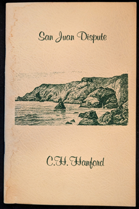
San Juan dispute examines the tense military standoff and precarious boundary negotiation situated within the strategic, island-choked waterways of the Salish Sea's central archipelago. Hanford details how the region's formidable archipelagic topography—specifically the complex, navigable deep-water corridors of Haro and Rosario Straits, the rugged, easily fortified shorelines of San Juan Island, and the highly ambiguous, heavily fragmented maritime boundary separating the mainland empires—strictly dictated the margins of aggressive territorial posturing, precarious joint military occupation, and intense naval maneuvering. By mapping the transformation of a localized agrarian conflict into a high-stakes international border crisis that utilized the island's commanding geographic position to control vital shipping lanes, the narrative highlights how this specific insular geography anchored a profoundly tense, militarized maritime frontier. Ultimately, this geopolitical and historical record serves as a localized spatial history, demonstrating how the severe cartographic ambiguity, vital strategic deep-water access, and isolated insular terrain of this Pacific Northwest archipelago fundamentally shaped the highly contested, geopolitically fraught character of the San Juan boundary dispute. 15 pages : portrait ; 22 cm Non-circulating [ 1 ]
|
1971 |
|
Skqee mus or, Pioneer days on the Nooksack by Robert Emmett Hawley 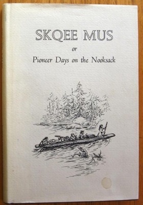
Robert Emmett Hawley (1862-1946) was ten years old when his father, Enoch Hawley journeyed up the Nooksack River by canoe to settle near a site later named Lynden. Skqee Mus tells of those early days on the Nooksack as seen through the eyes of the author. The Hawleys were the second white family in Lynden. The account tells of the early settlers in the area, the Nooksack Indians, and the family's struggle to make a living in this wild place. He took an active part in building a thriving town, in laying sidewalks, cutting timber, milling lumber, and speculating in its businesses. His account also relates of stories of the Hawley's neighbors: the Judsons, Kilcups, Bremners, Bertrands, Charlie Cline, Billy Waples and businesses and the Lynden Department Store, Ed Edson and the Clam Diggers' Club, as well as the founding of the Methodist Church and an Indian Mission, and of post offices and cemeteries. 189 pages illustrations 24 cm ONLINE Circulation [ 1 ] Non-circulating [ 1 ]
|
1971 |
|
The war that was never fought by Will Dawson
|
1971 |