Catalog of British Columbiana and Pacific Northwest Americana
The Encyclopedia Cascadia Catalog indexes mostly non-fiction literature covering the Pacific Northwest coast of North America, with an emphasis on British Columbia, Idaho, Oregon, and Washington State.
| Catalog Title | Published |
|---|---|
|
Cottardi Station, Wahkiakum County, Washington by Carlton E. Appelo 
By Carlton Appelo: Whenever the local phone book was printed there was always a wonderful historical book in the back. This one is about Cottardi Station, Washington located on the north side of the Columbia River near Altoona. Now just a memory not even a Ghost Town. 80 pages : illustrations ; 24 cm Non-circulating [ 1 ]
|
1980 |
|
The Magnificent distances early aviation in British Columbia, 1910-1940 by Dennis Duffy, Carol Crane, David N. Parker, Paul Stoddart 
The Magnificent Distances: Early Aviation in British Columbia, 1910-1940 chronicles the pioneering era of flight across the vast, challenging terrains of Canada's westernmost province. The narrative heavily focuses on how early bush pilots and commercial aviators navigated the formidable Coast Mountains, the remote northern wilderness, and the jagged Pacific coastline to connect isolated frontier communities. By documenting historical flights out of early coastal hubs like Vancouver and Victoria into the resource-rich but deeply inaccessible coastal inlets and interior valleys, the authors highlight the critical role aircraft played in overcoming the region's immense geographic barriers. Ultimately, the book illustrates how these daring aviation efforts transformed the widely scattered settlements of British Columbia, effectively bridging the "magnificent distances" of the province's incredibly rugged topography. ii, 78 pages : illustrations, maps ; 26 cm. Non-circulating [ 1 ]
|
1980 |
|
Summer of promise Victoria 1864-1914 by Derek Pethick 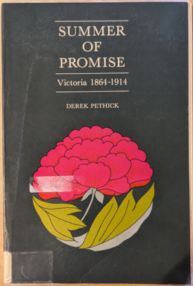
In 1864 Governor James Douglas handed over his office to Arthur Edward Kennedy, closing an era in Vancouver Island's history and ushering in a period of growth and development. The optimism felt by its people was to a large extent justified; the ensuing years were to bring stability, prosperity and many changes. In Summer of Promise, a sequel to Victoria: The Fort, the author chronicles the years from 1864 to the outbreak of World War One in 1914, seeing them through the eyes of the inhabitants of the city which was the capital of the colony and later of the province. Despite its geographical isolation, its population remained well aware of world events: the Boer War, the death of Queen Victoria, the ascension of Edward VII to the throne and the rising threat of the German navy were as much talked about as the waning of many traditional religious beliefs and the enfranchisement of women. Nearer home, these were important years for Victoria as the colony voted to join the Dominion of Canada, the railroad connected the new province with the rest of the country, and the "All Red Route" linked it by steamship to Australia and the Orient. Motorcars, aeroplanes, telephones, the telegraph and electricity brought British Columbia into the twentieth century. From the momentous to the mundane, and sometimes even to the ridiculous, Derek Pethick documents an era in Victoria's history. Summer of Promise is enlightening, fascinating and enjoyable reading. 191 pages, 8 unnumbered leaves of plates : illustrations ; 23 cm Non-circulating [ 1 ]
|
1980 |
|
Follow the pathfinders through the Okanogan and Ogopogoland to the Shuswap by George Bechtold
|
1980 |
|
Exploring the southern Selkirks including the Valhallas and Kokanee Glacier Provincial Park by John Carter, Douglas Leighton 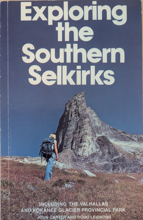
Exploring the Southern Selkirks serves as a comprehensive visual and geographic guide to the rugged, glaciated landscapes of the West Kootenay region in southeastern British Columbia. The authors focus extensively on the steep granite peaks of Valhalla Provincial Park and the pristine alpine environments found within Kokanee Glacier Provincial Park. Through detailed descriptions, the book captures the remote, mountainous terrain that defines the southern Selkirk range, an area characterized by dramatic elevation changes and deep river valleys. By highlighting these specific wilderness areas, the work illustrates the profound natural beauty and challenging topography that draw backcountry explorers to this distinct inland mountain corridor. 119 pages : illustrations, maps ; 22 cm Non-circulating [ 1 ]
|
1980 |
|
Heritage of the Wallowas life as it was by Ethel Halsey Scott 
Ethel Halsey, daughter of Bill Halsey (born 1873) and Vergie Bell Pinkley (born 1886), was born in the early 1900s. She tells of her life with her husband, Noel Scott, and her children and extended family and friends and neighbors, weaving these with the history of the Wallowa, Oregon area iii, 153 pages : illustrations ; 23 cm Non-circulating [ 1 ]
|
1980 |
|
Oregon Coast Range wilderness by Sherry Wellborn
|
1980 |
|
Early churches of Washington State by Arnold Pearson, Esther Pearson 
Author is an alumnus of Evanston Township High School, class of 1932 ix, 182 pages : illustrations, map ; 27 cm Non-circulating [ 1 ]
|
1980 |
|
The Nootka connection Europe and the Northwest coast, 1790-1795 by Derek Pethick 
Derek Pethick’s The Nootka Connection: Europe and the Northwest Coast, 1790–1795 chronicles the intense diplomatic, naval, and commercial maneuvers between Great Britain and Spain following the Nootka Crisis, which transformed the Pacific Northwest coastline into an arena of competing imperial claims. Centered on the pivotal diplomatic anchorage of Yuquot (Friendly Cove) and radiating through the Strait of Juan de Fuca, the Strait of Georgia, and Haida Gwaii, the volume documents how British and Spanish naval expeditions systematically superimposed European toponymy and sovereign boundary lines over the maritime territories of the Nuu-chah-nulth, Coast Salish, and Haida nations. Pethick details the delicate frontier logistics of this naval presence, demonstrating that sustained reconnaissance by commanders like George Vancouver and Juan Francisco de la Bodega y Quadra remained profoundly reliant on negotiated trade alliances and navigational intelligence provided by hereditary leaders such as Chief Maquinna and Wickaninnish. Ultimately, the work captures the transitional era when multilateral imperial treaties and maritime fur trade corridors laid the foundational cartographic framework that paved the way for Euro-American colonial settlement across the Pacific slope. 281 pages : illustrations, maps ; 24 cm Non-circulating [ 1 ]
|
1980 |
|
Pioneers of North Central Washington by Eva Greenslit Anderson
|
1980 |
|
The history of the Northern Pacific Railroad by Louis T. Renz
|
1980 |
|
So they called the town "Concrete" a story of life and times in unique Concrete, Washington by Charles M. Dwelley 
Concrete, as a town, had a colorful and interesting history and those who took part even briefly never forgot "those old days in Concrete." Some of the itinerant workers who arrived with the building of the railroad in 1900 - Italians, Swedes, Norwegians, Greeks from the old country; plus Northerners, Southerners, Easterners of all nationalities remained to become accorded an unusual acceptance and welcome that made them feel at home. Many who came for a short employment stayed on to marry and settle in, and lived to be buried here as old-timers. It was that kind of town. If you want to know the rest of the story, read on. 134 pages : illustrations ; 21 cm Non-circulating [ 1 ]
|
1980 |
|
Seattle's black Victorians, 1852-1901 by Esther Hall Mumford 
"...looks at black life in 19th century Seattle from many angles. The combination of newspaper files, county records, and oral history gives a density to the historical picture." John Berry, Seattle Sun -- Back cover 235 pages : illustrations, facsimiles, map, portraits ; 22 cm Desiderata
|
1980 |
|
San Juan Island coastal place names and cartographic nomenclature by Bryce Wood, Washington State Historical Society
|
1980 |
|
Strangers in blood fur trade company families in Indian country by Jennifer S. H. Brown 
Describes the social world of the traders in the 18th and 19th centuries. Examines differences between the North West Company and the Hudson's Bay Company and their effects on Indian-white relations xxiii, 255 pages, 6 unnumbered leaves of plates : illustrations (some color) ; 24 cm Desiderata
|
1980 |
|
The Northern Shoshoni by Brigham D. Madsen 
Brigham D. Madsen examines four distinct groups which comprise the Northern Shoshoni, focusing on the tribe since the arrival of the first white settlers. He describes the early days on the reservation and the tribe’s struggle to adapt to massive cultural changes. 259 pages : illustrations ; 29 cm Desiderata
|
1980 |
|
Coyote was going there Indian literature of the Oregon country by Jarold Ramsey (Compiler, Editor) 
The vivid imagination, robust humor, and profound sense of place of the Indians of Oregon are revealed in this anthology, which gathers together hitherto scattered and often inaccessible legends originally transcribed and translated by scholars such as Archie Phinney, Melville Jacobs, and Franz Boas. xxxvii, 295 pages : illustrations ; 24 cm Desiderata
|
1980 |
|
Point Roberts, U.S.A. the history of a Canadian enclave by Richard Eugene Clark , Runa Thordarson (Photographer), Robert B. Lindquist (Contributor) 
When the June 15, 1846 Treaty of Washington was signed by representatives of the United States and Great Britain, it established the forty-ninth parallel of north latitude as the boundary to the middle of the channel which separates the North American continent from Vancouver Island. That decision, probably unknowingly, left a small piece of real estate below the line but isolated by marine waters from the rest of United States / Washington land. That promontory subsequently became known as Point Roberts, a unique and interesting community, greatly influenced by Canada but fiercely American. Point Roberts is a story of political and geographic accident; it is also a story of the people who settled there, who fished and farmed, who lived under difficult circumstances and isolation. It is a chronicle of good times and bad, rising expectations and tragic events. It includes the efforts of people to create social and cultural institutions to solve their problems and to pass their culture on from one generation to the next — governmental units, churches, schools, water districts, even a cemetery. Point Roberts is also a study of two nations and their people facing off, sharing, trying to learn how to live together. That chapter still is not complete, nor is the history of Point Roberts. But its history has begun, and we are indebted to Richard Clark for gathering the existing bits and pieces to date together in this book. It teaches some valuable lessons — that human perseverance can overcome adversity, that human institutions and social inventions do advance a people, and that Point Roberts is an extremely interesting and valuable part of Washington State and the United States of America. viii, 137 pages : illustrations ; 23 cm Desiderata
|
1980 |
|
Fort Walla Walla Museum the story of how a determined and dedicated community built their museum to tell their region's history by Vance Orchard, Walla Walla Valley Pioneer and Historical Society 
Vance Orchard’s Fort Walla Walla Museum: the story of how a determined and dedicated community built their museum to tell their region's history chronicles the grassroots civic effort to preserve the agricultural, military, and pioneer heritage of the Inland Northwest. Set in a fertile valley that served as a vital crossroads for the Walla Walla, Cayuse, and Umatilla peoples long before Euro-American settlement, the text details how local historians and volunteers relied on strong community bonds and interdependent alliances to construct a massive repository of frontier artifacts. Orchard documents the cooperative labor required to physically relocate and restore nineteenth-century pioneer cabins, early agricultural equipment, and military structures, implicitly revealing how these early settler footprints were originally mapped directly onto the region's ancient indigenous trade networks and overland trails. Ultimately, this institutional history serves as a testament to collective civic dedication, demonstrating how a modern rural community actively curated and memorialized the complex, overlapping geographic legacy of the Walla Walla Valley. 47 pages : illustrations, portraits ; 22 cm Desiderata
|
1980 |
|
The Court years, 1939-1975 the autobiography of William O. Douglas by William O. Douglas 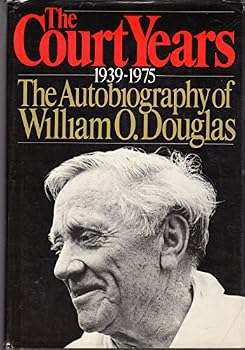
William O. Douglas served on the Supreme Court of the United States for over 36 years, from 1939 to 1975, the longest term of any Justice. His tenure was marked by an unyielding and brilliantly executed determination to- as he frequently put it- "keep the government off the backs of the people." Together with Hugo Black, Justice Douglas was responsible for many of the Supreme Court decisions which extended the protection of the Due Process Clause of the Constitution; limited the power of the large corporations; protected the maverick and the dissident from government harassment; extended and guarded the civil rights of blacks, of women and of other minorities; safeguarded American public lands and resources from those who would plunder them ... and on ... and on. He wrote more dissenting opinions (and wrote them faster) than any other Justice, and yet many of those dissents were later reflected in legislation or else in the majority opinions of the Court itself. Timely, newsworthy, historically important, This book is the personal record of that great lifelong struggle. It continues the memoirs Justice Douglas began so eloquently in his best-selling 'Go East, Young Man.' For the first time in the history of the Supreme Court, one of the Justices- himself- has set about to give the judicial history of the great issues of American life and to show how these issues were dealt with in the Conference Room and "among the Brethren." With a deep understanding of the Court process, with a pungent wit and an intimate knowledge both of the law and of those who interpreted it, Douglas reveals the Supreme Court as it has never been seen before. -- from Book Jacket xi, 434 pages, 8 unnumbered leaves of plates : illustrations ; 24 cm Desiderata
|
1980 |
|
William H. Gray, journal of his journey East, 1836-1837 by W. H. Gray, Donald R. Johnson
|
1980 |
|
Barkerville by Richard Thomas Wright 
Richard Thomas Wright’s Barkerville provides a comprehensive historical and spatial account of the urban and commercial capital of the Cariboo Gold Rush along Williams Creek. Wright traces how the discovery of rich placer gold deposits by Billy Barker in 1862 catalyzed the rapid construction of an extensive wooden mining town directly within the mountain watershed long navigated by Indigenous peoples. The work examines the engineering of massive wooden flumes, water wheels, and drift shafts, detailing the catastrophic fire of 1868 and the town’s swift Victorian reconstruction. Wright highlights the vital role of Chinese merchants, laundry operators, and miners who formed an enduring Chinatown community along Williams Creek, tracing how this remote gold metropolis weathered eventual resource depletion to become an internationally recognized provincial historic site. 124 pages : illustrations (some color), maps ; 28 cm Desiderata
|
1980 |
|
Cherryville a history of the community by Laura Langstaff
Laura Langstaff’s Cherryville: A History of the Community documents the historical geography of Cherryville and the rugged Monashee mining corridor along the upper Shuswap River drainage. Originally established as "Cherry Creek" following the 1860s discovery of placer gold, the chronicle traces how prospectors and pack trains carved precarious trails through dense mountain forests to reach the high-elevation Monashee Pass. Langstaff examines the transition from speculative placer workings to hard-rock quartz mining operations, detailing how depleted claims gave way to family dairy homesteads, cedar pole camps, and independent sawmilling outfits. The narrative highlights the resilient community networks that sustained isolated settlement pockets across Blue Springs, Creighton Valley, and the river reaches surrounding Shuswap Falls. 88 pages : illustrations, maps, portraits ; 23 cm Desiderata
|
1980 |
|
The Atlin gold rush by Ronald Johnson
Ronald Johnson’s The Atlin Gold Rush chronicles the sudden northward diversion of stampeders to extreme northwestern British Columbia during the 1898 Klondike stampede. Johnson documents how initial placer discoveries by Fritz Miller and Kenneth McLaren on Pine Creek triggered the immediate platting of the Atlin townsite directly along ancestral Taku River Tlingit lands. The text traces the establishment of early commercial avenues, recording the installation of massive hydraulic flumes, ditch networks, and floating dredge infrastructure that re-engineered the drainage systems of Pine, Spruce, and McKee creeks. Johnson details the social development of the frontier community through boom and decline, documenting the growth of satellite mining camps at Surprise and Boulder City and the lake transport docks at Scotia Bay that sustained the district’s industrial extraction. 88 pages : illustrations, maps, portraits ; 23 cm Desiderata
|
1980 |
|
Bloomington, Idaho a history of the town and its people by Bloomington Historical Committee
The Bloomington Historical Committee’s Bloomington, Idaho: A History of the Town and Its People records the founding, spatial arrangement, and family histories of one of the earliest Mormon settlements in the Bear Lake Valley. Settled in the spring of 1864 along Bloomington Creek, the text documents the communal surveying of farm plots, the construction of log meetinghouses, and the establishment of water rights that supported grain cultivation and cattle husbandry. The narrative chronicles the operation of early shingle mills and limestone quarries in Bloomington Canyon, recording community cultural activities, brass bands, and cooperative livestock herds. Comprehensive genealogical sections and property registers preserve the social and economic fabric linking Bloomington to its neighboring settlements in Paris and St. Charles. vi, 242 pages : illustrations, maps, portraits ; 28 cm Desiderata
|
1980 |