Catalog of British Columbiana and Pacific Northwest Americana
The Encyclopedia Cascadia Catalog indexes mostly non-fiction literature covering the Pacific Northwest coast of North America, with an emphasis on British Columbia, Idaho, Oregon, and Washington State.
| Catalog Title | Published |
|---|---|
|
Knappton the first 50 years, Pacific County, Washington by Carlton E. Appelo 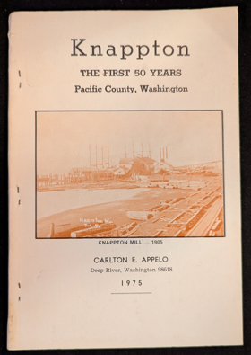
Knappton the first 50 years, Pacific County, Washington chronicles the grueling industrial expansion and isolated maritime settlement along the rugged, storm-battered northern shore of the massive Columbia River estuary. Appelo details how the region's formidable physical barriers—specifically the treacherous, shifting sandbars of the river mouth, the violent winter squalls driving in from the open Pacific, and the steep, impenetrable coastal rainforests plunging directly into the tidal wash—strictly dictated the margins of early human survival, commercial fishing, and timber extraction. By mapping the immense physical labor required to construct precarious salmon canneries and maritime quarantine facilities on piling-supported wharves directly over the tidal flats, and to wrestle massive old-growth timber from the sheer coastal bluffs, the narrative highlights the monumental effort necessary to anchor a permanent industrial enclave in this demanding estuarine environment. The profound lack of viable overland routes to the territorial interior initially forced these remote laborers and pioneer homesteaders into an absolute reliance on the perilous marine highway, completely anchoring their commercial existence and physical survival to the unpredictable arrival of coastal schooners and the severe hydrological force of the Columbia River's massive tidal exchange. Ultimately, this local historical record serves as a deeply localized spatial history, demonstrating how the extreme estuarine geography, violent maritime weather, and immense hydrological power of this Pacific Northwest frontier fundamentally shaped the fiercely resilient, strictly maritime-dependent character of the Knappton settlement. 88 pages : illustrations ; 23 cm Non-circulating [ 1 ]
|
1975 |
|
The Pierce chronicle personal reminiscences of E.D. Pierce as transcribed by Lou A. Larrick by E. D. Pierce, Lou A. Larrick, Gary Williams , Ronald W. Stark , Idaho Research Foundation (Publisher) 
The Pierce chronicle: personal reminiscences of E.D. Pierce as transcribed by Lou A. Larrick chronicles the grueling mineral exploration and precarious early prospecting across the deep, river-carved canyons and rugged western slopes of the Bitterroot Mountains in north-central Idaho. Pierce and his transcribers detail how the region's formidable physical barriers—specifically the towering, impenetrable granite peaks of the inland ranges, the dense, heavily timbered wilderness of the Clearwater River drainage, and the severe, snow-choked intermountain winters—strictly dictated the margins of early human survival and aggressive resource extraction. By mapping the immense physical labor required to force precarious overland trails through the unyielding alpine brush, navigate treacherous, rapid-choked river gorges, and painstakingly extract placer gold from the icy, remote stream beds, the narrative highlights the monumental effort necessary to anchor the territory's first mining encampments in this demanding inland environment. The profound geographic isolation from established territorial supply lines initially forced these highly mobile prospectors into a strict reliance on the precise topography of the mountain watersheds, completely anchoring their commercial existence and physical survival to the severe hydrological realities of the high-elevation streams and the perilous overland mountain passes. Ultimately, this personal and historical record serves as a deeply localized spatial history, demonstrating how the extreme intermountain geography, immense geological scale, and harsh climatic barriers of this Pacific Northwest frontier fundamentally shaped the fiercely resilient, strictly terrain-dependent character of Idaho's earliest gold rush exploration. xii, 127 pages : illustrations, facsimiles, portraits ; 23 x 29 cm Non-circulating [ 1 ]
|
1975 |
|
Five corners the story of Chilliwhack by Bruce Ramsey 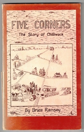
Five corners: the story of Chilliwhack chronicles the grueling agricultural transformation and isolated pioneer settlement situated within the vast, flood-prone alluvial floodplain of the lower Fraser Valley in British Columbia. Ramsey details how the region's formidable physical barriers—specifically the massive, unpredictable seasonal inundations of the Fraser River, the dense, waterlogged riparian forests of the valley floor, and the towering, impenetrable peaks of the surrounding Cascade and Coast mountains—strictly dictated the margins of early human survival and agrarian expansion. By mapping the immense physical labor required to painstakingly construct extensive earthen dikes against the swelling river currents, drain the marshy lowlands for cultivation, and carve rudimentary overland wagon routes through the dense brush to establish the vital "Five Corners" intersection, the narrative highlights the monumental cooperative effort necessary to forcibly convert this volatile riparian environment into highly productive agricultural tracts. The initial geographic isolation from the deepwater coastal ports forced these remote farming homesteads into a strict reliance on the precise topography of the Fraser River for transportation, completely anchoring their early commercial existence and civic development to the precarious navigation of shallow-draft sternwheelers and the severe hydrological realities of the basin. Ultimately, this local historical record serves as a deeply localized spatial history, demonstrating how the extreme riverine geography, heavy seasonal flooding, and immense physical labor of this Pacific Northwest frontier fundamentally shaped the fiercely resilient, tightly knit, and strictly agriculturally dependent character of the Chilliwack settlement. xii, 96 pages : illustrations, maps, portraits ; 22 cm Non-circulating [ 1 ]
|
1975 |
|
British Columbia chronicle, 1788-1846 adventures by sea and land by G. P. V. Akrigg, Helen B. Akrigg
British Columbia chronicle, 1788-1846: adventures by sea and land examines the precarious maritime exploration and grueling overland fur-trade expansion across the vast, geographically fractured expanse of early British Columbia. The Akriggs detail how the region's formidable physical barriers—specifically the violent, storm-battered archipelagos of the Pacific coast, the massive, impenetrable spine of the Rocky Mountains, and the treacherous, rapid-choked currents of the Fraser and Columbia river canyons—strictly dictated the margins of early human survival, indigenous contact, and imperial commerce. By mapping the immense physical labor required to pilot fragile sailing vessels through uncharted, tide-swept coastal fjords and to force precarious canoe routes and portages across sheer alpine divides, the narrative highlights the monumental endurance necessary to scientifically chart and commercially exploit this demanding, highly varied environment. The profound geographic isolation from established global empires initially forced these remote maritime expeditions and rugged overland brigades into a strict reliance on the precise topography of sheltered marine anchorages and inland river corridors, completely anchoring their physical survival and geopolitical claims to the severe hydrological forces and unpredictable winter climates of the northern wilderness. Ultimately, this comprehensive historical record serves as a macro-level spatial history, demonstrating how the immense geological scale, extreme coastal hydrology, and rugged terrestrial divides of this Pacific Northwest frontier fundamentally shaped the fiercely resilient, strictly terrain-dependent character of the region's earliest global exploration and fur-trade networks. xv, 429 pages, 12 unnumbered leaves of plates : illustrations, maps, portraits ; 23 cm Non-circulating [ 1 ]
|
1975 |
|
Columbia River Gorge history. Volume two by Jim Attwell 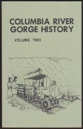
Columbia River Gorge history. Volume two chronicles the grueling infrastructural expansion and precarious pioneer settlement situated within the massive, sheer-walled basalt chasm that forcefully bisects the Cascade Range. Attwell details how the region's formidable physical barriers—specifically the towering, impenetrable basalt cliffs, the violent, gale-force wind tunnels channeling directly through the canyon, and the treacherous, rapid-choked currents of the Columbia River—strictly dictated the margins of early human survival, overland migration, and commercial navigation. By mapping the immense physical labor required to blast precarious railway grades and early highway routes directly into the unyielding bedrock, and to engineer complex wooden portages and lock systems to safely bypass the lethal river cascades, the narrative highlights the monumental effort necessary to anchor a permanent transit corridor and industrial presence in this demanding, sublime riverine environment. The sheer impossibility of alternate cross-mountain routes forced early pioneers, riverboat captains, and remote settlements into a strict reliance on the precise topography of the narrow river channel, completely anchoring their physical survival and economic existence to the severe hydrological forces of the Columbia and the perilous navigation of its deepwater currents. Ultimately, this local historical record serves as a deeply localized spatial history, demonstrating how the immense geological scale, extreme riverine geography, and harsh atmospheric forces of this Pacific Northwest frontier fundamentally shaped the fiercely resilient, strictly transportation-dependent character of the Columbia River Gorge communities. 210 pages : illustrations, maps ; 22 cm Non-circulating [ 1 ]
|
1975 |
|
Centralia, the first fifty years, 1845-1900 by Herndon Smith (Compiler), Centralia High School (Wash) 
Centralia, the first fifty years, 1845-1900 examines the steady civic expansion and critical overland transit development situated within the broad, fertile prairies and river corridors of the Chehalis River valley in southwestern Washington. Smith and the students of Centralia High School detail how the region's distinct topography—specifically its natural prairie clearings amidst dense lowland forests and its vital position at the confluence of the Chehalis and Skookumchuck rivers—strictly dictated the margins of early pioneer settlement and later rail expansion. By mapping the evolution of this natural terrestrial crossroads into a crucial railway hub connecting the Columbia River to Puget Sound, the narrative highlights how the specific valley geography anchored the town's enduring commercial role. Ultimately, this civic and educational record serves as a localized spatial history, demonstrating how the expansive valley terrain and strategic midpoint geography of this Pacific Northwest landscape fundamentally shaped the highly connected, transit-dependent character of early Centralia. xvi, 368 pages : illustrations, portraits ; 22 cm Non-circulating [ 1 ]
|
1975 |
|
The reminiscences of Doctor John Sebastian Helmcken by John Sebastian Helmcken, Dorothy Blakey Smith, Provincial Archives of British Columbia 
Born and brought up in Whitechapel, John Sebastian Helmcken worked his way through apprenticeships as a chemist and a medical pupil before gaining admission to Guy's Hospital to complete his training. The accounts he gives of working class family life and of the great economic and social disadvantages he had to confront in order to become a doctor make this volume of memoirs not only a valuable historical document, but also an autobiography with considerable human interest. In 1850 Helmcken arrived in Fort Victoria -- at that time still a fortified trading post -- to take up the position of Hudson's Bay Company doctor. British Columbia was then in the midst of rapid change: the fur trade was in decline, the gold rush was soon to begin, and the first phase of genuine settlement was just getting under way. In 1856 Helmcken entered what was to be a political life lasting 15years and served as Speaker in the first Legislative Assembly. This section of the Reminiscences is filled with vivid and often humorous descriptions of the personalities and everyday life of Victoria andBritish Columbia from the 1850's to the 1870's. In 1870 Helmcken secured his place in the history of Canada and British Columbia by accepting the task, together with Sir Joseph Trutchand R.W.W. Carrall, of negotiating British Columbia's entry into Canada. The Reminiscences, now held in the Provincial Archives of British Columbia, have a special significance for students of provincial and federal Canadian history. Helmcken's is a unique account of the way social and economic conditions were actually felt and experienced in B.C. at the time of Confederation. Together with his personal diary of the Ottawa negotiations, edited by Willard E. Ireland and included here, the memoirs are the most complete and intimate record available of how Canada secured a foothold on the Pacific. xlii, 373 pages, 6 unnumbered leaves of plates : illustrations ; 24 cm Desiderata
|
1975 |
|
Halfway to the goldfields a history of Lillooet by Lorraine Harris
Lorraine Harris’s Halfway to the Goldfields: A History of Lillooet provides a comprehensive historical study of the strategic crossroads situated along the Fraser River canyon at the junction of Cayoosh Creek and Seton River. Harris documents how the ancient river fisheries, village terraces, and trade junctions of the St'át'imc Nation were entered by thousands of prospectors during the 1858 Fraser Canyon Gold Rush. The narrative traces Lillooet’s designation as "Mile 0" of the original Cariboo Wagon Road, chronicling the construction of Sgt. Major John McMurphy’s military road and the establishment of freight-team packing depots. Harris examines early agricultural pre-emptions on the arid benches of Fountain, Fountain Valley, and Pavilion, while recording the multi-ethnic commercial presence of Chinese miners, European storekeepers, and St'át'imc pack-train operators who anchored the district’s enduring civic infrastructure. 176 pages : illustrations, maps, portraits ; 23 cm Desiderata
|
1975 |
|
Ferryboats on the Columbia River, including the bridges and dams by Robert H. Ruby, John A. Brown 
Ferryboats on the Columbia River, including the bridges and dams examines the evolving infrastructural connectivity and maritime transit across the massive, powerful waterway that historically divided the Pacific Northwest's interior. Ruby and Brown detail how the river's immense spatial scale—specifically its wide, sweeping currents, dramatic basalt gorges, and the expansive, arid plateau it bisects—strictly dictated the placement of early river crossings and later monumental engineering projects. By mapping the historical transition from isolated cable ferries navigating the volatile channels to the massive concrete dams and steel bridges that ultimately tamed the river's hydrological force, the narrative highlights how the sheer magnitude of the Columbia necessitated constant technological adaptation to bind the region together. Ultimately, this infrastructural record serves as a macro-level spatial history, demonstrating how the immense riverine geography and hydrological power of this dominant waterway fundamentally defined the highly engineered, transit-dependent character of the Columbia basin. 176 pages : illustrations, map (on lining paper) ; 28 cm Non-circulating [ 1 ]
|
1974 |
|
Oregon historical vignettes by Paul Keller, Jack Pement
Oregon historical vignettes examines the fragmented pioneer settlement and diverse cultural development spread across the sweeping, highly varied landscapes of the state, from the rugged Pacific coastline to the expansive eastern plateaus. Keller and Pement detail how the region's distinct macro-geography—specifically the fertile, sheltered expanse of the Willamette Valley, the formidable volcanic divide of the Cascade Range, and the vast, sun-baked high desert of the interior—strictly dictated the margins of agricultural expansion, resource extraction, and community isolation. By mapping these localized historical episodes against their distinct environmental backdrops, the narrative highlights how the specific coastal, riverine, and arid terrains anchored the unique economic and social identities of scattered Oregon settlements. Ultimately, this collection of historical sketches serves as a macro-level spatial history, demonstrating how the immense environmental diversity and stark geographic partitions of this Pacific Northwest frontier fundamentally shaped the multifaceted, deeply localized character of early Oregon. 104 pages : illustrations ; 29 cm Non-circulating [ 1 ]
|
1974 |
|
In the sea of sterile mountains the Chinese in British Columbia by James W. Morton
In the sea of sterile mountains the Chinese in British Columbia examines the pioneer settlement and vital infrastructural development situated within the deeply fissured river canyons and vast, unforgiving alpine ranges of the British Columbia interior. Morton details how the region's imposing topography—specifically the sheer rock walls of the Fraser River Canyon, the isolated, rugged goldfields of the Cariboo, and the expansive cordillera of the Canadian Rockies—strictly dictated the margins of resource extraction and perilous railway expansion. By mapping the establishment of isolated mining enclaves and precarious rail camps woven directly into these steep, rocky corridors, the narrative highlights how this specific canyon and alpine geography anchored the Chinese immigrant experience to the province's most demanding terrestrial environments. Ultimately, this historical record serves as a deeply localized spatial history, demonstrating how the immense vertical scale and stark geological isolation of this Pacific Northwest frontier fundamentally shaped the tightly bound, terrain-dependent character of early Chinese communities in British Columbia. xiii, 280 pages, 8 unnumbered leaves of plates : illustrations ; 24 cm Non-circulating [ 1 ]
|
1974 |
|
British Columbia recalled a picture history 1741-1871 by Derek Pethick, Susan Im Im Baumgarten
British Columbia recalled a picture history 1741-1871 examines the early maritime exploration and gradual coastal settlement mapped across the deeply indented fjords and heavily forested archipelagos of the Canadian Pacific coast. Pethick and Baumgarten detail how the region’s formidable macro-geography—specifically the labyrinthine marine waterways, the towering coastal mountain ranges plunging directly into the sea, and the dense temperate rainforests—strictly dictated the placement of early European fur trading outposts and subsequent colonial expansion. By charting the visual evolution of these scattered, precarious anchorages into established colonial ports, the narrative highlights how the rugged maritime topography anchored the region's early economic dependency entirely to deep-water navigation and immediate coastal resources. Ultimately, this visual historical record serves as a macro-level spatial history, demonstrating how the complex coastal geography and immense geographic isolation of this northern Pacific frontier fundamentally shaped the maritime-dependent, tightly constrained character of early British Columbia. 96 pages : illustrations ; 28 cm Non-circulating [ 1 ]
|
1974 |
|
Pioneering Pocatello was no picnic by Betty Hale, Leon Jenks
Pioneering Pocatello was no picnic examines the early settlement and crucial transit development situated within the narrow, windswept corridor of the Portneuf River valley where it opens onto the vast Snake River Plain in southeastern Idaho. Hale and Jenks detail how the region's distinct topography—specifically the arid, sagebrush-covered steppes, the rugged surrounding foothills, and the vital natural funnel created by the river valley—strictly dictated the margins of overland pioneer migration and the eventual establishment of a major railway junction. By mapping the transformation of this rugged geographic chokepoint into a permanent "Gate City" connecting the Pacific Northwest to the Great Basin, the narrative highlights how the specific valley contours anchored the town's enduring commercial role. Ultimately, this local historical record serves as a deeply localized spatial history, demonstrating how the expansive high-desert geography and strategic natural corridors of this inland frontier fundamentally shaped the transit-dependent, highly connected character of early Pocatello. 28 pages : illustrations ; 22 cm Non-circulating [ 1 ]
|
1974 |
|
Tillamook Indians of the Oregon coast by John Sauter, Bruce Johnson 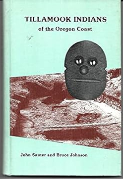
Tillamook Indians of the Oregon coast examines the indigenous settlement and sophisticated maritime culture situated within the deeply indented bays and dense temperate rainforests of the northern Oregon shoreline. Sauter and Johnson detail how the region's distinct coastal topography—specifically the rich tidal estuaries of Tillamook and Nehalem bays, the rugged basalt headlands jutting into the Pacific, and the heavily timbered barrier of the Coast Range—strictly dictated the margins of seasonal habitation and resource gathering. By mapping the intricate network of cedar-plank villages woven directly into the sheltered riparian corridors and estuarine marshes, the narrative highlights how this specific coastal geography anchored the tribes' deep reliance on abundant marine harvests and massive cedar timber. Ultimately, this anthropological record serves as a deeply localized spatial history, demonstrating how the rich estuarine environments, imposing mountainous isolation from the interior, and dynamic tidal forces of this Pacific Northwest shoreline fundamentally shaped the deeply rooted, marine-dependent character of the Tillamook peoples. ix, 196 pages : illustrations, maps ; 23 cm Non-circulating [ 1 ]
|
1974 |
|
Short trips and trails the Columbia Gorge by Oral Bullard, Don Lowe (Illustrator)
Short trips and trails the Columbia Gorge examines the intricate recreational network and scenic pathways woven through the dramatic, basalt-walled canyon that bisects the Cascade Range between Washington and Oregon. Bullard and Lowe detail how the region’s extreme vertical geography—specifically the sheer rock walls, the plunging waterfalls cascading through dense temperate rainforests, and the sharp climatic transition to arid interior plateaus—strictly dictates the margins of modern overland exploration. By mapping the precise routing of footpaths and historic highways along precarious cliff edges and deep riparian ravines, the narrative highlights how the sheer geological scale of the gorge anchors human movement to highly constrained, terrain-defined corridors. Ultimately, this recreational guide serves as a localized spatial history, demonstrating how the immense geological forces and dramatic elevation gradients of this Pacific Northwest chokepoint fundamentally shape the immersive, terrain-dependent character of Columbia Gorge trail navigation. 128 pages illustrations 23 cm Non-circulating [ 1 ]
|
1974 |
|
Columbia River Gorge history. Volume one by Jim Attwell 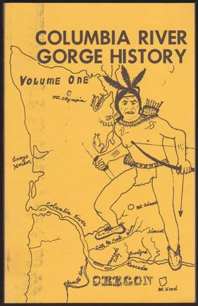
This is some of the history of the early days in the Columbia River Gorge. The Indians were her many, many moons before the white people came, but they left no written history. This writer did not come with the first explorers so must depend on some of the history left by them, however he was a descendant of some of the early settlers and friends of others, who have given him stories which he wishes to pass on. -- Amazon 150 pages : illustrations, maps ; 21 cm Non-circulating [ 1 ]
|
1974 |
|
Spokane corona eras & empires by Edmund T. Becher
The historical corona of the "Spokane Country," rife with romance and intrigue, truly shines brightly. It outshines most areas of the world because the Inland Empire was the last section of the North American continent to come under the control and development of a single modern imperialistic nation. This tardy development came about because the Inland Empire was ringed by formidable mountain ranges, difficult to penetrate-The Rocky Mountains to the eat, to the north the Selkirks, the Cascades on the west the the Blue Mountains on the southern rim.Geographical remoteness set the stage for the most interesting historical dramas possible. The isolation retarded the rapid influx of agricultural settlers, elsewhere often a rather prosaic over-night affair, and instead, forced an unusually long and exciting period of human-interest events involving fiercely resisting Indians, rugged explorers, freedom loving fur traders, missionaries, prospectors, miners, soldiers, cattle and sheep raisers, adventurers, surveyors and railroad builders, all of whom, for six or seven decades, were permitted to operate in a wild romantic land, uncluttered with white populations vii, 319 pages : illustrations, maps, portraits ; 24 cm Non-circulating [ 1 ]
|
1974 |
|
Origin of geographic names of Tacoma/Pierce County, Washington by Gary Fuller Reese
Origin of geographic names of Tacoma/Pierce County, Washington examines the toponymic evolution and territorial claiming across a vast transect stretching from the deep marine waters of Commencement Bay to the towering volcanic slopes of Mount Rainier. Reese details how the region's diverse topography—specifically the steep coastal bluffs of Puget Sound, the sprawling, flood-prone alluvial plains of the Puyallup River valley, and the dense, timbered foothills of the Cascade Range—strictly dictated the margins of indigenous habitation and subsequent pioneer settlement. By mapping the linguistic overlay applied to these distinct terrestrial and marine environments, the narrative highlights how the specific glacial geography and riverine corridors anchored the shifting cultural identities of the burgeoning port city and its surrounding hinterlands. Ultimately, this etymological record serves as a localized spatial history, demonstrating how the dramatic elevation gradient and varied coastal-to-alpine geography of this Pacific Northwest landscape fundamentally shaped the deeply rooted, terrain-derived character of Pierce County. iv, 99, v leaves ; 29 cm Non-circulating [ 1 ]
|
1974 |
|
Beneath Puget Sound a guide to northwest diving by Peter Ward
Beneath Puget Sound a guide to northwest diving examines the submerged marine landscapes and complex aquatic ecosystems situated within the deep, glacially carved fjords of Washington's inland sea. Ward details how the region's formidable underwater topography—specifically the steep, rocky drop-offs, the dense canopies of bull kelp, and the deep, light-starved basins scoured by violent tidal exchanges—strictly dictates the margins of both marine habitation and subaquatic human exploration. By mapping the intricate navigational pathways through these cold-water channels and submerged artificial reefs, the narrative highlights how the specific bathymetry of the Sound anchors the specialized, deeply localized diving culture of the region. Ultimately, this recreational guide serves as a submarine spatial history, demonstrating how the extreme tidal forces, complex glacial bathymetry, and rich ecological density of this Pacific Northwest marine frontier fundamentally shape the immersive, terrain-dependent character of Puget Sound diving. 107 pages illustrations Non-circulating [ 1 ]
|
1974 |
|
Oregon geographic names by Lewis A. McArthur, Lewis L. McArthur
Oregon geographic names examines the extensive toponymic evolution and territorial claiming mapped across the immensely diverse macro-geography of the state, from the rugged Pacific coastline to the expansive, arid high desert of the interior. The McArthurs detail how the region's stark topographical contrasts—specifically the fertile, sheltered expanse of the Willamette Valley, the towering volcanic peaks of the Cascade Range, and the deeply incised river canyons—strictly dictated the margins of indigenous habitation and subsequent pioneer settlement. By tracing the linguistic overlay applied to these distinct terrestrial and hydrological environments, the narrative highlights how the specific glacial, volcanic, and riverine landforms anchored the shifting cultural identities of the state's scattered communities. Ultimately, this comprehensive etymological record serves as a macro-level spatial history, demonstrating how the immense environmental diversity and dramatic elevation gradients of this Pacific Northwest landscape fundamentally shaped the deeply rooted, terrain-derived character of Oregon. ix, 835 pages : map ; 24 cm Non-circulating [ 1 ]
|
1974 |
|
Early transportation on Klamath waterways by Harry J. Drew, Klamath County Museum
Early transportation on Klamath waterways examines the vital maritime network and early pioneer transit situated within the vast, shallow lakes and expansive tule marshes of the high-desert Klamath Basin straddling the Oregon-California border. Drew and the Klamath County Museum detail how the region's unique hydrology—specifically the sprawling, reedy expanses of Upper and Lower Klamath Lakes, the narrow chokepoint of the Link River, and the surrounding arid plateaus—strictly dictated the margins of regional connectivity and commercial navigation. By mapping the evolution of shallow-draft steamboats and early ferries navigating these complex, interconnected wetlands, the narrative highlights how this specific lacustrine geography anchored the isolated region's early timber and agricultural economies before the arrival of overland rail. Ultimately, this historical record serves as a localized spatial history, demonstrating how the expansive, waterlogged topography and complex high-desert wetlands of this Pacific Northwest frontier fundamentally shaped the highly specialized, water-dependent character of the early Klamath communities. 100 pages, 1 unnumbered leaf of plates : illustrations, map ; 29 cm Non-circulating [ 1 ]
|
1974 |
|
Lewis Clark's field guide to wild flowers of field and slope in the Pacific Northwest by Lewis J. Clark 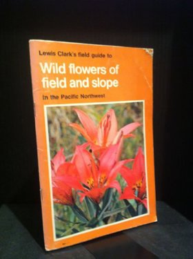
Lewis Clark was a professor at University of Victoria, Canada, for 45 years and carried out extensive botanical studies of the Pacific Northwest region. He was also a skilled photographer. His first book, Wild Flowers of British Columbia, published in 1973, was so successful it led to the series. They have sold more copies than any other field guide published for the Pacific Northwest region. [80] pages : color illustrations ; 21 cm. Desiderata
|
1974 |
|
Pilchuck the life of a mountain by Harry Wentworth Higman, Earl J. Larrison 
Harry W. Higman and Earl J. Larrison’s Pilchuck: the life of a mountain (1949) is a foundational ecological text that chronicles the complex biological and human geography of Mount Pilchuck, a prominent peak in the Cascade Range of Washington. Moving beyond a strict botanical or zoological survey, the authors detail how the mountain's rugged habitat niches—home to species like pikas, marmots, and mountain goats—were deeply understood and actively managed by the Coast Salish, Stillaguamish, and Tulalip peoples. The narrative reveals how these indigenous communities established ancient alpine hunting routes and resource networks across the high crags long before Euro-American arrival. As the region modernized, the text implicitly shows how the United States Forest Service eventually mapped early twentieth-century trails and fire-spotting infrastructure directly onto the mountain's established topography, transforming remote ecological zones into managed civic outposts. By blending meticulous natural history with an awareness of the region's human footprints, Higman and Larrison document the deep, interdependent alliances between local communities and their surrounding environments, ultimately demonstrating how the cooperative management of Mount Pilchuck bridged its ancient indigenous use and its modern conservation legacy. xiv, 288 pages : illustrations ; 21 cm Non-circulating [ 1 ]
|
1974 |
|
Go East, young man the early years : the autobiography of William O. Douglas by William O. Douglas 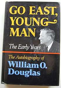
William O. Douglas’s Go East, Young Man: The Early Years provides an evocative personal and geographic record of central Washington during its early twentieth-century industrial and agricultural transformation. Growing up in the Yakima Valley, Douglas details how his physical recovery from childhood illness unfolded across the rugged trails and ridgelines of the Cascade foothills surrounding Mount Adams (Pahto)—a mountainous landscape whose alpine meadows and river valleys had long been stewarded by the Yakama Nation. The narrative documents the rapid superimposition of federal reclamation projects, extensive irrigation canal systems, and transcontinental rail corridors onto ancestral Yakama territory, fundamentally converting native sagebrush rangelands and seasonal root-gathering grounds into intensive commercial fruit orchards. Douglas’s accounts of working the local hop yards and harvest fields alongside Yakama families, itinerant farmhands, and Industrial Workers of the World organizers highlight the shared physical labor and complex social interdependencies that anchored the valley’s resource economy. Ultimately, the autobiography illustrates how this intimate immersion in an engineered Western landscape—caught between corporate agricultural expansion and an enduring Indigenous plateau geography—fundamentally forged the environmental ethic and defense of Indigenous treaty rights that Douglas would later champion on the United States Supreme Court. xv, 493 pages : illustrations ; 24 cm Desiderata
|
1974 |
|
Charles C. Rich Mormon general and western frontiersman by Leonard J. Arrington
Leonard J. Arrington’s Charles C. Rich: Mormon General and Western Frontiersman provides a definitive scholarly biography of the pioneer leader who spearheaded the colonization of the Bear Lake basin. Arrington analyzes the geopolitical and spiritual directives that led Rich to guide pioneer families across high mountain passes in the autumn of 1863 to settle an unforgiving alpine valley then believed to be within Utah Territory. The work chronicles the delicate diplomatic negotiations conducted with Shoshone Chief Washakie to secure peaceful shared access to the valley’s rangelands, detailing how Rich directed the laying out of townsites at Paris, Fish Haven, St. Charles, and Montpelier while establishing communal sawmills, gristmills, and cattle cooperatives that ensured regional survival. xvii, 386 pages : illustrations, maps, portraits ; 24 cm Desiderata
|
1974 |