Catalog of British Columbiana and Pacific Northwest Americana
The Encyclopedia Cascadia Catalog indexes mostly non-fiction literature covering the Pacific Northwest coast of North America, with an emphasis on British Columbia, Idaho, Oregon, and Washington State.
| Catalog Title | Published |
|---|---|
|
Moscow at the turn of the century by Homer David 
Moscow at the Turn of the Century offers a detailed local history of a rapidly growing pioneer community nestled within the distinctive, rolling loess hills of the Palouse region in northern Idaho. The narrative anchors the town's early civic and economic development directly to this fertile inland landscape near the Washington border, where rich soils fueled a booming dryland wheat economy. By documenting the physical expansion of the town grid, early local rail connections, and the foundational establishment of the University of Idaho, David traces the transformation of an isolated agricultural outpost into a permanent regional hub. Ultimately, the book provides a grounded geographic portrait of how early settlers adapted to and capitalized on the sweeping, wind-blown topography of this vital inland Pacific Northwest corridor. vii, 86 pages : illustrations ; 22 cm. Non-circulating [ 1 ]
|
1979 |
|
The colonial postal systems and postage stamps of Vancouver Island and British Columbia, 1849-1871 by Alfred Stanley Deaville 
The colonial postal systems and postage stamps of Vancouver Island and British Columbia, 1849-1871 examines the immense logistical challenges of establishing reliable communication networks across the vast, unforgiving terrains of Canada's westernmost colonial frontiers. Deaville details how early postal routes struggled to penetrate the region's extreme physical barriers, tracking the movement of mail from the isolated maritime hub of Victoria on Vancouver Island through the treacherous, steep-walled canyons of the Fraser River. By mapping the perilous overland express trails that supplied remote gold rush encampments deep within the rugged Cariboo interior, the narrative highlights the profound physical isolation of these early mainland settlements. Ultimately, the book illustrates how the development of early postal infrastructure was a direct, necessary response to the sprawling and mountainous topography that separated this rugged Pacific Northwest outpost from the rest of the world. 210 pages, 8 unnumbered leaves of plates : illustrations ; 24 cm Non-circulating [ 1 ]
|
1979 |
|
Ralph Edwards of Lonesome Lake by Ralph A. Edwards, Ed Gould 
Often called The Crusoe of Lonesome Lake, because of a best-selling book written by the American journalist Leland Stowe, Edwards has gone on to live at least one more life and reveals himself to be a pioneer of a breed that no longer exists. Best known for his almost single-handed rescue of the trumpeter swans from extinction in North America, Edwards now related in his own words other aspects of his long, varied life, including experience with his missionary parents in India, as a telegraph operator under fire in World War I and his eventual return to Lonesome Lake. 293 pages, 20 unnumbered leaves of plates : illustrations (some color) ; 23 cm Non-circulating [ 1 ]
|
1979 |
|
Tales of Richland, White Bluffs & Hanford, 1805-1943, before the atomic reserve by Martha Berry Parker 
From back This book, Tales of Richland, White Bluffs and Hanford, tells the story of these three towns before there was an atomic project. They were farming communities, rich in a wide variety of early bearing fruit, and with a long growing season for vegetables, feed grains and alfalfa hay. The author lived in Richland from 1932 to 1941. Her mother's family, the Charles Sawyers, came to the Fruitvale District in 1909. The Sawyers had a 19-acre farm just upriver from where the Graduate Center is at present (1986), north of Richland's Hanford School. Mrs Parker has a deep interest in Northwest history and has written two other books, Kin-i-wak, Kenewick, Tehe, Kennewick, and Washington, Oregon; a Map History of the Oregon Country. She is also an amateur archaeologist and is actively interested in Geology and Genealogy. 407 pages : illustrations ; 29 cm Non-circulating [ 1 ]
|
1979 |
|
Port Townsend--years that are gone an illustrated history by Peter Simpson, James Hermanson 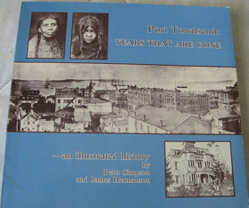
Port Townsend—Years That Are Gone provides a visual and historical chronicle of a maritime boomtown strategically situated at the extreme northeastern tip of Washington’s Olympic Peninsula. The authors detail how the city's exposed location at the turbulent junction of the Strait of Juan de Fuca and Admiralty Inlet dictated its early development, physically dividing the settlement between a bustling deepwater commercial waterfront and a residential district built atop steep coastal bluffs. By examining the ornate Victorian architecture constructed during its prosperous peak, the narrative demonstrates how the town's ultimate geographic isolation—surrounded by marine waterways and backed by rugged mountains—thwarted vital railroad connections and abruptly halted its expansion. Ultimately, the book captures the physical legacy of this unique seaport, mapping its rapid late-nineteenth-century boom and sudden bust directly onto the dramatic coastal topography of the Pacific Northwest. iii, 192 pages : illustrations ; 21 x 22 cm Non-circulating [ 1 ]
|
1979 |
|
Indian tribes of Washington, Oregon & Idaho by John Reed Swanton
Indian tribes of Washington, Oregon & Idaho provides a comprehensive ethnographic and geographic catalog of the Indigenous peoples who inhabited the vastly diverse environments of the inland and coastal Pacific Northwest. Swanton meticulously maps the historical territories of these tribes against the region's formidable topography, contrasting the marine-oriented cultures sustained by the resource-rich estuaries and temperate rainforests of the Pacific seaboard with the riverine societies dependent upon the massive Columbia and Snake River watersheds. The narrative further details how the severe geographic divides of the Cascade Range and the rugged Bitterroot Mountains dictated distinct seasonal migration routes and trade networks across the semi-arid inland plateaus. By anchoring specific tribal lineages and linguistic groups to precise river confluences, coastal bays, and mountain valleys, the book vividly illustrates how the deep physical contours of the region inherently shaped the cultural borders and survival strategies of its earliest inhabitants. 81 pages ; 23 cm Non-circulating [ 1 ]
|
1979 |
|
Salmon fishers of the Columbia by Courtland L. Smith 
Salmon Fishers of the Columbia provides a comprehensive historical study of the commercial fishing industry that dominated the massive, fast-flowing waterway forming the border between Washington and Oregon. The author details how the river's diverse physical environments—from the treacherous, storm-battered estuary at the Pacific Ocean to the steep, rocky rapids of the inland gorge—dictated highly specialized harvesting methods like gillnetting, seining, and the use of massive fish wheels. By anchoring the narrative to specific shifting sandbars and turbulent river channels, Smith illustrates how intense industrial competition ultimately clashed with the physical transformation of the basin through sweeping hydroelectric dam projects. Ultimately, the book serves as an environmental and geographic history, documenting how the relentless power and rich aquatic ecosystems of the Pacific Northwest’s largest river shaped generations of maritime livelihood before the natural waterway was permanently altered. ix, 117 pages : illustrations, charts, maps, portraits ; 29 cm Non-circulating [ 1 ]
|
1979 |
|
The making of Oregon a study in historical geography by Samuel Newton Dicken, Emily F. Dicken
|
1979 |
|
Grassroots a history of Lumby and district by Lumby Historians
The Lumby Historians’ Grassroots: A History of Lumby and District provides a comprehensive local and spatial record of the eastern valleys situated between Vernon and the Monashee foothills. The volume documents the early settlement of "White Valley" (later renamed Lumby after pioneer Moses Lumby), detailing how early French-Canadian and European pre-emptors cleared dense cedar and hemlock bottomlands to establish dairy farms and cattle spreads across Creighton Valley, Trinity Valley, and Blue Springs. The text traces the development of independent sawmill camps, regional rail links via the Canadian National Railway, and the construction of the early twentieth-century hydroelectric generating station at Shuswap Falls. Richly supported by property cadastrals, one-room schoolhouse records, and pioneer recollections, the chronicle captures the everyday realities of rural community formation. 312 pages : illustrations, maps, portraits ; 29 cm Desiderata
|
1979 |
|
Overlanders the Cassiar gold rush by Richard Thomas Wright
Richard Thomas Wright’s Overlanders: The Cassiar Gold Rush examines the 1870s placer gold rush that opened the remote plateau between the Stikine River and Dease Lake. Wright chronicles how prospectors ascended the Stikine River to Telegraph Creek before traversing the rugged overland pack trail to Dease Lake, establishing boomtown settlements along Thibert, Dease, and McDame creeks. The narrative details the boom years of Laketon, Centreville, Defot, and Porter Landing, exploring the significant presence of Chinese miners and merchants who reworked claims and sustained local commerce. Wright also outlines the subsequent establishment of Hudson's Bay Company trading posts and early government administration in the subarctic interior. 64 pages : illustrations, maps, portraits ; 28 cm Desiderata
|
1979 |
|
The Past remembered a Vashon-Maury Island student-community project by Marj Watkins , Garland Norin
The Past Remembered captures the deeply localized pioneer history of Vashon and Maury, twin landmasses joined by a narrow isthmus and entirely surrounded by the deep marine waters of Washington’s central Puget Sound. The compiled oral histories and community accounts document the immense physical labor required to clear dense island timberlands, gradually transforming the secluded, bluff-ringed topography into highly productive agricultural valleys and berry farms. Because the islands lacked any bridge connection to the rapidly growing Seattle mainland, the narratives strongly emphasize a profound geographic isolation that forced early residents to rely entirely on Mosquito Fleet steamers to navigate the region's turbulent tidal currents. Ultimately, this grassroots collection anchors personal memories to specific ferry landings and historic coastal homesteads, illustrating how this rugged, water-bound landscape inherently forged a deeply self-reliant Pacific Northwest island community. [2], ix, 147 pages : illustrations, portraits ; 28 cm Non-circulating [ 1 ]
|
1978 |
|
Forlorn hope the Battle of White Bird Canyon and the beginning of the Nez Perce War by John D. McDermott, Merle W. Wells 
On a June morning in 1877, 109 soldiers and civilian volunteers attacked a small band of Nez Perce Indians camped in White Bird Canyon, in what is now central Idaho. This account of that event is considered one of the best about the beginning of the Nez Perce War. McDermott's account of the battle, from both Indian and white points of view, is considered by many experts one of the best books ever written on an event from the western Indian wars. xv, 229 pages, 8 unnumbered leaves of plates : illustrations, maps, portraits ; 24 cm Non-circulating [ 1 ]
|
1978 |
|
Indians of Idaho by Deward E. Walker 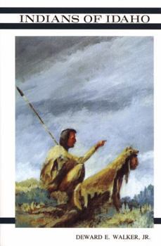
Indians of Idaho provides a comprehensive cultural and geographical survey of the diverse Indigenous peoples inhabiting the extreme topographical extremes of this inland Pacific Northwest corridor. Walker meticulously contrasts the plateau cultures of the north, who relied on the vital salmon runs and dense timberlands of the Clearwater and Salmon river basins, with the Great Basin peoples who adapted to the sprawling, arid volcanic expanses of the southern Snake River Plain. By mapping specific tribal territories onto these starkly different landscapes, the narrative details how the region's rugged mountain ranges and severe climate dictated precise seasonal migrations and specialized subsistence strategies. Ultimately, the book illustrates how the profound geographic divides within modern-day Idaho inherently shaped the distinct cultural identities and survival adaptations of its earliest inhabitants. Historical information concerning the Kutenai, Kalispel, Coeur d'Alene, NEz Perce, Shoshone-Bannock and Northern Paiute tribes of Idaho 207 pages : illustrations ; 22 cm. Non-circulating [ 1 ]
|
1978 |
|
Memoirs of Puget Sound early Seattle, 1853-1856 : the letters of David & Catherine Blaine by David Blaine, Catherine Blaine , Richard A. Seiber 
Memoirs of Puget Sound compiles the vivid frontier correspondence of early missionaries David and Catherine Blaine as they navigated the raw, heavily timbered shorelines of Elliott Bay during the earliest days of Seattle's settlement in Washington Territory. The letters extensively document the profound physical isolation and harsh climate of this nascent maritime encampment, detailing a muddy, stump-littered topography backed by an impenetrable wall of old-growth coastal forest. By recounting their reliance on the deepwater harbor for outside supply ships and their eventual flight to naval vessels during the Puget Sound War of 1855–1856, the Blaines highlight how precarious survival was on this remote territorial edge. Ultimately, this firsthand collection provides an invaluable geographic record of the rugged Puget Sound wilderness just as it began its dramatic transformation into a major coastal seaport. David Blaine was the first Christian minister in Seattle, Washington Territory, and founder of the Methodist Episcopal Church (now First United Methodist Church) in that city 220 pages, 2 unnumbered leaves of plates : illustrations ; 29 cm Non-circulating [ 1 ]
|
1978 |
|
Illahe the story of settlement in the Rogue River canyon by Kay Atwood
Illahe tells the story of the miners, packers, farmers, and families who settled southern Oregon's rugged Rogue River Canyon in the 1860s. Kay Atwood creates a personal picture of what life was like in the remote canyon, drawing on first-person accounts from diaries, journals, and interviews she conducted with descendants of the families who settled the area, most of whom shared Native American and white ancestry. Their stories recount hardships, dangerous river travel, deadly floods, extreme winters, constant isolation, and the self-sufficiency required to survive in this wild, beautiful place. In addition to presenting the words of the homesteaders and their descendants, Atwood has also gathered a treasure trove of rare historic photographs, supplemented by her own drawings and hand-drawn maps. For anyone who has enjoyed the Rogue River canyon and wondered about the history of this national Wild and Scenic Rivers corridor, as well as for readers interested in pioneer history and the settlement of southern Oregon, Illahe offers a fascinating portrait of a truly unique time and place. --Jacket iii, 251 pages : illustrations ; 23 cm Non-circulating [ 1 ]
|
1978 |
|
Sketches of Indian life in the Pacific northwest by Alexander Diomedi, Edward J. Kowrach
Sketches of Indian Life in the Pacific Northwest provides a firsthand account of a Jesuit missionary working among the Coeur d'Alene people deep within the heavily forested, mountainous panhandle of northern Idaho. The narrative chronicles the profound physical and cultural transitions of the tribe as their mission was relocated from the banks of the Coeur d'Alene River to the high agricultural plateau near DeSmet. By detailing the harsh winter conditions and formidable isolation of the surrounding Bitterroot Range, Diomedi illustrates how the severe inland topography directly shaped both indigenous subsistence strategies and the immense logistical challenges faced by early Catholic pioneers. Ultimately, the book serves as a localized geographic record of a remote inland frontier undergoing rapid cultural and environmental transformation. 96 pages : illustrations ; 27 cm Non-circulating [ 1 ]
|
1978 |
|
Postmarked Washington Lewis and Cowlitz counties by Guy Reed Ramsey, Lewis County Historical Society 
Postmarked Washington: Lewis and Cowlitz Counties meticulously traces the history of early postal routes and isolated settlements scattered across the heavily timbered river valleys and rugged Cascade foothills of southwestern Washington. Ramsey details how the turbulent, flood-prone watersheds of the Cowlitz and Chehalis rivers dictated the precise placement of pioneer homesteads and remote logging camps, forcing early communication networks to navigate dense old-growth forests and steep ravines. The narrative highlights the profound physical isolation of these early communities, many of which were wedged between the imposing volcanic slopes of Mount St. Helens to the south and Mount Rainier to the north, relying entirely on treacherous overland trails or seasonal river transport. Ultimately, by tracking the rise and subsequent abandonment of dozens of remote post offices, the book provides a deeply localized spatial history of how this formidable inland topography both fostered and eventually erased these fleeting Pacific Northwest outposts. x, 240 pages : illustrations maps, portraits ; 23 cm Non-circulating [ 1 ]
|
1978 |
|
This valley (Wallowa Valley) by Lola Hopkins 
Lola Hopkins, the "Grandma Moses" of Wallowa County, and now historian of Wallowa Valley advises. "Don't start writing a history when you're seventy-seven." Perhaps others shouldn't, but we are grateful that she did. She probably said something similar at sixty-five when she taught herself ink drawing. An accurate account of the history of one of Oregon's most beautiful areas. Surrounds the pioneer beginnings in this county. 174 pages : illustrations ; 22 cm Non-circulating [ 1 ]
|
1978 |
|
Railroads, reclamation and the river a history of Pasco by Walter A. Oberst
Railroads, Reclamation, and the River chronicles the transformation of Pasco from a desolate, wind-swept desert outpost into a vital regional hub strategically situated at the confluence of the Columbia, Snake, and Yakima rivers in southeastern Washington. Oberst details how the sprawling, relatively flat topography of this arid inland basin made it a natural geographic juncture for early transcontinental railways, breaking the area's profound isolation by linking the interior shrub-steppe to distant coastal markets. The narrative heavily emphasizes the monumental engineering efforts required to harness the immense volume of these converging waterways, mapping out the large-scale irrigation projects that finally allowed settlers to conquer the severe, dry climate and cultivate the sun-baked soil. Ultimately, the book serves as a localized environmental and industrial history, demonstrating how the precise hydrological positioning of this settlement fundamentally dictated its survival and economic evolution within the harsh extremes of the Pacific Northwest interior. 224 pages : illustrations, maps, portraits ; 23 cm Non-circulating [ 1 ]
|
1978 |
|
Coast Salish their art, culture and legends by Reg Ashwell
Coast Salish: Their Art, Culture and Legends explores the rich heritage of the Indigenous peoples who have long inhabited the sheltered, island-dotted marine waterways of the Salish Sea across present-day Washington and British Columbia. Ashwell details how the region's dense temperate rainforests and deep coastal estuaries provided the absolute material foundation for this maritime culture, specifically through the immense western red cedars utilized for monumental carvings, longhouses, and the massive canoes required to navigate the expansive inland sea. By anchoring their vibrant mythology and seasonal subsistence cycles directly to the turbulent tidal currents and salmon-choked river basins of the Strait of Georgia and Puget Sound, the narrative illustrates a society inextricably bound to its aquatic environment. Ultimately, the book serves as a localized cultural geography, demonstrating how the complex coastal topography and abundant marine resources of the Pacific Northwest seaboard fundamentally shaped the unique artistic and spiritual identity of the Coast Salish people. 86 pages : illustrations ; 22 cm Non-circulating [ 1 ]
|
1978 |
|
Time, tide, and timber a century of Pope & Talbot by Edwin T. Coman, Helen M. Gibbs 
Published in 1949 by Stanford University Press and authored by business historians Edwin T. Coman Jr. and Helen M. Gibbs, Time, Tide, and Timber: A Century of Pope & Talbot is an authorized corporate history chronicling the first hundred years of one of the Pacific Northwest’s most influential timber and shipping conglomerates. Commissioned by the company to commemorate its centennial, the volume traces the enterprise from its modest origins in 1849, when founders Andrew J. Pope and Captain William C. Talbot arrived in Gold Rush San Francisco from East Machias, Maine, to launch a lumber and lighterage business. The text details the firm's subsequent expansion into the Puget Sound region, its establishment of massive sawmills at Port Gamble, its extensive fleet of coastal and transoceanic sailing ships, and its eventual evolution into a sprawling modern corporate empire spanning forestry, real estate, and global maritime trade. 73 pages : illustrations ; 23 cm Non-circulating [ 1 ]
|
1978 |
|
Journal of a Catholic bishop on the Oregon trail the overland crossing of the Rt. Rev. A.M.A. Blanchet, Bishop of Walla Walla, from Montreal to Oregon Territory, March 23, 1847 to January 23, 1851. Blackrobe buries Whitmans by Augustine Magloire Alexander Blanchet, Edward J. Kowrach, J. B. A. Brouillet 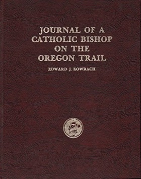
Journal of a Catholic Bishop on the Oregon Trail chronicles the grueling overland migration of early church officials into the remote, semi-arid expanses of the Columbia River Plateau in present-day southeastern Washington. The firsthand accounts vividly map the harsh geographic realities of the Walla Walla valley, a sprawling inland basin where extreme distances and rugged terrain severely hindered communication and isolated pioneer missionaries. By detailing the unforgiving landscape that formed the backdrop to the Whitman Massacre and the ensuing Cayuse War, the journal highlights how the profound physical barriers of the inland Northwest exacerbated the intense cultural conflicts of the era. Ultimately, this collection provides a localized spatial record of how the vast, unforgiving topography of the Oregon Territory's interior frontier fundamentally dictated the precarious survival of its earliest European outposts. 190 pages : illustrations ; 29 cm Non-circulating [ 1 ]
|
1978 |
|
Indians at work an informal history of native Indian labour in British Columbia, 1858-1930 by Rolf Knight 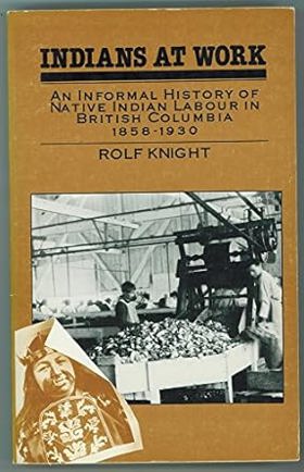
Indians at Work examines the vital role of Indigenous laborers who fueled early industrial expansion across the rugged, heavily forested expanses of British Columbia. Knight details how the province's formidable physical barriers—steep coastal mountains, impenetrable timberlands, and remote marine inlets—dictated a sprawling resource economy centered around commercial salmon canning, deepwater stevedoring, and remote logging operations. By mapping these labor networks from the treacherous rapids of the Fraser River canyons to isolated canneries along the northern coastal seaboard, the narrative demonstrates how Native workers applied their deep spatial knowledge to navigate and master this dangerous terrain. Ultimately, the book serves as a localized economic history, illustrating how the intense physical demands of extracting wealth from this unforgiving Pacific Northwest wilderness fundamentally relied upon the environmental expertise of its original inhabitants. 317 pages : illustrations ; 22 cm Desiderata
|
1978 |
|
Tracking down Oregon by Ralph Friedman 
Tracking Down Oregon provides an expansive journey through the diverse and rugged microclimates that define the state, stretching from its storm-battered Pacific coastline to the vast, arid high deserts of the inland interior. Friedman meticulously maps forgotten pioneer settlements and isolated homesteads hidden within the dense timber of the Coast Range and the steep, volcanic canyons of the Cascade Mountains. By venturing into the remote, sun-baked expanses of Eastern Oregon and tracing the deep river gorges that carve through the inland plateau, the narrative illustrates how extreme physical barriers dictated the scattered placement of early communities. Ultimately, the book serves as a deeply localized spatial travelogue, demonstrating how the stark topographical divides of this Pacific Northwest landscape inherently shaped the enduring frontier character of its most secluded rural outposts. Ralph Friedman catches the spirit of the pioneer, the entrepreneur the builders of Oregon. Interesting people and places are sprinkled throughout his narrative, and he gives directions on how to find them, even if only from an armchair. xii, 306 pages : illustrations ; 23 cm Desiderata
|
1978 |
|
Scappoose past and present by Evelyn Cooper
Evelyn Cooper’s Scappoose: Past and Present provides a comprehensive local history of the fertile plains nestled between the Tualatin Mountains and Multnomah Channel. Drawing its name from the Chinookan term for "gravelly ground," the text details the traditional seasonal villages of the Multnomah people, followed by the establishment of early nineteenth-century farmsteads by mountain men and Hudson's Bay Company retirees. Cooper chronicles the arrival of Oregon Trail wagon trains, the drainage of alluvial flats for intensive cattle and dairy farming, and the 1883 construction of the Northern Pacific Railway branch through Chapman Landing and Warren. The narrative traces the community's transformation into a residential and light industrial center, detailing the civic development of surrounding enclaves such as South Scappoose, Chapman, Spitzenberg, and Corey Hill. 168 pages : illustrations, maps, portraits ; 23 cm Desiderata
|
1978 |