Catalog of British Columbiana and Pacific Northwest Americana
The Encyclopedia Cascadia Catalog indexes mostly non-fiction literature covering the Pacific Northwest coast of North America, with an emphasis on British Columbia, Idaho, Oregon, and Washington State.
| Catalog Title | Published |
|---|---|
|
Place names of the Alberni Valley by Helen Ford, Dorrit MacLeod, Gene Joyce 
Place names of the Alberni Valley explores the linguistic footprint and early pioneer settlement etched into the deeply carved, heavily timbered interior of central Vancouver Island. Ford, MacLeod, and Joyce detail how the region's formidable physical barriers—specifically the sheer, towering peaks of the Vancouver Island Ranges and the long, treacherous, fjord-like trench of the Alberni Inlet—strictly dictated the establishment of early resource extraction camps and permanent communities. By mapping the historical origins behind local toponyms and the immense physical labor required to penetrate these dense, old-growth rainforests, the narrative highlights how the absolute necessity of securing deepwater maritime anchorages at the head of the inlet permanently anchored the precise locations of the valley's settlements. The profound geographic isolation from the island's more accessible eastern seaboard initially forced early homesteaders and massive timber syndicates into a complete reliance on the deepwater marine highway for their commercial survival and global export. Ultimately, this toponymic record serves as a deeply localized spatial history, demonstrating how the complex, deeply indented aquatic topography and immense forested valleys of this Pacific Northwest island inherently shaped the resilient, strictly maritime and timber-dependent footprint of the Alberni frontier. 84 pages, [1] folded leaf of plates : map ; 22 cm Non-circulating [ 1 ]
|
1978 |
|
Pacific Northwest themes historical essays, in honor of Keith A. Murray by Keith A. Murray, James William Scott , Western Washington University Center for Pacific Northwest Studies (Publisher) 
For "Official uses of violence against Northwest Coast Indians in Colonial British Columbia": author undertakes a justification for the use of violence against North West Coast Indians. The use of force to expand the British frontier on the Northwest Coast is noted as a product of British policy, a policy that was put into action when the circumstances warranted. The author referes to this policy as "diplomacy by other means." viii, 138 pages : map, portraits ; 23 cm Non-circulating [ 1 ]
|
1978 |
|
Deep River the C. Arthur Appelo story : Wahkiakum County, Washington by Carlton E. Appelo 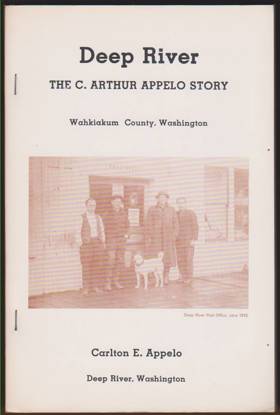
Deep River chronicles the industrial and pioneer history of a remote logging community nestled within the dense, rain-soaked coastal forests of southwestern Washington's Wahkiakum County. The narrative details how the area's profound geographic isolation—wedged between the sprawling lower Columbia River estuary and steep, heavily timbered hills—forced early settlers to rely entirely on a network of tidal waterways to transport massive old-growth logs and essential supplies. By tracing the Appelo family's mercantile and civic efforts, the book illustrates the immense physical labor required to sustain a permanent settlement amidst a soggy, stump-littered wilderness where rugged riverboats served as the only reliable connection to the outside world. Ultimately, this localized biography provides a vivid spatial history of how the formidable maritime climate and impenetrable riverine topography of the Pacific Northwest coast inherently defined the grueling rhythm of early logging camps. 107 pages : illustrations ; 24 cm Non-circulating [ 1 ]
|
1978 |
|
The James Francis Tulloch diary, 1875-1910 the true story of the ups and downs of James and Annie Tulloch and their nine children, all of whom were born and raised on Orcas Island in Washington State's San Juan Islands by James Francis Tulloch, Gordon Keith 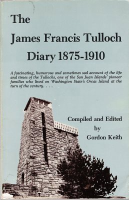
A fascinating, humorous and sometimes sad account of the life and times of the Tullochs, one of the San Juan Islands' pioneer families who lived on Washington State's Orcas Island at the turn of the century. Tulloch writes about his 35 years spent on Orcas Island with a candor and vigor seldom encountered in such a diary. Photos. Map. vii, 124 pages, 1 unnumbered leaf of plates : illustrations ; 23 cm Non-circulating [ 1 ]
|
1978 |
|
It came to pass in the San Juan Islands by Roderic Marble Olzendam, Gordon Keith 
It Came to Pass in the San Juan Islands captures the pioneer history and unique maritime culture of the sprawling, rugged archipelago situated at the turbulent junction of the Strait of Juan de Fuca and the Strait of Georgia in northwestern Washington. Olzendam and Keith detail how the isolated, rocky, and heavily timbered topography of these landmasses—ranging from the steep, mountainous slopes of Orcas Island to the more pastoral valleys of Lopez and San Juan—dictated a fiercely independent settler lifestyle reliant on small-scale farming, fishing, and the exploitation of the nearby water boundary with Canada. By highlighting the early communities' complete dependence on the Mosquito Fleet and emerging regional ferry networks to navigate the treacherous tidal currents of the Salish Sea, the narrative underscores the profound physical barriers that separated these remote outposts from the mainland. Ultimately, the book serves as a deeply localized spatial history, demonstrating how the formidable marine geography of this Pacific Northwest archipelago fundamentally forged the enduring self-reliance of its island inhabitants. ix, 139 pages : illustrations ; 23 cm Non-circulating [ 1 ]
|
1978 |
|
Oh Shaw! and other islands by Jo Ann Morse, Jo Ann Ridley 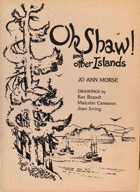
Oh Shaw! and other islands captures the localized history and unique pioneer character of the deeply secluded communities scattered throughout the San Juan archipelago in the marine waters of northwestern Washington. The narrative focuses prominently on Shaw Island, detailing how its rocky, heavily timbered shorelines and protected coves dictated an isolated, fiercely self-reliant lifestyle dependent on small-scale agriculture and the turbulent tidal currents of the Salish Sea. By exploring the broader chain of surrounding landmasses, the authors highlight the profound physical barriers of these marine waterways, where early daily survival and trade relied entirely on hazardous navigation by small boats and regional steamers. Ultimately, the book serves as a geographic tribute to how the remote, water-bound topography of the Pacific Northwest coast inherently shaped the enduring independence of these early maritime settlements. Limited edition prose and poetry book about Shaw Island which highlights watercolors by Rex Brandt, Joan Irving, and illustrator Malcolm Cameron. 38 pages : illustrations ; 23 cm Non-circulating [ 1 ]
|
1978 |
|
Marrowstone by Karen Russell, Jeanne Bean 
Marrowstone chronicles the pioneer settlement and distinct coastal evolution of a narrow, heavily forested landmass strategically situated at the entrance to Washington’s Admiralty Inlet. The authors detail how the island's isolated, water-bound topography required early homesteaders to rely entirely on the turbulent marine waterways of Puget Sound for transportation and trade while painstakingly clearing dense timber to establish small farms. By highlighting the island's commanding geographic position overlooking vital maritime shipping lanes, the narrative also maps the dramatic transformation of its rugged northern bluff into the massive coastal defense installation of Fort Flagler. Ultimately, the book provides a localized spatial history of how this remote Pacific Northwest outpost was fundamentally shaped by both the unforgiving tides of the Salish Sea and its critical strategic location. Contains Craven's Peninsula, 1878-1890; homesteaders; Marrowstone and Indian Island, 1891-1900; plat of Nordland townsite; family genealogies, and Nordland, 1899-1945 [8], vi, 222 pages : illustrations, genealogical tables, maps, portraits ; 24 cm Non-circulating [ 1 ]
|
1978 |
|
History of Vashon-Maury Islands by O. S. Van Olinda 
History of Vashon-Maury Islands provides a foundational, firsthand pioneer account of the intense physical labor required to settle these twin, bluff-ringed landmasses situated in the deep marine waters of Washington’s central Puget Sound. Van Olinda details how the islands' steep, heavily timbered interiors initially dictated community development, forcing early homesteads, logging operations, and vital agricultural tracts to cling strictly to the shoreline where protected coves offered the only viable access to outside markets. By chronicling the arduous process of carving the first inland wagon roads through dense old-growth forests to connect these disparate waterfront landings, the narrative underscores the profound geographic isolation of an environment entirely dependent on the Mosquito Fleet for survival and trade. Ultimately, the book serves as a deeply localized spatial record of early maritime homesteading, demonstrating how the formidable, water-bound topography of this Pacific Northwest island demanded extreme self-reliance and fundamentally shaped its distinct pioneer evolution. 106 pages : illustrations, map ; 21 cm Non-circulating [ 1 ]
|
1978 |
|
Grays Harbor, 1885-1913 by Robert A. Weinstein 
Grays Harbor, 1885-1913 captures the explosive industrial transformation of a massive, rain-soaked estuarine basin situated along Washington’s rugged Pacific coast. Weinstein details how the region’s profound geographic convergence—where the Chehalis River and numerous coastal tributaries empty into a sprawling, sheltered deepwater harbor—created an unrivaled logistical hub for extracting the immense wealth of the surrounding old-growth timberlands. By mapping the rise of the twin mill towns of Aberdeen and Hoquiam, the narrative illustrates how the physical isolation of this dense coastal rainforest forced early timber operations to rely entirely on a massive fleet of lumber schooners that continuously braved the treacherous, shifting sandbars of the harbor entrance. Ultimately, this heavily photographic record serves as a localized environmental and economic history, demonstrating how the sheer scale of both the maritime topography and the towering Pacific seaboard forests fundamentally shaped one of the most intense periods of resource extraction in the Pacific Northwest. 190 pages : illustrations, map, portraits ; 25 cm Non-circulating [ 1 ]
|
1978 |
|
Yesterday's promises a history of the district of Port Hardy by David Lewis 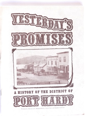
Yesterday's promises: a history of the district of Port Hardy chronicles the challenging pioneer settlement and resource-driven evolution of a remote outpost situated near the rugged northeastern tip of British Columbia’s Vancouver Island. Lewis details how the area's profound physical isolation—bounded by dense, impenetrable coastal rainforests to the south and the turbulent marine waters of Queen Charlotte Strait to the north—dictated an economy and lifestyle entirely reliant on the sea. The narrative highlights how the steep, heavily timbered shorelines and naturally protected bays served as vital staging grounds for the region's intense extractive industries, particularly commercial salmon fishing, copper mining, and large-scale logging operations. Because overland travel to the island's southern population centers was virtually impossible for decades, the community depended absolutely on coastal steamers and precarious maritime supply chains to navigate the perilous shoreline. Ultimately, the book serves as a localized spatial history, demonstrating how the unforgiving, storm-battered topography of this extreme Pacific Northwest coastal frontier inherently shaped the resilient, heavily industrialized character of its early inhabitants. 41 pages : illustrations ; 28 cm Non-circulating [ 1 ]
|
1978 |
|
Harney County an historical inventory by Royal G. Jackson, Jennifer A. Lee, Harney County Historical Society (Or) 
Harney County: An historical inventory provides a comprehensive architectural and spatial catalog of pioneer settlement across the vast, arid expanses of the high desert in southeastern Oregon. Jackson and Lee detail how the sprawling, unforgiving topography of the Harney Basin—dominated by sweeping sagebrush steppes, shallow alkaline lakes, and the towering fault-block escarpment of Steens Mountain—strictly dictated the placement and survival of early communities. By mapping the scattered remnants of remote homesteads, isolated stage stops, and massive cattle empires, the narrative highlights how the severe lack of surface water and extreme inland climate precluded traditional small-scale agriculture. Instead, settlers were forced to adapt their livelihoods to the immense scale of the landscape, relying on vast grazing allotments that stretched across the open terrain. Ultimately, this localized historical record demonstrates how the profound physical isolation and stark environmental extremes of this immense Great Basin frontier inherently forged the fiercely resilient character of Oregon's largest and most sparsely populated county. 200 pages : illustrations, folded map ; 21 cm Non-circulating [ 1 ]
|
1978 |
|
Early Oregon atlas early forts, old mines, old town sites by Ralph N. Preston
Early Oregon Atlas: Early Forts, Old Mines, Old Town Sites provides a vital cartographic record of pioneer settlement, resource extraction, and military expansion across the diverse and challenging landscapes of nineteenth-century Oregon. Preston’s historic maps detail how the state’s imposing physical barriers—from the dense timber of the Cascade Range to the arid, sprawling expanses of the eastern high desert—strictly dictated the placement of early frontier infrastructure. By pinpointing the exact locations of remote military outposts at strategic river crossings and isolated mining camps clinging to the rugged slopes of the Siskiyou and Blue Mountains, the atlas illustrates the immense physical labor required to penetrate and occupy these inaccessible regions. Furthermore, the mapping of abandoned town sites highlights the fleeting nature of early communities that were completely dependent on localized resource booms or subsequently bypassed by shifting overland routes attempting to navigate the complex terrain. Ultimately, this heavily spatial reference serves as a deeply localized geographical history, demonstrating how the unforgiving topography of the Pacific Northwest fundamentally shaped—and often erased—the precise physical footprint of the Oregon frontier. 60 pages : illustrations, maps ; 43 cm Non-circulating [ 1 ]
|
1978 |
|
Building the Skagit a century of Upper Skagit Valley history, 1870-1970 by Paul C. Pitzer
This brief history tells the story of a small valley in Washington State's North Cascades. Over the century since its discovery, it has been developed into a National Parks and Recreation Area, and a large hydroelectric resource that supplies much of Seattle's power. First there were the gold miners who came in 1880 and returned in 1908. Next came the homesteaders who fought the weather and the government for their land. After World War I, Seattle City Light gained control of the Skagit. Would they ever finish building the first dam at Gorge Creek? Why did the Mayor fire J.D. Ross, Seattle City Light's superintendent? What was the Old Skagit Tour like? Construction o all Skagit dams was difficult. The weather and the geology made completion of the project a notable achievement. Building the Skagit is one example of the struggles that have led to the development of our nation's natural resources 105 pages : illustrations, maps, portrait ; 21 cm Non-circulating [ 1 ]
|
1978 |
|
Mount Baker a chronicle of its historic eruptions and first ascent by Harry M. Majors
Mount Baker: A chronicle of its historic eruptions and first ascent documents the mid-nineteenth-century geological volatility and early alpine exploration of the massive, heavily glaciated stratovolcano that visually dominates the skyline of the northern Cascade Range. Majors details how the mountain's formidable physical barriers—from the impenetrable, tangled old-growth forests of the Nooksack River drainage to its sheer, crevasse-riddled alpine ice fields—long isolated its upper elevations and fiercely resisted early pioneer intrusion. By meticulously tracking historical observations of the peak's thermal activity and mapping Edmund Coleman’s arduous 1868 summit bid, the narrative highlights the immense physical endurance and precise spatial navigation required to conquer this unforgiving vertical environment. Ultimately, the book serves as a deeply localized environmental and mountaineering history, demonstrating how the towering, unstable topography of this Pacific Northwest peak actively shaped early scientific inquiry and severely tested the absolute limits of frontier exploration. 221 pages : illustrations ; 22 cm Non-circulating [ 1 ]
|
1978 |
|
Autobiography of Rear Admiral Charles Wilkes, U.S. Navy, 1798-1877 by Charles Wilkes, William James Morgan, United States Naval History Division 
Autobiography of Rear Admiral Charles Wilkes, U.S. Navy, 1798-1877 chronicles the unprecedented maritime surveying efforts of the United States Exploring Expedition as it navigated the complex and treacherous coastal geography of the Pacific Northwest in 1841. Wilkes details the immense logistical challenges of charting this unforgiving maritime frontier, famously underscored by the violent wreck of the USS Peacock upon the shifting, notoriously dangerous sandbars of the Columbia River's mouth. By meticulously mapping the deep, sheltered anchorages of Puget Sound and surveying the sprawling, fertile expanse of the inland Willamette Valley, the narrative illustrates how recognizing the region's specific topographic value—its immense timber reserves, navigable inland waterways, and strategic deepwater harbors—directly fueled American territorial ambitions. The expedition's reliance on Indigenous spatial knowledge to penetrate the dense coastal rainforests and complex riverine networks highlights the formidable physical barriers of the Pacific seaboard. Ultimately, this autobiographical account provides a vital spatial history, demonstrating how mastering and documenting the severe marine topography of the Pacific Northwest coast fundamentally laid the navigational groundwork for American imperial expansion. xxii, 944 pages : illustrations, facsimiles, portraits ; 25 cm ONLINE Circulation [ 1 ]
|
1978 |
|
Postmarked Washington Jefferson, Clallam & Mason counties by Guy Reed Ramsey 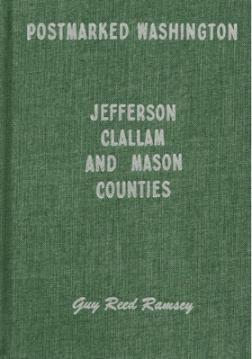
This is the story of the settlers and settlements of three counties on the Olympic Peninsula of Washington, with emphasis on stories of the postal service and postmasters that served the area. Examples of towns included are Port Angeles, Port Townsend, Sequim, Shelton, Forks, and Neah Bay. Hardbound, 180 pages, 6 x 9 inches. Included are maps, photographs, and sketches. 180 pages : illustrations ; 24 cm Non-circulating [ 1 ]
|
1978 |
|
Early Idaho atlas by Ralph N. Preston 
Early Idaho Atlas provides a vital cartographic record of pioneer settlement, resource extraction, and overland migration across the profoundly rugged and vertically extreme landscapes of the Idaho Territory. Preston’s historic maps detail how the region’s formidable physical barriers—ranging from the impassable, deep-cut gorges of the Snake and Salmon rivers to the towering, heavily timbered peaks of the Bitterroot Range—strictly dictated the precise placement of early frontier infrastructure. By pinpointing the exact locations of isolated mining camps clinging to steep alpine drainages and remote military outposts established along the arid, sprawling expanse of the southern Snake River Plain, the atlas illustrates the immense physical labor required to penetrate this fractured, inaccessible terrain. Furthermore, the mapping of early wagon roads and subsequent ghost towns highlights how transient communities were entirely dependent on localized mineral booms or perilous canyon travel routes that were frequently abandoned when the unforgiving geography proved too costly to overcome. Ultimately, this heavily spatial reference serves as a deeply localized geographical history, demonstrating how the severe, highly compartmentalized topography of the Pacific Northwest's eastern interior fundamentally shaped—and often erased—the precise physical footprint of the Idaho frontier. 60 pages : chiefly illustrations, maps ; 45 cm Desiderata
|
1978 |
|
Nipika a story of Radium Hot Springs by David Zieroth , Dianne Bersea (Illustrator), Parks Canada Western Region 
Nipika: a story of Radium Hot Springs explores the natural and cultural evolution of a unique geothermal oasis nestled deep within the rugged, steep-walled trench of the Columbia Valley in the Canadian Rockies of British Columbia. Zieroth details how the region's formidable physical barriers—specifically the towering peaks of the Kootenay and Purcell ranges and the narrow, sheer rock chokepoint of Sinclair Canyon—historically isolated this inland corridor and strictly dictated the movement of early Indigenous peoples and later European explorers. The narrative highlights how the specific geological anomaly of the thermal springs served as a vital focal point for human convergence, eventually forcing ambitious engineering efforts to blast modern roadways through the previously impenetrable alpine rock faces to connect the isolated valley to outside tourism and commerce. Ultimately, the book serves as a localized spatial history, demonstrating how the extreme mountainous topography and unique geothermal resources of this inland Pacific Northwest frontier fundamentally shaped its transition from a remote, inaccessible sanctuary into a heavily managed national park landscape. 36, [2] pages : illustrations ; 23 cm Non-circulating [ 1 ]
|
1978 |
|
Why that name? place names of Kamloops district by Mary Balf 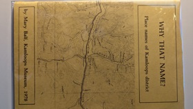
Why that name? place names of Kamloops district explores the linguistic footprint and settlement patterns etched into the semi-arid, rugged expanse of British Columbia's southern Interior Plateau. Balf details how the region's defining topographical feature—the strategic confluence of the North and South Thompson rivers—created a vital inland nexus that channeled centuries of human movement, from early Secwepemc (Shuswap) settlements to the sprawling overland routes of the fur trade and subsequent gold rushes. By decoding the origins behind local toponyms, the narrative reveals how the formidable physical barriers of steep, arid river canyons and the immense, open bunchgrass prairies strictly dictated where pioneers could establish vital ferry crossings, vast cattle ranches, and critical railway alignments. Ultimately, the book serves as a deeply localized spatial history, demonstrating how the complex riverine geography and stark environmental extremes of this inland Pacific Northwest frontier fundamentally anchored the enduring identity and physical footprint of the Kamloops district. 48 pages ; 22 cm Non-circulating [ 2 ]
|
1978 |
|
Go do some great thing the black pioneers of British Columbia by Crawford Kilian 
Go Do Some Great Thing: The Black Pioneers of British Columbia examines the migration and settlement of African Americans who sought refuge and economic opportunity across the rugged coastal and inland landscapes of the British Columbian frontier during the mid-nineteenth-century gold rushes. Kilian details how the expansive marine highway of the Pacific seaboard channeled these pioneers away from an increasingly oppressive California to the strategically sheltered deepwater port of Victoria on Vancouver Island. The narrative highlights how the formidable physical barriers of the region—from the treacherous, rapid-choked gorges of the Fraser River canyon to the dense, heavily timbered slopes of Salt Spring Island—dictated the grueling physical labor required to carve out permanent agricultural homesteads and mercantile networks. By mapping their adaptation to this challenging environment, the book illustrates how the profound geographic isolation of these northern island and riverine outposts provided a vital spatial sanctuary from American institutionalized racism. Ultimately, this foundational record serves as a deeply localized spatial history, demonstrating how the unforgiving marine and mountainous topography of the Pacific Northwest fundamentally shaped the resilient, independent character of British Columbia's earliest Black communities. 188 pages, 4 unnumbered leaves of plates : illustrations ; 24 cm Desiderata
|
1978 |
|
The days of potatoes 'n gravy History of Potatoes and Its People in the Klamath Basin by Bertha Enman 
The days of potatoes 'n gravy: History of Potatoes and Its People in the Klamath Basin chronicles the intensive agricultural transformation of the sprawling, high-elevation wetlands situated along the rugged border of southern Oregon and northern California. Enman details how the region's complex topography—a semi-arid high desert basin originally dominated by massive shallow lakes, dense tule marshes, and rich volcanic pumice—initially presented a formidable aquatic barrier to traditional pioneer settlement. The narrative highlights the immense physical labor and massive federal reclamation efforts required to drain these remote wetlands, forcibly converting the impenetrable watershed into a highly controlled, irrigated grid perfectly adapted for large-scale commercial potato cultivation. By mapping the deep relationship between the farming communities and the area's unforgiving microclimates, the book illustrates how the basin's profound geographic isolation and unique soil composition strictly dictated its economic survival and crop selection. Ultimately, this text serves as a deeply localized spatial history, demonstrating how the dramatic hydrological engineering of this extreme Pacific Northwest basin fundamentally transformed a wild aquatic landscape into a highly specialized agrarian frontier. iii, 67 pages : illustrations ; 23 cm Desiderata
|
1978 |
|
Westward to paradise by Charles J. Munson, Kenneth B. Platt 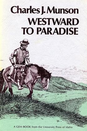
Charles Munson’s Cozy Cove Farm was the first registered farm in Latah County. He also served in Idaho’s state legislature for more than a decade, and as the state’s land commissioner from 1906 to 1909. His autobiography, Westward to Paradise, provides a firsthand account of Munson’s migration to Idaho and the early days of town building in Moscow. From the introduction by Kenneth B. Platt: “A great tale of adventure, made all the more appealing by understatement of the very real dangers encountered, hardships endured, difficulties overcome, and achievements won.” 174 pages : illustrations ; 21 cm. Desiderata
|
1978 |
|
Sitting on a salt spring by David Conover 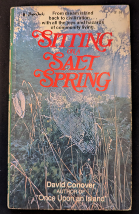
Sitting on a Salt Spring chronicles the ongoing challenges and profound isolation of maintaining a remote island resort amidst the rugged Gulf Islands archipelago in the marine waters of British Columbia. Conover details how the small, forested landmass of Wallace Island—surrounded by the treacherous tidal currents and sudden squalls of the Strait of Georgia—demanded relentless physical labor to sustain basic infrastructure and a tenuous maritime lifeline to the mainland. By anchoring his narrative to specific rocky coves, weathered docks, and dense stands of coastal timber, the author illustrates how the island's imposing natural barriers actively dictated the daily rhythms of survival and coastal hospitality. Ultimately, the book serves as a deeply localized environmental memoir, capturing how the beautiful yet unforgiving marine topography of the Pacific Northwest inextricably shaped a fiercely self-reliant, water-bound existence. 160 pages ; 18 cm Non-circulating [ 1 ]
|
1978 |
|
Bend, in central Oregon by Raymond R. Hatton
|
1978 |
|
Historical outline of Seymour Arm area, 1860-1970 by W. Bradley, E. Bradley
W. and E. Bradley’s Historical Outline of Seymour Arm Area, 1860–1970 chronicles the dramatic boom-and-bust cycles that defined the isolated northern arm of Shuswap Lake. The narrative traces the frantic 1865–1866 Big Bend gold rush, when the tent settlement of Seymour City (Ogdenville) materialized almost overnight at the head of the lake as a major transshipment port connecting river steamers to overland mountain trails leading to French and Gold creeks on the Columbia River. The authors detail how this speculative rush was superimposed directly over the seasonal territory of the Secwépemc, followed by the town’s near-instantaneous desertion once placer deposits dwindled. The volume then traces the early twentieth-century revival of Seymour Arm through ambitious English fruit-ranching syndicates, remote tie-cutting operations, and off-grid lakeshore homesteading in areas extending toward Bastion Bay and Albas. 48 pages : illustrations, map ; 23 cm Desiderata
|
1978 |