Catalog of British Columbiana and Pacific Northwest Americana
The Encyclopedia Cascadia Catalog indexes mostly non-fiction literature covering the Pacific Northwest coast of North America, with an emphasis on British Columbia, Idaho, Oregon, and Washington State.
| Catalog Title | Published |
|---|---|
|
The golden land a history of Sherman County, Oregon by Giles French 
Giles French’s The Golden Land chronicles the grueling agrarian transformation of Sherman County, a windswept, high-desert plateau severely isolated by the precipitous volcanic canyons of the Columbia, Deschutes, and John Day rivers. The narrative maps how the formidable topography and arid climatic realities of this rolling inland steppe initially restricted early pioneers to sparse livestock grazing, forcing them to endure an environment largely devoid of accessible surface water. By detailing the massive regional transition to mechanized dryland wheat farming, the text illustrates how the survival of the local economy was strictly dictated by the construction of localized rail spurs engineered to bridge the deep river gorges, finally connecting landlocked harvests to the Columbia River maritime highway. Ultimately, the account demonstrates that adapting to this rain-starved geography and conquering the profound physical barriers of its boundary canyons with heavy transit infrastructure were the absolute prerequisites for transforming a remote, sun-baked prairie into a lucrative, globally connected agricultural empire. [4], 237 pages, 9 unnumbered pages of plates : illustrations, portrait ; 25 cm Non-circulating [ 1 ]
|
1958 |
|
Milestones on the mighty Fraser by C. P. Lyons 
C. P. Lyons’s Milestones on the Mighty Fraser chronicles the grueling pioneer and industrial subjugation of British Columbia’s most violent riverine corridor, a massive hydrological artery carving through the sheer granite walls of the Coast Mountains. The narrative maps how the treacherous, raging rapids and precipitous, impassable canyons of the Fraser River initially dictated all movement, forcing early gold seekers and fur traders to navigate an unforgiving aquatic highway bordered by impenetrable alpine wilderness. By detailing the monumental, explosive engineering required to blast the Cariboo Wagon Road and subsequent transcontinental railways directly into the canyon's sheer cliff faces, the text illustrates how maintaining inland connectivity was strictly dictated by the severe topographical constraints of this narrow, volatile gorge. Ultimately, the account demonstrates that artificially bridging this treacherous waterway and deploying massive mechanized infrastructure to conquer its towering continental barriers were the absolute prerequisites for transforming an impenetrable natural obstacle into the vital commercial gateway connecting the Pacific seaboard to Canada's resource-rich interior. xxii, 130 pages, illustrations, maps Non-circulating [ 1 ]
|
1958 |
|
Whispers from "Old Genesee," and echoes of the Salmon River by John A. Platt 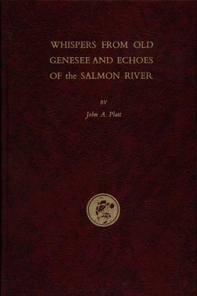
Early day history and folklore of the Idaho Panhandle, including Latah, Nez Perce, Idaho and Lewis counties. Preface by the author: "In writing the following pages I have been influenced by a desire to record for our sons and daughters, and their descendants, a written chronicle of the happenings of our lives, together with a mention of certain interesting events which occurred in the vicinity of Genesee during the pioneer days. As these events happened from sixty to seventy-five years ago, there may be some lapse of memory or wrong interpretations. I was only a small boy at the time the earlier events transpired, but they made such a deep impression on my mind that I have never forgotten them. This will not be a complete history – nor a literary masterpiece. It will contain some history, some biography, and perhaps a sprinkling of “blarney.” If the reader, as he peruses these pages, finds amusement, information or entertainment from my efforts, I will feel amply rewarded.” [7], 75, [6],46, [1] pages : illustrations, map, portraits ; 23 cm Non-circulating [ 1 ]
|
1959 |
|
A brief historical sketch of Port Townsend, Washington by William D. Welsh, Port Townsend Chamber of Commerce, Crown Zellerbach Corporation
William D. Welsh’s A brief historical sketch of Port Townsend, Washington chronicles the dramatic economic arc of a Victorian seaport whose destiny was absolutely dictated by its strategic but isolated marine geography. The narrative maps how the settlement's commanding position on the precipitous northeastern tip of the Olympic Peninsula initially guaranteed immense prosperity, allowing it to monopolize early pioneer commerce as the vital deep-water customs gateway bridging the Strait of Juan de Fuca and the inland sea. However, the text illustrates that the very same rugged, heavily timbered topography that framed the harbor ultimately proved fatal to its metropolitan ambitions, as the impenetrable coastal mountains effectively blocked any viable overland connection to the transcontinental railroad. Ultimately, the account demonstrates how this inescapable geographic isolation forced the bypassed maritime hub to adapt to severe continental detachment, permanently tethering its survival to localized timber and paper extraction industries that could leverage the remaining oceanic highway. 24 pages : illustrations (some color), map ; 21 cm Non-circulating [ 1 ]
|
1959 |
|
Reports and letters of Herbert Beaver, 1836-1838, chaplain to the Hudson's Bay Company and missionary to the Indians at Fort Vancouver by Herbert Beaver, Hudson's Bay Company 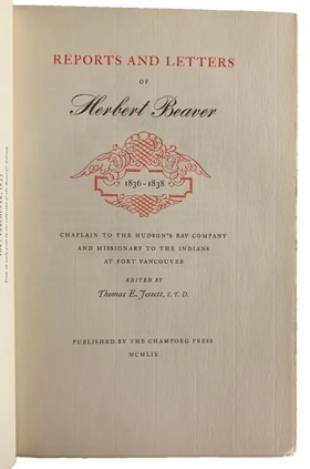
Herbert Beaver’s Reports and Letters chronicles the profound cultural collision that occurred when an inflexible British ecclesiastical framework was thrust into the profoundly isolated, geographically expansive trading empire of the Hudson’s Bay Company at Fort Vancouver. The text maps how the immense distances and unyielding topography of the Columbia River basin strictly dictated the outpost's pragmatic social structure, forcing the diverse frontier population to prioritize localized survival, massive agricultural self-sufficiency, and vital indigenous alliances over rigid metropolitan dogmas. By detailing Beaver’s vitriolic clashes with the fort's administration, the narrative illustrates how the sheer physical detachment from the European continent rendered traditional, uncompromising institutional infrastructure entirely incompatible with the severe environmental realities of the Pacific frontier. Ultimately, the account demonstrates that adapting to the immense scale and isolating geography of this critical riparian highway—often through localized, syncretic social customs—was the absolute prerequisite for maintaining a functional imperial foothold in the untamed western wilderness. xxiv, [2], 148, [5] pages : illustration ; 28 cm Non-circulating [ 1 ]
|
1959 |
|
"The McLoughlin Empire and Its Rulers reveals an amazing record of a lower Canada family of Scotch Protestant and Irish Catholic descent, which produced three remarkably astute and successful persons to guide the family destiny to a high point. Dr. John McLoughlin, trained as a physician, became the Chief Factor in the Columbia District of the Hudson's Bay Company, where he ruled a vast empire in the Northwest. Dr. David McLoughlin, his brother, also educated for a medical career, became a highly successful doctor in Paris, and personal physician to King Louis Philippe. Their sister, Marie Louise, as Sister St. Henry, found her success as the leading teacher and Mother Superior of the great Ursuline Monastery in Quebec, where she remained alert to the affairs of her family, educated her nieces, and aided in solving family problems. The story comes to light for the first time, through the discovery of a fascinating file of family correspondence, preserved by the Fraser family, relatives of the McLoughlins on their maternal side. It discloses a hitherto unknown side of the John McLoughlin saga - his personal finances, his children, his land holdings in the lower St. Lawrence River valley, and his prominent kin, both McLoughlin and Fraser. A carefully researched and well documented account is presented by Dr. Barker."--Publisher's description 370 pages illustrations, color coats of arms, facsimiles, genealogical table, 2 maps (1 folded) portraits 25 cm Non-circulating [ 1 ]
|
1959 |
|
Coastal exploration of Washington by Robert Ballard Whitebrook, Henry R. Wagner (Writer of introduction)
Robert Ballard Whitebrook’s Coastal Exploration of Washington provides a meticulous maritime chronicle of the initial European efforts to chart the treacherous and highly complex oceanic edge of the Pacific Northwest. The narrative maps how the formidable physical realities of the region—including dense, disorienting coastal fogs, violent Pacific surf, and an impenetrable coastal barrier of temperate rainforests—completely precluded overland discovery, forcing Spanish and British expeditions to rely entirely on vulnerable sailing vessels. By detailing the painstaking cartographic mastery of the labyrinthine, deep-water glacial fjords of the Strait of Juan de Fuca and Puget Sound, the text illustrates how early imperial strategies were strictly dictated by the severe environmental constraints of this volatile marine topography. Ultimately, the account demonstrates that navigating and documenting these dangerous aquatic highways was the absolute prerequisite for breaching the region's profound physical isolation and opening the untamed western frontier to global maritime commerce. xxv, 146 pages : illustrations, maps ; 24 cm Non-circulating [ 1 ]
|
1959 |
|
Fish and ships by Ralph W. Andrews, A. K. Larssen
Ralph W. Andrews and A. K. Larssen’s Fish and Ships chronicles the grueling industrial evolution of the commercial fishing fleets that extracted immense biological wealth from the violent, storm-battered marine topography of the North Pacific. The narrative maps how the severe environmental realities of treacherous coastal inlets and the unforgiving open ocean forced early maritime populations to engineer increasingly resilient vessels and mechanized harvesting infrastructure to survive these volatile aquatic environments. By detailing the transition from rudimentary pioneer techniques to massive, industrialized salmon and halibut operations, the text illustrates how a total reliance on mastering dangerous offshore currents strictly dictated the economic and physical survival of the region's isolated coastal settlements. Ultimately, the account demonstrates that conquering the extreme meteorological and oceanographic challenges of this rugged marine frontier was the absolute prerequisite for building a sustaining, export-driven maritime empire along the Pacific seaboard. 173 pages illustrations 23 cm Non-circulating [ 1 ]
|
1959 |
|
A brief history of Waldron Island by Charles H. Ludwig 
HISTORY OF A SEASONAL CAMPING SITE OF THE LUMMI INDIANS. The second edition was published in 1972 in response to requests for copies of the original mimeographed first edition. The preface to the second edition contains some comments on the more recent history of the island and Frederick Marks, one of the very early settlers on Waldron. 44 pages map, table Desiderata
|
1959 |
|
The Salmon King of Oregon R.D. Hume and The Pacific fisheries by Gordon B. Dodds 
Robert D. Hume, capitalist, pioneer in the development of the salmon-canning industry of the Pacific Coast, and one of America's first conservationists, was an entrepreneur whose activities illustrate much about the economy, politics, and society of the Northwest. 257 pages illustrations 23 cm Non-circulating [ 1 ]
|
1959 |
|
Nehalem Tillamook tales by Elizabeth derr Jacobs, Melville Jacobs 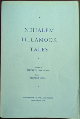
Elizabeth Derr Jacobs and Melville Jacobs’s Nehalem Tillamook Tales chronicles the oral traditions of an indigenous coastal society whose entire cultural and economic existence was forged by the rugged, rain-drenched topography of the northern Oregon seaboard. The recorded narratives map how the impenetrable barrier of the coastal temperate rainforest and the treacherous maritime climate forced the Nehalem Tillamook to orient their survival exclusively around the region's volatile estuarine networks and salmon-rich river systems. By preserving these ancestral accounts, the text illustrates how the mastery of advanced cedar-craft infrastructure—specifically the construction of monumental dugout canoes and weather-resilient plank houses—was strictly dictated by the necessity of navigating and enduring this wet, heavily timbered environment. Ultimately, the collection demonstrates that for these early maritime populations, profound physical and cultural adaptation to a geographically isolated, water-bound landscape was the absolute prerequisite for long-term endurance along the unforgiving Pacific edge. 216 s Non-circulating [ 1 ]
|
1959 |
|
Early Vancouver narratives of pioneers of Vancouver, B.C. by James Skitt Matthews 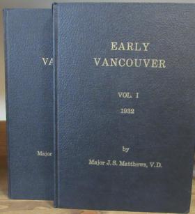
James Skitt Matthews’s Early Vancouver chronicles the grueling pioneer efforts to carve a viable metropolitan footprint out of the massive, unyielding temperate rainforests dominating the Burrard Inlet peninsula. The collected narratives map how the sheer biological density of ancient timber stands and the rugged, marshy topography of the coastal shoreline initially strangled overland movement, forcing early settlers to rely exclusively on the sheltered aquatic highway of the deep-water harbor. By detailing the arduous transition from primitive waterfront logging camps to the western terminus of the transcontinental railway, the text illustrates how clear-cutting this imposing vegetation and constructing robust maritime infrastructure were strictly dictated by the region's severe environmental constraints. Ultimately, the account demonstrates that systematically conquering the imposing physical realities of this rain-soaked, heavily forested marine frontier was the absolute prerequisite for anchoring Canada's vital gateway to the Pacific seaboard. 8 volumes : illustrations, maps, plans, portraits ; 24 cm Desiderata
|
1959 |
|
A ram in the thicket the story of a roaming homesteader family on the Mormon frontier by Frank C. Robertson 
Frank Robertson's hard-edged autobiography about pioneering life in northern and southern Idaho in the 1890s appears in this reprint edition with an introduction by historian Charles S. Peterson, Professor Emeritus at Utah State University and Professor of History at Southern Utah University. Enmeshed in poverty, unremitting toil, and personal conflict, the Robertson family lived first in the wilderness near Moscow, Idaho, then subsequently converted to Mormonism and moved to Chesterfield, Idaho. The family continued to face financial hardships until 1922 when Frank Robertson sold his first short story. From then until his death in 1969, this prolific and popular western writer produced countless short stories and at least 150 books. Robertson's life story is a kind of regional history in itself, and his writing is firmly rooted in those experiences. He worked diligently at his writing, found what would sell, and won great popularity with American and European audiences. With a vigorous resurgence in western regionalism underway, republication of A Ram in the Thicket makes this man's remarkable autobiography available once again to interested readers.The Story of a Roaming Homesteader Family on the Mormon Frontier 311 pages illustrations 22 cm Desiderata
|
1959 |
|
Robert Newell's Memoranda travles in the teritory of Missourie : travle to the Kayuse War : together with A report on the Indians south of the Columbia River by Robert Newell , Dorothy Johansen , Lawton Kennedy (Book designer, Printer), Champoeg Press (Publisher) 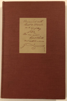
Robert Newell (1807-1868) was an American Mountain Man and 'Doctor' who settled in Oregon and was involved in Indian Affairs of the Oregon Territory. He served as a peace commissioner in the Cayuse War keeping the Nez Perce neutral during the conflict. He settled in Oregon after 1840 and had 3 wives with 16 children and served in the Territorial Government and later the State Government. 159 pages, 2 unnumbered leaves of plates (1 folded) : illustrations, maps ; 27 cm Desiderata
|
1959 |
|
Name calling notes on the discovery and exploration of the Olympic Peninsula by Robert Hitchman
|
1959 |
|
Fort Victoria from fur trading post to capital city of British Columbia, Canada by Herbert P. Plasterer 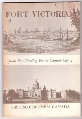
Fort Victoria: From Fur Trading Post to Capital City of British Columbia, Canada by Herbert P. Plasterer is a concise 1967 historical booklet that traces the foundational years of British Columbia's capital. The work provides a focused overview of Victoria's evolution, detailing its origins as a strategic 19th-century Hudson's Bay Company fort and its rapid expansion during the colonial era. Ultimately, it serves as an accessible, localized snapshot of the pioneer history and key milestones that transformed a remote settlement into a modern political center. 38 pages : illustrations ; 23 cm Non-circulating [ 1 ]
|
1960 |
|
Prince Rupert, a gateway to Alaska by R. Geddes Large
R. Geddes Large’s Prince Rupert, a Gateway to Alaska chronicles the ambitious, heavily mechanized struggle to carve a transcontinental railway terminus out of the punishing, muskeg-shrouded topography of British Columbia’s remote northern coast. The narrative maps how the sheer physical severity of Kaien Island—characterized by relentless maritime downpours, impenetrable temperate rainforests, and unyielding bedrock—required massive explosive engineering simply to secure a structural foothold for the Grand Trunk Pacific Railway. Despite the agonizing overland construction through the rugged Coast Mountains, the settlement's precise location was strictly dictated by the immense strategic value of its deep-water, ice-free harbor, which offered an unparalleled maritime shortcut to Asian markets and northern frontier resources. Ultimately, the book illustrates how conquering this profoundly isolated and inhospitable coastal geography was the absolute prerequisite for establishing a vital, industrialized marine gateway to Alaska and the broader Pacific seaboard. 210 pages illustrations 29 cm Non-circulating [ 1 ]
|
1960 |
|
Historic Silver City the story of the Owyhees by Mildretta Adams
Mildretta Adams’s Historic Silver City: The Story of the Owyhees chronicles the brutal pioneer extraction of immense mineral wealth from the stark, unforgiving high-desert topography of southwestern Idaho. The narrative maps how the severe geographic isolation, punishing alpine winters, and precipitous volcanic canyons of the Owyhee Mountains demanded massive logistical feats simply to construct the precarious toll roads and stamp mills necessary to sustain a booming silver metropolis. By detailing the explosive rise and inevitable collapse of this remote mining enclave, the book illustrates how temporarily conquering the extreme environmental realities of the arid inland empire was the absolute prerequisite for exploiting its geological riches, just as those same harsh geographic constraints ultimately dictated its abandonment. 60 pages : illustrations ; 23 cm Non-circulating [ 1 ]
|
1960 |
|
A brief history of Franklin, first permanent settlement in the state of Idaho by Idaho Pioneer Association, Boise Public Library Idaho Collection 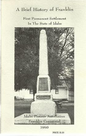
The Idaho Pioneer Association’s A brief history of Franklin chronicles the grueling agrarian colonization of Cache Valley, where Mormon pioneers established Idaho’s first permanent settlement in an isolated, high-altitude basin just north of the Utah border. The narrative maps how the formidable geography of the surrounding Bear River Range and the region's punishing alpine winters forced these early colonizers to immediately undertake massive, cooperative hydrological engineering projects to divert mountain streams for vital crop irrigation. By detailing the communal construction of protective forts and localized agricultural infrastructure, the text illustrates how an absolute reliance on the fertile but climatically severe valley floor dictated early survival strategies in a deeply isolated frontier environment. Ultimately, the account captures how mastering this localized geography and conquering the harsh climatic realities of the inland empire were the absolute prerequisites for establishing a lasting, agriculturally independent pioneer foothold in the rugged topography of southeastern Idaho. 41 pages illustrations with photographs 23 cm Non-circulating [ 1 ]
|
1960 |
|
Echoes of Puget Sound fifty years of logging and steamboating by Torger Birkeland
Torger Birkeland’s Echoes of Puget Sound chronicles the symbiotic pioneer industries of maritime transit and timber extraction that defined early settlement within the deep glacial fjords of western Washington. The narrative maps how the impenetrable biological mass of the ancient temperate rainforest completely precluded early overland road construction, forcing isolated coastal logging camps to rely entirely on a sprawling network of shallow-draft steamers for basic survival. By detailing the grueling, daily navigation of this vital Mosquito Fleet, the text illustrates how the physical constraints of the rugged shoreline required the mastery of dynamic tidal currents to tow massive log booms to centralized regional mills. Ultimately, the account captures the profound geographical determinism of the inland sea, demonstrating that conquering these volatile aquatic highways was the absolute prerequisite for unifying a fragmented, wilderness-bound frontier into an integrated timber empire. 251 pages illustrations 22 cm Non-circulating [ 1 ]
|
1960 |
|
Yakima, Washington Jubilee, 1885-1960 by Click Relander, George M. Martin , Yakima Diamond Jubilee, Inc (Issuing body), Yakima Diamond Jubilee 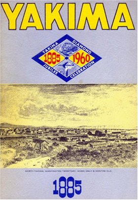
Click Relander and George M. Martin’s Yakima, Washington Jubilee, 1885-1960 chronicles the dramatic agricultural transformation of an arid, sun-baked basin trapped within the profound rain shadow of the towering Cascade Range. The narrative maps how the severe climatic realities of this sprawling sagebrush steppe forced early pioneers to execute massive hydrological projects, systematically diverting the glacier-fed Yakima River into extensive, life-sustaining irrigation networks. By detailing the physical relocation of the entire pioneer settlement to intercept the newly constructed Northern Pacific Railway, the text illustrates how a total reliance on engineered waterways and mechanized overland transit strictly dictated the region's economic viability. Ultimately, the account demonstrates that artificially mastering this localized hydrology to conquer a punishing high-desert climate was the absolute prerequisite for transitioning a barren inland expanse into a lucrative, globally recognized agricultural epicenter. iv, 25, [12], 26-50, [2] pages : illustrations, portraits ; 25 cm Non-circulating [ 1 ]
|
1960 |
|
Land of the Royal Kwantlen. A history of North Surrey, B.C by John Pearson, John M. Reitz 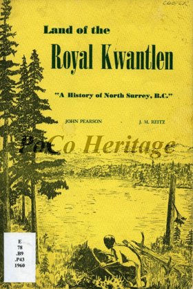
John Pearson and John M. Reitz’s Land of the Royal Kwantlen chronicles the complex historical evolution of North Surrey from an indigenous riverine stronghold to an engineered agricultural extension of metropolitan Vancouver. The narrative maps how the massive, volatile hydrology of the lower Fraser River initially dictated all human activity, forcing both the Kwantlen First Nation and early European pioneers to rely entirely on this dominant aquatic highway for transit and sustenance amidst the dense, impenetrable coastal rainforest. By detailing the arduous pioneer efforts to clear immense timber stands and construct drainage infrastructure across the low-lying alluvial floodplains, the text illustrates how early agrarian colonization was strictly governed by the severe physical realities of the tidal delta. Ultimately, the account demonstrates that artificially stabilizing this dynamic, flood-prone topography and bridging the formidable Fraser watercourse were the absolute prerequisites for integrating this isolated riparian settlement into the broader Pacific seaboard economy. 27 pages 24 cm Desiderata
|
1960 |
|
Pronunciation guide of Oregon place names by Robert Monaghan 
Robert Monaghan’s Pronunciation Guide of Oregon Place Names provides a unique linguistic and cultural chronicle of the state's diverse indigenous and pioneer heritage, serving as a phonetic map of human settlement across a profoundly fragmented landscape. The compilation implicitly maps the sprawling, varied topography of Oregon, tracing a vast geographic vocabulary that spans from the storm-battered, rain-swept coastal estuaries and the towering, densely timbered barrier of the Cascade Range, out to the arid, sprawling sagebrush steppes of the inland high desert. By detailing the precise, often counterintuitive local pronunciations of remote towns, volatile rivers, and precipitous mountain passes, the book illustrates how early human adaptation was intimately tied to specific, physically isolated geographic pockets. The text highlights how the region’s formidable topographical barriers effectively preserved distinct linguistic microclimates, where the complex vocabularies of indigenous nations—whose languages were deeply adapted to local ecological realities—collided and inextricably merged with the dialects of transient French-Canadian fur trappers and weary overland pioneers. Ultimately, the guide captures the enduring cultural imprint of Oregon’s severe environmental realities, demonstrating how mastering the authentic spoken nomenclature of this rugged, varied terrain serves as an oral record of surviving, claiming, and integrating into the diverse physical landscapes of the Pacific Northwest. 81 pages ; 23 cm Non-circulating [ 1 ]
|
1961 |
|
A Gulf Islands patchwork some early events on the islands of Galiano, Mayne, Saturma, North and South Pender by British Columbia Historical Association Gulf Islands Branch 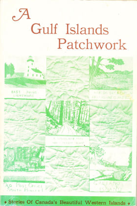
The British Columbia Historical Association’s A Gulf Islands Patchwork provides a fragmented but intimate pioneer chronicle of the sprawling Southern Gulf Islands archipelago, specifically detailing early settlement on Galiano, Mayne, Saturna, and the Penders. The narrative maps the defining, water-bound topography of these rugged landmasses, scattered across the treacherous tidal currents of the Strait of Georgia. By detailing the early establishment of remote lighthouses, coastal homesteads, and vital ferry landings, the book illustrates how the sheer physical isolation of this marine environment dictated every aspect of daily survival and community integration. The text highlights how early indigenous populations and subsequent pioneer settlers were forced to rely entirely on volatile aquatic highways—most notably navigating the violent, rip-tide currents of Active Pass—as dense, rocky interiors severely restricted overland transit and large-scale agriculture. Ultimately, the collection captures the profound environmental constraints of this coastal frontier, demonstrating how mastering complex maritime navigation and adapting to the unyielding isolation of a fractured island geography were the absolute prerequisites for establishing a viable, interconnected pioneer society along the remote Pacific seaboard. 192 pages : illustrations ; 23 cm Non-circulating [ 1 ]
|
1961 |
|
History of Columbia County by Columbia County Historical Society
Published annually between 1961 and 1973 by the Columbia County Historical Society, this twelve-volume series serves as the primary compendium of micro-histories, pioneer memoirs, and spatial records for the region. The compiled monographs systematically document early settler claims, logging skid roads, and riverboat landings that superseded ancient Chinookan seasonal villages along the lower Columbia. The serial contains dedicated historical studies on the timber camps and rural hamlets of Beaver Homes, Canaan, Trenholm, Yankton, Deer Island, and Goble, while detailing the early riverfront industries of Columbia City, Saint Helens, and Rainier. Featuring extensive family diaries, cemetery inscriptions, and cadastral maps, the collection preserves the foundational human geography of Columbia County. Annual serial (Vols. I-XII) : illustrations, maps, portraits ; 23 cm Desiderata
|
1961 |