Regional District of East Kootenay Regional District
The Regional District of East Kootenay (RDEK) is a local government in southeastern British Columbia, Canada. The region was first inhabited by First Nations peoples, including the Ktunaxa, Secwepemc, and Kootenai. The first European explorers arrived in the early 1800s, and the region was eventually settled by miners, ranchers, and farmers. The RDEK was formed in 1965, and its current boundaries were established in 1996. The region is home to a variety of towns and villages, including Cranbrook, Kimberley, Fernie, and Invermere. It is also home to Kootenay National Park, which is a popular destination for hiking, camping, and fishing.
Mapped Location
Regional District of East Kootenay: The mapped location is an approximation and should not be used for navigation or wayfinding.
Information
General information on Regional District of East Kootenay
- Feature Type: Regional District
- Regional District Administrative Centre: City of Cranbrook
- Established: Tuesday, November 30, 1965
Official, historical, colloquial and alternative toponyms for Regional District of East Kootenay
A brief list of names that this geographic feature has been named
| Name | Description |
|---|---|
| Regional District of East Kootenay | Official |
Related Catalog Titles
A Bibliography for Regional District of East Kootenay, Regional District
Fernie at war, 1914-1919 by Wayne R. Norton
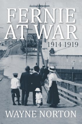
"Fernie, a small community located in BC's Kootenay region, entered the First World War in 1914 with optimism and a sense of national pride - it emerged five years later having experienced staggering losses and multiple controversies that threatened to tear their community apart. As a resource-based economy with unusually large and varied immigrant populations, and exceptionally high recruitment levels, Fernie was profoundly affected by conflicting impulses of labour, loyalty and ethnicity. Demands for internment of enemy aliens, resistance to prohibition and moral reform, the consequences of natural and man-made disasters, the unprecedented banning of recruitment, and the western labour revolt were all issues that contributed to a war-time experience for Fernie that was more dramatic and more revealing of underlying tensions than that of any other Canadian community. In his new book, Fernie at War, historian and author Wayne Norton explores what it meant to live in Fernie during those confusing and divisive years."--Provided by publisher
224 pages : illustrations, maps ; 23 cm
CIRC [ 0 ]
Nipika a story of Radium Hot Springs by David Zieroth , Dianne Bersea (Illustrator), Parks Canada Western Region
Regional District of East Kootenay
- Athalmer
- Baker
- Baynes Lake
- Brisco
- Bull River
- Caithness
- Village of Canal Flats
- Chapman Camp
- Cokato
- Corbin
- City of Cranbrook
- Crowsnest
- Dry Gulch
- Edgewater
- Elk Prairie
- District of Elkford
- Elko
- Fairmont Hot Springs
- City of Fernie
- Flathead
- Flathead
- Fort Steele
- Galloway
- Grasmere
- Hosmer
- District of Invermere
- Jaffray
- Jumbo Glacier Mountain Resort Municipality
- City of Kimberley
- Kootenay Crossing
- Kragmont
- Lumberton
- Marysville
- Mayook
- Meachen
- Morrissey
- Moyie
- Newgate
- North Star
- Old Town
- Panorama
- Premier Lake
- Village of Radium Hot Springs
- Rockyview
- Roosville
- Round Prairie
- Shuswap
- Skookumchuck
- District of Sparwood
- Spillimacheen
- St. Eugene Mission
- Ta Ta Creek
- Toby Creek
- Vermilion Crossing
- Wardner
- Wasa
- Wilmer
- Windermere
- Wycliffe
Political Boundaries
Last updated: 2023-08-03