Village of Radium Hot Springs Regional District of East Kootenay, British Columbia
Hotsprings / Hot Springs - Site of a natural flow of hot or warm water issuing from the ground. Plural of Hotspring / Hot Spring. In Kootenay National Park, N. of Windermere Lake, Kootenay Land District
Mapped Location
Village of Radium Hot Springs: The mapped location is an approximation and should not be used for navigation or wayfinding.
Information
General information on Village of Radium Hot Springs
- Feature Type: Incorporated
Official, historical, colloquial and alternative toponyms for Village of Radium Hot Springs
A brief list of names that this geographic feature has been named
| Name | Description |
|---|---|
| Village of Radium Hot Springs | Official |
Origin Notes and History of Village of Radium Hot Springs
References to Village of Radium Hot Springs that document the origin of its place name
Adopted 12 May 1965 on 82K/NE as a long-established name.
Until about 1915 these were called Sinclair Hot Springs. An analysis of the water was made at McGill University 14 May 1912, and it was discovered to contained radioactive particles - hence the change of name. "The natural temperature of the main spring of the Sinclair/Radium Hot Springs in Kootenay National Park....is about 114 degrees Fahrenheit. The radioactivity is unusually high and it is believed that their theraputic efficacy may be partly due to this fact" ("Natural Resources", Canada, July 1929).
Related Catalog Titles
A Bibliography for Village of Radium Hot Springs, Regional District of East Kootenay, British Columbia
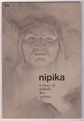
Nipika a story of Radium Hot Springs by David Zieroth , Dianne Bersea (Illustrator), Parks Canada Western Region
Regional District of East Kootenay
- Athalmer
- Baker
- Baynes Lake
- Brisco
- Bull River
- Caithness
- Village of Canal Flats
- Chapman Camp
- Cokato
- Corbin
- City of Cranbrook
- Crowsnest
- Dry Gulch
- Edgewater
- Elk Prairie
- District of Elkford
- Elko
- Fairmont Hot Springs
- City of Fernie
- Flathead
- Flathead
- Fort Steele
- Galloway
- Grasmere
- Hosmer
- District of Invermere
- Jaffray
- Jumbo Glacier Mountain Resort Municipality
- City of Kimberley
- Kootenay Crossing
- Kragmont
- Lumberton
- Marysville
- Mayook
- Meachen
- Morrissey
- Moyie
- Newgate
- North Star
- Old Town
- Panorama
- Premier Lake
- Village of Radium Hot Springs
- Rockyview
- Roosville
- Round Prairie
- Shuswap
- Skookumchuck
- District of Sparwood
- Spillimacheen
- St. Eugene Mission
- Ta Ta Creek
- Toby Creek
- Vermilion Crossing
- Wardner
- Wasa
- Wilmer
- Windermere
- Wycliffe
Political Boundaries
Last updated: 2023-10-21