City of Fernie Regional District of East Kootenay, British Columbia
City - A populated place with legally defined boundaries, incorporated as a city municipality under the provincial Municipal Act. E side of Elk River, E of Cranbrook, Kootenay Land District
Mapped Location
City of Fernie: The mapped location is an approximation and should not be used for navigation or wayfinding.
Information
General information on City of Fernie
- Feature Type: Incorporated
Official, historical, colloquial and alternative toponyms for City of Fernie
A brief list of names that this geographic feature has been named
| Name | Description |
|---|---|
| City of Fernie | Official |
Origin Notes and History of City of Fernie
References to City of Fernie that document the origin of its place name
Incorporated as a Town municipality 28 July 1904. Fernie (Town) confirmed in the 15th Report of the Geographic Board of Canada, 31 March 1917, as labelled on BC map 1EM, 1915. Since re-incorporated as a City municipality. Fernie (City) confirmed 12 December 1939 on 82/SE.
Fernie Post Office was opened 1 August 1898. Incorporated 1904, first mayor Fred Stork. See also the municipality's own website
After William Fernie (1837-1921), miner and capitalist, who promoted coal mining here and founded the city c1897.
"After Peter and William Fernie, early settlers. William discovered coal in the Crowsnest coal field. Peter died in Victoria in October 1915, age 84."
William Fernie, now a resident of Victoria, describes his experiences thus: "I went into the pass per pack trail in the spring of 1887 to prospect for coal on one of the tributaries of Michel creek, which is one of the tributaries of Elk river and I found several seams of coal there and took up some thousands of acres there and applied to the British Columbia government to purchase same, but failed to finish the survey of them until the following year. In the spring of 1889 I went back to the valley of the Elk river and prospected for coal on Coal creek and adjacent lands in the Elk River valley and found many seams of coal and applied to purchase 10,000 acres of same. I was engaged from that time steadily in prospecting and developing the property of the company until 1900 when I retired from the service of the company. In 1898 the townsite of Fernie was cleared and the site surveyed into streets and lots. The town was named after me as being the discoverer of the coal, a director of the company and having had control of all the field work until the work got too big for one man to handle." (BC Geographic Division transcript, as contributed for publication in the 17th Report of the Geographic Board of Canada, 31 March 1921).
"Named after William Fernie (1837?-1921). An Englishman by birth, Fernie travelled in Australia, New Zealand and South America before arriving in BC. In 1861 he prospected for gold near Revelstoke, later moved on to the Cariboo and in 1864 arrived at the Wild Horse Creek gold camp.The next year he was a foreman on the extension of the Dewdney Trail to Wild Horse Creek. Fernie was government agent and mining recorder for the Kootenay district 1876-82."
Originally Coal Creek.
The traditional name for this site is C/aqanak, pronounced tsa-qa-nak. [meaning/significance not provided] (April 2006 advice from Janice Alpine, Ktunaxa Language Program)
Related Catalog Titles
A Bibliography for City of Fernie, Regional District of East Kootenay, British Columbia
Fernie at war, 1914-1919 by Wayne R. Norton
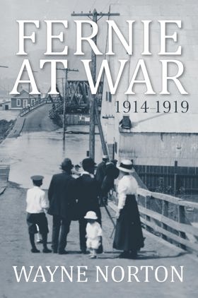
"Fernie, a small community located in BC's Kootenay region, entered the First World War in 1914 with optimism and a sense of national pride - it emerged five years later having experienced staggering losses and multiple controversies that threatened to tear their community apart. As a resource-based economy with unusually large and varied immigrant populations, and exceptionally high recruitment levels, Fernie was profoundly affected by conflicting impulses of labour, loyalty and ethnicity. Demands for internment of enemy aliens, resistance to prohibition and moral reform, the consequences of natural and man-made disasters, the unprecedented banning of recruitment, and the western labour revolt were all issues that contributed to a war-time experience for Fernie that was more dramatic and more revealing of underlying tensions than that of any other Canadian community. In his new book, Fernie at War, historian and author Wayne Norton explores what it meant to live in Fernie during those confusing and divisive years."--Provided by publisher
224 pages : illustrations, maps ; 23 cm
CIRC [ 0 ]
Regional District of East Kootenay
- Athalmer
- Baker
- Baynes Lake
- Brisco
- Bull River
- Caithness
- Village of Canal Flats
- Chapman Camp
- Cokato
- Corbin
- City of Cranbrook
- Crowsnest
- Dry Gulch
- Edgewater
- Elk Prairie
- District of Elkford
- Elko
- Fairmont Hot Springs
- City of Fernie
- Flathead
- Flathead
- Fort Steele
- Galloway
- Grasmere
- Hosmer
- District of Invermere
- Jaffray
- Jumbo Glacier Mountain Resort Municipality
- City of Kimberley
- Kootenay Crossing
- Kragmont
- Lumberton
- Marysville
- Mayook
- Meachen
- Morrissey
- Moyie
- Newgate
- North Star
- Old Town
- Panorama
- Premier Lake
- Village of Radium Hot Springs
- Rockyview
- Roosville
- Round Prairie
- Shuswap
- Skookumchuck
- District of Sparwood
- Spillimacheen
- St. Eugene Mission
- Ta Ta Creek
- Toby Creek
- Vermilion Crossing
- Wardner
- Wasa
- Wilmer
- Windermere
- Wycliffe
Political Boundaries
Last updated: 2023-10-21