Catalog of British Columbiana and Pacific Northwest Americana
The Encyclopedia Cascadia Catalog indexes mostly non-fiction literature covering the Pacific Northwest coast of North America, with an emphasis on British Columbia, Idaho, Oregon, and Washington State.
| Catalog Title | Published |
|---|---|
|
Ocean Shores, Washington, the exciting growth years by Margaret L. Rasmussen (Compiler) 
Ocean Shores, Washington, the exciting growth years examines the rapid, master-planned coastal development situated on the sandy, wind-swept Point Brown peninsula that divides the pounding Pacific Ocean from the sheltered waters of Grays Harbor. Rasmussen details how the region's dynamic coastal topography—specifically the shifting sand dunes, the dense tracts of stunted coastal pine, and the low-lying estuarine margins—strictly dictated the limitations of early access and subsequent resort engineering. By mapping the aggressive mid-century transformation of this isolated coastal spit through the dredging of extensive freshwater canal networks and the stabilization of shifting sands for gridded expansion, the narrative highlights how the specific peninsular geography was forcibly molded to anchor a recreational economy. Ultimately, this local historical record serves as a localized spatial history, demonstrating how the fragile dune ecology, pervasive maritime exposure, and distinct estuarine boundaries of this Pacific Northwest coastline fundamentally shaped the highly engineered, recreation-dependent character of modern Ocean Shores. 104 pages : illustrations, 1 map (folded color in pocket) ; 22 cm Non-circulating [ 1 ]
|
1974 |
|
How the twig was bent by Ted Robertson 
How the twig was bent examines the civic maturation and agrarian expansion situated within the expansive, sun-baked rain-shadow basins and sagebrush steppes of central Washington's Yakima Valley. Robertson details how the region's imposing interior macro-geography—specifically the towering climatic barrier of the Cascade Range to the west, the sprawling arid plateaus, and the vital riparian corridors of the Yakima and Naches rivers—strictly dictated the margins of permanent settlement and commercial growth. By mapping the transformation of this isolated desert landscape through extensive, terrain-altering irrigation networks into a highly ordered grid of thriving orchards, the narrative highlights how these specific hydrological realities anchored the region's socio-economic development. Ultimately, this historical record serves as a localized spatial history, demonstrating how the stark arid topography and critical riverine lifelines of this Pacific Northwest interior fundamentally shaped the highly engineered, agriculturally dependent character of the Yakima community. 72, xi pages illustrations Non-circulating [ 1 ]
|
1974 |
|
Valley of the spirits the Upper Skagit Indians of western Washington by June M. Collins
"Although the Upper Skagit Indians at one time controlled the great Skagit River drainage system in northwestern Washington, relatively little has been known about them, owing to the isolation in which many of them lived. When June Collins began her field work among the Upper Skagit in 1942, many precontact religious traditions and family and kinship practices had survived. Continuing her field work at intervals over a period of twenty years, she formed strong friendships with her informants. She is therefore able to present one of the most detailed and thorough ethnographic studies ever undertaken of a Northwest Coast people. Of particular interest is the exceptionally detailed description of Upper Skagit religious life, which was characterized by a belief in guardian spirits. Basing her analysis on dozens of case studies and descriptions by informants, Collins discusses the nature of the spirits, how they were acquired by the individual, the powers they conferred, and the dances held in their honor"--Book jacket xiii, 267 pages : illustrations ; 22 cm. Non-circulating [ 1 ]
|
1974 |
|
Our foundering fathers the story of Kirkland by Arline Ely, Kirkland Public Library 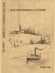
A short history of Kirkland, Washington written by an editor of a Puget Sound magazine. 128 pages, including index. Includes many historic pictures and local stories 128 pages, 28 unnumbered leaves of plates : illustrations ; 23 cm Non-circulating [ 1 ]
|
1975 |
|
James Madison Alden Yankee artist of the Pacific coast, 1854-1860 by Franz Stenzel, James Madison Alden, Amon Carter Museum of Western Art
James Madison Alden: Yankee artist of the Pacific coast, 1854-1860 chronicles the grueling topographical documentation and precarious maritime surveying across the vast, storm-battered coastlines and rugged, untamed river valleys of the Pacific frontier. Stenzel and the Amon Carter Museum of Western Art detail how the region's formidable physical barriers—specifically the treacherous, shifting sandbars of the coastal estuaries, the massive, impenetrable inland mountain ranges tracing the 49th parallel, and the violent, fog-shrouded maritime chokepoints of the Pacific shoreline—strictly dictated the margins of early federal cartography, border demarcation, and territorial navigation. By mapping the immense physical labor and precise technical skill required to pilot fragile survey vessels through deep, uncharted fjords and to painstakingly haul heavy cartographic equipment across precipitous alpine divides to accurately paint and plot the international boundary, the narrative highlights the monumental endurance necessary to scientifically chart this demanding, highly varied environment. The profound geographic isolation from established naval anchorages and supply depots initially forced these federal boundary and coast survey expeditions into a strict reliance on the precise topography of sheltered coves and inland river corridors, completely anchoring their physical survival and scientific documentation to the severe hydrological forces and unpredictable climatic shifts of the coastal wilderness. Ultimately, this biographical and visual record serves as a macro-level spatial history, demonstrating how the immense geographical scale, extreme coastal hydrology, and rugged terrestrial divides of the Pacific Northwest frontier fundamentally shaped the fiercely resilient, strictly terrain-dependent character of the region's earliest formalized maritime and borderland exploration. xiii, 209 pages : illustrations (some color) ; 25 cm Non-circulating [ 1 ]
|
1975 |
|
Five corners the story of Chilliwhack by Bruce Ramsey 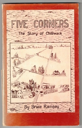
Five corners: the story of Chilliwhack chronicles the grueling agricultural transformation and isolated pioneer settlement situated within the vast, flood-prone alluvial floodplain of the lower Fraser Valley in British Columbia. Ramsey details how the region's formidable physical barriers—specifically the massive, unpredictable seasonal inundations of the Fraser River, the dense, waterlogged riparian forests of the valley floor, and the towering, impenetrable peaks of the surrounding Cascade and Coast mountains—strictly dictated the margins of early human survival and agrarian expansion. By mapping the immense physical labor required to painstakingly construct extensive earthen dikes against the swelling river currents, drain the marshy lowlands for cultivation, and carve rudimentary overland wagon routes through the dense brush to establish the vital "Five Corners" intersection, the narrative highlights the monumental cooperative effort necessary to forcibly convert this volatile riparian environment into highly productive agricultural tracts. The initial geographic isolation from the deepwater coastal ports forced these remote farming homesteads into a strict reliance on the precise topography of the Fraser River for transportation, completely anchoring their early commercial existence and civic development to the precarious navigation of shallow-draft sternwheelers and the severe hydrological realities of the basin. Ultimately, this local historical record serves as a deeply localized spatial history, demonstrating how the extreme riverine geography, heavy seasonal flooding, and immense physical labor of this Pacific Northwest frontier fundamentally shaped the fiercely resilient, tightly knit, and strictly agriculturally dependent character of the Chilliwack settlement. xii, 96 pages : illustrations, maps, portraits ; 22 cm Non-circulating [ 1 ]
|
1975 |
|
The birth, death, and resurrection of Fairhaven by George Hunsby
The birth, death, and resurrection of Fairhaven chronicles the grueling industrial boom, speculative collapse, and gradual civic reclamation of a coastal maritime enclave situated along the steep, heavily timbered shores of Bellingham Bay in northwestern Washington. Hunsby details how the region's formidable physical barriers—specifically the towering, impenetrable stands of old-growth coastal rainforest, the sheer, rocky sandstone bluffs plunging directly into the tidal wash, and the rugged, isolating ridges of the Chuckanut Mountains—strictly dictated the margins of early human survival, speculative urban planning, and aggressive resource extraction. By mapping the immense physical labor required to blast precarious railway grades through solid coastal bedrock, strip massive timber from the precipitous slopes, and forcibly engineer sprawling deepwater wharves and heavy brick commercial blocks directly into the unyielding hillside, the narrative highlights the monumental effort necessary to anchor a permanent industrial boomtown in this demanding maritime environment. The profound geographic isolation from established southern rail hubs initially forced these remote speculators and laborers into an absolute reliance on the perilous marine highway, completely anchoring their fleeting commercial existence and early economic survival to the coastal timber and coal trade, and the precise tidal topography of the bay. Ultimately, this local historical record serves as a deeply localized spatial history, demonstrating how the extreme coastal geography, immense physical labor, and shifting maritime realities of this Pacific Northwest frontier fundamentally shaped the fiercely resilient, economically volatile, and distinctly terrain-dependent character of Fairhaven's dramatic urban lifecycle. 101 leaves, 7 unnumbered leaves of plates : illustrations ; 22 cm Non-circulating [ 1 ]
|
1975 |
|
Mount Hood a complete history : exciting story of America's most-climbed mountain by Jack Grauer
Mount Hood a complete history: exciting story of America's most-climbed mountain chronicles the grueling alpine exploration and gradual infrastructural development of the towering, glacier-clad stratovolcano dominating the skyline of the northern Oregon Cascades. Grauer details how the region's formidable physical barriers—specifically the massive, shifting alpine glaciers, the treacherous, avalanche-prone upper snowfields, and the dense, impenetrable subalpine forests guarding the lower elevations—strictly dictated the margins of early human survival, high-altitude navigation, and recreational expansion. By mapping the immense physical labor required to carve precarious access roads through the rugged timberline, construct massive stone and timber alpine lodges directly into the harsh volcanic slope, and painstakingly forge perilous climbing routes across sheer icefalls and deep crevasses, the narrative highlights the monumental effort necessary to anchor a permanent human presence in this demanding, extreme alpine environment. The profound geographic isolation and severe winter weather systems initially forced these remote climbing expeditions and early mountain guides into a strict reliance on the precise topography of the glacial ridges for safe ascent, completely anchoring their physical survival and burgeoning recreational economy to the severe climatic and geological realities of the volatile peak. Ultimately, this mountaineering and historical record serves as a deeply localized spatial history, demonstrating how the immense geological scale, extreme alpine geography, and harsh meteorological forces of this Pacific Northwest frontier fundamentally shaped the fiercely resilient, highly specialized, and strictly terrain-dependent character of the Mount Hood climbing community and its surrounding alpine infrastructure. 296 pages : illustrations ; 28 cm Non-circulating [ 1 ]
|
1975 |
|
The Western shore Oregon country essays honoring the American Revolution by Thomas Vaughan 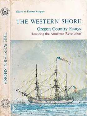
The Western shore: Oregon country essays honoring the American Revolution examines the precarious maritime exploration and grueling overland expansion across the vast, heavily forested expanses and storm-battered coastlines of the early Oregon Country. Vaughan and his contributors detail how the region's formidable physical barriers—specifically the treacherous, shifting sandbars of the Columbia River mouth, the towering, impenetrable spine of the Cascade Range, and the immense, arid expanses of the interior plateau—strictly dictated the margins of early human survival, imperial contest, and pioneer settlement. By mapping the immense physical labor required to force precarious wagon routes through steep, rock-choked mountain passes, establish isolated coastal outposts, and navigate volatile, unmapped river corridors, the narrative highlights the monumental effort necessary to anchor an enduring American presence in this demanding, deeply remote environment. The profound geographic isolation from the established political and commercial centers of the eastern seaboard initially forced these remote explorers and homesteaders into a strict reliance on the precise topography of the Columbia basin and the sheltered marine anchorages, completely anchoring their physical survival and burgeoning geopolitical claims to the severe climatic and hydrological realities of the territory. Ultimately, this collection of historical essays serves as a macro-level spatial history, demonstrating how the immense geographical scale, extreme coastal hydrology, and rugged terrestrial divides of the Pacific Northwest frontier fundamentally shaped the fiercely resilient, highly contested, and strictly terrain-dependent character of the early Oregon Country. xii, 367 pages : illustrations ; 23 cm Non-circulating [ 2 ]
|
1975 |
|
Skagit settlers trials and triumphs, 1890-1920 by Skagit County Historical Society, Margaret Willis
Skagit settlers trials and triumphs, 1890-1920 chronicles the grueling agricultural transformation and isolated pioneer settlement situated within the vast, flood-prone river corridors and dense lowland forests of northwestern Washington's Skagit River valley. Willis and the Skagit County Historical Society detail how the region's formidable physical barriers—specifically the massive, unpredictable seasonal inundations of the Skagit River, the towering, impenetrable stands of old-growth cedar and fir, and the dense, waterlogged tidal marshes of the river delta—strictly dictated the margins of early human survival and agrarian expansion. By mapping the immense physical labor required to painstakingly construct extensive earthen dikes against the swelling river currents and intruding saline tides, extract deep-rooted stumps from the damp earth, and forcibly carve productive agricultural tracts from the heavy coastal wilderness, the narrative highlights the monumental cooperative effort necessary to anchor permanent farming communities in this demanding riparian environment. The initial geographic isolation from established overland routes forced these remote homesteaders into a strict reliance on the precise topography of the Skagit River for transportation, completely anchoring their physical survival and early commercial existence to the precarious navigation of shallow-draft sternwheelers and the severe hydrological realities of the basin. Ultimately, this civic and historical record serves as a deeply localized spatial history, demonstrating how the extreme riverine geography, heavy seasonal flooding, and immense physical labor of this Pacific Northwest frontier fundamentally shaped the fiercely resilient, tightly knit, and strictly agriculturally dependent character of the early Skagit settlements. ix, 228 pages : illustrations ; 29 cm. Non-circulating [ 1 ]
|
1975 |
|
Shoreline memories Volume 1 by Shoreline Historical Society 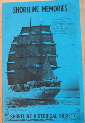
Shoreline memories Volume 1 chronicles the grueling agricultural transformation and gradual civic expansion across the heavily forested glacial plateaus and steep coastal bluffs overlooking Puget Sound. The Shoreline Historical Society details how the region's formidable physical barriers—specifically the towering, impenetrable stands of old-growth Douglas fir, the heavily compacted, unyielding glacial till soils, and the deep, rugged ravines that sharply bisected overland routes—strictly dictated the margins of early human survival, agrarian development, and eventual community integration. By mapping the immense physical labor required to painstakingly extract massive deep-rooted stumps from the damp earth, break the rocky soil for rudimentary farming, and cut precarious plank roads through the dense wilderness toward the burgeoning port of Seattle, the narrative highlights the monumental cooperative effort necessary to forcibly convert this rugged terrain into habitable homesteads and interconnected neighborhoods. The initial geographic isolation from the established urban core forced these remote pioneer enclaves into a strict reliance on the precise topography of the Puget Sound shoreline for early "mosquito fleet" maritime transportation, completely anchoring their physical survival and early commercial existence to the arduous overland transport and the severe maritime realities of the coastal bluffs. Ultimately, this civic and historical record serves as a deeply localized spatial history, demonstrating how the immense botanical density and challenging glacial topography of this Pacific Northwest frontier fundamentally shaped the fiercely resilient, highly adaptable character of the early Shoreline community before its transition into a permanent suburban expanse. 2 volumes : illustrations ; 21 cm Non-circulating [ 1 ]
|
1975 |
|
Shoreline memories Volume 2 by Shoreline Historical Society 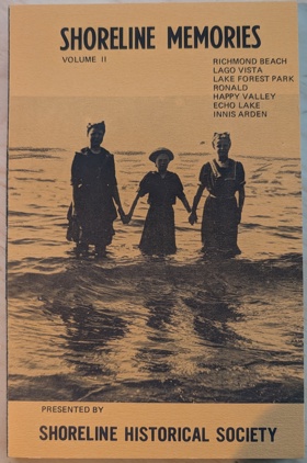
Shoreline memories Volume 2 continues to chronicle the grueling infrastructural expansion and gradual suburban integration across the heavily forested glacial plateaus and steep coastal bluffs overlooking Puget Sound. The Shoreline Historical Society details how the region's formidable physical barriers—specifically the deeply incised ravines bisecting the coastal plain, the heavily compacted, unyielding glacial till, and the persistent, dense coastal brush—strictly dictated the margins of ongoing civic development and overland connectivity. By mapping the immense physical labor required to force permanent highway grades and interurban rail lines through the rugged topography, bridge the precipitous coastal gullies, and transform precarious pioneer tracts into structured commercial corridors, the narrative highlights the monumental cooperative effort necessary to forcibly bind this demanding environment to the expanding metropolis. The fading geographic isolation from the Seattle urban core shifted these remote enclaves into a strict reliance on the precise topography of the north-south transit corridors, completely anchoring their mid-century economic existence and civic identity to the relentless paving and grading of the glacial plateau. Ultimately, this civic and historical record serves as a deeply localized spatial history, demonstrating how the challenging glacial geography, heavy maritime precipitation, and immense physical labor of this Pacific Northwest frontier fundamentally shaped the fiercely resilient, highly adaptable character of the Shoreline community as it cemented its permanent suburban landscape. 2 volumes : illustrations ; 21 cm Non-circulating [ 1 ]
|
1975 |
|
They knew our valley by Maurice Helland
They knew our valley chronicles the grueling agricultural reclamation and isolated pioneer settlement situated within the vast, arid rain-shadow basins and sagebrush steppes of the Yakima Valley in central Washington. Helland details how the region's formidable physical barriers—specifically the towering, rain-blocking spine of the Cascade Range to the west, the vast, sun-baked expanses of the arid plateau, and the unpredictable, seasonal fluctuations of the Yakima River—strictly dictated the margins of early human survival and agrarian expansion. By mapping the immense physical labor required to carve extensive irrigation canals through the unyielding, sun-baked earth, clear endless tracts of stubborn deep-rooted sagebrush, and forcibly divert glacial meltwater to cultivate the parched soil, the narrative highlights the monumental cooperative effort necessary to forcibly convert this harsh desert environment into highly productive agricultural tracts. The profound geographic isolation from the heavily populated coastal ports initially forced these remote homesteaders and early orchardists into a strict reliance on the precise topography of the river basin and complex, gravity-fed irrigation networks, completely anchoring their physical survival and early commercial existence to the severe hydrological realities of the interior watershed. Ultimately, this local historical record serves as a deeply localized spatial history, demonstrating how the extreme arid geography, severe climatic isolation, and immense physical labor of this Pacific Northwest frontier fundamentally shaped the fiercely resilient, highly cooperative, and strictly agriculturally dependent character of the Yakima Valley communities. 182 pages, 1 leaf of plates : illustrations, folded map ; 24 cm Non-circulating [ 1 ]
|
1975 |
|
The Stanwood story Volume Two by Alice Essex
The Stanwood story Volume Two chronicles the grueling agricultural reclamation and isolated pioneer settlement situated at the marshy, flood-prone delta of the Stillaguamish River in northwestern Washington. Essex details how the region's formidable physical barriers—specifically the dense, impenetrable coastal tidelands, the unpredictable, violent winter flooding of the meandering Stillaguamish, and the heavily timbered, waterlogged soils of the valley floor—strictly dictated the margins of early human survival and agrarian expansion. By mapping the immense physical labor required to construct massive earthen dikes against the intruding saline tides of Port Susan and to painstakingly extract deep-rooted old-growth cedar stumps from the damp earth, the narrative highlights the monumental cooperative effort necessary to forcibly convert this dense estuarine environment into highly productive agricultural and commercial tracts. The initial geographic isolation from deeper marine anchorages forced these remote riverine homesteads into a strict reliance on the shallow-draft navigation of the river estuary, completely anchoring their physical survival and early timber economy to the severe hydrological realities of the delta and the precise tidal rhythms of Puget Sound. Ultimately, this civic and historical record serves as a deeply localized spatial history, demonstrating how the extreme estuarine geography, heavy maritime precipitation, and immense physical labor of this Pacific Northwest frontier fundamentally shaped the fiercely resilient, tightly knit, and strictly riverine-dependent character of the Stanwood settlement. volumes illustrations 28 cm Non-circulating [ 1 ]
|
1975 |
|
River reflections Snohomish City, 1859 to 1910 : a popular narrative history of Snohomish City by Snohomish Historical Society 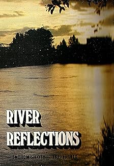
River reflections Snohomish City, 1859 to 1910 : a popular narrative history of Snohomish City chronicles the grueling timber extraction and early pioneer settlement situated within the flood-prone alluvial floodplain and dense lowland forests of western Washington's Snohomish River valley. The Snohomish Historical Society details how the region's formidable physical barriers—specifically the towering, impenetrable stands of old-growth coastal timber, the unpredictable, violent winter flooding of the meandering Snohomish River, and the heavily waterlogged, root-choked riparian soils—strictly dictated the margins of early human survival, agrarian expansion, and commercial logging. By mapping the immense physical labor required to painstakingly extract massive cedar and fir stumps from the damp earth, construct precarious logging booms and early mills along the muddy banks, and forcibly carve a commercial grid from the dense coastal wilderness, the narrative highlights the monumental cooperative effort necessary to anchor a permanent riverine boomtown in this demanding riparian environment. The profound geographic isolation from deeper marine anchorages initially forced these remote loggers, merchants, and homesteaders into a strict reliance on the precise topography of the Snohomish River for transportation, completely anchoring their physical survival and early timber economy to the precarious navigation of shallow-draft sternwheelers and the severe hydrological realities of the basin. Ultimately, this local historical record serves as a deeply localized spatial history, demonstrating how the extreme riverine geography, heavy maritime precipitation, and immense physical labor of this Pacific Northwest frontier fundamentally shaped the fiercely resilient, tightly knit, and strictly riverine-dependent character of early Snohomish City. 2 volumes : illustrations ; 28 cm Non-circulating [ 1 ]
|
1975 |
|
Episode of the west the Pendleton Round-Up, 1910-1951 : facts and figures by E. N. Boylen 
Episode of the west the Pendleton Round-Up, 1910-1951: facts and figures examines the cultural consolidation and equestrian traditions situated within the vast, semi-arid high desert plains and rolling bunchgrass prairies of northeastern Oregon's Umatilla River valley. Boylen details how the region's sweeping topography—specifically the expansive, sun-baked grazing lands, the rugged foothills of the Blue Mountains, and the wide, open spaces necessary for massive livestock operations—strictly dictated the margins of regional agriculture and fostered a deeply entrenched ranching culture. By mapping the transformation of this specific arid landscape into a celebrated arena of frontier exhibition, the narrative highlights how the sheer scale of the inland plateau directly shaped the grand equestrian spectacles and deeply rooted indigenous traditions of the famous rodeo. Ultimately, this civic and statistical record serves as a localized spatial history, demonstrating how the expansive, wide-open geography of this Pacific Northwest interior fundamentally defined the rugged, culturally intertwined, and fiercely pastoral character of the Pendleton community. 92, [6] pages : illustrations, portraits ; 21 cm Non-circulating [ 1 ]
|
1975 |
|
Rogues, buffoons & statesmen by Gordon R. Newell
Rogues, buffoons & statesmen chronicles the grueling political consolidation and precarious early statecraft across a vast, geographically fractured territory from the deeply forested, mud-bound legislative encampment of early Olympia. Newell details how the region's formidable physical barriers—specifically the towering, impenetrable spine of the Cascade Range that physically severed the inland and coastal constituencies, the dense coastal temperate rainforests, and the extreme tidal mudflats of southern Puget Sound—strictly dictated the margins of early civic centralization, overland travel, and frontier governance. By mapping the immense physical labor required by early representatives to navigate treacherous maritime routes and perilous mountain passes simply to convene, alongside the monumental effort necessary to construct a centralized, permanent capitol campus atop the heavily timbered bluffs, the narrative highlights the logistical endurance necessary to anchor a unified political apparatus in this demanding environment. The profound geographic isolation of the capital from the rapidly expanding deepwater ports and vast eastern agricultural basins initially forced these diverse, often conflicting regional factions into a strict reliance on the precise topography of early rail and steamboat networks, completely anchoring their fierce legislative battles to the severe climatic and geological realities of the state. Ultimately, this political and biographical record serves as a macro-level spatial history, demonstrating how the severe physical divides, immense geographic scale, and rugged territorial extremes of this Pacific Northwest frontier fundamentally shaped the fiercely resilient, highly contested, and uniquely colorful character of Washington's early political architects. 506, [6] pages : illustrations, portraits ; 27 cm Non-circulating [ 1 ]
|
1975 |
|
The big woods logging and lumbering, from bull teams to helicopters by Ellis Lucia
The big woods logging and lumbering, from bull teams to helicopters examines the relentless industrial timber extraction across the vast, heavily corrugated mountain ranges and deep coastal rainforests of the Pacific Northwest. Lucia details how the region's immense spatial scale—specifically the towering canopies of old-growth Douglas fir, the precipitous alpine slopes, and the plunging river canyons—strictly dictated the margins of resource extraction and drove the rapid evolution of logging technology. By mapping the transition from early, mud-bound bull teams navigating the lowland riparian corridors to complex aerial yarding operations scaling the unyielding higher elevations, the narrative highlights how the rugged, shifting terrain demanded increasingly sophisticated methods of harvest. Ultimately, this industrial record serves as a macro-level spatial history, demonstrating how the extreme vertical geography and dense botanical magnitude of this forest frontier fundamentally shaped the highly mechanized, terrain-conquering character of the regional timber industry. 22 pages : illustrations ; 27 cm Desiderata
|
1975 |
|
They came to a ridge by Ann Nilsson Driscoll, Maryann McKie 
This history was written with the hope that the pioneers of our area be remembered, and that the simple duties and pleasures of the pioneer people may be interesting to those who read it. The true pioneers of American and Driscoll Ridges are those who came here to establish their families and make a home in this new land. The period of the true pioneer to this area extends from when Frank May came in 1876 until about 1900. In my research I have carefully refrained from elaborating on the material so as to write it with as much authenticity as possible. -The Author 96 pages : illustrations, map, portraits ; 23 cm Non-circulating [ 1 ]
|
1975 |
|
They Cast a Long Shadow. A History of the Nonwhite Races on Bainbridge Island by Brian, Ed Roberts, Bainbridge Island School District 303, WA 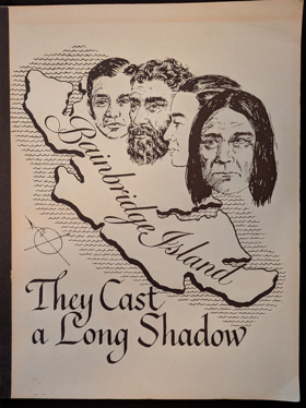
Written as a curriculum aid for students in the Bainbridge Island, Washington school district, this collection of stories about the Japanese, the Chinese, the Hawaiians, the Filipinos, the Vietnamese, and the American and Canadian Indians is an attempt to explain "what life is like for people who look different". The stories all relate the history of each of these ethnic groups on Bainbridge Island, an agricultural community, from the time of their arrival through the present. Accounts of individual's experiences from each group and black and white photographs are used to illustrate the stories. (PR) 122 Non-circulating [ 1 ]
|
1975 |
|
San Juan County, Washington, inventory of natural areas on private lands by Nature Conservancy (U.S.)., San Juan County (Wash). Planning Department 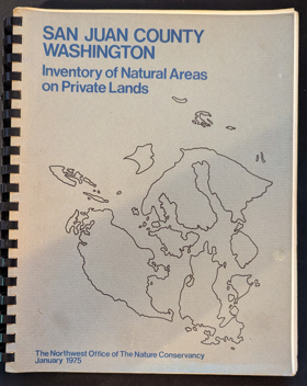
San Juan County, Washington, inventory of natural areas on private lands examines the ecological conservation and spatial mapping of the scattered, rain-shadowed archipelago situated within the protected marine waters of the Salish Sea. The Nature Conservancy and the county planning department detail how the region's fragmented island topography—specifically the rocky, tide-swept shorelines, the rare Garry oak woodlands, and the isolated, ecologically fragile prairie bluffs—strictly dictated the margins of private land ownership and environmental preservation. By mapping the delicate terrestrial ecosystems dispersed across these insular landmasses, the narrative highlights how the specific maritime isolation and complex marine geography harbor distinct, highly localized ecological sanctuaries amid increasing development pressures. Ultimately, this environmental inventory serves as a deeply localized spatial history, demonstrating how the intricate archipelagic geography and fragile microclimates of this Pacific Northwest maritime frontier fundamentally shaped the ecologically vital, carefully managed character of the San Juan Islands. 128, [54] pages : illustrations ; 28 cm Non-circulating [ 1 ]
|
1975 |
|
Chilkoot Pass, then and now by Archie Satterfield 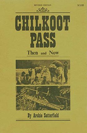
Archie Satterfield’s Chilkoot Pass, then and now provides a dual historical and modern geographic portrait of the treacherous alpine corridor connecting the Alaskan coast to the interior Yukon River basin. Set against the sheer ice fields and punishing inclines of the Coast Mountains, the narrative reveals that this iconic Klondike Gold Rush route was not a newly blazed pioneer gateway, but rather an ancient, fiercely protected overland trade monopoly long established and controlled by the coastal Tlingit people. Satterfield chronicles the staggering physical and logistical realities of the 1897–1898 stampede, detailing how thousands of prospectors were forced to pack a mandatory ton of supplies over the summit's grueling "Golden Stairs." To survive the brutal subarctic conditions, avalanches, and extreme exhaustion, these stampeders relied heavily on interdependent partnerships, cooperative labor, and the specialized packing expertise of indigenous guides. Ultimately, the text documents the brief, intense industrialization of the pass through the construction of aerial tramways and boomtown tent cities, contrasting this frantic frontier engineering with the route’s modern legacy as a preserved international trail that permanently bears the physical scars of the region's defining gold rush. vii, 183 pages : illustrations ; 22 cm Non-circulating [ 1 ]
|
1975 |
|
The Western shore Oregon country essays honoring the American Revolution by Thomas Vaughan
|
1975 |
|
"The Astorian." by Roger T. Tetlow
|
1975 |
|
Chuck Davis' guide to Vancouver by Chuck Davis
|
1975 |