Catalog of British Columbiana and Pacific Northwest Americana
Encyclopedia Cascadia Catalog contains book titles of mostly non-fiction Pacific Northwest Coast of North America Titles (primarially British Columbia, Idaho, Oregon and Washington State) in an easy-to-understand title catalog. If you see a link with this badge ONLINE CIRC it means that there is an online institution that provides free access to that title. In some cases there may be more than one institution hosting the title digitally.
| Catalog Title | Published |
|---|---|
|
Passes to the North history of Wenatchee Mountains by Edson Dow
|
1963 |
|
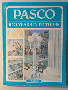
Pasco, 100 years in pictures by Walter Oberst, Ralph Smith
|
1983 |
|
Parallel destinies Canadian-American relations west of the Rockies by John M. Findlay, Kenneth Coates 
The Canadian West and the American Northwest offer a valuable setting for considering issues of borders and borderlands. The regions contain certain similarities, and during the first half of the nineteenth century they were even grouped together as a distinct political and economic unit, called the "Oregon Country" by Americans and the "Columbia Department" of the Hudson's Bay Company by the British. The essays in this volume -- which grew out of a conference commemorating the Oregon Treaty of 1846 -- view the boundary between Canada and the United States as a dividing line and also as a regional backbone, with people on each side of the border having key experiences and attitudes in common. In their eloquence and scope, they illustrate how historical study of Canadian-American relations in the West calls into question the parameters of the nation-state. The border has not had a single constant meaning; rather, its significance has changed over time and varied from group to group. The essays in Part One concern the movement of peoples and capital across a relatively permeable boundary during the nineteenth century. Many people in this era--especially Natives, miners, immigrants, and capitalists--did not regard the international boundary as particularly important. Part Two considers how the United States and Canada took pains to strengthen and enforce the international boundary during the twentieth century. In this era, the nation-state became more assertive about defining and defending the borderline. Part Three offers considerations of the distinctions, both real and imagined, that emerged during the nineteenth and twentieth centuries between Canada and the United States. Its essays examine different schools of history, divergent ideas toward wilderness, and the influence of anti-Americanism on Canadians' view of national development in North America. xxii, 302 pages : maps ; 24 cm CIRC [ 0 ]
|
2002 |
|
Paradise won the struggle to create Gwaii Haanas National Park Reserve by Elizabeth May 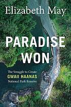
Originally published in 1990, Paradise Won has been updated and details the epic 12-year struggle to stop logging in the unique global ecosystem referred to as “Canada’s Galapagos.” Gwaii Haanas National Park Reserve is located in the southernmost part of Haida Gwaii (formerly known as the Queen Charlotte Islands), 130 kilometres off the mainland of British Columbia, Canada. Gwaii Haanas protects an archipelago of 138 islands in the territory of the Haida people, who have lived in Haida Gwaii for well over 14,000 years. From the 1970s through the early 1980s, plans to expand logging in the area led to the first concerted efforts to protect Gwaii Haanas and – in 1985 – the Haida Nation created the “Haida Heritage Site.” In spite of efforts to protect the landscape, logging continued and resulted in a prolonged legal and political battle. In 1987, logging finally ended when the governments of Canada and British Columbia signed the South Moresby Memorandum of Understanding, which safeguarded the area and permitted shared stewardship, treating the unique marine and terrestrial environments as though they were a national park, though many land claims were still outstanding. This updated edition of Paradise Won includes a new foreword by the author and will bring back into focus this remarkable story of the power and importance of Indigenous rights and how activism can spur average citizens to action in order to fight climate change and protect fragile ecosystems everywhere. 326 pages : color illustrations, map ; 23 cm CIRC [ 0 ]
|
2020 |
|
Panoramas of promise Pacific Northwest cities and towns on nineteenth-century lithographs by John William Reps, David H. Stratton 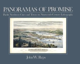
"Beginning with Henry James Warre's view of Oregon City in 1846 and concluding with highly technical panoramas of Seattle and Portland by artists like E. S. Glover and Augustus Koch, John Reps demonstrates what lithographs of Pacific Northwest communities can tell us about the past. The text is illustrated by 44 beautiful, detailed drawings, eight in color. Source: Publisher." -- Google Books viewed August 7, 2020 11 unnumbered preliminary pages, 93 pages : illustrations (some color) ; 21 x 26 cm CIRC [ 1 ]
|
1984 |
|
Palouse rails Granger railroads of the inland Northwest by Thomas Hillebrant 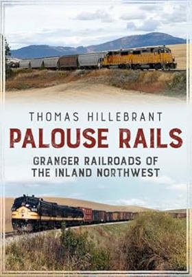
The Palouse region of Eastern Washington and North Idaho produces the highest yields of any wheat-growing district in North America, followed closely by farmlands in the adjoining Walla Walla and Camas Prairie regions. Early farmers clamored for railroads to carry their harvests to world markets, and soon a veritable spider's web of competing rail routes left few corners of the Inland Northwest untouched. Some lines also reached into nearby forests to haul timber to local sawmills and ship out finished lumber. As the principal transporter of people and goods prior to World War II, railroads served an integral role in the communities they served. Despite traffic losses to competing trucks and river barges, railroads still haul considerable grain and wood products tonnage on these lines today. Palouse Rails tells the stories of seven major railroads serving these regions, from their origins to the present day, through the eyes of contemporary railroad photographers. These images capture the railroad equipment, locations, personnel, and operations that, for generations, have connected Inland Northwest's agricultural regions with each other and with the world. 180 pages, 12 unnumbered pages of plates : illustrations (some color) ; 25 cm CIRC [ 0 ]
|
2018 |
|
Painters of the Northwest Impressionism to Modernism, 1900-1930 by John E. Impert 
From its sweeping coastlines to its soaring inland mountains, verdant valleys, and volcanoes standing in splendid isolation, the Pacific Northwest has long inspired artists to capture the unique spirit of its varied landscape. Yet the early years of twentieth-century Pacific Northwest painting remain shrouded in mystery. In this groundbreaking work, John Impert introduces readers to the rich and varied array of artists and works of art that defined the region's artistic transition from a nature-bound impressionism to the arrival of modernism. Focusing on nine artists--Paul Morgan Gustin, C. C. McKim, Clyde Keller, J. Edgar Forkner, Clara Jane Stephens, Dorothy Dolph Jensen, Eustace Paul Ziegler, Mark Tobey, and C. S. Price--art historian John Impert organizes his work around the landscapes, people, and city scenes they painted. He identifies the influence of impressionism, in particular the singular way in which each artist's biography, style, and iconography contribute to a distinctive northwestern sensibility. Painters of the Northwest shows us for the first time how a spectacular natural environment, one that conformed aesthetically to nineteenth-century ideals of romanticism and transcendental reverence, combined with an emphasis on subject over style to create a body of work far more concerned with the natural environment than with the socioeconomic issues that occupied city-bound artists of the day. Establishing a chronology, history, and art historical canon for this little-studied place and time, this book is a long-overdue foundational history of early twentieth-century painting in the Pacific Northwest.--Google Books xi, 208 pages : illustrations (chiefly color) ; 23 x 28 cm CIRC [ 0 ]
|
2018 |
|
Pageant of B.C. glimpses into the romantic development of Canada's far western province by B. A. McKelvie 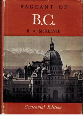
McKelvie's title is too modest: this is in essence a very well researched short history of British Columbia to the end of the nineteenth century, written for the general reader. Its more than 100 short chapters "first appeared in serial form in The Vancouver Daily Province, between February 1953 and March 1955". 263 pages plates (some color), portraits 23 cm CIRC [ 0 ]
|
1955 |
|
|
1971 |
|
Pacific voyages the story of sail in the great ocean by Gordon Miller 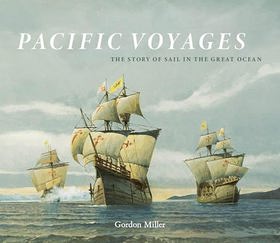
"In Western myths and imagination, the Pacific is the home of soft, warm, gentle trade winds, idyllic island lagoons and waving palms--the exotic earthly paradise of escapists, adventurers and romantics. Until James Cook showed otherwise, eighteenth-century Europeans also believed this ocean to contain a great southern continent of untold riches and beauty. The islands of the South Pacific can indeed be enchanting, their charm often exceeding expectations, but as European mariners realized when they first arrived here in the sixteenth century, the Pacific Ocean is also a region of ferocious tropical cyclones, treacherous, reef-littered atolls, wearying doldrums and mind-numbing distances. This book is maritime artist and historian Gordon Miller's tribute to the humble little ships that first ventured across the great Pacific, and the brave sailors that manned them. It is a brief, selective and condensed story of the charting, exploitation and occupation of the Pacific Ocean, mostly in small, wooden ships, with only wind and human muscle for power. These maritime pioneers united North and South America, Australia, New Zealand, the entire Pacific Ocean, all the coasts that surround it, and all the islands within. Even confined to the last four centuries of oceangoing sail, this is a large and complex story--a story brought to life by Miller's carefully researched text and masterfully rendered maritime paintings."-- Provided by publisher xi, 252 pages : illustrations (chiefly color), color maps ; 27 x 30 cm CIRC [ 0 ]
|
2023 |
|
Pacific tugboats by Gordon R. Newell
|
1957 |
|
Pacific steamers by Will Lawson 
Detailed history and listing of steam ships in the Pacific, changes in technology, with ships mainly from Australia, New Zealand, United States, and Canada xx, 244 pages, 72 unnumbered leaves of plates : illustrations ; 22 cm CIRC [ 1 ]
|
1927 |
|
Pacific seaweeds a guide to common seaweeds of the West Coast by Louis D. Druehl , Bridgette E. Clarkston , Shirarose Wilensky 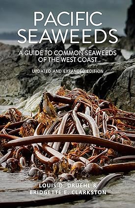
This updated and expanded guide thoroughly documents every aspect of seaweed life, from species identification and seaweed biology to the essential--and often surprising--roles seaweed plays in the marine ecosystem and our everyday lives. Seaweeds are used in everything from cosmetics to sustainable biofuels, and some species, like kelp, contribute to the remediation of coastal ecosystems. Featuring an attractive new full-colour design, the expanded Pacific Seaweeds includes updated species descriptions, dozens of additional colour photos, new species discovered since the original edition, and brand-new sections on common shore plants and the use of DNA techniques to discover, catalog and identify seaweeds. It also features several new recipes and an essay on umami--because in addition to all its other uses, some species of seaweed make delectable food. Packed with illustrations, vivid colour photographs, comprehensive scientific information and further readings, this easy-to-use guidebook will appeal to marine biologists, amateur beachcombers, gourmet foragers and everyone in between. 320 pages : illustrations (some color), map, portrait ; 22 cm CIRC [ 0 ]
|
2016 |
|
Pacific Northwest themes historical essays, in honor of Keith A. Murray by Keith A. Murray, James William Scott , Western Washington University Center for Pacific Northwest Studies (Publisher) 
For "Official uses of violence against Northwest Coast Indians in Colonial British Columbia": author undertakes a justification for the use of violence against North West Coast Indians. The use of force to expand the British frontier on the Northwest Coast is noted as a product of British policy, a policy that was put into action when the circumstances warranted. The author referes to this policy as "diplomacy by other means." viii, 138 pages : map, portraits ; 23 cm CIRC [ 1 ]
|
1978 |
|
Pacific Northwest lighthouses Oregon to the Aleutians by Bruce Roberts, Ray Jones 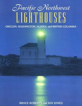
Pacific Northwest Lighthouses pays tribute to the forty-five lifesaving beacons From Coos Bay, Oregon, to Unimark Island in the Aleutians. The lighthouses on the harrowing northwestern coastline of the United States and Canada are memorialized in dramatic tales and glorious photos that evoke the continuing battle between men and sea. Profiles include complete details on directions and visiting hours 88 pages : illustrations (some color) ; 28 cm. CIRC [ 1 ]
|
1997 |
|
Pacific Northwest letters of George Gibbs by George Gibbs, Vernon Carstensen
|
1954 |
|
Pacific Northwest cheese a history by Tami J. Parr 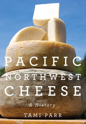
In this rich and engaging history, Tami Parr shows how regional cheesemaking found its way back to the farm. It?s a lively story that begins with the first fur traders in the Pacific Northwest and ends with modern-day small farmers in Oregon, Washington, and Idaho. For years, farmers in the Pacific Northwest made and sold cheese to support themselves, but over time the craft of cheesemaking became a profitable industry and production was consolidated into larger companies and cooperatives. Eventually, few individual cheesemakers were left in the region. In the late sixties and early seventies, influenced by the counterculture and back-to-the-land movements, the number of small farms and cheesemakers began to grow, initiating an artisan cheese renaissance that continues today 208 pages : illustrations ; 26 cm CIRC [ 0 ]
|
2013 |
|
Pacific Northwest Americana, 1949-1974 a supplement to Charles W. Smith's third edition 1950 by Richard E. Moore, Nadine H. Purcell, Charles W. Smith, Pacific Northwest Library Association Committee on the Smith Bibliography Supplement
|
1981 |
|
Pacific Northwest Americana a checklist of books and pamphlets relating to the history of the Pacific Northwest by Charles W. Smith
Compiled in 1921 by University of Washington librarian Charles W. Smith (expanding upon a 1909 preliminary edition), Pacific Northwest Americana: A Checklist of Books and Pamphlets Relating to the History of the Pacific Northwest serves as a foundational bibliography designed to definitively catalog the region's historical literature. Acting as a master inventory for subscribing libraries, historical societies, and private collectors, the extensive checklist standardized the historical canon of Washington, Oregon, Idaho, and British Columbia by organizing thousands of pioneer memoirs, government surveys, and missionary tracts into a cohesive, searchable archive. By establishing the institutional parameters of what constituted legitimate scholarly material, the work effectively built the academic infrastructure for studying the region. A keen insight drawn from the work is how the seemingly neutral, bureaucratic act of archival cataloging functioned as a powerful tool of colonial gatekeeping; by strictly defining regional history as a collection of published, settler-produced texts and government pamphlets, Smith's bibliography institutionalized an academic canon that elevated pioneer narratives to the realm of empirical fact while structurally erasing Indigenous oral histories from the official scholarly record. xi, [1], 329 pages 27 cm ONLINE CIRC [ 2 ] CIRC [ 1 ]
|
1921 |
|
Pacific graveyard a narrative of shipwrecks where the Columbia River meets the Pacific Ocean by Jim Gibbs 
Man's age-old struggle with the sea comes historically alive in these true stories of shipwrecks off the Oregon and Washington coasts -- all near the mouth of the Columbia River. Dramatic photos of disaster and rescue at sea are placed with the stories they illustrate. Narrative appendix lists all wrecks; pictorial map gives locations. Fourth edition. 5 1/2 x 8 1/2. Highlighted by over 100 superb photos. Index. 304 pages. Companion to "Pacific Graveyard Shipwrecks Chart." 302 pages : illustrations, maps ; 22 cm CIRC [ 1 ]
|
1993 |
|
Pacific coast. Coast pilot of California, Oregon, and Washington Territory by United States Coast Survey, George Davidson
Published in 1869 by the United States Coast Survey under the direction of George Davidson, this exhaustive maritime manual provided the first rigorous, scientific hydrographic documentation of the American Pacific seaboard. The guide meticulously details the treacherous coastal geography, hazardous river bars, and nascent lighthouse infrastructure of Oregon and Washington, offering critical navigational instructions for surviving the notoriously deadly Columbia River entrance. A keen insight drawn from the text is how Davidson's exhaustive scientific cartography functioned as essential state-building infrastructure; by mathematically mapping and demystifying the hazardous "Graveyard of the Pacific," the survey directly catalyzed the Pacific Northwest's economic integration into the broader global maritime trade network. 262 pages plates 27 cm ONLINE CIRC [ 1 ]
|
1869 |
|
Pacific coast survey of 1849 and 1850 by Lewis A. McArthur
Originally published in 1915 as a reprint from the Oregon Historical Quarterly, Pacific Coast Survey of 1849 and 1850 by Lewis A. McArthur chronicles the first systematic United States Coast Survey expeditions along the western seaboard. The monograph details the arduous hydrographic and topographic mapping efforts led by the author’s grandfather, naval lieutenant William Pope McArthur, which transformed the rugged Pacific coastline and the treacherous Columbia River into navigable, standardized maritime charts. Through detailed geographic logs and biographical accounts of the grueling expedition, the text documents the foundational cartographic work that literally put the newly acquired territories on the American administrative map. A keen insight drawn from the work is how supposedly objective scientific surveys functioned as the primary vanguard of colonial incorporation; by systematically translating indigenous coastlines into legible, federal hydrographic data, early surveyors provided the essential infrastructure that accelerated commercial shipping, military control, and rapid settler expansion in the Pacific Northwest. [246]-274 pages : portrait ; 24 cm ONLINE CIRC [ 1 ]
|
1915 |
|
Ozette excavating a Makah whaling village by Ruth Kirk 
Makah families left the coastal village of Ozette in the 1920s to comply with the federal government's requirement that they send their children to school, and by doing so they ended nearly 2000 years of occupation at this strategic whale- and seal-hunting site on Washington's Olympic Peninsula ologist Richard Daugherty took note of the site in a survey of the coast in 1947 and later returned at the request of the Makah tribal chairman when storm waves began exposing both architecture and artifacts. Full-scale excavations from 1966 to 1981 evealed houses and their contents--including ordinarily perishable wood and basketry objects that had been buried in a mudflow well before the arrival of Europeans in the region xvii, 102 pages : illustrations, maps ; 26 cm CIRC [ 1 ]
|
2015 |
|
Oysterville roads to grandpa's village by Willard R. Espy , Earl Thollander (Illustrator) 
Features tales of four families who settled up and down the East Coast of America three centuries ago and subsequently migrated west, eventually arriving at the tiny settlement of Oysterville on the Pacific coast in the territory of Washington. 300 pages : illustrations ; 26 cm CIRC [ 1 ]
|
1992 |
|
Ox-team days on the Oregon trail by Ezra Meeker, Howard R. Driggs
Published in 1922 as a collaborative revision between iconic pioneer Ezra Meeker and educational author Howard R. Driggs, Ox-Team Days on the Oregon Trail is a heavily sanitized, accessible autobiography aimed directly at the American public school system. The book recounts Meeker’s grueling 1852 overland migration to the Pacific Northwest by ox-drawn wagon, his early homesteading struggles, and his famous early twentieth-century crusade to retrace the route and erect physical monuments along the fading Oregon Trail. Serving as both a personal memoir and a pedagogical tool, the text was meticulously engineered to immortalize the pioneer experience as the ultimate expression of American grit and national destiny. A keen insight drawn from the work is how the authors actively weaponized pioneer nostalgia for civic indoctrination; by repackaging the ecologically disruptive and inherently colonial act of westward expansion into an uplifting, state-sanctioned children’s textbook, Meeker and Driggs effectively cleansed the Oregon Trail of its violent realities. Their narrative actively shielded subsequent generations from the brutal consequences of Indigenous displacement, ensuring that the massive demographic invasion of the Pacific Northwest was memorialized purely as a righteous, patriotic pilgrimage essential to the American character. viii, 225 pages : illustrations ; 21 cm. ONLINE CIRC [ 1 ]
|
1922 |