Catalog of British Columbiana and Pacific Northwest Americana
Encyclopedia Cascadia Catalog contains book titles of mostly non-fiction Pacific Northwest Coast of North America Titles (primarially British Columbia, Idaho, Oregon and Washington State) in an easy-to-understand title catalog. If you see a link with this badge ONLINE CIRC it means that there is an online institution that provides free access to that title. In some cases there may be more than one institution hosting the title digitally.
| Catalog Title | Published |
|---|---|
|
The structure of Twana culture by William W. Elmendorf, A. L. Kroeber 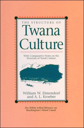
This remarkable account of Washington’s Twana Indians contains the most complete body of information compiled on any Native American group in the southern coast Salish region. 576 pages : illustrations, maps ; 23 cm CIRC [ 1 ]
|
1992 |
|
Early Castle Rock and north Cowlitz County, Washington by Leland G. Jackson 
The late Leland Jackson (author), whose ancestors were among the early families to migrate to the area that was to become Castle Rock, Washington, was fortunate enough to appreciate local history and sufficiently skilled to write about it in a style that is both informative and easy to follow. This book provides readers insight into the hardships and joys the settlers experienced. xi, 160 pages : illustrations, maps ; 28 cm CIRC [ 1 ]
|
1992 |
|
Oysterville roads to grandpa's village by Willard R. Espy , Earl Thollander (Illustrator) 
Features tales of four families who settled up and down the East Coast of America three centuries ago and subsequently migrated west, eventually arriving at the tiny settlement of Oysterville on the Pacific coast in the territory of Washington. 300 pages : illustrations ; 26 cm CIRC [ 1 ]
|
1992 |
|
Vancouver a visual history by Bruce Macdonald 
Absolutely unique in its presentational style, Vancouver: A Visual History is a delightful and important book. This stunning, full-colour historical atlas brings to life Vancouver s first fourteen decades, beginning with a map of the 1850s depicting the land use, economy and settlement patterns of its first peoples, and ending with a map of the 1980s. Using a repeating grid format, in which each ten-year period of the city s history is examined through the application of the same criteria, each decade is introduced by a full-colour map that illustrates land use patterns. A column of text to the left of this map describes the major land use changes that have occurred since the previous decade; to the right of the map are notes that provide related details of the city s evolving history. Following each double-page map, the reader is introduced to the prominent personalities of the decade, in the area of sports, politics, business, labour, culture and community service, as well as given an overview of each period s economic focus, settlement patterns, political directions and key historical events xi, 84 p. : ill. (some col.), col. maps, ports. ; 32 cm. CIRC [ 1 ]
|
1992 |
|
The Victoria and Sidney railway, 1892-1919 by Darryl E. Muralt, British Columbia Railway Historical Association, British Columbia Heritage Trust 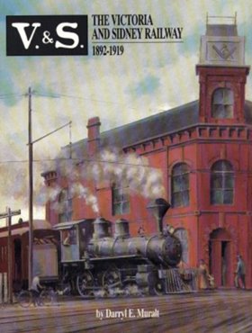
Wonderfully written history of the ever-troubled Victoria and Sidney Railway in British Columbia. Packed with black and white photos, the book brings the railway and the people who ran it (and the long-suffering passegers) to life while providing a fascinating look at life in rural Canada at the turn of the century. With maps, equipment rosters, chronology and numerous appendices that flesh out the history of the Saanich Peninsula. 236 pages. 236 pages : illustrations, maps, portraits ; 28 cm CIRC [ 1 ]
|
1992 |
|
The Fraser Valley a history by John A. Cherrington 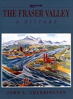
One of the world's most fertile agricultural regions, the Fraser Valley is in the midst of explosive change from the pressures of technology and urbanization. The author follows the Valley's history from the eighteenth century when Stalo natives were constantly on guard against visits from raiding Yacultas, through the Victorian era, when waves of settlers fought harsh winters, floods and mosquitoes to build a new community in the Valley, to the twentieth century, when the depredations of two world wars and the impact of the automobile changed the Valley forever. Throughout, Cherrington reminds us that beneath the serene, increasingly urbanized surface of the Fraser Valley, there is a turbulent past of Sasquatches and steamships, fur traders and fishermen, priests and prospectors - a recent past that, in an era of freeways and microchips, seems increasingly remote. 391 pages : illustrations, maps ; 29 cm CIRC [ 1 ]
|
1992 |
|
T'sou-ke a festival of community spirit, 1790-1990 by Elida Peers, Sooke Region Museum (Sooke, B.C.), Sooke Region Historical Society, Sooke Festival Society 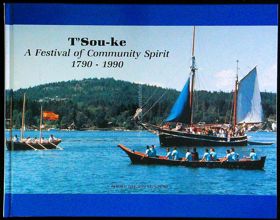
An introduction to the T'Sou-ke people and the people of Sooke, a small community on the western coast of Vancouver Island. 156 pages : illustrations (some color), maps, portraits ; 22 x 29 cm CIRC [ 1 ]
|
1992 |
|
Qualicum Beach a history of Vancouver Island's best kept secrets by Brad Wylie 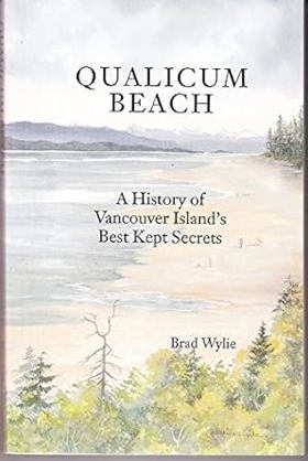
Qualicum Beach: A History of Vancouver Island's Best Kept Secrets is a non-fiction historical work by Brad Wylie, first published in 1992. The book offers a detailed look at the history of the Qualicum Beach region, highlighting its cultural heritage and place within Canadian history. Across its 222 pages, Wylie traces the area's early stories, first settlements, and key regional milestones that helped shape this beautiful coastal community on Vancouver Island. It provides an engaging and informative resource for readers interested in local lore, heritage, and the fascinating historical development of one of British Columbia's unique communities. 219 p. : ill. ; 21 cm. CIRC [ 1 ]
|
1992 |
|
Kamloops one hundred years of community, 1893-1993 by Wilf Schmidt, Wayne R. Norton 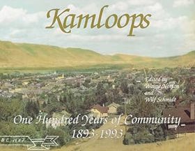
In this unique collection of writing and photography, nineteen skilled individuals have explored various facets of Kamloops' colorful past, present and future. Through their eyes, we see the landscapes, the city scenes and the people who made life in this southwestern B.C. community interesting and exciting. Kamloops: One Hundred Years of Community has an historic hand-tinted 1937 photograph as a four-color wrap-around cover. It also contains 87 black and white photographs, many previously unpublished. Soft cover, 8 1/2" x 11" horizontal format. 148 p. : ill. ; 22 x 28 cm. CIRC [ 1 ]
|
1992 |
|
Battle Rock the hero's story : a true account, Oregon coast Indian attack : an Oregon documentary by Bert Webber, Margie Webber, J. M. Kirkpatrick 
Published by maritime historians Bert Webber, Margie Webber, and J.M. Kirkpatrick, Battle Rock: The Hero's Story chronicles the harrowing 1851 clash between a small party of American gold-seekers led by Captain William Tichenor and the local Quat-a-qtie (Tututni) people on the southern Oregon coast. The book details the group's desperate defense atop a rocky sea stack in present-day Port Orford after an initial exploratory landing provoked fierce Indigenous resistance to protect their ancestral territory. Drawing on historical documents, pioneer journals, and local accounts, the text preserves a violent and foundational episode of frontier expansion. A keen insight drawn from the work is how regional historical documentation often elevates colonial survival narratives while obscuring the broader geopolitical trauma; by framing the skirmish through the heroic lens of isolated pioneers under siege, the account masks the reality that the true assault was an unprovoked imperial intrusion onto sovereign Indigenous land. 75 pages : illustrations, maps, portraits ; 22 cm CIRC [ 1 ]
|
1992 |
|
Above the falls an oral and folk history of the Upper Glenn Creek, Coos County, Oregon by Lionel Youst 
Thousands of visitors have been enthralled by the beauty and grandeur of the 378-foot Golden Falls of Glenn Creek, about 25 miles east of Coos Bay. They are part of the Golden and Silver Falls State Park, one of the treasures of western Oregon. Very few of the visitors have had any idea of the land, nor of the history of the land above those falls. Above the Golden and Silver Falls is a lovely valley about three miles long. For 60 years a few families lived their lives in that remote and idyllic location. In 1958 the bridge at the base of Silver Falls was removed and the road was closed. The land above the falls became uninhabited timberland, inaccessible to the public. This book contains scores of verbatim interviews from the survivors and their descendants, 160 photographs, and exhaustive research into original documents. Fully indexed, bibliography, maps, and charts. viii, 320 pages : illustrations, maps, portraits ; 28 cm CIRC [ 1 ]
|
1992 |
|
Flagstaff Hill on the national historic Oregon Trail, Baker City, Oregon an interpretive guide by James R. Evans, Bert Webber 
Published by historians James R. Evans and Bert Webber, Flagstaff Hill on the National Historic Oregon Trail, Baker City, Oregon: An interpretive guide serves as an informative companion to one of the most prominent overland trail sites in the American West. The book explores the dramatic geography and historic significance of Flagstaff Hill, which overlooks the historic ruts carved by thousands of covered wagons descending toward the Snake River valley. Utilizing archival photographs, maps, and trail diaries, the guide details the grueling final stretches of the Oregon Trail where pioneers faced exhaustion, disease, and the daunting transition from wilderness trekkers to exhausted settlers. A keen insight drawn from the work is how interpretive monuments freeze a complex historical tragedy into a romanticized pioneer narrative; by elevating Flagstaff Hill as a scenic monument to manifest destiny, the site risks reducing a violent process of indigenous displacement into a sanitized spectacle of rugged perseverance. 143 pages : illustrations, maps ; 22 cm CIRC [ 1 ]
|
1992 |
|
Old West in Grant County country by Monty Hormel 
Authored by local historian Monty Hormel, Old West in Grant County Country chronicles the rugged frontier heritage and colorful historical legacy of eastern Oregon's high desert mining and ranching country. The book details the turbulent late-19th-century era defined by gold rushes, cattle drives, vigilante justice, and the sheer tenacity of homesteaders who carved out lives in an arid, isolated landscape. Through vintage photographs and local archives, the text preserves the vanishing oral histories and dramatic episodes that shaped communities like John Day and Canyon City. A keen insight drawn from the work is how the popular mythology of the "Old West" masks the mundane economic desperation of frontier extraction; by examining the boom-and-bust cycles driven by mineral exhaustion and grazing limits, the narrative reveals that legendary tales of outlaw lawlessness often served to distract from the grinding precariousness of living on depleted land. vii, 95 pages : illustrations ; 22 cm CIRC [ 1 ]
|
1992 |
|
West Pointers and early Washington the contributions of U.S. Military Academy graduates to the development of the Washington Territory, from the Oregon Trail to the Civil War, 1834-1862 by John A. Hemphill, Robert C. Cumbow 
The contributions of U.S. Military Academy Graduates to the Development of the Washington Territory, from the Oregon Trail to the Civil War 1934-1862. iv, 235 pages : illustrations, maps ; 28 cm CIRC [ 1 ]
|
1992 |
|
Gray & Columbia's River by Joean K. Fransen 
Authored by Joean K. Fransen, Gray & Columbia's River chronicles the maritime explorations of Captain Robert Gray and his historic 1792 discovery of the great river of the West. The book traces Gray's momentous voyage aboard the Columbia Rediviva, detailing his navigation of treacherous Pacific Northwest coastal waters and the lucrative sea otter trade that tied the region to global maritime markets. Through engaging historical narrative, the text highlights the sheer tenacity and seamanship required of early American merchants operating along an unmapped and dangerous frontier. A keen insight drawn from the work is how a single geographic discovery altered the geopolitical fate of an entire continent; by successfully crossing the treacherous bar of the Columbia River, Gray secured vital territorial claims for the United States that fundamentally reshaped the destiny of the Pacific Northwest. ii, 143 pages : illustrations, maps ; 22 cm CIRC [ 1 ]
|
1992 |
|
Murder at Hogans Corner, Washington an American destiny by Wallace Louis Exum 
Authored by Wallace Louis Exum, Murder at Hogans Corner, Washington: An American Destiny investigates a dark, sensationalized 1930s homicide that sent shockwaves through a rural Grays Harbor County crossroads community. The book reconstructs the chilling details of the crime, the subsequent manhunt, and the local judicial proceedings that riveted the Pacific Northwest during the height of the Great Depression. Through meticulous archival research, the author uses the lens of a single sensational murder to expose the raw underbelly of an isolated frontier region wrestling with sudden economic despair. A keen insight drawn from the work is how true-crime narratives function as mirrors for societal anxiety; by probing a localized act of violence against the backdrop of economic collapse, the text reveals that the true horror of the era was not merely an isolated murder, but the pervasive social unraveling of a forgotten rural populace pushed to the brink by structural poverty. xiii, 227 pages : portrait ; 21 cm CIRC [ 1 ]
|
1992 |
|
The Northwest Coast British navigation, trade, and discoveries to 1812 by Barry M. Gough 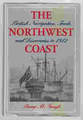
"The Northwest Coast was irrevocably changed the day that Captain James Cook sailed into Nootka Sound in 1778. Cook's discovery of the sea otter population along the coast initiated the maritime fur trade, which in turn led to feverish competition among several nations, especially Britain, Russia, and the United States, as well as the celebrated rivalry between Spain and Britain for control of Nootka. By 1812, a toehold of British empire was established, and the aboriginal way of life was shattered." "The Northwest Coast documents Britain's rise to pre-eminence in this far-flung corner of empire. It shows how the relentless activities of its commercial interests, the adroit use of its naval power, and the steely resolve of its diplomats secured British claims to dominion and rights to trade along the Northwest Coast. Written by a leading maritime scholar and based on fresh research into all known manuscripts and printed works on Pacific trade and exploration, this book incorporates new interpretations on exploration and commercial activity in this area, significantly updating and expanding the author's award-winning book, Distant Dominion. The Northwest Coast documents the interaction, often violent, between British sailors and aboriginal people; depicts many of the rivalries among British mariners; and examines various claims to the discovery of the Northwest Passage. Gough's compelling narrative combined with his extensive use of quotations from the journals and correspondence of explorers and merchant traders provide insights into the motives and attitudes of these early pioneers of empire."--Jacket 1 online resource (xiv, 265 pages, 8 unnumbered pages of plates) : illustrations, maps CIRC [ 1 ]
|
1992 |
|
Back roads of Washington 74 trips on Washington's scenic byways by Earl Thollander 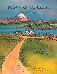
Wander off the beaten path with artist Earl Thollander and discover some of the most picturesque areas of the state. In hand-written text and vivid illustrations, Back Roads of Washington guides readers through 6,000 miles of scenic beauty. This regional classic captures the memorable details of back roads that can be enjoyed on the way to a destination, on a Sunday drive, or sitting in a comfortable armchair. -- Amazon 200 pages : illustrations, maps ; 28 cm CIRC [ 1 ]
|
1992 |
|
Levant F. Thompson hop king, banker, senator, Pierce County, Washington pioneer by Jack R. Evans 
Authored by local historian Jack R. Evans, Levant F. Thompson: Hop King, Banker, Senator, Pierce County, Washington Pioneer chronicles the extraordinary life and rapid rise of a defining 19th-century Pacific Northwest entrepreneur. The book traces Thompson’s multifaceted career from an ambitious agrarian settler into a dominant agricultural baron controlling vast hop-growing empires, before pivoting into banking and state politics. Through extensive archival records and biographical details, the text illuminates the volatile economic forces and speculative fortunes that built the infrastructure of early Pierce County. A keen insight drawn from the work is how regional agricultural monopolies served as the foundational launchpad for political power; by converting massive windfalls from the speculative hop boom into banking capital and legislative influence, pioneers like Thompson demonstrated that early Washington state politics were directly engineered by those who could successfully weather the boom-and-bust cycles of single-crop commodity markets. ii, i, 49 pages : illustrations ; 21 cm. CIRC [ 1 ]
|
1992 |
|
Mercer's belles the journal of a reporter by Roger Conant, Lenna A. Deutsch 
Originally published in 1960 and long out of print, Mercer's Belles is a classic of Northwest history and even inspired a television series, "Here Come the Brides." Roger Conant's 1866 report of his shipboard travels with the "Mercer Girls" on their three-month voyage from New York to San Francisco and Seattle is here republished in its entirety, including Lenna Deutsch's invaluable reference material and the original photographs. A new foreword by Northwest historian Susan Armitage places the journal in historical perspective. Civil War losses had created a surplus of unattached women on the eastern seaboard. In the new western territories, women were sought as wives and teachers. Asa Mercer, president of the territorial university in Seattle, organized a project for female emigration. To a group of men in the West he promised, for a fee, to bring a suitable wife of good moral character and reputation. To the women of the East he offered free passage to Washington Territory. People greeted Mercer's plans with mixed feelings, and he never recruited the number of women he originally anticipated would make the long journey west. The story of "Mercer's Belles" came to occupy an important and interesting niche in regional history. Never has the story been told as thoroughly, as entertainingly, or as well as in Roger Conant's journal, accompanied by Lenna Deutsch's insightful reference material. It is fitting that Mercer's Belles now be made available for a new generation of readers. 1 online resource (xvii, 147 pages) : illustrations CIRC [ 1 ]
|
1992 |
|
Centennial history of Lemhi County, Idaho by Lemhi County History Committee (Lemhi County, Idaho) 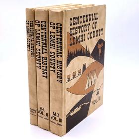
Authored and compiled by the Lemhi County History Committee, the three-volume Centennial History of Lemhi County, Idaho provides an exhaustive archival portrait of settlement, mining, and indigenous displacement in east-central Idaho's rugged mountainous terrain. The comprehensive set documents the turbulent evolution of the Salmon River country from ancestral Shoshone and Bannock homelands into a rugged frontier carved by the 1860s gold rushes, ranching, and copper mining. Through extensive pioneer diaries, family genealogies, and local records, the volumes preserve the granular details of daily survival in an isolated, high-altitude basin. A keen insight drawn from the work is how multi-volume local histories compiled by community committees function as collective acts of self-mythologizing; by meticulously cataloging every homestead and mining claim while glossing over the violent removal of the indigenous population, the collection illustrates how local memory is often curated to enshrine pioneer resilience while institutionalizing the erasure of native sovereignty. 3 volumes : illustrations, maps ; 29 cm ONLINE CIRC [ 3 ]
|
1992 |
|
Naval Station Puget Sound at Sand Point by Dennis Stuhaug, United States Department of the Navy Morale, Welfare and Recreation Department 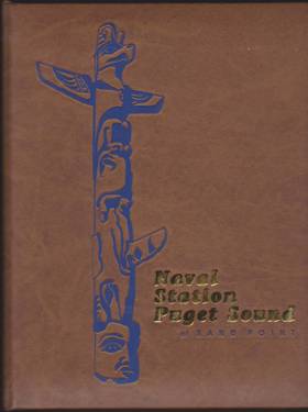
Published by the Department of the Navy alongside local author Dennis Stuhaug, Naval Station Puget Sound at Sand Point chronicles the fascinating military and aviation heritage of Seattle’s historic waterfront base. The book details the facility's evolution from a vital 1920s naval air station—famous as a key stop for the 1924 round-the-world flight—into a crucial World War II training and logistics hub. Through archival photographs and military records, the text captures how the installation served as a dynamic nexus between civilian urban life and naval defense along Lake Washington. A keen insight drawn from the work is how the transformation of military bases into public parks reflects the shifting priorities of modern cities; as Sand Point was decommissioned and turned into Magnuson Park, it demonstrated how post-industrial urban spaces are reclaimed to heal the ecological and social splits left behind by military-industrial expansion. 104 pages : illustrations (1 color), portraits (1 color) ; 29 cm CIRC [ 0 ]
|
1992 |
|
Ghost voices Yakima Indian myths, legends, humor, and hunting stories by Donald M. Hines 
The largest, most detailed collection of Yakima lore ever. Introductory notes and numerous photographs provide historical and cultural context. Tribal Myths and Legends explain the origin of the tribes, of fire, or the origins of landmarks, also mysterious, haunted lakes. Humorous Tales relate the ridiculous, often earthy antics of Coyote. Hunting Stories reveal the techniques, the terrors of the hunt for the ferocious grizzly, treacherous black bear, or deer, and more. 435 pages, 26 unnumbered pages of plates : illustrations ; 22 cm CIRC [ 0 ]
|
1992 |
|
Wildmen, wobblies & whistle punks Stewart Holbrook's lowbrow Northwest by Stewart H. Holbrook, Brian Booth 
Stewart Holbrook was a high school dropout who emerged from logging camps to become the author of three dozen books, the Pacific Northwest’s foremost storyteller, one of the nation’s most popular historians, and a satirical painter known as “Mr. Otis.” Today readers are rediscovering Holbrook’s colorful and irreverent accounts of Pacific Northwest history. Wildmen, Wobblies, and Whistle Punks collects twenty-six of Holbrook’s best writings about the region. Combining solid scholarship with humor and a gift for celebrating the offbeat, Holbrook’s stories record a vibrant, often overlooked side of Northwest history. Here are forgotten scandals and murders; stories of forest fires, floods, and other calamities; tales of loggers and life in the logging camps; and profiles of various lowbrow characters—radicals, do-gooders, dreamers, schemers, and zealots. vi, 313 pages : illustrations, map ; 23 cm. CIRC [ 0 ]
|
1992 |
|
Indian rock art of the Columbia Plateau by James D. Keyser 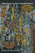
From the river valleys of interior British Columbia south to the hills of northern Oregon and east to the continental divide in western Montana, hundreds of cliffs and boulders display carved and painted designs created by ancient artists who inhabited this area, the Columbia Plateau, as long as seven thousand years ago. Expressing a vital social and spiritual dimension in the lives of these hunter-gatherers, rock art captivates us with its evocative power and mystery. At once an irreplaceable yet fragile cultural resource, it documents Native histories, customs, and visions through thousands of years. This valuable reference and guidebook addresses basic questions of what petroglyphs and pictographs are, how they were produced, and how archaeologists classify and date them. The author, James Keyser, identifies five regions on the Columbia Plateau, each with its own variant of the rock art style identifiable as belonging exclusively to the region. He describes for each region the setting and scope of the rock art along with its design characteristics and possible meaning. Through line drawings, photographs, and detailed maps he provides a guide to the sites where rock art can be viewed. In western Montana, rock art motifs express the ritualistic seeking of a spirit helper from the natural world. In interior British Columbia, rayed arcs above the heads of human figures demonstrate the possession of a guardian spirit. Twin figures on the central Columbia Plateau reveal another belief - the special power of twins - and hunting scenes celebrate successes of the chase. The grimacing, evocative face of Tsagiglalal, in lower Columbia pictographs, testifies to the Plateau Indians' "death cult" response to the European diseases that decimated their villages between 1700 and 1840. On the southeastern Plateau, images of horseback riders mark the adoption, after 1700, of the equestrian and cultural habits of the northwestern Great Plains Indians. Despite geographic differences in emphasis, similarities in design and technique link the drawings of all five regions. Human figures, animals depicting the numerous species known on the Plateau, geometric motifs, mysterious beings, and tally marks, whether painted or carved, appear throughout the Columbia Plateau 139 pages : illustrations, maps ; 26 cm CIRC [ 0 ]
|
1992 |