Village of Kaslo Regional District of Central Kootenay, British Columbia
Village (1) - A populated place with legally defined boundaries, incorporated as a village municipality under the provincial Municipal Act. W side of Kootenay Lake, NE of Nelson, Kootenay Land District
Mapped Location
Village of Kaslo: The mapped location is an approximation and should not be used for navigation or wayfinding.
Information
General information on Village of Kaslo
- Feature Type: Incorporated
Official, historical, colloquial and alternative toponyms for Village of Kaslo
A brief list of names that this geographic feature has been named
| Name | Description |
|---|---|
| Village of Kaslo | Official |
Origin Notes and History of Village of Kaslo
References to Village of Kaslo that document the origin of its place name
Kaslo (Station) adopted 7 December 1927 on Geological Survey sheet 603A, as long-labelled on maps. Form of name changed to Kaslo (Station, Post Office & Steamer Landing) 7 October 1947 on Columbia River Basin manuscript 11. Re-incorporated as a Village Municipality 1 January 1959. Name confirmed as Kaslo (Village) 3 March 1961 on 82F/15.
The traditional name for this site is ?aqastu, pronounced a-kas-thoo. [meaning/significance not provided] (April 2006 advice from Janice Alpine, Ktunaxa Language Program)
Townsite plotted in 1891 by John Keen. Kaslo Post Office was opened 1 August 1892. Kaslo City incorporated 14 August 1893. Mining recorders office moved from Ainsworth to Kaslo in 1894.
"Kaslo was named by my brother and myself in the year 1890. Previous to this time my brother and myself staked a pre-emption and a purchase comprising a mile square or 640 acres more or less at the mouth of the river that flows into Kootenay lake at this point. The river was then and had been for many years before named 'Kaslo' so we named the town after the river. As to how the river got the name 'Kaslo' there does not seem to be any exact proof, but I do know that there is nothing in the fable of ' where blackberries grow ' as blackberries do not or ever did grow here. In early days I lived alone at this point and for a whole year had nothing by Indians around and not one of them could tell me a word as to how the name originated. The name is not Indian, that is certain. What I do know is this: for a time when I was alone here I had an old Frenchman trapper staying with me in the cabin for awhile and he told me that years before when the Hudson Bay Co came in on this lake to get lead from the Blue Bell Mine for bullets, that there was a Frenchman with their party by the name of John Kaslo or Kasleau, who came up the lake to the head looking for placer gold and had named the river after his name. This seems to me to be reasonable as there is traces of old placer workings on the river. I would be inclined to think that 'Kasleau' is the right spelling as Lardo at the head of the lake is shortened from 'Lardeau'. I could never find any Indian that knew anything about that blackberry story and I know all the old time Indians." (signed D.P. Kane, postmaster)
"The name Kaslo is derived from an Indian word, "As-Kas-leo", meaning place where blackberries grow. The name was given to the spot prior ot the advent of the whites, and was due to the fact that the Indians went to that point on the shore of Kootenay Lake each summer to harvest the prolific yield of blackberries that grew on or near the area now covered by the city...." (Telephone Talk; vol 4, no 1; January 1914; transcript provided June 2004 by historian Innes Cooper, Armstrong)
"Named after John Kasleau, Hudson's Bay Company trapper, who placer mined on the creek. The town was plotted by John Keen in 1891 and [he] corrupted the name to Kaslo." (25 September 1925 advice from Mrs. John Keen, Kaslo, to BC Bureau of Mines.)
Related Catalog Titles
A Bibliography for Village of Kaslo, Regional District of Central Kootenay, British Columbia
Silver rush British Columbia's silvery Slocan, 1891-1900 by Peter J. Smith
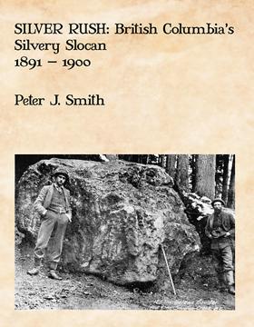
Silver Rush tells the story of British Columbia’s “Silvery Slocan.” In the 1890s, mining camps like Sandon, Three Forks, Whitewater and their neighbours; New Denver, Silverton, Slocan City, Kaslo and Nakusp, thrived. Once the most productive mining region in British Columbia, prospectors and miners came from Idaho, Montana and other mining centres to reap the silver harvest. Capitalists flooded in from Spokane, Seattle, Vancouver, and investment centres across North America and the world. Plummeting silver prices, labour troubles and the Klondike gold rush eventually put an end to the silver rush but the legacy of that rush endures to this day.
vi, 642 pages : illustrations (some colour), maps ; 28 cm
CIRC [ 0 ]
Regional District of Central Kootenay
- Ainsworth Hot Springs
- Alamo
- Alice Siding
- Appledale
- Applegrove
- Argenta
- Arrow Creek
- Arrow Park
- Balfour
- Beasley
- Belleview
- Birchdale
- Blewett
- Blueberry Creek
- Bonnington Falls
- Boswell
- Brandon
- Brilliant
- Brouse
- Burton
- Canyon
- Carrolls Landing
- City of Castlegar
- Cody
- Cooper Creek
- Corra Linn
- Crawford Bay
- Crescent Bay
- Crescent Valley
- Town of Creston
- Curzon
- Deer Park
- East Arrow Park
- Edgewood
- Erickson
- Erie
- Fauquier
- Fosthall
- Fraser
- Fry Creek
- Gerrard
- Gibson Creek
- Glade
- Glenbank
- Glenlily
- Granite
- Gray Creek
- Hall
- Harrop
- Hills
- Howser
- Huscroft
- Jersey
- Johnsons Landing
- Village of Kaslo
- Kinnaird
- Kitchener
- Kootenay Bay
- Krestova
- Kuskonook
- Lardeau
- Lebahdo
- Lemon Creek
- Lister
- Longbeach
- Makinson
- Marblehead
- Meadow Creek
- Meadows
- Mirror Lake
- Mountain Station
- Village of Nakusp
- Needles
- City of Nelson
- Nelway
- Village of New Denver
- New Settlement
- Ootischenia
- Pass Creek
- Passmore
- Perrys
- Playmor Junction
- Poplar Creek
- Porto Rico
- Procter
- Queens Bay
- Raspberry
- Remac
- Renata
- Retallack
- Riondel
- Robson
- Robson West
- Rosebery
- Ross Spur
- Rykerts
- Village of Salmo
- Sanca
- Sandon
- Shoreacres
- Shoreholme
- Shutty Bench
- Village of Silverton
- Sirdar
- Village of Slocan
- Slocan Park
- South Slocan
- Summit Lake
- Sunshine Bay
- Taghum
- Tarrys
- Three Forks
- Thrums
- Vallican
- Walkers
- Willow Point
- Winlaw
- Wynndel
- Yahk
- Ymir
- Zincton
Political Boundaries
Last updated: 2023-09-27