Village of Nakusp Regional District of Central Kootenay, British Columbia
Village (1) - A populated place with legally defined boundaries, incorporated as a village municipality under the provincial Municipal Act. SE side of Upper Arrow Lake, S of Revelstoke, Kootenay Land District
Mapped Location
Village of Nakusp: The mapped location is an approximation and should not be used for navigation or wayfinding.
Information
General information on Village of Nakusp
- Feature Type: Incorporated
Official, historical, colloquial and alternative toponyms for Village of Nakusp
A brief list of names that this geographic feature has been named
| Name | Description |
|---|---|
| Village of Nakusp | Official |
Origin Notes and History of Village of Nakusp
References to Village of Nakusp that document the origin of its place name
Nakusp (Village) adopted in 18th Report of the Geographic Board of Canada. Form of name changed to Nakusp (Post Office, Station & Steamer Landing) 9 June 1960 on 82K . Incorporated as a Village Municipality 24 November 1964. Confirmed as Nakusp (Village) 27 July 1966 on 82NW. Boundary extended per OIC 400, 26 September 2013 to include parcels upstream on Kuskanax Creek containing Nakusp Hot Springs and the former Nakusp Hot Springs Provincial Park.
Nakusp Post Office was opened 1 August 1892.
The [Indigenous people] called this place Nakipus, meaning "the bay behind the long point." (as told by Jack Evans, early trapper and prospector, and printed in the Slocan Enterprise, 11 August 1931).
From the Indigenous word "Neqo'sp" meaning "closed-in" or "safe" (BC name card). According to Chief Louis "...Indians come down the lake in canoes...storm very bad, canoes nealy lost at Kuskanax Creek, but upon entering the big bay, Neqo'sp, they were safe." (Pioneer Days of Nakusp... Kate Johnson, 1952.) "The story is told that in the early days some twenty years ago, in the store of F.W. Jordan, an old timer was asked how Nakusp got its name. This was a man of few English words but he illustrated the point by taking out his tobacco bag. He opened the mouth of the bag then drew the strings tight again, signifying a safe place, a quiet shelter, secure site, or words to that effect." (Slocan Enterprise, 5 February 1930)
Related Catalog Titles
A Bibliography for Village of Nakusp, Regional District of Central Kootenay, British Columbia
Silver rush British Columbia's silvery Slocan, 1891-1900 by Peter J. Smith
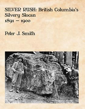
Silver Rush tells the story of British Columbia’s “Silvery Slocan.” In the 1890s, mining camps like Sandon, Three Forks, Whitewater and their neighbours; New Denver, Silverton, Slocan City, Kaslo and Nakusp, thrived. Once the most productive mining region in British Columbia, prospectors and miners came from Idaho, Montana and other mining centres to reap the silver harvest. Capitalists flooded in from Spokane, Seattle, Vancouver, and investment centres across North America and the world. Plummeting silver prices, labour troubles and the Klondike gold rush eventually put an end to the silver rush but the legacy of that rush endures to this day.
vi, 642 pages : illustrations (some colour), maps ; 28 cm
CIRC [ 0 ]
Regional District of Central Kootenay
- Ainsworth Hot Springs
- Alamo
- Alice Siding
- Appledale
- Applegrove
- Argenta
- Arrow Creek
- Arrow Park
- Balfour
- Beasley
- Belleview
- Birchdale
- Blewett
- Blueberry Creek
- Bonnington Falls
- Boswell
- Brandon
- Brilliant
- Brouse
- Burton
- Canyon
- Carrolls Landing
- City of Castlegar
- Cody
- Cooper Creek
- Corra Linn
- Crawford Bay
- Crescent Bay
- Crescent Valley
- Town of Creston
- Curzon
- Deer Park
- East Arrow Park
- Edgewood
- Erickson
- Erie
- Fauquier
- Fosthall
- Fraser
- Fry Creek
- Gerrard
- Gibson Creek
- Glade
- Glenbank
- Glenlily
- Granite
- Gray Creek
- Hall
- Harrop
- Hills
- Howser
- Huscroft
- Jersey
- Johnsons Landing
- Village of Kaslo
- Kinnaird
- Kitchener
- Kootenay Bay
- Krestova
- Kuskonook
- Lardeau
- Lebahdo
- Lemon Creek
- Lister
- Longbeach
- Makinson
- Marblehead
- Meadow Creek
- Meadows
- Mirror Lake
- Mountain Station
- Village of Nakusp
- Needles
- City of Nelson
- Nelway
- Village of New Denver
- New Settlement
- Ootischenia
- Pass Creek
- Passmore
- Perrys
- Playmor Junction
- Poplar Creek
- Porto Rico
- Procter
- Queens Bay
- Raspberry
- Remac
- Renata
- Retallack
- Riondel
- Robson
- Robson West
- Rosebery
- Ross Spur
- Rykerts
- Village of Salmo
- Sanca
- Sandon
- Shoreacres
- Shoreholme
- Shutty Bench
- Village of Silverton
- Sirdar
- Village of Slocan
- Slocan Park
- South Slocan
- Summit Lake
- Sunshine Bay
- Taghum
- Tarrys
- Three Forks
- Thrums
- Vallican
- Walkers
- Willow Point
- Winlaw
- Wynndel
- Yahk
- Ymir
- Zincton
Political Boundaries
Last updated: 2023-09-27